 Block
Pageland, South Carolina
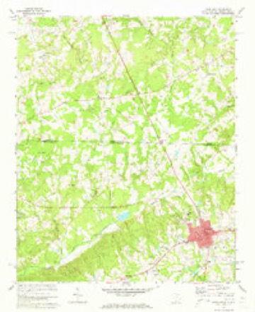
13 topographic sheets cover this place, the earliest surveyed in 1941 and the latest in 1986. It stands in the Pageland census division. It lies in ZIP code area 29728. The Survey maps it on the Pageland quadrangle. 2,456 people lived here at the 2020 count. It stands 656 feet above sea level.
Population over time
2 figuresPageland fell from 2,760 to 2,456 between 2010 and 2020. These are the recorded population figures Wikidata holds for this place, reached through the Geographic Names Information System number this page is keyed on rather than by name, so they belong to this place and not to another of the same name. Most are census counts, but not all are: an early figure may be a founding or settlement estimate, and an estimate published within five years of a census is left out. The change column is computed, and is left blank where more than 20 years separate a figure from the one before it, because a gap that long is not a change between two counts.
| Year | People | Change |
|---|---|---|
| 2010 | 2,760 | |
| 2020 | 2,456 | -304 (-11%) |
Topographic sheets covering this place
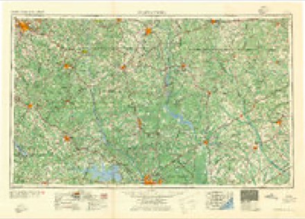
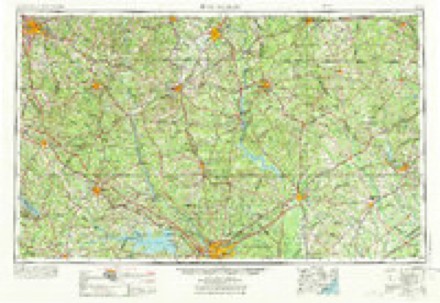
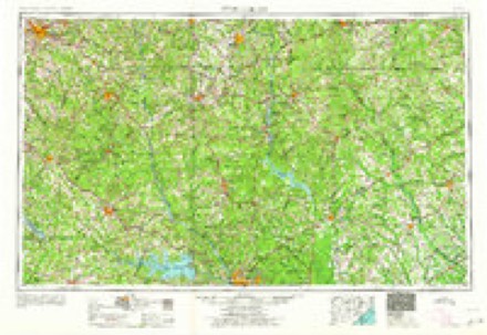
7 surveys from 13 printed sheetsMatched by testing this settlement's coordinate against the published boundary of every sheet in the United States Geological Survey's historical collection. Each opens the scanned sheet at the Survey.
- 1941 USGS Spartanburg quadrangle1:250000
- 1953 USGS Spartanburg quadrangle1:250000, 4 printings
- 1960 USGS Spartanburg quadrangle1:250000, 2 printings
- 1963 USGS Spartanburg quadrangle1:250000
- 1964 USGS Spartanburg quadrangle1:250000
- 1971 USGS Pageland quadrangle1:24000, 2 printings
- 1986 USGS Lancaster quadrangle1:100000, 2 printings

Fires near this place
290 since 1992Regional context, not property-specific evidence. The federal wildfire occurrence database lists 290 fires within 5 miles of Pageland between 1992 and 2020, burning about 1,031 acres in total. 8 started naturally. 18 were recorded as arson. Distance is straight-line from the map coordinates, so a fire counted here may appear on a neighbouring settlement's page as well.
| Reported cause | Fires |
|---|---|
| Debris and open burning | 143 |
| Missing data/not specified/undetermined | 65 |
| Equipment and vehicle use | 23 |
| Arson/incendiarism | 18 |
| Smoking | 15 |
| Misuse of fire by a minor | 15 |
| Natural | 8 |
| Other causes | 2 |
| Fireworks | 1 |
The most recent of them, most recent first, with the day each was reported and the service that recorded it.
| Date | Cause | Size | Reported by | Name on the report |
|---|---|---|---|---|
| 9 September 2005 | Debris and open burning | 58 acres | North Carolina Forest Service | ZION CHURCH ROAD |
| 6 September 1997 | Debris and open burning | 1.0 acres | South Carolina Forestry Commission | not named |
| 5 September 2011 | Misuse of fire by a minor | under an acre | South Carolina Forestry Commission | not named |
| 26 September 2019 | Debris and open burning | 1.0 acres | South Carolina Forestry Commission | not named |
| 1 September 2018 | Natural | under an acre | South Carolina Forestry Commission | not named |
| 8 August 1999 | Misuse of fire by a minor | under an acre | South Carolina Forestry Commission | not named |
| 7 August 2002 | Equipment and vehicle use | 4.0 acres | South Carolina Forestry Commission | not named |
| 6 August 1999 | Debris and open burning | under an acre | South Carolina Forestry Commission | not named |
Settlements close enough to share some of these fires:
Mines and quarries near this place
10 of 21 shownRegional context, not property-specific evidence. The federal mineral resources record lists 21 workings within 5 miles of Pageland: 12 unknowns, 5 past producers, 4 producers. 4 still produce. What was taken out: Sand and Gravel, Construction, Gold, Stone, Crushed/Broken, Stone, Dimension. Distance is straight-line from the map coordinates, so a quarry counted here may appear on a neighbouring settlement's page as well.
| Where | Site | Commodity | Status | Recorded |
|---|---|---|---|---|
| Evans Mill | Stone, Dimension | Past Producer | Igneous Intrusion | |
| Oro Quarry | Stone, Crushed/Broken | Past Producer | Igneous | |
| Pageland Sand Mine #2 | Sand | Unknown | Sedimentary | |
| Edgeworth and Brewer Mine | Gold | Past Producer | ||
| Edgeworth-Brewer Mine | Gold | Unknown | 1856 | |
| Oro Mine | Gold | Unknown | Stratabound Discordant | |
| Blaney Pit | Sand and Gravel, Construction | Producer | ||
| Chesterfield County Pit | Sand and Gravel, Construction | Producer | ||
| Chesterfield Pit | Sand and Gravel, Construction | Past Producer | ||
| Dickerson Pageland Sand Pit No.2 | Sand and Gravel, Construction | Past Producer | Sedimentary |
Storms near this place
32 since 1999Regional context, not property-specific evidence. The National Weather Service names Pageland in 32 storm reports between 1999 and 2024: 17 thunderstorm wind, 11 hail, 4 flash flood. No death or injury is recorded in these reports. Each account below is quoted exactly as the forecast office filed it, from the NOAA Storm Events Database, and each date opens the federal record of that event.
| When | Event | Place named | Harm | What the report says |
|---|---|---|---|---|
| September 2014 | Flash Flood | Pageland | $44,000 | EM reported up to 6 inches of rain fell over the whole duration of the event washing out several roads and bridges. |
| July 2012 | Hail | Pageland | $20,000 | SKYWARN spotter reported Hen egg size hail covering the ground and White Plains Golf Course. |
| July 2012 | Hail | Pageland | $15,000 | SKYWARN spotter reported golfball size hail at Kirkley Road and Peach Orchard Road. |
| July 2012 | Thunderstorm Wind | Pageland | $12,000 | SKYWARN Spotter follow-up to previous report... a church on Airport road across from Central High School has a partially destroyed roof. Winds were estimated to be 65 mph. |
| April 2011 | Thunderstorm Wind | Pageland | $8,000 | Public reported a metal roof peeled off a horse stall and multiple trees down. |
| January 2013 | Thunderstorm Wind | Pageland | $6,000 | DOT reported several trees down in the Pageland area. |
| July 2012 | Thunderstorm Wind | Pageland | $6,000 | SKYWARN spotter reported trees down in Pageland. |
| April 2011 | Thunderstorm Wind | Pageland | $4,000 | Sheriff reported powerlines down with outages in Pageland. |
| June 2009 | Thunderstorm Wind | Pageland | $4,000 | Sheriff reported trees down on Evans Mill road. |
| April 2013 | Thunderstorm Wind | Pageland | $1,000 | Dispatch reported a couple of trees down on Juniper Road near Pageland. |
| July 2009 | Thunderstorm Wind | Pageland | $1,000 | DOT reported a couple of trees down on hwy 601. |
| April 2022 | Hail | Pageland | $10 | Media relayed a public report of pea size hail near Pageland. Time estimated. |
| April 2021 | Hail | Pageland | $10 | A spotter reported two brief periods of pea to dime size hail at Pageland Town Hall. Time estimated. |
| August 2024 | Flash Flood | Pageland | - | SCDOT closed J. Vann Anderson Road near Outen Road due to water overtopping a bridge. |
| January 2020 | Thunderstorm Wind | Pageland | - | County dispatch reported trees down on SC Hwy 9. Time estimated. |
| April 2018 | Thunderstorm Wind | Pageland | - | Trees down in Pageland. |
| July 2016 | Thunderstorm Wind | Pageland | - | Trees down on Brock Rd. |
| July 2016 | Thunderstorm Wind | Pageland | - | Lynches River Electric Coop reported several power outages in the Pageland area due to limbs on power lines. |
| April 2013 | Hail | Pageland | - | Nickel size hail reported at the intersection of East Pageland Hwy and SC 151 by SKYWARN HAM. |
| August 2011 | Hail | Pageland | - | Mike Yaborough, spotter in Pageland, relayed a public report of quarter size hail in Pageland at 905pm received via a police scanner of the Pageland Ciey Police Dept. |
| August 2008 | Hail | Pageland | - | City Hall reported penny size hail. |
| August 2008 | Thunderstorm Wind | Pageland | - | Sheriff reported a couple of trees down on Griggs Street. |
| July 2008 | Thunderstorm Wind | Pageland | - | County Sheriff reporeted trees down in Pageland. |
| July 2006 | Thunderstorm Wind | Pageland | - | Highway dept. reported a couple of trees down on Airport road. |
| May 2006 | Hail | Pageland | - | SKYWARN spotter reported golf ball size hail in Pageland. |
| July 2005 | Thunderstorm Wind | Pageland | - | Lynches River Electric coop reported trees down on powerlines causing power outages just north of town. |
| May 2005 | Flash Flood | Pageland | - | Highway Dept. reported flood rural roadways and streams closing some of them off. |
| May 2005 | Hail | Pageland | - | Sheriff reported nickel size hail in Pageland. |
| May 2003 | Hail | Pageland | - | Police reported 3/4 inch hail. |
| August 2003 | Flash Flood | Pageland | - | Sheriff reported several roads closed in Pageland with flooding in yards getting into some homes. |
| July 2002 | Hail | Pageland | - | Sheriff reported 3/4 inch hail in Pageland. |
| July 1999 | Thunderstorm Wind | Pageland | - | Sheriff called and reported trees down. |
Newspapers printed here
1,880 digitised pages1 paper published in this town, digitised by the Library of Congress and free to read: 341 issues, 1,880 pages. Every page is searchable, so a name or a street can be looked for directly in what the town printed about itself at the time.
| Newspaper | Published |
|---|---|
| The Pageland Journal | 1911 to 1978 |
What the paper printed
5,366 wordsFront pages of the local paper, read from the Library of Congress scans: 5 issues all from 1914, 5,366 words in total. Each is reproduced on its own page, exactly as the recogniser returned it.
These pages read less well than anything else here, and the number is worth stating: about three words in four come through cleanly, against nine in ten for the building records. An 1896 broadsheet sets eight-point type in seven columns on microfilm, which is the hardest thing in this archive to read by machine. We tested our own recognisers against the Library's and they were not better, so the Library's text is what appears, with the wholly unreadable columns removed. Read it as a guide to what the paper covered, and follow the link to the scan before quoting anything.
| Issue | Paper | Length |
|---|---|---|
| 1914-01-13 | The Pageland Journal | 698 words |
| 1914-04-08 | The Pageland Journal | 1,194 words |
| 1914-06-03 | The Pageland Journal | 1,212 words |
| 1914-08-05 | The Pageland Journal | 1,103 words |
| 1914-09-30 | The Pageland Journal | 1,159 words |
Nearest settlements
The eight closest, with where each one stands in the county. Distances are straight-line, computed from the Geographic Names Information System coordinates.
| Map | Place | Distance | Sheets |
|---|---|---|---|
| Mangums (historical) | 2.8 miles | 13 | |
| High Point | 2.8 miles | 13 | |
| Crowburg | 3.0 miles | 13 | |
| Evans Mill | 3.9 miles | 13 | |
| Five Forks | 3.9 miles | 12 | |
| White Plains | 4.7 miles | 12 | |
| Dudley | 5.6 miles | 13 | |
| Hornsboro | 5.7 miles | 13 |
Elsewhere
Matched on this settlement's Geographic Names Information System number rather than its name, so it cannot be a different place of the same name in another state.
| Wikipedia article on Pageland | An encyclopaedic summary. Its text is share-alike, so it is linked here rather than copied. |
| Wikidata item Q2621058 | The structured record the population and elevation above come from. Public domain (CC0). |
Provenance
This settlement is recorded in the Geographic Names Information System as feature 1250011. The sheet list is computed by point-in-boundary test against the United States Geological Survey's historical topographic inventory. Both are works of the United States government and carry no copyright under 17 U.S.C. 105.
Wildfire. Short, Karen C. 2022. Spatial wildfire occurrence data for the United States, 1992-2020 [FPA_FOD_20221014]. 6th Edition. Fort Collins, CO: Forest Service Research Data Archive. https://doi.org/10.2737/RDS-2013-0009.6 Collected with United States Government funding and usable without additional permissions or fees.
Mines and quarries. USGS Mineral Resources Data System (MRDS) https://mrdata.usgs.gov/mrds/ A work of the United States government, no copyright under 17 U.S.C. 105.
Storms. NOAA National Centers for Environmental Information, Storm Events Database https://www.ncei.noaa.gov/stormevents/ A work of the United States government, no copyright under 17 U.S.C. 105. Narratives are quoted verbatim from the National Weather Service report and are not edited or summarised.