 Block
Slandsville, South Carolina
18 topographic sheets cover this place, the earliest surveyed in 1920 and the latest in 1990. It stands in the Summerville census division. It lies in ZIP code area 29483. The Survey maps it on the Stallsville quadrangle.
Topographic sheets covering this place
10 surveys from 18 printed sheetsMatched by testing this settlement's coordinate against the published boundary of every sheet in the United States Geological Survey's historical collection. Each opens the scanned sheet at the Survey.
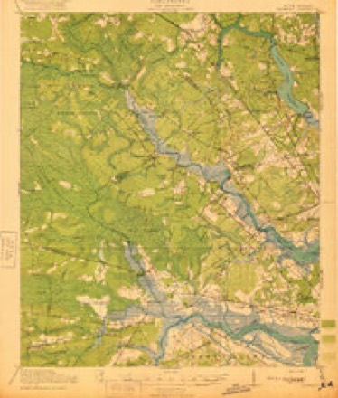
- 1920 USGS Ravenels quadrangle1:62500, 3 printings
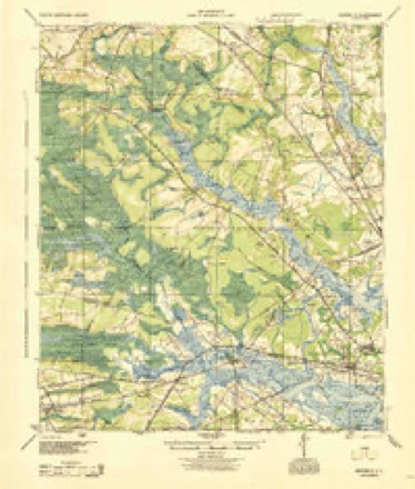
- 1944 USGS Ravenels quadrangle1:62500
- 1947 USGS Savannah quadrangle1:250000
- 1948 USGS Savannah quadrangle1:250000
- 1957 USGS Savannah quadrangle1:250000, 4 printings
- 1957 USGS Stallsville quadrangle1:24000, 3 printings
- 1960 USGS Savannah quadrangle1:250000
- 1961 USGS Savannah quadrangle1:250000, 2 printings
- 1986 USGS Walterboro quadrangle1:100000
- 1990 USGS Walterboro quadrangle1:100000
Fires near this place
322 since 1992Regional context, not property-specific evidence. The federal wildfire occurrence database lists 322 fires within 5 miles of Slandsville between 1992 and 2019, burning about 1,201 acres in total. None started naturally. 68 were recorded as arson. Distance is straight-line from the map coordinates, so a fire counted here may appear on a neighbouring settlement's page as well.
| Reported cause | Fires |
|---|---|
| Debris and open burning | 110 |
| Missing data/not specified/undetermined | 97 |
| Arson/incendiarism | 68 |
| Misuse of fire by a minor | 42 |
| Equipment and vehicle use | 3 |
| Power generation/transmission/distribution | 1 |
| Smoking | 1 |
The most recent of them, most recent first, with the day each was reported and the service that recorded it.
| Date | Cause | Size | Reported by | Name on the report |
|---|---|---|---|---|
| 5 September 1999 | Debris and open burning | 1.5 acres | South Carolina Forestry Commission | not named |
| 3 September 1999 | Arson/incendiarism | 1.0 acres | South Carolina Forestry Commission | not named |
| 2 September 2001 | Arson/incendiarism | 6.0 acres | South Carolina Forestry Commission | not named |
| 18 September 2001 | Misuse of fire by a minor | under an acre | South Carolina Forestry Commission | not named |
| 13 September 2009 | Misuse of fire by a minor | under an acre | South Carolina Forestry Commission | not named |
| 1 September 2001 | Debris and open burning | 1.0 acres | South Carolina Forestry Commission | not named |
| 4 August 1998 | Misuse of fire by a minor | 1.0 acres | South Carolina Forestry Commission | not named |
| 29 August 1997 | Debris and open burning | under an acre | South Carolina Forestry Commission | not named |
Settlements close enough to share some of these fires:
Mines and quarries near this place
10 of 11 shownRegional context, not property-specific evidence. The federal mineral resources record lists 11 workings within 5 miles of Slandsville: 4 past producers, 4 producers, 3 unknowns. 4 still produce. What was taken out: Sand and Gravel, Construction, Clay. Distance is straight-line from the map coordinates, so a quarry counted here may appear on a neighbouring settlement's page as well.
| Where | Site | Commodity | Status | Recorded |
|---|---|---|---|---|
| Knightsville Mine | Clay | Unknown | Sedimentary | |
| Knightsville Mine | Clay | Past Producer | ||
| Newington Mine & Mill | Clay | Past Producer | ||
| Newington Pit | Clay | Unknown | Sedimentary | |
| Salisbury Mine | Clay | Producer | ||
| Becker Sand and Gravel Co., Div. Of | Sand and Gravel, Construction | Past Producer | ||
| Evergreen Pit | Sand and Gravel, Construction | Producer | Sedimentary | |
| Murray Mine | Sand and Gravel, Construction | Producer | ||
| Murray Pit | Sand and Gravel, Construction | Producer | Sedimentary | |
| Summerville Plant | Sand and Gravel, Construction | Past Producer | Sedimentary |
Storms near this place
60 of 125 shownRegional context, not property-specific evidence. The National Weather Service names Slandsville in 125 storm reports between 2007 and 2025: 66 thunderstorm wind, 25 hail, 22 flash flood, 6 lightning. No death or injury is recorded in these reports. Each account below is quoted exactly as the forecast office filed it, from the NOAA Storm Events Database, and each date opens the federal record of that event.
| When | Event | Place named | Harm | What the report says |
|---|---|---|---|---|
| September 2017 | Flash Flood | Slandsville | $500,000 | Dorchester County Emergency Management reported that water entered at least 31 homes due to flash flooding along Eagle Creek. This included homes on Tranquil Lane and Harrison Road in the Tranquil Acres/Estates neighborhood, as well as homes in the Summerwood subdivision off of Ladson Road. Of the 31 impacted structures, 18 had 12 inches or less of water, 10 had between 13 and 23 inches of water, and 3 had between 24 and 35 inches of water inside. |
| August 2024 | Flash Flood | Slandsville | $60,000 | A Dorchester County emergency manager reported paved roadway damage on Summers Drive between Highway 17A and Victoria Point Lane. A small bridge in between these locations was also starting to crumble at this time. |
| October 2008 | Flash Flood | Slandsville | $50,000 | A trained spotter reported that Orangeburg Road was closed due to the road being collapsed from flooding between Dorchester Road and Route 17A in Knightsville, South Carolina. |
| July 2022 | Flash Flood | Slandsville | $30,000 | Dorchester County Emergency Management reported flash flooding at two locations near Highway 61, Bacon's Bridge Road, and Dorchester Road. Flood waters were entering a residence on West Walnut Circle and another residence on White Church Lane. A personal weather station located one street west of White Church Lane measured 4.90 inches of rain between 5:04 pm EST and 11:39 pm EST. A personal weather station located just west of West Walnut Circle measured 5.31 inches of rain between 4:59 pm EST and 10:19 pm EST. |
| July 2013 | Flash Flood | Slandsville | $30,000 | Trolley Road, near Oakbrook was closed due to flooding. Several cars were floating in waist-deep water. |
| February 2023 | Flood | Slandsville | $25,000 | The South Carolina Highway Patrol reported roadway flooding near the intersection of Orangeburg Road and Williams Family Drive. Broadcast media also reported a section of Orangeburg Road between US 17A and Dorchester Road closed due to part of the road being washed out near a construction zone. |
| July 2025 | Lightning | Slandsville | $20,000 | Dorchester County Emergency Management reported that lightning struck a structure and started a fire in the 1000 block of Lovebug Lane. |
| August 2024 | Flash Flood | Slandsville | $20,000 | Dorchester County Emergency Management reported that the Department of Transportation was shutting down Delmar Highway at Ashley Ridge High School because floodwaters were washing the roadway away. |
| August 2024 | Flash Flood | Slandsville | $10,000 | A Dorchester County emergency manager reported a water rescue in progress on Magwood Drive. Another resident on the 9000 Block of Dorchester Road requested assistance. In addition, a guardrail along Dorchester Road was washed out with water along the road bankfull. |
| June 2013 | Lightning | Slandsville | $10,000 | Media reported a lightning strike caused a house fire along County Home Road. The report was confirmed by a Dorchester County fire chief. |
| August 2011 | Thunderstorm Wind | Slandsville | $6,000 | A trained spotter reported numerous trees down on Bacons Bridge Road. |
| May 2025 | Thunderstorm Wind | Slandsville | $5,000 | Dorchester County Emergency Management reported a power line down in the 100 block of Blythe Avenue off of Bacons Bridge Road. |
| December 2018 | Flood | Slandsville | $5,000 | A trained spotter reported a few stalled cars due to flooding on Bacons Bridge Road just north of Dorchester Road. |
| August 2018 | Flood | Slandsville | $5,000 | A Dorchester County Emergency Manager reported flooding due to heavy rainfall approximately 1-2 days prior upstream of the Ashborough neighborhood, mainly along Lake Ashborough extending toward the Ashley River. Mayfield Street and a park had water approximately 6 to 8 inches deep in some places. A few rescues were made due to stalled cars on streets. A few homes were also surrounded by water between Mayfield Street and the Ashley River. |
| August 2011 | Thunderstorm Wind | Slandsville | $5,000 | The public reported a large tree snapped mid way up and fell on a home under construction in Taylor Plantation. |
| July 2009 | Flash Flood | Slandsville | $5,000 | The public reported significant flooding along Indigo Fields Boulevard, with at least 1 to 1.5 feet of water covering the street, and water entering the garages of many homes. |
| July 2009 | Flash Flood | Slandsville | $5,000 | The Dorchester County Warning Point reported that 5 cars were stranded along Middleton Boulevard in the Ashborough East Subdivision near Summerville, South Carolina. |
| July 2011 | Flash Flood | Slandsville | $3,000 | A trained weather spotter reported the closure of Trolley Road between Midland Park and Dorchester Road due to flooding from heavy rainfall. 10 cars were reported stalled, with water 2 to 3 feet deep in spots. |
| June 2009 | Thunderstorm Wind | Slandsville | $2,500 | A National Weather Service employee reported 5 large trees down along Highway 165 between County Line Road and Highway 17 in Delemar Crossroads, South Carolina. |
| July 2007 | Thunderstorm Wind | Slandsville | $2,500 | Five trees were reported down at Summers Bind near the intersection of Ashley Phosphate and Dorchester Road. |
| July 2012 | Lightning | Slandsville | $2,000 | House struck by lightning off Boone Hill Road near Summerville High School. |
| June 2010 | Lightning | Slandsville | $2,000 | Lightning struck a tree which fell onto a power line near 1710 Old Trolley Road. |
| June 2009 | Thunderstorm Wind | Slandsville | $2,000 | Law Enforcement reported power lines down along Thornhill Drive in the Ashborough East Subdivision, 1 mile north-northeast of Cooke Crossroads, South Carolina. |
| April 2020 | Thunderstorm Wind | Slandsville | $1,500 | A Dorchester County emergency manager reported power lines down in the 300 block of Sprucewood Drive. |
| April 2007 | Thunderstorm Wind | Slandsville | $1,500 | Trees were reported down along Highway 61 between Cooke Crossroads and Highway 17A. |
| August 2025 | Thunderstorm Wind | Slandsville | $1,000 | Emergency management reported a tree down near the intersection of Beach Hill Road and Windward Drive. |
| June 2013 | Thunderstorm Wind | Slandsville | $1,000 | A spotter reported a pine tree down. |
| May 2012 | Lightning | Slandsville | $1,000 | Lightning struck and damaged the stone chimney at the clubhouse in Taylor Plantation. |
| July 2012 | Thunderstorm Wind | Slandsville | $1,000 | The Dorchester County warning point reported a large tree down and blocking the road. The tree came down as a result of the outflow boundary in advance of the thunderstorms. |
| August 2011 | Thunderstorm Wind | Slandsville | $1,000 | A trained spotter reported a large maple tree down in a yard along Glebe Road. |
| June 2011 | Thunderstorm Wind | Slandsville | $1,000 | A spotter reported a tree down in a wooded area. |
| August 2011 | Thunderstorm Wind | Slandsville | $1,000 | Law enforcement reported a tree in roadway, near Summerville, South Carolina. |
| August 2010 | Thunderstorm Wind | Slandsville | $1,000 | A sheriff department reported a tree down across Highway 61 near Middleton Place. |
| June 2009 | Thunderstorm Wind | Slandsville | $1,000 | The public reported a tree down on a power line at the intersection of Greenwood Drive and Clubhouse Road, near Clubhouse Crossroads, South Carolina. |
| July 2017 | Thunderstorm Wind | Slandsville | $500 | South Carolina Highway Patrol reported a tree down on Ashley River Road near Middleton Place. |
| July 2014 | Thunderstorm Wind | Slandsville | $500 | A pine tree limb approximately ten inches in diameter and fourteen feet long broke off as a storm passed by just to the south. The limb came down on Weatherbark Circle off of Dorchester Road. |
| June 2014 | Flash Flood | Slandsville | $500 | Law enforcement reported 3 feet of water in front of a business on Old Trolley Road and that the road was closed due to flooding between Travelers Boulevard and Springview Lane. A disabled vehicle was in the road with people stuck in the waters. The cost was generally estimated to be 0.50K. |
| July 2013 | Thunderstorm Wind | Slandsville | $500 | A tree was reported down at the 4800 block of Ashley River Road. |
| July 2013 | Thunderstorm Wind | Slandsville | $500 | Highway Patrol reported a tree down at the intersection of Beech Hill Road and Bacons Bridge Road. |
| May 2012 | Thunderstorm Wind | Slandsville | $500 | One tree down on Park Forest Parkway, relayed by Channel 5. |
| June 2011 | Thunderstorm Wind | Slandsville | $500 | A NWS employee reported 1 large limb down along Appian Way. |
| August 2011 | Thunderstorm Wind | Slandsville | $500 | A amateur radio operator reported a 6 foot limb on a power line along Boonehill Road. |
| July 2010 | Lightning | Slandsville | $500 | The public reported that lightning struck a large oak tree in Taylor Plantation, with large pieces of the tree several feet in length, thrown up to 30 feet away from the base of the tree. |
| July 2010 | Thunderstorm Wind | Slandsville | $500 | Law enforcement reported a tree down one mile north of Middleton Place along Ashley River Road, 6 miles south-southwest of Ladson, South Carolina. |
| June 2009 | Thunderstorm Wind | Slandsville | $500 | Broadcast Media relayed a public report of several large tree limbs down in a residential yard off of Highway 165, 1 mile north of Delemar Crossroads, South Carolina. |
| June 2008 | Thunderstorm Wind | Slandsville | $500 | A 20 foot tall tree that was 4 inches in diameter was knocked down 4 miles south of Knightsville, South Carolina. |
| July 2010 | Thunderstorm Wind | Slandsville | $250 | A National Weather Service employee reported several tree limbs ranging in size from 1 to 3 inches in diameter along with a substantial amount of leaf litter, 7 miles south-southeast of Summerville, South Carolina. |
| May 2008 | Thunderstorm Wind | Slandsville | $250 | A trained weather spotter reported 6 inch diameter tree limbs were knocked down by strong winds at the intersection of Highway 61 and 165. |
| October 2008 | Flash Flood | Slandsville | $250 | A National Weather Service employee reported 1 to 2 feet of water in front of and in the back of his home in Taylor Plantation 14 miles west of North Charleston, South Carolina. |
| June 2025 | Thunderstorm Wind | Slandsville | - | A trained spotter reported a fascia blown off at the roof line of a house. |
| June 2025 | Thunderstorm Wind | Slandsville | - | A Dorchester County emergency manager reported a tree down on a power line along the 1900 Block of Summers Drive. |
| August 2025 | Flash Flood | Slandsville | - | Dorchester County Emergency Management reported the intersection of Orangeburg Road and Highway 17A impassible due to flooding. |
| August 2025 | Flash Flood | Slandsville | - | Emergency management reported roadways impassable around 1000 Anne Revenge Run in Summerville, South Carolina. Water was also reported to be approaching the porches of some homes. |
| August 2025 | Flash Flood | Slandsville | - | Dorchester County Emergency Management relayed images showing water entering the bottom floors of several homes along Boon Hill Road. |
| January 2024 | Thunderstorm Wind | Slandsville | - | Dorchester County Emergency Management reported a tree down along Beech Hill Road and Delemar Highway. |
| June 2024 | Hail | Slandsville | - | A mPING report of 2 inch hail was received by the public. |
| June 2024 | Hail | Slandsville | - | The public reported ping pong ball size hail near Beech Hill Elementary. |
| June 2024 | Hail | Slandsville | - | A NWS employee reported golf ball size hail. |
| June 2024 | Hail | Slandsville | - | A Dorchester County emergency manager reported hail up to the size of golf balls. |
| June 2024 | Thunderstorm Wind | Slandsville | - | The public reported trees down along Legend Oaks Way. |
Nearest settlements
The eight closest, with where each one stands in the county. Distances are straight-line, computed from the Geographic Names Information System coordinates.
| Map | Place | Distance | Sheets |
|---|---|---|---|
| Indian Springs | 0.9 miles | 18 | |
| Ashley Retreat | 1.0 miles | 18 | |
| Farmdale | 1.2 miles | 18 | |
| Flowertown Village | 1.4 miles | 18 | |
| Summerville Farms | 1.4 miles | 18 | |
| Oakdale Estates | 1.8 miles | 18 | |
| Newington Plantation | 1.9 miles | 18 | |
| Cotton Hill | 2.0 miles | 19 |
Elsewhere
Matched on this settlement's Geographic Names Information System number rather than its name, so it cannot be a different place of the same name in another state.
| Wikidata item Q122590431 | The structured record the population and elevation above come from. Public domain (CC0). |
Provenance
This settlement is recorded in the Geographic Names Information System as feature 1226669. The sheet list is computed by point-in-boundary test against the United States Geological Survey's historical topographic inventory. Both are works of the United States government and carry no copyright under 17 U.S.C. 105.
Wildfire. Short, Karen C. 2022. Spatial wildfire occurrence data for the United States, 1992-2020 [FPA_FOD_20221014]. 6th Edition. Fort Collins, CO: Forest Service Research Data Archive. https://doi.org/10.2737/RDS-2013-0009.6 Collected with United States Government funding and usable without additional permissions or fees.
Mines and quarries. USGS Mineral Resources Data System (MRDS) https://mrdata.usgs.gov/mrds/ A work of the United States government, no copyright under 17 U.S.C. 105.
Storms. NOAA National Centers for Environmental Information, Storm Events Database https://www.ncei.noaa.gov/stormevents/ A work of the United States government, no copyright under 17 U.S.C. 105. Narratives are quoted verbatim from the National Weather Service report and are not edited or summarised.