 Block
Spartanburg, South Carolina
18 topographic sheets cover this place, the earliest surveyed in 1941 and the latest in 1986. It stands in the Spartanburg census division. It lies in ZIP code area 29306. It stands on Butterfly Creek. The Survey maps it on the Spartanburg quadrangle. 38,732 people lived here at the 2020 count. It stands 807 feet above sea level.
Research this city
On record in Spartanburg
Buildings and businesses the archive holds for this place. Each opens its own page, with the source record it came from.
On the National Register 12 of 38 shown
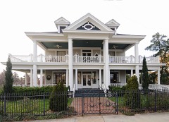 Alexander Houselisted 2003
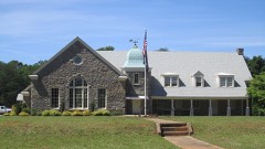 American Legion Buildinglisted 2003
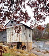 Anderson's Milllisted 1978
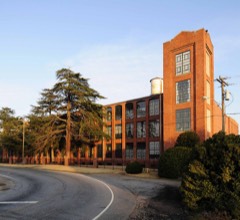 Arcadia Mill No. 2listed 2005
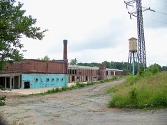 Arcadia Mill No.1listed 2014
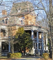 Bon Havenlisted 1976
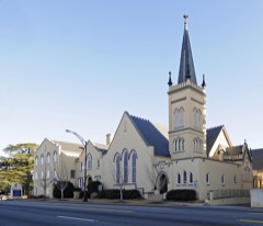 Central Methodist Churchlisted 2003
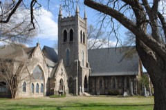 Church of the Adventlisted 2000
 Cleveland Law Rangelisted 1973
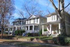 Converse Heights Historic Districtlisted 2007
 Converse Milllisted 2015
 Drayton Milllisted 2012
Every listing in Spartanburg County
Surveyed buildings and structures 1 record
- Finch Hotel, 184 East Main Street, Spartanburgfederal building survey, 22 photographs
Population over time
2 figuresSpartanburg grew from 37,013 to 38,732 between 2010 and 2020. These are the recorded population figures Wikidata holds for this place, reached through the Geographic Names Information System number this page is keyed on rather than by name, so they belong to this place and not to another of the same name. Most are census counts, but not all are: an early figure may be a founding or settlement estimate, and an estimate published within five years of a census is left out. The change column is computed, and is left blank where more than 20 years separate a figure from the one before it, because a gap that long is not a change between two counts.
| Year | People | Change |
|---|---|---|
| 2010 | 37,013 | |
| 2020 | 38,732 | +1,719 (+5%) |
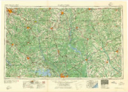
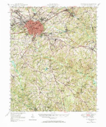
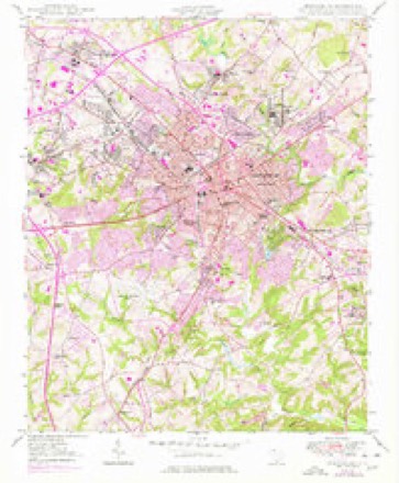
Topographic sheets covering this place
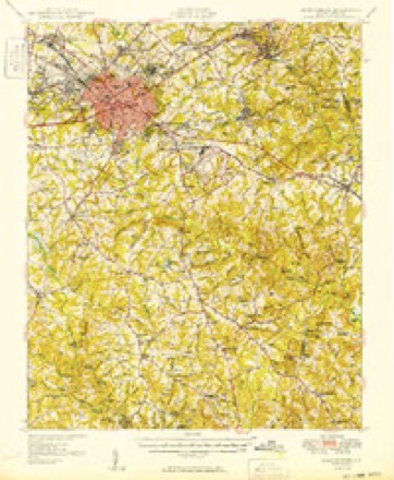
10 surveys from 18 printed sheetsMatched by testing this settlement's coordinate against the published boundary of every sheet in the United States Geological Survey's historical collection. Each opens the scanned sheet at the Survey.
- 1941 USGS Spartanburg quadrangle1:250000
- 1947 USGS Spartanburg quadrangle1:62500
- 1949 USGS Spartanburg quadrangle1:24000, 3 printings
- 1949 USGS Spartanburg quadrangle1:62500
- 1953 USGS Spartanburg quadrangle1:250000, 4 printings
- 1960 USGS Spartanburg quadrangle1:250000, 2 printings
- 1963 USGS Spartanburg quadrangle1:250000
- 1964 USGS Spartanburg quadrangle1:250000
- 1983 USGS Spartanburg quadrangle1:24000, 2 printings
- 1986 USGS Spartanburg quadrangle1:100000, 2 printings
Photographs
7 photographs, 1941 to 1943Taken for the Office of War Information and the Farm Security Administration, who photographed the country between 1935 and 1944. Works of United States government photographers, with no known restriction on use. Each opens its catalogue record.

Delano, Jack, 1941. Library of Congress

Delano, Jack, 1941. Library of Congress
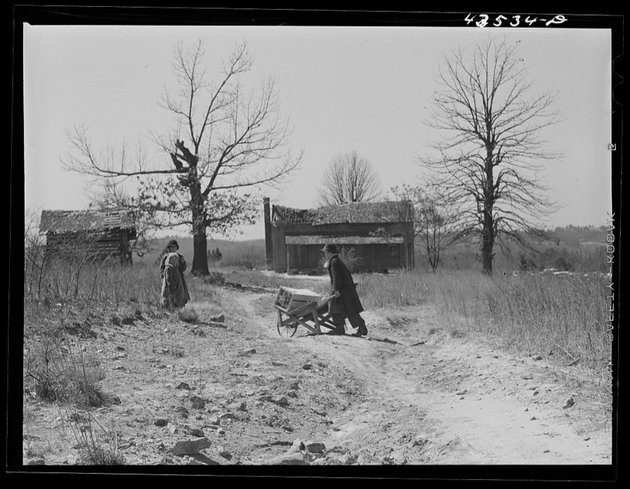
Delano, Jack, 1941. Library of Congress
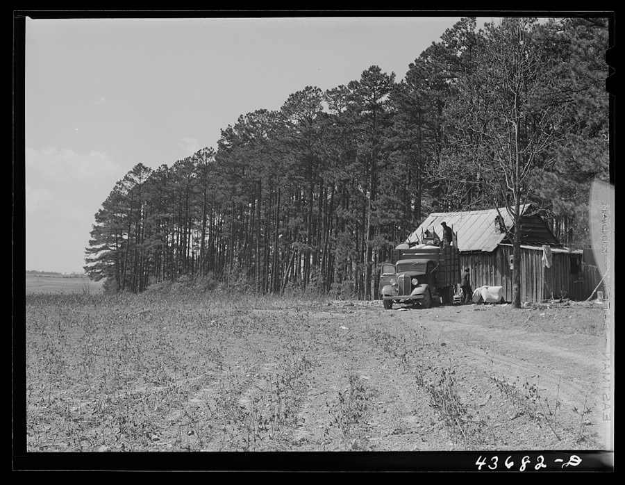
Delano, Jack, 1941. Library of Congress
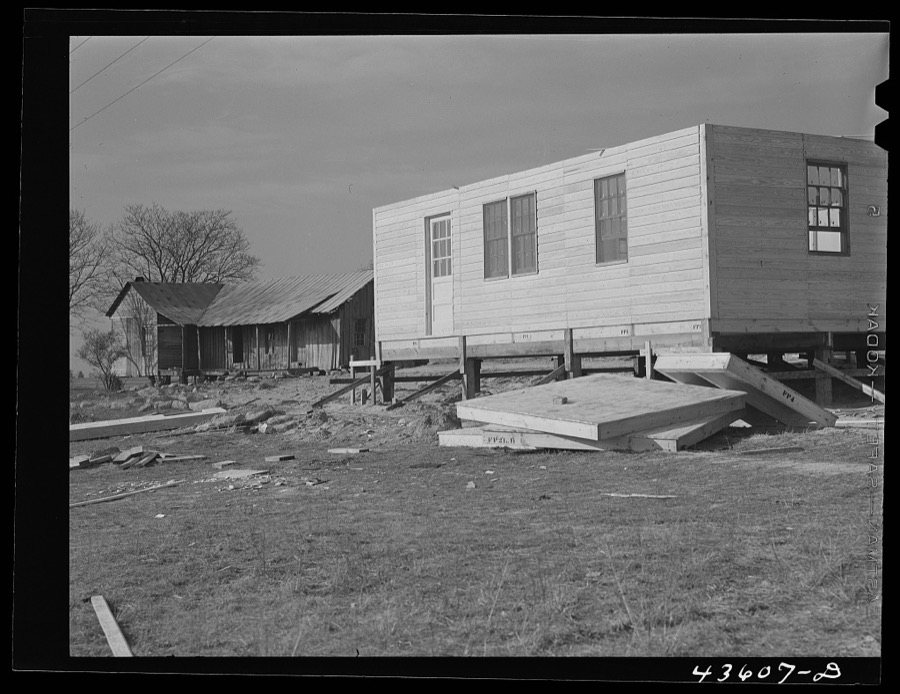
Delano, Jack, 1941. Library of Congress

Vachon, John, 1943. Library of Congress
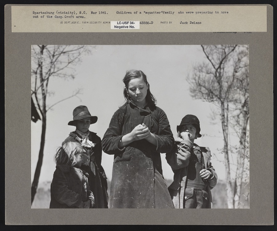
Delano, Jack, 1941. Library of Congress
Fires near this place
136 since 1992Regional context, not property-specific evidence. The federal wildfire occurrence database lists 136 fires within 5 miles of Spartanburg between 1992 and 2019, burning about 463 acres in total. 1 started naturally. 9 were recorded as arson. Distance is straight-line from the map coordinates, so a fire counted here may appear on a neighbouring settlement's page as well.
| Reported cause | Fires |
|---|---|
| Missing data/not specified/undetermined | 71 |
| Debris and open burning | 25 |
| Misuse of fire by a minor | 17 |
| Arson/incendiarism | 9 |
| Smoking | 4 |
| Recreation and ceremony | 3 |
| Power generation/transmission/distribution | 2 |
| Equipment and vehicle use | 2 |
| Fireworks | 1 |
| Natural | 1 |
| Railroad operations and maintenance | 1 |
The most recent of them, most recent first, with the day each was reported and the service that recorded it.
| Date | Cause | Size | Reported by | Name on the report |
|---|---|---|---|---|
| 6 September 1997 | Debris and open burning | 3.0 acres | South Carolina Forestry Commission | not named |
| 29 September 1993 | Missing data/not specified/undetermined | 2.0 acres | South Carolina Forestry Commission | not named |
| 28 September 1993 | Missing data/not specified/undetermined | 2.0 acres | South Carolina Forestry Commission | not named |
| 16 September 1999 | Debris and open burning | 1.0 acres | South Carolina Forestry Commission | not named |
| 31 August 2011 | Debris and open burning | 2.0 acres | South Carolina Forestry Commission | not named |
| 21 August 2007 | Missing data/not specified/undetermined | under an acre | South Carolina Forestry Commission | not named |
| 13 August 2007 | Debris and open burning | under an acre | South Carolina Forestry Commission | not named |
| 12 August 2002 | Debris and open burning | 1.0 acres | South Carolina Forestry Commission | not named |
Settlements close enough to share some of these fires:
Mines and quarries near this place
1 within 5 milesRegional context, not property-specific evidence. The federal mineral resources record lists 1 working within 5 miles of Spartanburg: 1 unknown. None of them still produces. What was taken out: Titanium, Iron. Distance is straight-line from the map coordinates, so a quarry counted here may appear on a neighbouring settlement's page as well.
| Where | Site | Commodity | Status | Recorded |
|---|---|---|---|---|
| North Spartanburg | Titanium, Iron | Unknown | Placer , Modern , Fluvial |
Storms near this place
60 of 123 shownRegional context, not property-specific evidence. The National Weather Service names Spartanburg in 123 storm reports between 1994 and 2022: 61 thunderstorm wind, 36 hail, 10 flash flood, 7 heavy rain. The reports record 1 death and 3 injuries. Each account below is quoted exactly as the forecast office filed it, from the NOAA Storm Events Database, and each date opens the federal record of that event.
| When | Event | Place named | Harm | What the report says |
|---|---|---|---|---|
| August 2007 | Lightning | Spartanburg | 1 killed, 1 hurt | no account filed |
| May 2003 | Thunderstorm Wind | Spartanburg | 1 hurt, $50,000 | Numerous trees and power lines were blown down, some of which fell on structures. Two mobile homes had their roofs blown off in Roebuck. A female was injured by a fallen tree. |
| May 2003 | Lightning | Spartanburg | 1 hurt | no account filed |
| August 1999 | Hail | Spartanburg | $9,000,000 | no account filed |
| May 2014 | Hail | Spartanburg | $3,000,000 | Public reported up to golf ball size hail from the west side of Spartanburg to the area around Spartanburg Regional Hospital. |
| August 1998 | Flash Flood | Spartanburg | $2,500,000 | A flash flood developed rapidly late in the evening following 4 to 5 inches of rainfall in a short time. The flash flood affected several creeks from the city of Spartanburg southward to Roebuck, Walnut Grove, and Pauline. The most damage may have occurred along Timms Creek and Lawson Fork Creek. Several roads were washed out, several people required rescue from their homes, a country club experienced severe damage, and a restaurant was destroyed. Most of the severe flooding was in the first 2 hours. |
| August 1999 | Hail | Spartanburg | $1,000,000 | no account filed |
| August 1998 | Flash Flood | Spartanburg | $500,000 | For the second consecutive night a flash flood hit Spartanburg. This time the primary flood occurred along Fairforest Creek and the communities affected were the west side of the city, Arcadia, Una, and Reidville Road. A road buckled leaving a 6 to 8 foot crater, rescues of motorists were required at Una, and a motel was flooded which required evacuation of the residents. |
| May 1998 | Lightning | Spartanburg | $150,000 | no account filed |
| May 2003 | Hail | Spartanburg | $100,000 | Hail on the east side of Spartanburg was responsible for extensive damage to vehicles on auto dealership lots. |
| July 1997 | Lightning | Spartanburg | $100,000 | no account filed |
| July 1995 | Thunderstorm Wind | west Spartanburg | $62,000 | ,,,,,,,,Urban Flooding |
| January 1996 | Thunderstorm Wind | Spartanburg | $35,000 | no account filed |
| July 2002 | Thunderstorm Wind | Spartanburg | $30,000 | A microburst in the Arcadia community caused several trees to snap off at their bases. One tree fell on a mobile home. |
| October 2005 | Heavy Rain | Spartanburg | $20,000 | Saturated ground caused a retaining wall to collapse, crushing 2 vehicles. |
| August 2003 | Flash Flood | Spartanburg | $20,000 | Severe urban flooding developed in the city. Several vehicles were trapped by flood waters, and some motorists required rescue. Flooding also developed along Lawson's Fork and Fairforest Creeks. A couple of bridges were washed out by flood waters. |
| June 2010 | Thunderstorm Wind | Spartanburg | $10,000 | Numerous trees and power lines were blown down in and around the city. At least one tree fell on a home and an automobile. |
| July 2005 | Thunderstorm Wind | Spartanburg | $5,000 | Large limbs down near the highway 29 exit of Interstate 85. Trees down along highway 176 near its intersection with Interstate 26. Quite a few trees down in Boiling Springs at around 9:25, at least one of which fell on a house. |
| July 2004 | Heavy Rain | Spartanburg | $5,000 | Heavy rainfall caused some street flooding in the city. Flood water entered some businesses. |
| November 2002 | Thunderstorm Wind | Spartanburg | $2,000 | Numerous trees and power lines were blown down. |
| November 2003 | Thunderstorm Wind | Spartanburg | $1,000 | Some trees were blown down. At least one fell on a house. |
| January 1995 | Thunderstorm Wind | Spartanburg | $1,000 | no account filed |
| July 2022 | Thunderstorm Wind | East Spartanburg | - | County comms reported a couple of trees down on the southeast side of Spartanburg. |
| July 2019 | Thunderstorm Wind | East Spartanburg | - | County comms reported multiple trees blown down southeast of Spartanburg. |
| July 2018 | Hail | Spartanburg | - | Public reported (via Social Media) ping pong ball to golf ball size hail on the south side of Spartanburg. |
| July 2015 | Hail | Spartanburg | - | Spotter reported quarter size hail in the city of Spartanburg. |
| May 2014 | Hail | Spartanburg | - | County comms reported hail of at least quarter size at Croft State Park. |
| June 2014 | Thunderstorm Wind | Spartanburg | - | County comms reported multiple trees and power lines blown down at Woodburn Rd and Country Club Rd. |
| June 2013 | Thunderstorm Wind | Spartanburg | - | Multiple trees were blown down onto roads and power lines on Connecticut Ave and North Church Street in Spartanburg. |
| April 2011 | Thunderstorm Wind | Spartanburg | - | Trees were blown down around the city of Spartanburg, mainly on the east side. Some trees damaged structures and vehicles, including a tree that fell on a vehicle on Woodland St. Another tree fell on and damaged a business on Pine St and another tree fell on a home on Palmetto St. |
| February 2009 | Hail | Spartanburg | - | Hail reported in the Converse Heights area. |
| June 2009 | Hail | Spartanburg | - | Hail was reported on North Church St. |
| December 2009 | Heavy Rain | Spartanburg | - | Urban and poor drainage flooding caused closure of a handful of roads in the northern half of Spartanburg County, including portions of Monks Grove Church Rd and highway 221 near Spartanburg. |
| April 2008 | Hail | Spartanburg | - | Several reports of hail, up to half dollar size, on the south side of Spartanburg. |
| June 2008 | Hail | Spartanburg | - | Hail reported in the Arcadia area. |
| May 2007 | Hail | Spartanburg | - | Reported near the intersection of Reidville Rd and Camelot Dr. |
| April 2006 | Hail | Spartanburg | - | Nickel hail reported at Converse College. |
| June 2006 | Heavy Rain | Spartanburg | - | Torrential rain from a thunderstorm caused some urban flooding in Inman, especially on Park Rd, which was covered with over a foot of water at Asheville highway and E Street. |
| June 2006 | Hail | Spartanburg | - | Nickel size hail near the intersection of highway 29 and Interstate 26. |
| July 2006 | Thunderstorm Wind | Spartanburg | - | Several trees downed around the city. Wofford College DPS reported several large limbs blown down around campus. |
| July 2006 | Thunderstorm Wind | Spartanburg | - | Power lines down at the intersection of Beechwood and Beech Hill in the city. Large tree limbs down near the intersection of Southgate Rd and highway 176. |
| July 2006 | Hail | Spartanburg | - | Dime size hail at the intersection of highway 296 and I-26. |
| July 2006 | Thunderstorm Wind | Spartanburg | - | Two trees blown down near the intersection of Anderson Mill and Old Anderson Mill Roads. |
| June 2006 | Thunderstorm Wind | Spartanburg | - | Numerous trees and power lines blown down and some roof damage, mainly in the southwest and south part of the city. |
| September 2006 | Thunderstorm Wind | Spartanburg | - | A sign blown down and trees blown down on power lines on Asheville Highway. |
| April 2005 | Thunderstorm Wind | Spartanburg | - | Quite a few trees and power lines down in and around the city. |
| June 2005 | Thunderstorm Wind | Spartanburg | - | A tree and power line down off highway 9 in the Lake Bowen area. Large limbs down close to town. |
| June 2005 | Thunderstorm Wind | Spartanburg | - | Two trees down along highway 9. |
| July 2005 | Thunderstorm Wind | Spartanburg | - | Large limbs blown down in the Pacolet Mills area. A spotter measured a 53 mph gust and reported a 1 foot diameter tree blown down. |
| July 2005 | Thunderstorm Wind | Spartanburg | - | Tops blown out of large oak trees along a city block wide area in Cherokee Springs. Some debris fell on power lines. |
| July 2005 | Lightning | Spartanburg | - | Lightning ignited a house fire. |
| June 2004 | Thunderstorm Wind | Spartanburg | - | Several 3-to-5 diameter limbs were blown down near the intersection of highway 221 and Floyd Rd. |
| June 2004 | Heavy Rain | Spartanburg | - | Poor drainage caused flooding to develop near the intersection of West Main and North Highpoint during a heavy thunderstorm. |
| June 2004 | Heavy Rain | Spartanburg | - | Heavy rainfall caused high water to enter 2 warehouses: one in the city, and the other at Camp Croft. |
| August 2004 | Heavy Rain | Spartanburg | - | Heavy rainfall caused some urban flooding to develop around the city. |
| August 2003 | Thunderstorm Wind | Spartanburg | - | A few trees were blown down in the Converse area. |
| August 2003 | Thunderstorm Wind | Spartanburg | - | Numerous trees were blown down on the east side of the city. |
| December 2002 | Flash Flood | Spartanburg | - | Some roads flooded, along with some small creeks and streams. |
| September 2002 | Thunderstorm Wind | Spartanburg | - | A blown down tree fell on a mobile home. |
| May 2002 | Thunderstorm Wind | Spartanburg | - | A few trees were blown down. |
Newspapers printed here
40,444 digitised pages6 papers published in this town, digitised by the Library of Congress and free to read: 4,530 issues, 40,444 pages. Every page is searchable, so a name or a street can be looked for directly in what the town printed about itself at the time.
| Newspaper | Published |
|---|---|
| The Spartan | 1843 to 1852 |
| The Spartan | 1896 to 1898 |
| Spartanburg Journal | 1900 to 1906 |
| The Carolina Spartan | 1898 to 1913 |
| The Journal and the Carolina Spartan | 1913 to 1920 |
| The Carolina Spartan | 1852 to 1896 |
What the paper printed
35,927 wordsFront pages of the local paper, read from the Library of Congress scans: 16 issues spread across its run from 1844 to 1917, 35,927 words in total. Each is reproduced on its own page, exactly as the recogniser returned it.
These pages read less well than anything else here, and the number is worth stating: about three words in four come through cleanly, against nine in ten for the building records. An 1896 broadsheet sets eight-point type in seven columns on microfilm, which is the hardest thing in this archive to read by machine. We tested our own recognisers against the Library's and they were not better, so the Library's text is what appears, with the wholly unreadable columns removed. Read it as a guide to what the paper covered, and follow the link to the scan before quoting anything.
| Issue | Paper | Length |
|---|---|---|
| 1856-03-20 | The Carolina Spartan | 3,024 words |
| 1856-05-15 | The Carolina Spartan | 2,873 words |
| 1856-07-10 | The Carolina Spartan | 2,999 words |
| 1856-08-28 | The Carolina Spartan | 3,346 words |
| 1856-10-30 | The Carolina Spartan | 3,406 words |
| 1894-05-16 | The Carolina Spartan | 2,248 words |
| 1844-07-17 | The Spartan | 2,498 words |
| 1844-08-14 | The Spartan | 2,362 words |
| 1844-08-28 | The Spartan | 2,417 words |
| 1844-09-25 | The Spartan | 2,251 words |
| 1849-06-28 | The Spartan | 2,470 words |
| 1898-02-16 | The Spartan | 836 words |
| 1902-05-09 | Spartanburg Journal | 1,366 words |
| 1906-09-06 | Spartanburg Journal | 428 words |
| 1902-04-30 | The Carolina Spartan | 1,907 words |
| 1917-02-02 | The Journal and the Carolina Spartan | 1,496 words |
Nearest settlements
The eight closest, with where each one stands in the county. Distances are straight-line, computed from the Geographic Names Information System coordinates.
| Map | Place | Distance | Sheets |
|---|---|---|---|
| Washington Heights | 0.9 miles | 18 | |
| Hartwell Courts | 1.0 miles | 18 | |
| Converse Heights | 1.0 miles | 18 | |
| Hub City Courts | 1.1 miles | 18 | |
| Summerhill | 1.1 miles | 18 | |
| Little Vista Heights | 1.2 miles | 18 | |
| Fairview Heights | 1.2 miles | 18 | |
| Woodburn Hills | 1.3 miles | 18 |
Elsewhere
Matched on this settlement's Geographic Names Information System number rather than its name, so it cannot be a different place of the same name in another state.
| Wikipedia article on Spartanburg | An encyclopaedic summary. Its text is share-alike, so it is linked here rather than copied. |
| Wikidata item Q773325 | The structured record the population and elevation above come from. Public domain (CC0). |
Provenance
This settlement is recorded in the Geographic Names Information System as feature 1250982. The sheet list is computed by point-in-boundary test against the United States Geological Survey's historical topographic inventory. Both are works of the United States government and carry no copyright under 17 U.S.C. 105.
Wildfire. Short, Karen C. 2022. Spatial wildfire occurrence data for the United States, 1992-2020 [FPA_FOD_20221014]. 6th Edition. Fort Collins, CO: Forest Service Research Data Archive. https://doi.org/10.2737/RDS-2013-0009.6 Collected with United States Government funding and usable without additional permissions or fees.
Mines and quarries. USGS Mineral Resources Data System (MRDS) https://mrdata.usgs.gov/mrds/ A work of the United States government, no copyright under 17 U.S.C. 105.
Storms. NOAA National Centers for Environmental Information, Storm Events Database https://www.ncei.noaa.gov/stormevents/ A work of the United States government, no copyright under 17 U.S.C. 105. Narratives are quoted verbatim from the National Weather Service report and are not edited or summarised.