 Block
Townville, South Carolina
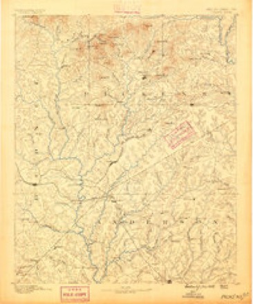
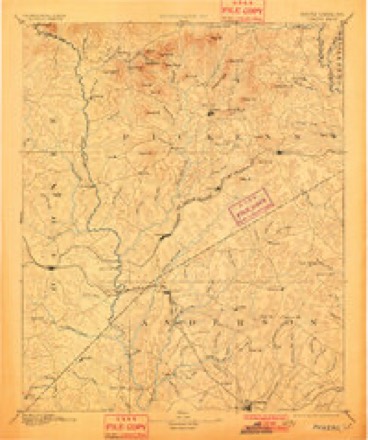
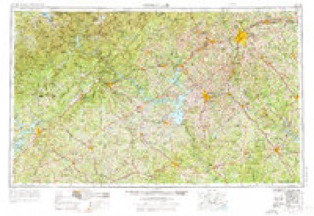
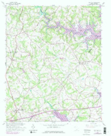
17 topographic sheets cover this place, the earliest surveyed in 1888 and the latest in 1991. It stands in the Townville census division. It lies in ZIP code area 29689. The Survey maps it on the Fair Play quadrangle. 4,504 people lived here at the 2020 count. It stands 817 feet above sea level.
Topographic sheets covering this place
7 surveys from 17 printed sheetsMatched by testing this settlement's coordinate against the published boundary of every sheet in the United States Geological Survey's historical collection. Each opens the scanned sheet at the Survey.
- 1888 USGS Pickens quadrangle1:125000
- 1894 USGS Pickens quadrangle1:125000, 6 printings
- 1954 USGS Greenville quadrangle1:250000, 3 printings
- 1958 USGS Fair Play quadrangle1:24000, 4 printings
- 1958 USGS Greenville quadrangle1:250000
- 1984 USGS Greenville quadrangle1:100000
- 1991 USGS Greenville quadrangle1:100000
Fires near this place
79 since 1992Regional context, not property-specific evidence. The federal wildfire occurrence database lists 79 fires within 5 miles of Townville between 1992 and 2020, burning about 252 acres in total. 4 started naturally. None was recorded as arson. Distance is straight-line from the map coordinates, so a fire counted here may appear on a neighbouring settlement's page as well.
| Reported cause | Fires |
|---|---|
| Missing data/not specified/undetermined | 28 |
| Debris and open burning | 28 |
| Equipment and vehicle use | 6 |
| Natural | 4 |
| Recreation and ceremony | 4 |
| Smoking | 4 |
| Misuse of fire by a minor | 3 |
| Power generation/transmission/distribution | 1 |
| Fireworks | 1 |
The most recent of them, most recent first, with the day each was reported and the service that recorded it.
| Date | Cause | Size | Reported by | Name on the report |
|---|---|---|---|---|
| 23 September 2008 | Debris and open burning | under an acre | South Carolina Forestry Commission | not named |
| 17 September 2009 | Smoking | under an acre | South Carolina Forestry Commission | not named |
| 15 September 1999 | Debris and open burning | 1.0 acres | South Carolina Forestry Commission | not named |
| 13 September 1999 | Debris and open burning | under an acre | South Carolina Forestry Commission | not named |
| 5 August 2015 | Debris and open burning | 1.0 acres | South Carolina Forestry Commission | not named |
| 5 August 2011 | Natural | under an acre | South Carolina Forestry Commission | not named |
| 5 August 2011 | Natural | under an acre | South Carolina Forestry Commission | not named |
| 10 August 2006 | Natural | under an acre | South Carolina Forestry Commission | not named |
Settlements close enough to share some of these fires:
Mines and quarries near this place
3 within 5 milesRegional context, not property-specific evidence. The federal mineral resources record lists 3 workings within 5 miles of Townville: 2 past producers, 1 unknown. None of them still produces. What was taken out: Gold, Vermiculite. Distance is straight-line from the map coordinates, so a quarry counted here may appear on a neighbouring settlement's page as well.
| Where | Site | Commodity | Status | Recorded |
|---|---|---|---|---|
| American Vermiculite #1 Pit | Vermiculite | Past Producer | Metamorphosed Igneous Intrusion | |
| Cochran Mine | Gold | Past Producer | ||
| Sitton Prospect | Gold | Unknown | Vein |
Storms near this place
38 since 1997Regional context, not property-specific evidence. The National Weather Service names Townville in 38 storm reports between 1997 and 2025: 22 thunderstorm wind, 9 hail, 5 tornado, 1 funnel cloud. No death or injury is recorded in these reports. Each account below is quoted exactly as the forecast office filed it, from the NOAA Storm Events Database, and each date opens the federal record of that event.
| When | Event | Place named | Harm | What the report says |
|---|---|---|---|---|
| April 2009 | Tornado (EF1) | Townville | $300,000 | NWS survey found an area of tornado damage that began on Dry Rock Rd near its intersection with Andersonville Rd. (It is possible that the tornado began over Lake Hartwell.) Damage was mainly confined to uprooted or snapped trees at this point, although two mobile homes were shifted off their foundation at this location.. The most significant damage occurred just east of this location, in the Snyder Rd area. A storage shelter was destroyed in this area and a travel trailer blown off concretet blocks. Other storage shelters received signifiumerous trees were snapped off or uprooted along Snyder Rd, with trees falling on several homes. The tornado traveled east from Snyder Rd, crossing an inlet of Lake Hartwell before re-emerging in the Sandy Shores Dr area. The tornado continued east, moving back over Lake Hartwell, where some trees were blown down on islands. The tornado apparently dissipated over the lake. East of Snyder Rd, damage was almost exclusively confined to snapped and uprooted trees, although some boat shelters and docks on Lake Hartwell were lifted and tossed as much as 100 feet. This tornado was produced by a supercell thunderstorm. |
| July 2013 | Flash Flood | Townville | $35,000 | Pearman Dairy Road/SC28 flooded near Westside High School. A foot of water was flowing over the road with a car in a ditch at the intersection of Old Asbury Road and Whitehall Road (7 W Anderson). Flooding at the intersection of highway 24 and New Hope Road (6 W Anderson). A sink hole opened up on Hattons Ford Road during very heavy rain. Two utility trucks were damaged after driving into the hole which was about 3 feet deep and spanned the entire road (4.5 SE Townville). Indian Trail Road near highway 24 was flooded by a stream near highway 24. |
| June 2018 | Thunderstorm Wind | Townville | $20,000 | Ham Radio operator and the public reported multiple trees blown down on I-85 between mile markers 11 and 12, and multiple trees down along Quail Ridge Rd, with falling trees causing minor structural and vehicle damage. Public reported three large trees blown down on North St in Anderson, with one tree damaging a home. |
| April 2015 | Thunderstorm Wind | Townville | $10,000 | NWS Storm Survey found intermittent wind damage, primarily confined to snapped limbs, small-to-medium sized uprooted trees, and a few large trees uprooted, was observed between Lake Hartwell and Highway 187, about 1 mile north of I-85. A couple of homes received minor roof damage in this area due to falling limbs or trees. Sporadic damage to trees continued east/northeast, across Highway 187, to Pine Needle Cir and Hix Dr, where the most significant damage was observed. A small house near the intersection of Hix Rd and Pine Needle Rd had much of the roof lifted and thrown, with debris spread into a field as far as 100 yards. Sporadic damage, mainly in the form of downed limbs, small snapped and uprooted hardwood trees, and larger uprooted softwoods continued northeast across Highway 71. Additional reports of sporadic damage were received from closer to Townville, including the Fair Play Rd area near the Oconee line. |
| June 1998 | Thunderstorm Wind | Townville | $10,000 | no account filed |
| January 2020 | Tornado (EF0) | Townville | $1,000 | NWS storm survey found a very short weak anticyclonic tornado damage path within a larger area of straight-line wind damage near the Oconee County line south of Townville. The tornado touched down south of Fairplay Rd near Little Beaverdam Creek and tracked NE paralleling the county line before lifting just south of the center of Townville. Multiple trees were uprooted while damage was limited to metal sheeting removed from an outbuilding near the end of the path. |
| April 2025 | Thunderstorm Wind | Townville | - | Fire dept reported trees and power lines blown down in western portions of Anderson County. |
| June 2025 | Thunderstorm Wind | Townville | - | Public reported numerous trees, large limbs, and some power lines blown down throughout Anderson County. The ASOS at the Anderson Regional Airport measured a wind gust of 51 kts, or 60 mph. |
| February 2024 | Thunderstorm Wind | Townville | - | County comms reported sporadic trees blown down across northern Anderson County, including on Hopkins Rd in Townville, at Blackman Rd and Martin Ln in Sandy Springs, and a couple of trees blown down in the West Pelzer area and on Stone Rd in Belton. |
| August 2023 | Hail | Townville | - | Public reported 3/4 inch hail near Townville Landing. |
| January 2020 | Thunderstorm Wind | Townville | - | NWS storm survey reported a series of downbursts blew down numerous trees and large limbs from Ramage Rd, across Highway 24, to Circle Dr and Conneross Rd along Lake Hartwell. |
| January 2020 | Tornado (EF0) | Townville | - | NWS storm survey found a very short, weak tornado damage path in the Circle Dr area bordering Lake Hartwell. Multiple large softwood trees were uprooted and smaller trees snapped in this area. |
| October 2019 | Thunderstorm Wind | Townville | - | County comms reported multiple trees blown down near the center of Townville. |
| June 2019 | Thunderstorm Wind | Townville | - | Highway patrol reported a tree blown down on I-85 at mile marker 5 and another tree down nearby at Old Dobbins Bridge Rd and Sullivan Rd. The ASOS at the Anderson Regional Airport measured a gust of 60 mph. |
| April 2019 | Thunderstorm Wind | Townville | - | County comms reported numerous trees and power lines blown down throughout Anderson County. |
| August 2018 | Thunderstorm Wind | Townville | - | County comms reported a tree blown down near the intersection Of Milford Rd and Highway 243 and another tree down on I-85 near mile marker 10. |
| August 2015 | Thunderstorm Wind | Townville | - | Highway patrol reported multiple trees blown down east of Townville. |
| June 2015 | Hail | Townville | - | Public reported nickel size hail near Townville. |
| May 2015 | Thunderstorm Wind | Townville | - | Public and Highway Patrol reported multiple trees, large limbs, and power lines blown down across western Anderson County from the Townville area to Starr and Iva. An automated gauge measured a 56 mph gust at the Anderson Regional Airport at 7:08 PM. |
| June 2015 | Hail | Townville | - | Public reported quarter size hail just off Highway 24 at Lake Hartwell. |
| August 2015 | Thunderstorm Wind | Townville | - | Highway Patrol reported a tree blown down at Hattons Ford Rd and Pine Cir in Townville and another tree down on Dobbins Bridge Rd. |
| May 2011 | Thunderstorm Wind | Townville | - | Several trees and large limbs were blown down in the Townville area, with the Chicoma Dr area being the hardest hit. At least one tree fell on a house. Part of the metal roof was blown off the Fire Department. |
| April 2011 | Thunderstorm Wind | Townville | - | Numerous trees were blown down across the entire county. At least one tree fell on a building in the city of Anderson and in Pendleton. ASOS measured a wind gust of 65 mph at the Anderson County airport, about 3 miles west of Anderson. |
| June 2011 | Thunderstorm Wind | Townville | - | Several trees were blown down to the south of Pendleton, including on I-85 near mile marker 11, at highway 187 and Fisher Jenkins Rd on highway 76 near Sandy Springs. |
| July 2008 | Thunderstorm Wind | Townville | - | Numerous trees and power lines were blown down in and around the Townville area. |
| August 2008 | Tornado (EF0) | Townville | - | This tornado touched down in Hart County, Georgia before skipping across Lake Hartwell and into extreme western Anderson County. The tornado then moved into Oconee County. The intermittent damage path was mainly limited to downed trees and power lines in Anderson County. |
| August 2004 | Thunderstorm Wind | Townville | - | Several trees were blown down. A canopy was blown off a home. |
| September 2004 | Tornado (F0) | Townville | - | This brief tornado produced mainly tree damage in the Double Springs community. |
| November 2000 | Thunderstorm Wind | Townville | - | A 250 pound block of concrete was picked up and thrown by the wind. |
| April 2012 | Hail | Townville | - | no account filed |
| May 2006 | Hail | Townville | - | no account filed |
| February 2005 | Hail | Townville | - | no account filed |
| April 2002 | Hail | Townville | - | no account filed |
| April 2002 | Funnel Cloud | Townville | - | no account filed |
| August 1999 | Hail | Townville | - | no account filed |
| August 1999 | Thunderstorm Wind | Townville | - | no account filed |
| July 1998 | Thunderstorm Wind | Townville | - | no account filed |
| April 1997 | Hail | Townville | - | no account filed |
Nearest settlements
The eight closest, with where each one stands in the county. Distances are straight-line, computed from the Geographic Names Information System coordinates.
| Map | Place | Distance | Sheets |
|---|---|---|---|
| Oakdale | 3.5 miles | 17 | |
| Shadow Wood | 4.0 miles | 17 | |
| Double Springs | 4.3 miles | 17 | |
| New Light | 5.4 miles | 17 | |
| Leisure Village | 5.4 miles | 17 | |
| Rock Creek Acres | 5.7 miles | 17 | |
| The Shoals | 5.9 miles | 17 | |
| Price (historical) | 6.3 miles | 15 |
Elsewhere
Matched on this settlement's Geographic Names Information System number rather than its name, so it cannot be a different place of the same name in another state.
| Wikipedia article on Townville | An encyclopaedic summary. Its text is share-alike, so it is linked here rather than copied. |
| Wikidata item Q14709662 | The structured record the population and elevation above come from. Public domain (CC0). |
Provenance
This settlement is recorded in the Geographic Names Information System as feature 1251191. The sheet list is computed by point-in-boundary test against the United States Geological Survey's historical topographic inventory. Both are works of the United States government and carry no copyright under 17 U.S.C. 105.
Wildfire. Short, Karen C. 2022. Spatial wildfire occurrence data for the United States, 1992-2020 [FPA_FOD_20221014]. 6th Edition. Fort Collins, CO: Forest Service Research Data Archive. https://doi.org/10.2737/RDS-2013-0009.6 Collected with United States Government funding and usable without additional permissions or fees.
Mines and quarries. USGS Mineral Resources Data System (MRDS) https://mrdata.usgs.gov/mrds/ A work of the United States government, no copyright under 17 U.S.C. 105.
Storms. NOAA National Centers for Environmental Information, Storm Events Database https://www.ncei.noaa.gov/stormevents/ A work of the United States government, no copyright under 17 U.S.C. 105. Narratives are quoted verbatim from the National Weather Service report and are not edited or summarised.