 Block
From the record
One of 62 National Register listings published here for Beaufort County · listed in 2020 · category: Building.
Sources: the National Register database, National Park Service
Listed on the National Register of Historic Places in 2020.
One of 62 National Register listings published here for Beaufort County · listed in 2020 · category: Building.
Sources: the National Register database, National Park Service
Regional context, not property-specific evidence. The federal wildfire occurrence database lists 118 fires within 5 miles of Means-Gage House between 1992 and 2019, burning about 410 acres in total. None started naturally. 27 were recorded as arson. Distance is straight-line from the map coordinates, so a fire counted here may appear on a neighbouring settlement's page as well.
| Reported cause | Fires |
|---|---|
| Debris and open burning | 46 |
| Arson/incendiarism | 27 |
| Missing data/not specified/undetermined | 24 |
| Misuse of fire by a minor | 15 |
| Equipment and vehicle use | 3 |
| Recreation and ceremony | 2 |
| Fireworks | 1 |
The most recent of them, most recent first, with the day each was reported and the service that recorded it.
| Date | Cause | Size | Reported by | Name on the report |
|---|---|---|---|---|
| 6 September 1997 | Arson/incendiarism | under an acre | South Carolina Forestry Commission | not named |
| 6 August 1993 | Missing data/not specified/undetermined | under an acre | South Carolina Forestry Commission | not named |
| 5 August 2008 | Debris and open burning | under an acre | South Carolina Forestry Commission | not named |
| 20 August 2007 | Debris and open burning | under an acre | South Carolina Forestry Commission | not named |
| 2 August 2001 | Debris and open burning | 8.0 acres | South Carolina Forestry Commission | not named |
| 14 August 2000 | Debris and open burning | 1.0 acres | South Carolina Forestry Commission | not named |
| 5 July 1993 | Missing data/not specified/undetermined | 1.0 acres | South Carolina Forestry Commission | not named |
| 3 July 1996 | Missing data/not specified/undetermined | 1.0 acres | South Carolina Forestry Commission | not named |
Regional context, not property-specific evidence. The National Weather Service names Beaufort, the town this property stands in, in 110 storm reports between 1994 and 2025: 74 thunderstorm wind, 19 hail, 8 lightning, 6 flash flood. The reports record 1 injury. Each account below is quoted exactly as the forecast office filed it, from the NOAA Storm Events Database, and each date opens the federal record of that event.
| When | Event | Place named | Harm | What the report says |
|---|---|---|---|---|
| August 1999 | Lightning | Beaufort | 1 hurt | Lightning injured a man on Lady's Island. |
| August 2008 | Thunderstorm Wind | Beaufort | $100,000 | The Beaufort County 911 Dispatch center reported numerous trees and power lines down across the county. Two trees were reported down on vehicles and three trees were reported down on homes. Two boats also sank in the Broad River when strong thunderstorm winds caused them to capsize. |
| September 1996 | Lightning | Beaufort | $35,000 | no account filed |
| May 1997 | Thunderstorm Wind | Beaufort | $25,000 | A house was damaged on Harbour Island and several trees down. |
| August 2008 | Thunderstorm Wind | Beaufort | $20,000 | A large tree was reported down on a car at a car dealership off Highway 21 in Beaufort, South Carolina. The top of the car was crushed. |
| July 2008 | Thunderstorm Wind | Beaufort | $10,000 | A large tree was reported down on an unoccupied home near the intersection of Lafayette Street and Spectable Street in Beaufort, South Carolina. |
| August 1999 | Lightning | Beaufort | $10,000 | Lightning strike resulted in a fire on Lady's Island. |
| March 2008 | Lightning | Beaufort | $5,000 | Law Enforcement reported a house on fire due to a lightning strike. |
| May 2006 | Thunderstorm Wind | Beaufort | $5,000 | Trees and powerlines down on Goothey Road. |
| June 1995 | Thunderstorm Wind | Beaufort | $5,000 | Trees down. |
| May 2010 | Thunderstorm Wind | Beaufort | $3,000 | Law Enforcement reported 6 trees down in Beaufort, South Carolina. Trees were reported down at the intersections of the following roads, Cloverdale and Kings Neck, Morrall and Murray, Big Estate and River, Old Sheldon Church and Trask Parkway. Trees were also reported down at the following residences 4349 Joe Frazier Road and 536 Joe Frazier Road. |
| July 2012 | Thunderstorm Wind | Beaufort | $2,000 | Tree down on a house on Laudonniere Street. |
| June 2011 | Thunderstorm Wind | Beaufort | $2,000 | A dispatch center reported trees down on Colony Gardens Road. |
| June 2010 | Thunderstorm Wind | Beaufort | $2,000 | The police reported at least one tree down at the intersection of 4th and Centerview Drive. |
| August 2006 | Thunderstorm Wind | Beaufort | $2,000 | 2 large trees down on Coffin Point Road. |
| June 2016 | Thunderstorm Wind | Beaufort | $1,750 | The Beaufort County 911 Call Center reported a tree limb brought down a power line at the 500 block of Battery Creek Road. |
| September 2021 | Thunderstorm Wind | Beaufort | $1,500 | Beaufort County Sheriff's Office reported three trees down in the area. One tree was down on a house at 411 Meritta Avenue. Another tree was down at the end of 16th Street in Port Royal. Finally, another tree was down and blocking one lane of traffic on Talbird Road near the intersection with Waddell Road. |
| June 2011 | Thunderstorm Wind | Beaufort | $1,500 | The public reported power lines down and on fire along Highway 21 in the Pristine area. |
| October 2008 | Thunderstorm Wind | Beaufort | $1,500 | The public reported that 1 tree was down on a house near the intersection of Morris Street and Sycamore Street in Beaufort, South Carolina. |
| June 2019 | Thunderstorm Wind | Beaufort | $1,250 | The Beaufort County 911 Call Center reported power lines down on Sams Point Road. |
| August 2023 | Thunderstorm Wind | Beaufort | $1,000 | The Beaufort County 911 Call Center reported a tree down on Hogarth Street. |
| August 2019 | Lightning | Beaufort | $1,000 | An emergency manager reported a tree down along Pickpocket Plantation Drive due to lightning. |
| July 2012 | Thunderstorm Wind | Beaufort | $1,000 | One Palmetto tree was reported down. Very strong wind that lasted 2 to 3 minutes. |
| August 2011 | Thunderstorm Wind | Beaufort | $1,000 | A county official reported a tree down and blocking Adventure Street. |
| August 2008 | Thunderstorm Wind | Beaufort | $1,000 | A tree was reported down on a power line in Beaufort, South Carolina. |
| August 2006 | Thunderstorm Wind | Beaufort | $1,000 | Tree down on MLK Boulevard and Highway 21 on St. Helena Island. |
| August 2006 | Thunderstorm Wind | Beaufort | $1,000 | Large tree down along Highway 21 at the Chowan Creek Bridge. |
| August 1999 | Lightning | Beaufort | $1,000 | Lightning strike resulted in a residence fire. |
| June 2024 | Thunderstorm Wind | Beaufort | $500 | A spotter reported several large tree limbs down near the intersection of Carteret Street and Craven Street. |
| December 2020 | Thunderstorm Wind | Beaufort | $500 | A Beaufort County emergency manager reported construction scaffolding blown down onto Highway 21 northbound, closing the road for 50 minutes. |
| August 2012 | Thunderstorm Wind | Beaufort | $500 | Beaufort County warning point reported a tree down on Oyster Cove Road. |
| June 2011 | Thunderstorm Wind | Beaufort | $500 | The public reported 6 inch diameter tree branches blown down. |
| September 2011 | Thunderstorm Wind | Beaufort | $500 | Beaufort County 911 Center reported 1 tree down on Waight Street in Beaufort. |
| March 2011 | Hail | Beaufort | $500 | The Public reported half dollar size hail broke a car window on Shell Point Road in Beaufort, South Carolina. |
| December 2008 | Thunderstorm Wind | Beaufort | $500 | Law enforcement reported a tree down on Middle Road in Beaufort, South Carolina. |
| August 2008 | Thunderstorm Wind | Beaufort | $250 | The public reported glass was blown out of a McDonald's sign on Highway 21 in Beaufort, South Carolina. |
| October 2008 | Thunderstorm Wind | Beaufort | $50 | The public reported a large branch down on the roadway near the intersection of Ribaut Road and Hermitage Road in Beaufort, South Carolina. |
| May 2025 | Thunderstorm Wind | Beaufort | - | Beaufort County Emergency Management reported a tree down at the halfway point of Sea Gull Drive. |
| May 2025 | Thunderstorm Wind | Beaufort | - | Beaufort County Emergency Management reported a tree down near the intersection of Brickyard Point Road and Marsh Drive. |
| May 2025 | Thunderstorm Wind | Beaufort | - | Beaufort County Emergency Management reported a tree down in the 1800 block of Oconnell Street. |
| August 2025 | Flash Flood | Beaufort | - | The Beaufort County Sheriff Office reported a vehicle stalled in floodwaters near the intersection of Charles Street and Craven Street. |
| August 2025 | Flash Flood | Beaufort | - | The Beaufort County Sheriff Office reported a vehicle stalled in floodwaters in the 2100 Block Boundary Street. |
| May 2024 | Hail | Beaufort | - | Beaufort County Emergency Management reported nickel sized hail on Lady's Island. |
| April 2022 | Thunderstorm Wind | Beaufort | - | A Beaufort County emergency manager reported a tree down near the intersection of Duke Street and Marsh Road. |
| April 2022 | Thunderstorm Wind | Beaufort | - | A Beaufort County emergency manager reported a tree down along North Hermitage Road. |
| April 2022 | Thunderstorm Wind | Beaufort | - | A Beaufort County emergency manager reported a tree down along Boundary Street. |
| April 2022 | Thunderstorm Wind | Beaufort | - | A Beaufort County emergency manager reported a tree down along Sycamore Street. |
| June 2022 | Thunderstorm Wind | Beaufort | - | The Beaufort County Dispatch reported a tree down on Ribaut road near the intersection with North Street. |
| June 2022 | Thunderstorm Wind | Beaufort | - | The Beaufort County Dispatch reported a tree down near the intersection of Marsh Road and Duke Street. |
| June 2021 | Thunderstorm Wind | Beaufort | - | A Beaufort County emergency manager reported a tree down and blocking both lanes of Wilmington Street near the intersection with Prince Street. |
| April 2020 | Thunderstorm Wind | Beaufort | - | The Beaufort County 911 Call Center reported a tree fell onto a power line along Center Drive West. |
| April 2020 | Thunderstorm Wind | Beaufort | - | Law enforcement reported a tree down and blocking Ribaut Road between Hermitage Road and Depot Road. |
| April 2020 | Thunderstorm Wind | Beaufort | - | A trained spotter reported a seven inch diameter tree uprooted, roof shingles blown off a home, three wooden storm shutters torn from anchors and several large tree limbs down near the intersection of Carteret Street and Craven Street. |
| April 2019 | Thunderstorm Wind | Beaufort | - | A Beaufort County emergency manager reported a tree down near the intersection of Ribaut Road and Allison Road. |
| June 2016 | Thunderstorm Wind | Beaufort | - | Law enforcement reported trees down throughout the city of Beaufort. Several trees were down on houses along Tekoa Lane and on cars on Center Drive East, Ribaut Road, Boundary Street and North Hermitage. |
| July 2015 | Thunderstorm Wind | Beaufort | - | Beaufort County Emergency Management reported a tree blown down at the intersection of Baggett Street and Union Street. |
| July 2015 | Thunderstorm Wind | Beaufort | - | Beaufort County dispatch reported that there were numerous trees down in and around Beaufort. |
| July 2015 | Thunderstorm Wind | Beaufort | - | Beaufort County dispatch reported a tree down on Lafayette Street. |
| July 2015 | Thunderstorm Wind | Beaufort | - | Beaufort County dispatch reported a tree down near the intersection of Bay Street and Ribaut Road. |
| July 2014 | Thunderstorm Wind | Beaufort | - | Beaufort County emergency manager reported a tree down on a vehicle on Ladys Island Drive. |
7 papers published in this town, digitised by the Library of Congress and free to read: 399 issues, 1,593 pages. Every page is searchable, so a name or a street can be looked for directly in what the town printed about itself at the time.
| Newspaper | Published |
|---|---|
| Port Royal Standard and Commercial | 1874 to 1876 |
| Beaufort Republican | 1871 to 1873 |
| The Free South | 1863 to 1864 |
| The Tribune | 1874 to 1876 |
| The Beaufort Republican and Sea Island Chronicle | 1869 to 1871 |
| The Beaufort Tribune and Port Royal Commercial | 1877 to 1879 |
| The Crescent | 1879 to 1881 |
No historic map-sheet match is published for this property yet. That does not mean no map exists. This record needs a coordinate-quality review before it can be joined to a sheet boundary. Browse the county's mapped places while that work is pending.
Other National Register properties close enough to walk or drive between, ordered by distance from this one. Both positions come from the same geocoding pass that matched these properties to their map sheets.
| Photograph | Property | Distance | Listed |
|---|---|---|---|
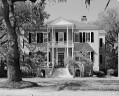 | Tabby Manse | under 500 feet | 1971 |
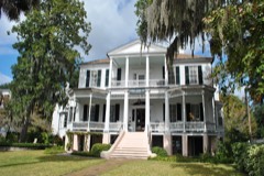 | John A. Cuthbert House | under 500 feet | 1972 |
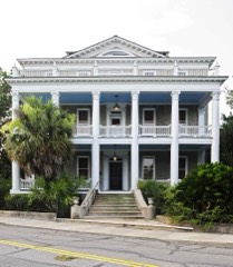 | Anchorage, The | 0.1 miles | 1971 |
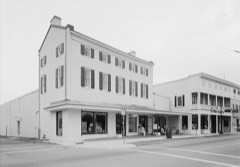 | Grand Army of the Republic Hall | 0.2 miles | 1969 |
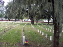 | Beaufort National Cemetery | 0.2 miles | 1997 |
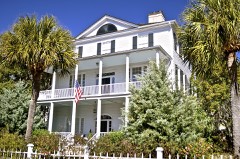 | William Barnwell House | 0.3 miles | 1971 |
| National Archives record | The nomination case file for reference 100005675 in Record Group 79. |
| Beaufort County | All 62 listed properties in this county. |