 Block
From the record
One of 9 National Register listings published here for Chesterfield County · listed in 2022 · category: District.
Sources: the National Register database, National Park Service
Listed on the National Register of Historic Places in 2022.
One of 9 National Register listings published here for Chesterfield County · listed in 2022 · category: District.
Sources: the National Register database, National Park Service
Regional context, not property-specific evidence. The federal wildfire occurrence database lists 299 fires within 5 miles of Coulter Memorial Academy Historic District between 1992 and 2020, burning about 1,365 acres in total. 3 started naturally. 55 were recorded as arson. Distance is straight-line from the map coordinates, so a fire counted here may appear on a neighbouring settlement's page as well.
| Reported cause | Fires |
|---|---|
| Debris and open burning | 110 |
| Missing data/not specified/undetermined | 83 |
| Arson/incendiarism | 55 |
| Equipment and vehicle use | 20 |
| Railroad operations and maintenance | 13 |
| Misuse of fire by a minor | 11 |
| Smoking | 3 |
| Natural | 3 |
| Fireworks | 1 |
The most recent of them, most recent first, with the day each was reported and the service that recorded it.
| Date | Cause | Size | Reported by | Name on the report |
|---|---|---|---|---|
| 9 September 2007 | Debris and open burning | 3.0 acres | South Carolina Forestry Commission | not named |
| 7 September 2002 | Equipment and vehicle use | 4.0 acres | South Carolina Forestry Commission | not named |
| 4 September 1999 | Debris and open burning | 1.0 acres | South Carolina Forestry Commission | not named |
| 29 September 2001 | Equipment and vehicle use | 2.0 acres | South Carolina Forestry Commission | not named |
| 26 September 1995 | Missing data/not specified/undetermined | 1.0 acres | South Carolina Forestry Commission | not named |
| 25 September 1998 | Railroad operations and maintenance | under an acre | South Carolina Forestry Commission | not named |
| 24 September 1998 | Arson/incendiarism | under an acre | South Carolina Forestry Commission | not named |
| 14 September 2007 | Arson/incendiarism | under an acre | South Carolina Forestry Commission | not named |
Regional context, not property-specific evidence. The federal mineral resources record lists 11 workings within 5 miles of Coulter Memorial Academy Historic District: 6 unknowns, 3 producers, 2 past producers. 3 still produce. What was taken out: Clay, Sand and Gravel, Construction, Titanium, Iron, Iron, Thorium, Zirconium, Titanium. Distance is straight-line from the map coordinates, so a quarry counted here may appear on a neighbouring settlement's page as well.
| Where | Site | Commodity | Status | Recorded |
|---|---|---|---|---|
| Juniper Creek | Iron, Thorium, Zirconium, Titanium | Unknown | Placer , Modern , Fluvial | |
| Thompson Creek | Titanium, Iron | Unknown | Placer , Modern , Fluvial | |
| Cash Mine | Sand and Gravel, Construction | Producer | ||
| Unidentified Gravel Mine | Sand and Gravel, Construction | Unknown | Sedimentary | |
| Cheraw Mine | Clay | Unknown | Sedimentary | |
| Cheraw Mine | Clay | Producer | ||
| Gin Creek Mine | Clay | Past Producer | ||
| Irby Mine | Clay | Unknown | Sedimentary | |
| Palmetto Mine | Clay | Producer | ||
| Unidentified Clay Mine | Clay | Past Producer | Sedimentary |
Regional context, not property-specific evidence. The National Weather Service names Cheraw, the town this property stands in, in 58 storm reports between 1998 and 2024: 25 thunderstorm wind, 23 hail, 6 flash flood, 3 heavy rain. The reports record 4 injuries. Each account below is quoted exactly as the forecast office filed it, from the NOAA Storm Events Database, and each date opens the federal record of that event.
| When | Event | Place named | Harm | What the report says |
|---|---|---|---|---|
| August 2011 | Thunderstorm Wind | Cheraw | 4 hurt, $80,000 | Sheriff reported trees down in Cheraw... some on vehicles and some on homes. |
| July 2012 | Hail | Cheraw | $50,000 | Public reported golfball size hail on the north side of Cheraw. |
| October 2016 | Flash Flood | Cheraw | $10,000 | SCDOT reported Old Cash Road near Juniper Road closed due to flooding. They also reported a roadway washout along Songbird Road between Teals Mill Road and Bear Creek Road. |
| December 2015 | Flash Flood | Cheraw | $7,000 | County EM reported a few roads closed due to flash flooding including the U.S. 52 bypass in Cheraw. |
| July 2012 | Hail | Cheraw | $5,000 | Public reported quarter size hail covering the ground near Highway 145. |
| July 2009 | Hail | Cheraw | $4,000 | Cheraw State Park reported penny size hail and several trees struck and split by lightning. |
| September 2014 | Thunderstorm Wind | Cheraw | $3,000 | Chesterfield County Dispatch reported trees down on Hwy 1 near the National Guard Armory. |
| June 2011 | Thunderstorm Wind | Cheraw | $3,000 | EM reported trees downin Cheraw on Laney and Old Cash roads. |
| June 2011 | Thunderstorm Wind | Cheraw | $2,000 | EM reported large branches and a few trees down in Cheraw. |
| January 2010 | Thunderstorm Wind | Cheraw | $2,000 | DOT reported a few trees down in the Cheraw area. |
| July 2012 | Thunderstorm Wind | Cheraw | $1,000 | DOT reported a couple of trees down on Old Chesterfield Hwy. |
| April 2023 | Hail | Cheraw | $100 | Personnel at Cheraw Water Plant reported hail slightly larger than dime size but smaller than nickel size. Time estimated. |
| September 2018 | Flash Flood | Cheraw | $100 | Some roads closed due to flooding in Cheraw and vicinity, including Manor Rd between W Market St Ext and US Hwy 1, and Market St (US Hwy 1) between Christian St and 2nd St. |
| September 2018 | Flash Flood | Cheraw | $100 | Miller Ingram Dr closed due to Wilson Branch creek overflowing its banks. |
| September 2018 | Flash Flood | Cheraw | $100 | Video, shared via social media, showed water over Cash Rd near Old Cash Rd. Road was closed. |
| May 2024 | Hail | Cheraw | - | Broadcast meteorologist passed on a public report with photo of roughly ping-pong sized hail in Cheraw. |
| May 2024 | Hail | Cheraw | - | SKYWARN Spotters noted several reports of quarter sized hail just north of Cheraw along Highway 52. |
| May 2024 | Thunderstorm Wind | Cheraw | - | A tree was downed on a power line at Little St and Huger St in Cheraw. Time estimated. |
| May 2024 | Thunderstorm Wind | Cheraw | - | A tree was downed on a house on High St in Cheraw. Time estimated. |
| August 2023 | Thunderstorm Wind | Cheraw | - | Chesterfield County Dispatch reported multiple trees down along Highway 52. |
| August 2020 | Hail | Cheraw | - | Spotter reported hail up to the size of a quarter in Cheraw. |
| September 2018 | Heavy Rain | Cheraw | - | CO-OP Observer Station CEWS1, Cheraw Water Plant, measured a total rainfall amount, associated with Tropical Cyclone Florence, of 22.58 inches. The rain fell from late afternoon Friday Sept. 14th through early morning Monday Sept. 17th. |
| June 2016 | Thunderstorm Wind | Cheraw | - | Winds downed power lines at the intersection of Legrand Street and Depot Street. |
| June 2016 | Thunderstorm Wind | Cheraw | - | Reported downed trees along with a blown transformer on Market Street. |
| June 2016 | Heavy Rain | Cheraw | - | Public reported rainfall up to 3 inches which caused ponding of water along Church Street in Cheraw. |
| June 2016 | Thunderstorm Wind | Cheraw | - | Law enforcement reported a tree down across the roadway at US 1 and US 52. |
| July 2016 | Thunderstorm Wind | Cheraw | - | Numerous trees and power lines were downed in and around the town of Cheraw. Many areas were without power. |
| July 2016 | Thunderstorm Wind | Cheraw | - | Public report of a 60 MPH wind gust. Pea size hail also reported. |
| September 2014 | Hail | Cheraw | - | Sheriff dispatch reported that officers observed dime size hail near the town of Cheraw. |
| June 2013 | Heavy Rain | Cheraw | - | COOP Observer at Cheraw Water Plant reported 1.31 inches of rain from a thunderstorms within a half hour. |
| February 2011 | Hail | Cheraw | - | Spotter reported nickel size hail in Cheraw. |
| July 2010 | Hail | Cheraw | - | Public reported 1.25 inch hail. |
| July 2010 | Hail | Cheraw | - | Public reported golf ball size hail. |
| June 2008 | Hail | Cheraw | - | Public reported quarter size hail and large branches down. |
| June 2008 | Hail | Cheraw | - | COOP observer reported nickel size hail. |
| July 2008 | Thunderstorm Wind | Cheraw | - | Highway Maintenance reported a few trees down near Cheraw. |
| July 2008 | Thunderstorm Wind | Cheraw | - | Coop Observer reported trees and large limbs down along with some small hail. |
| August 2008 | Thunderstorm Wind | Cheraw | - | Public reported trees dwon at US 21 and hwy 52. |
| June 2007 | Hail | Cheraw | - | H. Cooper Black Park reported nickel size hail. |
| May 2006 | Hail | Cheraw | - | Public reported golf ball size hail. |
| June 2006 | Hail | Cheraw | - | Highway Dept. reported 3/4 inch hail on US Hwy 52. |
| July 2006 | Hail | Cheraw | - | Public reported 3/4 inch hail on SC Hwy 9. |
| June 2006 | Hail | Cheraw | - | Forestry Commission reported 3/4 inch hail at Cheraw State Park. |
| August 2006 | Thunderstorm Wind | Cheraw | - | Fire Dept. reported numerous trees down and power outages. |
| August 2006 | Thunderstorm Wind | Cheraw | - | Cheraw State Park reported some trees and large limbs down on the north side of the park. |
| August 2006 | Hail | Cheraw | - | SKYWARN spotter reported nickel size hail at the intersection of hwy 52 and State road. |
| November 2006 | Thunderstorm Wind | Cheraw | - | Sheriff reported trees down on US 52 in the Cash area. |
| September 2004 | Tornado (F1) | Cheraw | - | An F1 intermittently touched down and did minor damage to several homes, businesses, and an elementary school.. Numerous trees and powerlines were down. |
| July 2003 | Thunderstorm Wind | Cheraw | - | Sheriff reported trees down on Cattle Ridge Road. |
| May 2003 | Flash Flood | Cheraw | - | SKYWARN spotters reported flash flooding in and around Cheraw. Several roads closed due to water over the highways. |
| March 2002 | Hail | Cheraw | - | Coop observer reported 1 inch hail. |
| April 2002 | Hail | Cheraw | - | Sheriff reported dime size hail. |
| August 2001 | Thunderstorm Wind | Cheraw | - | Cheraw State Park reported large limbs down on the golf course. |
| June 2000 | Thunderstorm Wind | Cheraw | - | EOC reported trees down in Cheraw. |
| June 2000 | Hail | Cheraw | - | NWS COOP observer reported 3/4 inch hail. |
| August 2000 | Thunderstorm Wind | Cheraw | - | Public reported trees and powerlines down. |
| January 1998 | Thunderstorm Wind | Cheraw | - | EPD and Highway Maintenance report several trees down on SC Hwy 22. |
| March 1998 | Hail | Cheraw | - | Sheriff reported 1 inch hail in Cheraw. |
5 papers published in this town, digitised by the Library of Congress and free to read: 600 issues, 3,005 pages. Every page is searchable, so a name or a street can be looked for directly in what the town printed about itself at the time.
| Newspaper | Published |
|---|---|
| Cheraw Gazette | 1847 to 1861 |
| Farmers' Gazette, and Cheraw Advertiser | 1839 to 1843 |
| Cheraw Chronicle | 1896 to 2005 |
| Cheraw Gazette | 1835 to 1838 |
| Farmers' Gazette | 1843 to 1847 |
No historic map-sheet match is published for this property yet. That does not mean no map exists. This record needs a coordinate-quality review before it can be joined to a sheet boundary. Browse the county's mapped places while that work is pending.
Other National Register properties close enough to walk or drive between, ordered by distance from this one. Both positions come from the same geocoding pass that matched these properties to their map sheets.
| Photograph | Property | Distance | Listed |
|---|---|---|---|
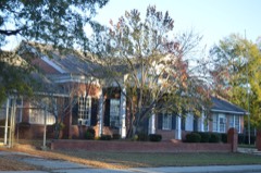 | Robert Smalls School | 0.2 miles | 2014 |
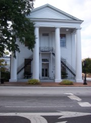 | Cheraw Historic District | 0.3 miles | 1974 |
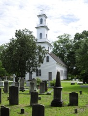 | St. David's Episcopal Church and Cemetery | 0.5 miles | 1971 |
| National Archives record | The nomination case file for reference 100008217 in Record Group 79. |
| Chesterfield County | All 9 listed properties in this county. |