
BlockBefore
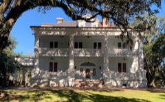
Photograph of Naval Health Clinic Charleston
Photograph by Official U. S. Navy Photograph, Public domain. Via Wikimedia Commons.

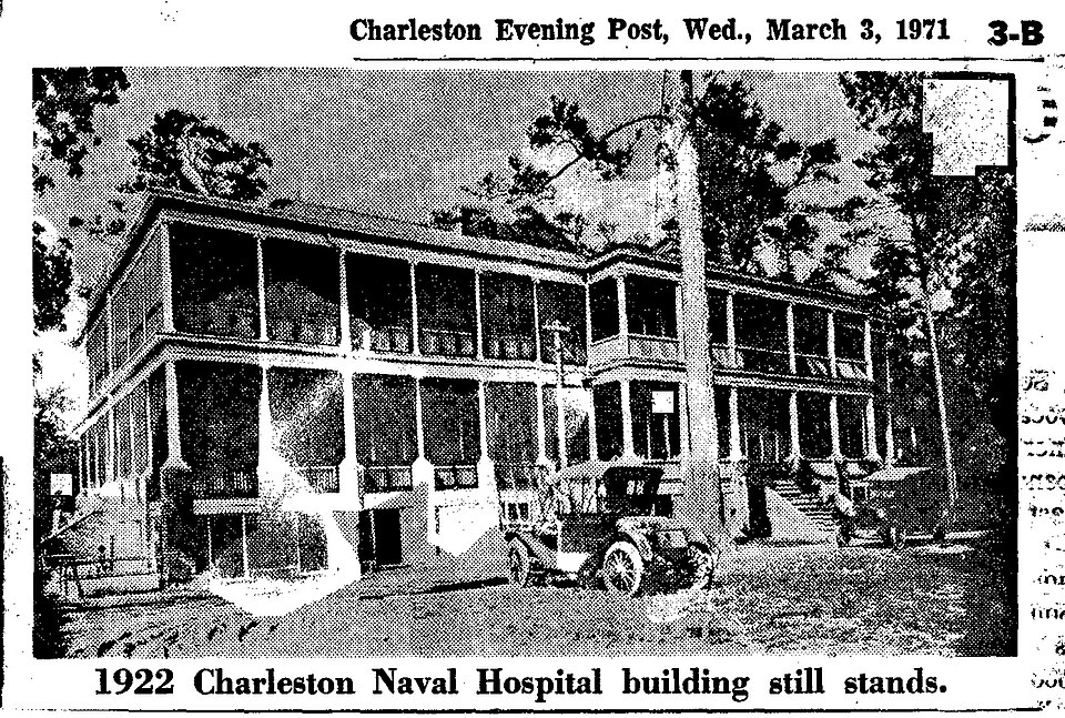
Charleston Naval Hospital Historic District

Listed on the National Register of Historic Places in 2010.

From the record

“The Charleston Naval Hospital Historic District is a portion of the Charleston Navy Base that included a collection of buildings connected with the medical needs of the Navy base.”

Wikipedia article Charleston Naval Hospital Historic District, CC BY-SA 4.0.

One of 227 National Register listings published here for Charleston County · listed in 2010 · category: District.

Sources: the Wikipedia article · the case file at the National Archives · the National Register database, National Park Service

The listing

Fires near this property

24 since 1994

Regional context, not property-specific evidence. The federal wildfire occurrence database lists 24 fires within 5 miles of Charleston Naval Hospital Historic District between 1994 and 2020, burning about 197 acres in total. 1 started naturally. 4 were recorded as arson. Distance is straight-line from the map coordinates, so a fire counted here may appear on a neighbouring settlement's page as well.

Reported cause Fires
Debris and open burning8
Missing data/not specified/undetermined7
Arson/incendiarism4
Misuse of fire by a minor2
Fireworks1
Natural1
Recreation and ceremony1

The most recent of them, most recent first, with the day each was reported and the service that recorded it.

DateCause SizeReported by Name on the report
4 August 1999Arson/incendiarismunder an acreSouth Carolina Forestry Commissionnot named
29 August 1998Debris and open burningunder an acreSouth Carolina Forestry Commissionnot named
7 July 2012Fireworks8.0 acresSouth Carolina Forestry Commissionnot named
29 July 1998Debris and open burningunder an acreSouth Carolina Forestry Commissionnot named
4 June 1999Arson/incendiarism5.0 acresSouth Carolina Forestry Commissionnot named
20 June 2015Natural3.0 acresSouth Carolina Forestry Commissionnot named
18 May 1994Missing data/not specified/undetermined1.0 acresSouth Carolina Forestry Commissionnot named
11 May 2000Arson/incendiarism15 acresSouth Carolina Forestry Commissionnot named

Every fire recorded in Charleston County

Mines and quarries near this property

3 within 5 miles

Regional context, not property-specific evidence. The federal mineral resources record lists 3 workings within 5 miles of Charleston Naval Hospital Historic District: 1 unknown, 1 producer, 1 past producer. 1 still produces. What was taken out: Sand and Gravel, Construction. Distance is straight-line from the map coordinates, so a quarry counted here may appear on a neighbouring settlement's page as well.

Where SiteCommodity StatusRecorded
Mt Pleasant PitSand and Gravel, ConstructionPast ProducerSedimentary
Ware Brothers PitSand and Gravel, ConstructionUnknownSedimentary
Ware Brothers PitSand and Gravel, ConstructionProducer

Every working recorded in Charleston County

Storms near this property

46 since 1994

Regional context, not property-specific evidence. The National Weather Service names North Charleston, the town this property stands in, in 46 storm reports between 1994 and 2006: 22 thunderstorm wind, 13 hail, 8 flash flood, 3 lightning. The reports record 3 injuries. Each account below is quoted exactly as the forecast office filed it, from the NOAA Storm Events Database, and each date opens the federal record of that event.

WhenEvent Place namedHarm What the report says
August 2006Flash FloodNorth Charleston3 hurtEmergency Management reported a large concrete commercial building at Goer industries experienced a 40 X 40 foot section of collapsed roof. 3 people had minor injuries.
September 1998Flash FloodNorth Charleston$413,500no account filed
August 1998Thunderstorm WindNorth Charleston$80,000Winds blew a 60-foot yacht off its stand and into a shed causing considerable damaga to the yacht.
September 1994Thunderstorm WindNorth Charleston$50,000At Parc Circle in North Charleston, trees down, bleachers damaged, fence mangled, and scoreboard destroyed. The damage was $25,000.
April 2006Thunderstorm WindNorth Charleston$10,000Wind damaged observed at the Hess Terminal near the base of the Don Holt Bridge. Hess sign bent parallel to the ground. SC DOT portable lighted sign blown down. Rail crossing gate damaged.
August 2006Thunderstorm WindNorth Charleston$10,00060 foot tall oak tree fell and crushed car and did damage to small shed at Midland Park on Stall Road. Numerous large trees down on buildings at midland park. Powerlines down on Stall Road.
August 2006Thunderstorm WindNorth Charleston$10,000Numerous large trees down on Rivers Ave. Sign down on Dunlap Street. Pool furniture blown into pool at Summit Place Apartments. One trailer blown over.
July 1997Thunderstorm WindNorth Charleston$10,000A 40x80 foot section of the roof at the ABF Freight System, Inc was blown off .
May 2006Thunderstorm WindNorth Charleston$5,000Trees down on several homes in the Park Circle area.
August 2006Thunderstorm WindNorth Charleston$5,000Large tree down in bank parking lot at intersection of Rivers and Ashley Phosphate. Street light pole down at Northwoods mall.
May 2006HailNorth Charleston-Near intersection of Dunlap Street and Rivers Avenue.
May 2006HailNorth Charleston-Ocurred at NWS office on South Aviation Ave.
May 2006HailNorth Charleston-Penny hail near the Ashley Phosphate and Pepperidge areas.
May 2006HailNorth Charleston-Large hail and a tree down on a house at Merrimac Street off 526.
August 2006Flash FloodNorth Charleston-Numerous cars stranded and flooded at the intersection of East Montague and Piedmont. Other heavy flooding at McMillan near the old navy base gate.
August 2006Thunderstorm WindNorth Charleston-Large branches down on frontage road.
July 2005Thunderstorm WindNorth Charleston-Power lines down near intersection of Highway 52 and Rivers Ave.
July 2005Flash FloodNorth Charleston-2 to 3 feet of water in parking lot and across roads in Northwoods Estates. Cars stalled in water.
August 2005LightningNorth Charleston-Lightning struck a house and nearby light pole.
August 2005Thunderstorm WindNorth Charleston-A severe thunderstorm produced estimated 70 to 80 mph wind gusts in the Forest Hills 2 subdivision. Numerous trees were snapped off, shingles were blown off around 25 homes, and wooden fences were damaged. One tree fell into a persons living room. One inch diameter hail also fell in Hanahan.
August 2005Flash FloodNorth Charleston-Heavy rainfall caused flooding across the Charleston metro area. Hawthorne trailer park on Rivers Avenue in North Charleston was completely flooded with some cars under water. Many roads were flooded in downtown Charleston which caused some cars to stall out. Several roads were also flooded in the Hanahan area.
May 2004Thunderstorm WindNorth Charleston-Thunderstorm winds knocked down trees along Ashley Phosphate road.
July 2004HailNorth Charleston-Penny size hail occurred at the intersection of Ashley Phosphate and Interstate 26.
September 2004Thunderstorm WindNorth Charleston-Two trees were blown along the 52 Connector.
May 2003Thunderstorm WindNorth Charleston-Several trees were blown down near the intersection of Ashley Phosphate and the Frontage Road.
July 2003Thunderstorm WindNorth Charleston-Thunderstorm winds blew down large limbs.
December 2002Thunderstorm WindNorth Charleston-Several trees were down across Rutledge Ave near Hampton Park.
July 2002Thunderstorm WindNorth Charleston-A large tree was blown down.
October 2002Flash FloodNorth Charleston-Very heavy rain across the area produced flooding in low lying places and areas with poor drainage. Some streets became impassable.
October 2002LightningNorth Charleston-Lightning struck a McDonald's restaurant around 1 a.m., causing a fire that did extensive damage to the roof.
February 2000Thunderstorm WindNorth Charleston-An unoccupied mobile home flipped over and was thrown against another mobile home. The unoccupied mobile home was not tied down very well. Approximately 50 other mobile homes had skirting damage or skirting torn away.
December 2000Thunderstorm WindNorth Charleston-Limbs and power lines down.
September 1998Thunderstorm WindNorth Charleston-Large limbs and power lines down.
June 1998LightningNorth Charleston-Lightning struck a church.
July 1997Thunderstorm WindNorth Charleston-Trees and powerlines down.
July 1997Thunderstorm WindNorth Charleston-Powerlines down
May 1995HailNorth Charleston-Large tree limbs down.
July 2004HailNorth Charleston-no account filed
May 2003HailNorth Charleston-no account filed
August 2000HailNorth Charleston-no account filed
September 1999Flash FloodNorth Charleston-no account filed
April 1998HailNorth Charleston-no account filed
May 1998HailNorth Charleston-no account filed
June 1997Flash FloodNorth Charleston-no account filed
March 1996HailNorth Charleston-no account filed

Every storm recorded in Charleston County

Map coverage status

No historic map-sheet match is published for this property yet. That does not mean no map exists. This record needs a coordinate-quality review before it can be joined to a sheet boundary. Browse the county's mapped places while that work is pending.

Listed places nearby

6 within 8 miles

Other National Register properties close enough to walk or drive between, ordered by distance from this one. Both positions come from the same geocoding pass that matched these properties to their map sheets.

Sources for this property

National Archives recordThe nomination case file for reference 10000851 in Record Group 79.
Wikipedia articleCommunity-written account of this property, licensed CC BY-SA.
Charleston CountyAll 227 listed properties in this county.

Provenance

  • Listing record. National Park Service National Register of Historic Places, listed-properties dataset, current to 2026-05-22.
  • Map join. Address geocoded through the United States Census geocoder, then tested against the published boundary of every sheet in the USGS Historical Topographic Map Collection.
  • How this page is made. Listing fields come from federal records; map-sheet coverage is a labelled coordinate-to-boundary calculation, not a source-field claim.
  • Wildfire. Short, Karen C. 2022. Spatial wildfire occurrence data for the United States, 1992-2020 [FPA_FOD_20221014]. 6th Edition. Fort Collins, CO: Forest Service Research Data Archive. https://doi.org/10.2737/RDS-2013-0009.6 Collected with United States Government funding and usable without additional permissions or fees.
  • Mines and quarries. USGS Mineral Resources Data System (MRDS) https://mrdata.usgs.gov/mrds/ A work of the United States government, no copyright under 17 U.S.C. 105.
  • Storms. NOAA National Centers for Environmental Information, Storm Events Database https://www.ncei.noaa.gov/stormevents/ A work of the United States government, no copyright under 17 U.S.C. 105. Narratives are quoted verbatim from the National Weather Service report and are not edited or summarised.