 Block
From the record
One of 20 National Register listings published here for Dillon County · listed in 2024 · category: District.
Sources: the National Register database, National Park Service
Listed on the National Register of Historic Places in 2024.
One of 20 National Register listings published here for Dillon County · listed in 2024 · category: District.
Sources: the National Register database, National Park Service
Regional context, not property-specific evidence. The federal wildfire occurrence database lists 207 fires within 5 miles of Alpheus Victor and Martha Cooper Bethea Farmstead between 1992 and 2020, burning about 987 acres in total. 8 started naturally. 32 were recorded as arson. Distance is straight-line from the map coordinates, so a fire counted here may appear on a neighbouring settlement's page as well.
| Reported cause | Fires |
|---|---|
| Missing data/not specified/undetermined | 79 |
| Debris and open burning | 42 |
| Arson/incendiarism | 32 |
| Equipment and vehicle use | 28 |
| Natural | 8 |
| Misuse of fire by a minor | 7 |
| Recreation and ceremony | 4 |
| Railroad operations and maintenance | 3 |
| Smoking | 2 |
| Power generation/transmission/distribution | 1 |
| Other causes | 1 |
The most recent of them, most recent first, with the day each was reported and the service that recorded it.
| Date | Cause | Size | Reported by | Name on the report |
|---|---|---|---|---|
| 9 September 2010 | Equipment and vehicle use | 1.0 acres | South Carolina Forestry Commission | not named |
| 9 September 2009 | Equipment and vehicle use | 50 acres | South Carolina Forestry Commission | not named |
| 6 September 2005 | Misuse of fire by a minor | 2.0 acres | South Carolina Forestry Commission | not named |
| 3 September 1999 | Equipment and vehicle use | 1.0 acres | South Carolina Forestry Commission | not named |
| 3 September 1993 | Missing data/not specified/undetermined | under an acre | South Carolina Forestry Commission | not named |
| 24 September 2007 | Equipment and vehicle use | 4.0 acres | South Carolina Forestry Commission | not named |
| 19 September 1997 | Debris and open burning | under an acre | South Carolina Forestry Commission | not named |
| 17 September 2001 | Missing data/not specified/undetermined | under an acre | South Carolina Forestry Commission | not named |
Regional context, not property-specific evidence. The National Weather Service names Dillon, the town this property stands in, in 45 storm reports between 1994 and 2024: 31 thunderstorm wind, 11 hail, 1 tornado, 1 funnel cloud. The reports record 1 injury. Each account below is quoted exactly as the forecast office filed it, from the NOAA Storm Events Database, and each date opens the federal record of that event.
| When | Event | Place named | Harm | What the report says |
|---|---|---|---|---|
| April 2023 | Thunderstorm Wind | Dillon | 1 hurt | Several trees down on W. Main St. in Dillon. A man was pinned under tree limbs and was taken to the hospital. |
| July 1996 | Thunderstorm Wind | Dillon | $300,000 | no account filed |
| October 2016 | Flash Flood | Dillon | $250,000 | A portion of Mt Calvary Road was closed due to flood waters. Adjacent structures were impacted by the flood waters. The time was estimated. |
| September 2004 | Tornado (F0) | Dillon | $100,000 | A tornado flattened and old barn and part of the roof of a shed was torn off. A few trees were snapped...one damaging a roof of a home. |
| June 1995 | Thunderstorm Wind | Dillon | $15,000 | Powerlines, road signs and trees blown down by thunderstorm winds. One house damaged falling tree. |
| July 2000 | Thunderstorm Wind | Dillon | $10,000 | Large tree fell on a house. |
| April 1994 | Thunderstorm Wind | Dillon | $5,000 | no account filed |
| April 2011 | Thunderstorm Wind | Dillon | $3,000 | A large tree was reportedly down on a house on East Jefferson Street. |
| July 2015 | Thunderstorm Wind | Dillon | $2,000 | A tree was reportedly down on a parked car on Lauren Avenue. |
| July 2013 | Thunderstorm Wind | Dillon | $2,000 | Trees were reported down on Radford Boulevard. |
| May 1999 | Thunderstorm Wind | Dillon | $2,000 | Thunderstorm Winds damaged trees and snapped a railroad crossing barrier. |
| July 2016 | Thunderstorm Wind | Dillon | $1,500 | A tree was reportedly down on Interstate 95 at mile marker 191. The time was estimated based on radar data. |
| May 2020 | Thunderstorm Wind | Dillon | $1,000 | A tree was blown down on Hopkins Road. |
| August 2017 | Thunderstorm Wind | Dillon | $1,000 | A tree was reported down along Interstate 95. |
| January 2024 | Thunderstorm Wind | Dillon | - | There were numerous reports of trees down in the Dillon area. |
| April 2011 | Funnel Cloud | Dillon | - | The public reported a funnel cloud near the Little Pee Dee River. |
| July 2008 | Thunderstorm Wind | Dillon | - | Power lines were reported down on E Cleveland Street and N 4th Avenue. The Report was relayed via Dillon County 911 Center. |
| March 2008 | Hail | Dillon | - | Hail up to the size of golf balls reported by law enforcement through the 911 Center. |
| March 2008 | Thunderstorm Wind | Dillon | - | Law enforcement reported numerous trees down in and near Dillon. Some trees were down on houses and across powerlines. Some of the trees were blocking roadways. |
| May 2008 | Hail | Dillon | - | Hail up to the size of pennies was reported. |
| May 2008 | Hail | Dillon | - | Nickel size hail was reported by the public. Time was estimated based on radar. |
| August 2008 | Thunderstorm Wind | Dillon | - | Trees were reported down. |
| June 2007 | Hail | Dillon | - | Nickel size hail destroyed 90 acres of cotton near the intersection of SR 34 and Harley Bridge Rd. Penny size hail was also reported across town. |
| August 2007 | Thunderstorm Wind | Dillon | - | Trees down on Cedar Street. Isolated downed trees were observed across the county. |
| April 2006 | Thunderstorm Wind | Dillon | - | Downed trees reported in uptown Dillon and on Hwy 9. |
| May 2006 | Hail | Dillon | - | Nickel size hail fell at a farm supply store. |
| March 2005 | Thunderstorm Wind | Dillon | - | Dillon 911 reported trees down on Hwy 38 near Oak Grove. |
| February 2003 | Thunderstorm Wind | Dillon | - | Dillon 911 reported trees down on power lines. |
| May 2003 | Thunderstorm Wind | Dillon | - | The Dillon county 911 center reported numerous trees down. |
| July 2003 | Thunderstorm Wind | Dillon | - | Dillon 911 reported three trees down. |
| May 2002 | Thunderstorm Wind | Dillon | - | Dillon 911 reported trees down. |
| August 2002 | Hail | Dillon | - | Dime size hail reported. |
| June 2001 | Thunderstorm Wind | Dillon | - | Public reported trees down across the road at the Lake View Millpond. |
| June 2001 | Thunderstorm Wind | Dillon | - | Dillon county sheriff reported two large trees down...one on Countryside Rd. and the other on Interstate 95. |
| August 2001 | Thunderstorm Wind | Dillon | - | One large tree down. |
| April 2000 | Thunderstorm Wind | Dillon | - | Sherriff reported a tree down across SC Hwy 57. |
| April 2000 | Hail | Dillon | - | 911 operator reported numerous reports of dime size hail in the town of Dillon. |
| July 2000 | Hail | Dillon | - | 911 center reported quarter size hail. |
| July 2000 | Hail | Dillon | - | 911 center reported dime size hail. |
| August 1999 | Thunderstorm Wind | Dillon | - | A tree was downed along Highway SC 34. |
| July 1995 | Thunderstorm Wind | Dillon | - | Several tree limbs down and power outages in rural areas. |
| July 1995 | Thunderstorm Wind | Dillon | - | A tree with a 24-inch diameter trunk crashed into the roof of a house. |
| May 1999 | Hail | Dillon | - | no account filed |
| May 1999 | Thunderstorm Wind | Dillon | - | no account filed |
| May 1996 | Hail | Dillon | - | no account filed |
1 paper published in this town, digitised by the Library of Congress and free to read: 365 issues, 3,089 pages. Every page is searchable, so a name or a street can be looked for directly in what the town printed about itself at the time.
| Newspaper | Published |
|---|---|
| The Dillon Herald | 1894 to ???? |
No historic map-sheet match is published for this property yet. That does not mean no map exists. This record needs a coordinate-quality review before it can be joined to a sheet boundary. Browse the county's mapped places while that work is pending.
Other National Register properties close enough to walk or drive between, ordered by distance from this one. Both positions come from the same geocoding pass that matched these properties to their map sheets.
| Photograph | Property | Distance | Listed |
|---|---|---|---|
| Joel Allen House | 2.7 miles | 1974 | |
 | James W. Hamer House | 3.9 miles | 2007 |
 | Dillon County Courthouse | 4.1 miles | 1981 |
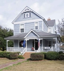 | James W. Dillon House | 4.1 miles | 1971 |
| Dillon Graded School and Dillon Public School | 4.1 miles | 2014 | |
 | Dillon Downtown Historic District | 4.3 miles | 2003 |
| National Archives record | The nomination case file for reference 100010894 in Record Group 79. |
| Dillon County | All 20 listed properties in this county. |