 Block
From the record
One of 13 National Register listings published here for Marlboro County · listed in 2025 · category: Building.
Sources: the National Register database, National Park Service
Listed on the National Register of Historic Places in 2025.
One of 13 National Register listings published here for Marlboro County · listed in 2025 · category: Building.
Sources: the National Register database, National Park Service
Regional context, not property-specific evidence. The federal wildfire occurrence database lists 361 fires within 5 miles of Marlboro County Training School between 1992 and 2020, burning about 1,262 acres in total. 3 started naturally. 70 were recorded as arson. Distance is straight-line from the map coordinates, so a fire counted here may appear on a neighbouring settlement's page as well.
| Reported cause | Fires |
|---|---|
| Missing data/not specified/undetermined | 115 |
| Debris and open burning | 115 |
| Arson/incendiarism | 70 |
| Equipment and vehicle use | 25 |
| Misuse of fire by a minor | 19 |
| Smoking | 7 |
| Railroad operations and maintenance | 5 |
| Natural | 3 |
| Power generation/transmission/distribution | 1 |
| Fireworks | 1 |
The most recent of them, most recent first, with the day each was reported and the service that recorded it.
| Date | Cause | Size | Reported by | Name on the report |
|---|---|---|---|---|
| 3 September 1993 | Missing data/not specified/undetermined | under an acre | South Carolina Forestry Commission | not named |
| 25 September 2007 | Missing data/not specified/undetermined | 2.0 acres | South Carolina Forestry Commission | not named |
| 24 September 2007 | Debris and open burning | 1.0 acres | South Carolina Forestry Commission | not named |
| 21 September 2019 | Arson/incendiarism | under an acre | South Carolina Forestry Commission | not named |
| 20 September 2005 | Missing data/not specified/undetermined | 1.0 acres | South Carolina Forestry Commission | not named |
| 2 September 2011 | Debris and open burning | under an acre | South Carolina Forestry Commission | not named |
| 2 September 1999 | Arson/incendiarism | 20 acres | South Carolina Forestry Commission | not named |
| 2 September 1993 | Missing data/not specified/undetermined | 1.0 acres | South Carolina Forestry Commission | not named |
Regional context, not property-specific evidence. The federal mineral resources record lists 9 workings within 5 miles of Marlboro County Training School: 3 producers, 3 unknowns, 2 past producers, 1 plant. 4 still produce. What was taken out: Sand and Gravel, Construction. Distance is straight-line from the map coordinates, so a quarry counted here may appear on a neighbouring settlement's page as well.
| Where | Site | Commodity | Status | Recorded |
|---|---|---|---|---|
| Field Plant Pit | Sand and Gravel, Construction | Unknown | ||
| Harrel Pit | Sand and Gravel, Construction | Past Producer | ||
| Hollis Mine | Sand and Gravel, Construction | Unknown | Sedimentary | |
| Hollis Mine | Sand and Gravel, Construction | Past Producer | ||
| Marboro Plant | Sand and Gravel, Construction | Plant | ||
| Marlboro Field Plant | Sand and Gravel, Construction | Producer | Sedimentary | |
| Marlboro Mine | Sand and Gravel, Construction | Producer | ||
| Marlboro Plant | Sand and Gravel, Construction | Producer | Sedimentary | |
| Unnamed Gravel Pit | Sand and Gravel, Construction | Unknown | Sedimentary |
Regional context, not property-specific evidence. The National Weather Service names Bennettsville, the town this property stands in, in 53 storm reports between 1994 and 2024: 27 thunderstorm wind, 12 hail, 4 flash flood, 4 heavy rain. The reports record 1 death. Each account below is quoted exactly as the forecast office filed it, from the NOAA Storm Events Database, and each date opens the federal record of that event.
| When | Event | Place named | Harm | What the report says |
|---|---|---|---|---|
| August 1996 | Flash Flood | Bennettsville | 1 killed, $100,000 | no account filed |
| October 2016 | Flash Flood | Bennettsville | $250,000 | Crooked Creek was out of its banks and caused considerable flooding in the town of Bennettsville. Flood waters did impact some homes in town. Evacuations were reported to include the communities of Richardson Park and Shady Rest. The time was estimated. |
| October 2016 | Flash Flood | Bennettsville | $100,000 | A portion of Covington Mill Pond Road was washed out. The time was estimated. |
| July 1998 | Thunderstorm Wind | Bennettsville | $80,000 | Thunderstorm winds caused damage to buildings and sheds at Gold Kist, cotton trailers were overturned at McColl Ginnerry, and the sign, a light pole and car windows were broken at a car dealership. |
| May 2019 | Thunderstorm Wind | Bennettsville | $50,000 | Call center reported multiple trees and power lines down in Bennettsville. |
| July 2008 | Thunderstorm Wind | Bennettsville | $30,000 | Trees were blown down. The walls and rafters of a funeral home that was under construction collapsed. |
| May 2003 | Thunderstorm Wind | Bennettsville | $30,000 | 911 reported numerous trees down. A mobile home was significantly damage. |
| March 1999 | Lightning | Bennettsville | $30,000 | A morning thunderstorm lightning strike caused a fire to a residence. No injuries. |
| July 2003 | Thunderstorm Wind | Bennettsville | $20,000 | An apparent microburst snapped three large oak trees that fell on two cars. A home had the shingles blown off, and a shed had the roof blown off. Trees were reported down on State St. and South Parsonidge. Small hail was also reported. |
| September 2004 | Tornado (F0) | Bennettsville | $15,000 | A tornado damaged a steel conveyor belt track at a sand and gravel mine. Several trees were snapped, and the roof of a front porch of a church was lifted off. |
| July 2016 | Thunderstorm Wind | Bennettsville | $12,000 | Numerous trees were reported down across Bennettsville. The time was estimated based on radar data. |
| May 1998 | Thunderstorm Wind | Bennettsville | $10,000 | Strong winds downed trees, signs, and blew debris around Bennettsville. Heavy rains measured up to 4.5 inches, causing curb-deep water in the city. Hail reports ranged to 1 inch diameter. |
| August 2011 | Flood | Bennettsville | $5,000 | Flooding was reported on Beauty Spot Road East. A car hydroplaned and wrecked. |
| April 2001 | Thunderstorm Wind | Bennettsville | $5,000 | Spotter reported trees down on power lines on Hickory Grove Road. A metal carport was also destroyed. A Bennettsville city administrator reported trees down on East Main Street, Breeden Heights, Crestview Street, and Kinney Circle. |
| June 1999 | Thunderstorm Wind | Bennettsville | $5,000 | Downed trees and power outages were reported. |
| June 2010 | Thunderstorm Wind | Bennettsville | $3,000 | A few large trees were reported down along Broad Street. |
| August 2024 | Flood | Bennettsville | $2,000 | Flood waters were flowing over the intersection of Beauty Spot Road and East Main Street. |
| April 2010 | Thunderstorm Wind | Bennettsville | $1,500 | A tree was reported down on a house along Spruce Street. No damage to the house was reported. |
| May 2020 | Thunderstorm Wind | Bennettsville | $1,000 | A large tree was blown down in the road. |
| July 2016 | Thunderstorm Wind | Bennettsville | $1,000 | A tree was reported down near the intersection of Stornaway Street and West Main Street. The time was estimated based on radar data. |
| April 2012 | Hail | Bennettsville | $1,000 | Hail to the size of quarters was reported. |
| August 2011 | Thunderstorm Wind | Bennettsville | $1,000 | A large tree was reported down across Highway 9. The time was estimated based on radar data. |
| July 2005 | Thunderstorm Wind | Bennettsville | $1,000 | Strong winds knocked large limbs down and blew a fence over. |
| July 2012 | Hail | Bennettsville | $250 | Hail to the size of nickels was reported. |
| January 2024 | Thunderstorm Wind | Bennettsville | - | Several reports of trees and power lines down including along Willamette Road, Hodges Ave, Salem Road, and Ancil Street. |
| May 2024 | Hail | Bennettsville | - | Quarter-sized hail fell in Bennettsville. Photo evidence tweeted by broadcast media. Event time estimated by radar. |
| July 2023 | Thunderstorm Wind | Bennettsville | - | Multiple trees down across the county per 911 call center, including 1000 block of Airport Rd. |
| August 2023 | Thunderstorm Wind | Bennettsville | - | Trees and power lines down off Main Street. |
| May 2013 | Flood | Bennettsville | - | Flooding on Main Street in Bennettsville. Water was covering the sidewalks. |
| July 2010 | Heavy Rain | Bennettsville | - | Flooding was reported along Hwy 15-401 near the Sanders Auction House. Several lanes were closed. |
| August 2008 | Thunderstorm Wind | Bennettsville | - | A large tree was reported down on power lines on Breeden Street. |
| June 2007 | Hail | Bennettsville | - | Nickel size hail fell along SR 79. |
| June 2007 | Hail | Bennettsville | - | Nickel size hail covered the ground one mile west of Chavistown on State Route 9. |
| June 2006 | Thunderstorm Wind | Bennettsville | - | Trees down near the intersection of SR 9 and SR 79. |
| March 2005 | Thunderstorm Wind | Bennettsville | - | Trees down on Hwy 38 (Blenheim Highway). |
| July 2005 | Heavy Rain | Bennettsville | - | The 911 center reported numerous flooded roadways. |
| August 2004 | Tornado (F0) | Bennettsville | - | A tornado touched down near the intersection of Hwy 79 and Hwy 38. The tornado moved northeast, with F0 damage to trees. The tornado dissipated about one mile south of Goodwins Millpond. |
| July 2004 | Heavy Rain | Bennettsville | - | Flooding was reported on W Main Street. Many other streets were flooded, and portions of Hwy 15 and Hwy 401 were closed. |
| April 2003 | Hail | Bennettsville | - | The Sheriff's department reported quarter size hail. |
| July 2003 | Hail | Bennettsville | - | Emergency manager reported nickel size hail. |
| July 2003 | Heavy Rain | Bennettsville | - | Heavy rain caused widespread street flooding. |
| March 2002 | Hail | Bennettsville | - | Spotter reported pea to ping pong ball size hail. |
| April 2001 | Thunderstorm Wind | Bennettsville | - | Spotter reported large tree down on Grants Mill Road east. |
| June 2001 | Thunderstorm Wind | Bennettsville | - | Spotter's wind equipment measured a 58 mph wind gust. |
| June 2000 | Thunderstorm Wind | Bennettsville | - | Marlboro county 911 reported two trees down. |
| August 2000 | Flash Flood | Bennettsville | - | Marlboro 911 reported street flooding. |
| May 1999 | Hail | Bennettsville | - | Slow moving thunderstorm dropped hailstones measuring up to golf ball size, covering the ground. |
| May 1998 | Hail | Bennettsville | - | Hail occurred with winds strong enough to cause power outages. |
| April 1998 | Hail | Bennettsville | - | Reported by 911 dispatcher |
| November 1995 | Thunderstorm Wind | Bennettsville | - | Small pine trees knocked down. |
| September 1996 | Thunderstorm Wind | Bennettsville | - | no account filed |
| May 1995 | Thunderstorm Wind | Bennettsville | - | no account filed |
| April 1994 | Hail | Bennettsville | - | no account filed |
2 papers published in this town, digitised by the Library of Congress and free to read: 358 issues, 1,967 pages. Every page is searchable, so a name or a street can be looked for directly in what the town printed about itself at the time.
| Newspaper | Published |
|---|---|
| The Marlboro Democrat | 1882 to 1908 |
| The Marlboro Democrat | 1911 |
No historic map-sheet match is published for this property yet. That does not mean no map exists. This record needs a coordinate-quality review before it can be joined to a sheet boundary. Browse the county's mapped places while that work is pending.
Other National Register properties close enough to walk or drive between, ordered by distance from this one. Both positions come from the same geocoding pass that matched these properties to their map sheets.
| Photograph | Property | Distance | Listed |
|---|---|---|---|
 | Bennettsville Historic District (Boundary Increase) | 0.8 miles | 1993 |
 | Bennettsville Historic District | 0.8 miles | 1978 |
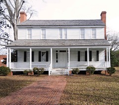 | Jennings-Brown House | 0.8 miles | 1972 |
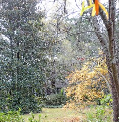 | Magnolia | 1.2 miles | 1973 |
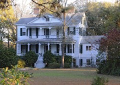 | Appin | 1.4 miles | 1982 |
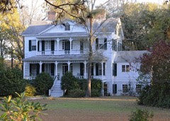 | Appin (Boundary Increase) | 1.7 miles | 2007 |
| National Archives record | The nomination case file for reference 100011778 in Record Group 79. |
| Marlboro County | All 13 listed properties in this county. |