 Block
From the record
One of 62 National Register listings published here for York County · listed in 2026 · category: Building.
Sources: the National Register database, National Park Service
Listed on the National Register of Historic Places in 2026.
One of 62 National Register listings published here for York County · listed in 2026 · category: Building.
Sources: the National Register database, National Park Service
Regional context, not property-specific evidence. The federal wildfire occurrence database lists 80 fires within 5 miles of St. James Rosenwald School between 1992 and 2018, burning about 406 acres in total. None started naturally. 3 were recorded as arson. Distance is straight-line from the map coordinates, so a fire counted here may appear on a neighbouring settlement's page as well.
| Reported cause | Fires |
|---|---|
| Missing data/not specified/undetermined | 40 |
| Debris and open burning | 27 |
| Equipment and vehicle use | 4 |
| Arson/incendiarism | 3 |
| Smoking | 3 |
| Misuse of fire by a minor | 2 |
| Recreation and ceremony | 1 |
The most recent of them, most recent first, with the day each was reported and the service that recorded it.
| Date | Cause | Size | Reported by | Name on the report |
|---|---|---|---|---|
| 7 September 2010 | Debris and open burning | under an acre | South Carolina Forestry Commission | not named |
| 3 September 2015 | Misuse of fire by a minor | 1.0 acres | South Carolina Forestry Commission | not named |
| 23 September 2007 | Debris and open burning | 4.0 acres | South Carolina Forestry Commission | not named |
| 18 September 2013 | Missing data/not specified/undetermined | 1.5 acres | South Carolina Forestry Commission | not named |
| 14 September 1992 | Missing data/not specified/undetermined | under an acre | South Carolina Forestry Commission | not named |
| 5 August 2002 | Missing data/not specified/undetermined | 1.0 acres | South Carolina Forestry Commission | not named |
| 4 August 1999 | Debris and open burning | 4.0 acres | South Carolina Forestry Commission | not named |
| 20 August 2000 | Missing data/not specified/undetermined | 1.0 acres | South Carolina Forestry Commission | not named |
Regional context, not property-specific evidence. The federal mineral resources record lists 73 workings within 5 miles of St. James Rosenwald School: 35 unknowns, 25 past producers, 7 prospects, 5 occurrences. 1 still produces. What was taken out: Gold, Sulfur, Copper, Kyanite. Distance is straight-line from the map coordinates, so a quarry counted here may appear on a neighbouring settlement's page as well.
| Where | Site | Commodity | Status | Recorded |
|---|---|---|---|---|
| Almathea Mine | Gold, Copper | Unknown | 1913 | |
| Carroll and Ross Mine | Gold, Sulfur, Copper | Past Producer | ||
| Castles Prospect | Gold, Lead, Silver | Unknown | 1952 | |
| Castles Prospect | Gold, Lead, Silver, Sulfur | Prospect | ||
| Dewitt Blanton Property | Manganese | Prospect | ||
| Hull Prospect and Placer | Gold, Tellurium, Bismuth | Unknown | 1960 | |
| McKnight Prospect | Lead, Zinc | Occurrence | ||
| Mccaw Mine | Silver, Copper, Gold, Iron, Sulfur | Unknown | 1904, 1905 | |
| Mullis Mine | Sand | Unknown | Sedimentary | |
| Schlegemich Mine | Gold, Silver, Copper | Unknown | Vein |
Regional context, not property-specific evidence. The National Weather Service names Hickory Grove, the town this property stands in, in 23 storm reports between 1994 and 2025: 18 thunderstorm wind, 4 hail, 1 flash flood. The reports record 1 injury. Each account below is quoted exactly as the forecast office filed it, from the NOAA Storm Events Database, and each date opens the federal record of that event.
| When | Event | Place named | Harm | What the report says |
|---|---|---|---|---|
| April 2011 | Thunderstorm Wind | Hickory Grove | 1 hurt | County comms reported numerous trees blown down across the county. Around a dozen homes were damaged by falling trees. One woman was injured on Owens Rd in York when a tree fell on her home. Several other homes were damaged or destroyed in|the York area. Other homes damaged by falling trees included a home near downtown Rock Hill and two homes on Lakeview Dr in Fort Mill. The ASOS at the Rock Hill airport measured a 58 mph gust at 1:00 AM. |
| August 2023 | Thunderstorm Wind | Hickory Grove | $20,000 | Emergency manager reported numerous trees and power lines blown down across all of York County. At least one tree fell through the roof of a house near York and another tree fell on a fence. |
| August 2025 | Flash Flood | Hickory Grove | $2,000 | Emergency manager reported flash flooding developed across central and southern York County after 3.5 to 5.5 inches of rain fell in just a few hours. Inundation of Wilson Chapel Rd occurred in the Sharon area, likely due to Bullock Creek overflowing its banks. One lane of Bookout Rd in McConnells was flooded by water from South Fork Fishing Creek. A tributary of Stony Fork flooded Stallcup Rd just southwest of Rock Hill. Phil Grant Rd was washed out near Strait Rd near the Chester County line due to a small drainage. Additionally, extensive yard flooding was reported in a neighborhood on the north side of Rock Hill due to Big Dutchman Creek overflowing its banks. However, other than water entering a couple of outbuildings, no structures or roads were impacted in this area. |
| April 1998 | Hail | Hickory Grove | $1,000 | no account filed |
| October 2023 | Thunderstorm Wind | Hickory Grove | - | County comms reported power lines blown down on Potato House Rd at Wylie Rd and on Sherer Rd. |
| August 2023 | Thunderstorm Wind | Hickory Grove | - | County comms reported several trees blown down near the intersection of Dagnal Rd and Hopewell Rd. |
| January 2020 | Thunderstorm Wind | Hickory Grove | - | County comms reported numerous trees and power lines blown down, mainly in the western part of York County. |
| May 2020 | Thunderstorm Wind | Hickory Grove | - | Fire department reported several trees blown down in areas south of Hickory Grove. |
| August 2020 | Thunderstorm Wind | Hickory Grove | - | Fire dept reported multiple trees blown down in the Hickory Grove area. |
| July 2017 | Thunderstorm Wind | Hickory Grove | - | County comms reported numerous trees blown down in the Hopewell community. |
| June 2012 | Thunderstorm Wind | Hickory Grove | - | Two trees were blown down on Peachtree St. |
| June 2012 | Thunderstorm Wind | Hickory Grove | - | Multiple large tree limbs were blown down a couple miles south of Hickory Grove. |
| July 2012 | Thunderstorm Wind | Hickory Grove | - | Numerous trees were blown down in the western part of the county, from the Hickory Grove area to McConnells. |
| May 2011 | Thunderstorm Wind | Hickory Grove | - | Numerous trees were blown down across the county from north of Hickory Grove to the northeast corner of the county. In addition, windows were blown out of a home on Kannan Church Rd near Smyrna. |
| May 2011 | Thunderstorm Wind | Hickory Grove | - | Numerous trees were blown down from the Hickory Grove area, across Sharon and to McConnells. Hickory Grove was especially hard hit, with several homes damaged or destroyed by falling trees. In addition, much of the roof was blown off a chicken house near Hickory Grove. Several other smaller structures received minor damage as well. |
| June 2008 | Thunderstorm Wind | Hickory Grove | - | Large tree limbs were blown down on Howells Ferry Rd. |
| April 2007 | Thunderstorm Wind | Hickory Grove | - | Trees down on Smithford Rd, Third St, and Walnut St in and around the Hickory Grove community. |
| July 2006 | Thunderstorm Wind | Hickory Grove | - | A tree was blown down in Hickory Grove and a power pole snapped off on West Madison St in York. |
| July 2005 | Thunderstorm Wind | Hickory Grove | - | Several trees blown down. |
| June 2008 | Hail | Hickory Grove | - | no account filed |
| May 2006 | Hail | Hickory Grove | - | no account filed |
| April 2003 | Hail | Hickory Grove | - | no account filed |
| June 1994 | Thunderstorm Wind | Hickory Grove | - | no account filed |
No historic map-sheet match is published for this property yet. That does not mean no map exists. This record needs a coordinate-quality review before it can be joined to a sheet boundary. Browse the county's mapped places while that work is pending.
Other National Register properties close enough to walk or drive between, ordered by distance from this one. Both positions come from the same geocoding pass that matched these properties to their map sheets.
| Photograph | Property | Distance | Listed |
|---|---|---|---|
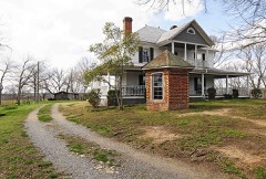 | Allison Plantation | 2.4 miles | 1980 |
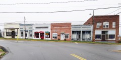 | Sharon Downtown Historic District | 4.8 miles | 2001 |
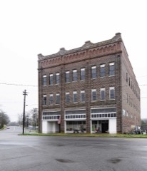 | W. L. Hill Store | 5.0 miles | 1995 |
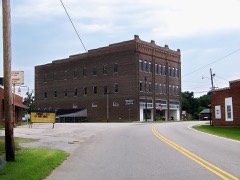 | Hill Complex Historic District | 5.0 miles | 2003 |
| National Archives record | The nomination case file for reference 100012667 in Record Group 79. |
| York County | All 62 listed properties in this county. |