| August 2005 | Lightning | Barnwell | 1 hurt | Emergency Manager reported one person was injured by lightning. |
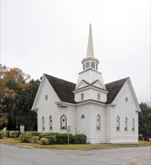
| August 2023 | Lightning | Barnwell | $2,000,000 | Hagood Avenue Baptist Church in the town of Barnwell was struck by lightning and caught fire. The fire caused extensive damage to the church. |
| June 1995 | Thunderstorm Wind | Barnwell | $500,000 | Trees and powerlines down in Barnwell. |
| April 2011 | Lightning | Barnwell | $80,000 | The People-Sentinel reported a home was destroyed by fire that was started by a lightning strike. |
| June 1995 | Thunderstorm Wind | Barnwell | $50,000 | Winds blew down many trees and powerlines throughout county. |
| June 2007 | Thunderstorm Wind | Barnwell | $25,000 | Emergency Manager reported an intense microburst destroyed a 40'X 60' building, took down many trees (one split a home), took siding off a few homes, and twisted metal fences. |
| June 2011 | Thunderstorm Wind | Barnwell | $8,000 | Sheriff reported trees and powerlines down in the Barnwell area along with street flooding. |
| November 2011 | Thunderstorm Wind | Barnwell | $6,000 | Sheriff reported trees down in the Barnwell area. |
| August 2007 | Thunderstorm Wind | Barnwell | $6,000 | Emergency Manager reported 2 mobile homes were moved off their foundations and had minor damage to them. A few trees and numerous large branches were also down. |
| June 2010 | Thunderstorm Wind | Barnwell | $5,000 | Sheriff reported a couple of trees down from Hwy 3 and Pineneedle road to near Galilee and South Toby Creek roads. |
| January 2013 | Thunderstorm Wind | Barnwell | $4,000 | Sheriff reported a few trees down southwest of Barnwell. |
| April 2015 | Thunderstorm Wind | Barnwell | $3,000 | DOT reported several trees down between Barnwell and Williston. |
| January 2010 | Thunderstorm Wind | Barnwell | $2,000 | Sheriff reported trees down near Mt. Olive Circle. |
| June 2006 | Lightning | Barnwell | $2,000 | Lightning struck the Barnwell Communications Center doing about 2 thousand dollars in damage to equipment. |
| April 1999 | Hail | Barnwell | $1,000 | Spotter and damage survey confirmed hail damage to pickup truck. |
| April 1999 | Tornado (F0) | Barnwell | $1,000 | Spotter and damage survey confirmed an F0 tornado took down trees and powerlines. |
| June 2011 | Thunderstorm Wind | Barnwell | $500 | Highway Patrol reported a tree down in the road at SC 3 and US 278. |
| April 2025 | Flash Flood | Barnwell | - | Emergency Manager reported flash flooding throughout the city of Barnwell. EM observed 4.8 inches of rain at their home and stated that many city streets flooded as storm drains could not handle that amount. Time estimated by EM. |
| May 2022 | Thunderstorm Wind | Barnwell | - | EM reported multiple trees down on Hwy. 64 in Barwell heading towards Olar. |
| May 2022 | Thunderstorm Wind | Barnwell | - | Barnwell County Dispatch reported widespread trees and powerlines down across the county. |
| June 2022 | Thunderstorm Wind | Barnwell | - | Barnwell Co dispatch reported trees and power lines down across the county. Time estimated. |
| September 2017 | Thunderstorm Wind | Barnwell | - | Barnwell Co SC EM reported several trees down. |
| July 2013 | Thunderstorm Wind | Barnwell | - | DOT reported large branches down from Barnwell to the Savannah River Site. |
| March 2012 | Hail | Barnwell | - | Sheriff dispatch reported quarter size hail in Barnwell. |
| May 2011 | Hail | Barnwell | - | Public reported quarter size hail just south of Barnwell. |
| April 2009 | Hail | Barnwell | - | Sheriff reported 1 inch hail on the south side of town near the intersection of hwys 278, 3, and 310. |
| June 2009 | Thunderstorm Wind | Barnwell | - | Sheriff Dispatch reported trees and power lines down in the town of Barnwell. |
| June 2008 | Thunderstorm Wind | Barnwell | - | Emergency manager reported a couple of trees down on Longbranch Road. |
| June 2008 | Hail | Barnwell | - | EM reported nickel size hail about halfway between Barnwell and Hilda on highway 70. |
| April 2007 | Thunderstorm Wind | Barnwell | - | Highway dept. reported trees down on hwy 64. |
| June 2007 | Hail | Barnwell | - | Savannah River Site reported nickel size hail. |
| August 2007 | Thunderstorm Wind | Barnwell | - | DOT reported several trees down on hwy 57. |
| July 2007 | Flood | Barnwell | - | Savannah River Site reported water flowing over road B and road 7 after several inches of rain fell over the area. |
| May 2006 | Thunderstorm Wind | Barnwell | - | Sheriff reported trees down on Green Branch and Blease Creek roads. |
| July 2006 | Thunderstorm Wind | Barnwell | - | Public reported large limbs down and minor flooding across roads. |
| February 2005 | Hail | Barnwell | - | Savannah River Site reported golf ball size hail. |
| May 2005 | Hail | Barnwell | - | Post Office reported penny size hail on hwy 70. |
| June 2004 | Thunderstorm Wind | Barnwell | - | Sheriff reported trees down east of Barnwell on hwy 64. |
| September 2004 | Tornado (F0) | Barnwell | - | An F0 took down some trees and powerlines and damaged some signs in Barnwell. |
| November 2004 | Thunderstorm Wind | Barnwell | - | Sheriff reported trees down on Lake Drive. |
| July 2003 | Flash Flood | Barnwell | - | Toby creek flooded the bridge at hwy 64 closing the road. |
| June 2003 | Hail | Barnwell | - | Sheriff reported nickel size hail northwest of Barnwell on hwy 278. |
| May 2002 | Thunderstorm Wind | Barnwell | - | Sheriff reported trees down west of Barnwell. |
| May 2002 | Hail | Barnwell | - | Sheriff reported golf ball size hail in Barnwell. |
| May 2002 | Thunderstorm Wind | Barnwell | - | Sheriff reported trees down northeast of Barnwell. |
| July 2002 | Thunderstorm Wind | Barnwell | - | Sheriff reported numerous trees down in Barnwell. |
| June 2001 | Thunderstorm Wind | Barnwell | - | Sheriff reported trees down. |
| June 2001 | Hail | Barnwell | - | EM reported nickel size hail in Barnwell. |
| June 2001 | Thunderstorm Wind | Barnwell | - | Savannah River Site reported trees down and a guard shack overturned. |
| August 2000 | Thunderstorm Wind | Barnwell | - | Electric coop reported trees and powerlines down in Barnwell. |
| August 2000 | Thunderstorm Wind | Barnwell | - | Savannah River Site recorded a gust to 89 mph. |
| March 1999 | Hail | Barnwell | - | Law Enforcement at the Savannah River Site reported 3/4 inch hail. |
| March 1999 | Thunderstorm Wind | Barnwell | - | Sheriff reported trees down. |
| July 1999 | Hail | Barnwell | - | Sheriff reported nickel size hail. |
| April 1999 | Thunderstorm Wind | Barnwell | - | Highway Patrol reported trees down along highway 278. |
| June 1998 | Thunderstorm Wind | Barnwell | - | Sheriff reported large branches down on highways 78 and 781. |
| May 1998 | Hail | Barnwell | - | Sheriff reported 1 inch hail on highway 278. |
| June 1998 | Thunderstorm Wind | Barnwell | - | Savannah River Site reported trees down and tin roof blown off building. |
| April 1997 | Thunderstorm Wind | Barnwell | - | no account filed |
| April 1997 | Hail | Barnwell | - | no account filed |
 Block