| June 2004 | Lightning | Moncks Corner | 1 killed, 1 hurt | Lightning struck a couple while they were riding a jet ski. The man was killed and the woman received minor injuries. |
| September 1998 | Tornado (F2) | Moncks Corner | 9 hurt, $2,800,000 | Seventy-three (73) homes were damaged, fourteen mobile homes destroyed and seven (7) homes destroyed. The Fairlawn sobdivision, just southeast of Moncks corner was hardest hit. |
| April 2020 | Tornado (EF3) | Moncks Corner | 6 hurt | The National Weather Service Storm Survey Team confirmed an EF-3 tornado with an estimated maximum wind speed of 145 mph just east of Moncks Corner, South Carolina. The tornado began in the Fairlawn Subdivision, just east of Moncks Corner. Several homes had significant damage along Old Fort Road and Dennis Boulevard. There was a home at the east end of Dennis Boulevard that had significant damage to justify the EF-3 tornado rating. There was also extensive snapping and uprooting of trees, as well as vehicle and trailer damage in the area. The tornado moved east-southeast, generally down Dennis Boulevard, then east across the west branch of the Cooper River, before turning east-northeast across South Carolina 402 and Cane Gully Road. At this location, a mobile home was completely destroyed and several other homes and structures sustained significant damage. The tornado then continued east-northeast snapping and uprooting trees, with significant damage to at least one home off of Myrtle Lane, and minor roof and siding damage to approximately four additional homes just south of Bullhead Road. The tornado then dissipated near the intersection of Myrtle Lane and Wright Road. This tornado was part of a family of tornadoes that began more than 100 miles to the southwest, in Screven County, Georgia. |
| June 2000 | Thunderstorm Wind | Moncks Corner | 6 hurt | Pontoon boat capsized on Lake Moultrie. All six passengers were safely rescued. |
| August 2024 | Tornado (EF1) | Moncks Corner | 2 hurt | A National Weather Service Storm Survey Team confirmed an EF1 tornado with an estimated maximum wind speed of 95 mph in Moncks Corner, South Carolina occurring from 153 AM to 200 AM EST.||The tornado, which originated in an outer rainband associated with Tropical Storm Debby, touched down just east of McCormick Circle, snapping two trees in the woods behind an Applebee's. The tornado then moved northwest, causing damage to the Applebee's sign and then turned west, flipping vehicles that led to 2 minor injuries. The tornado then continued on a west track, impacting an Arby's. This was the location of the strongest damage as numerous windows were blown out at the Arby's on both the west and east-facing sides of the building. The rooftop A/C was also blown into the Arby's parking lot. However, no other structural damage was noted and therefore the degree of damage was kept near the middle of the expected wind speed, or at 95 mph. The Walmart Supercenter to the northwest of Arby's also sustained some very minor roof fascia damage, which was starting to peel off from the main structure. The tornado then continued to move northwest and passed Mitton Road, where several trees were uprooted with a few branches greater than 3 inches in diameter broken. There was also a residence on Mitton Road that had roof damage to less than 20% of the structure. The tornado then moved northwest and weakened as it crossed Kitfield Road, where some branches (mostly 1-3 in diameter) were broken. There were also branches (1-3 in diameter) snapped northwest of this location on Lois Circle and Broughton Road. The tornado then continued a path northwest, before dissipating on the northern end of the Pinopolis Peninsula along the south end of Lake Moultrie. |
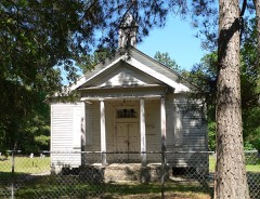
| May 2019 | Lightning | Moncks Corner | $50,000 | Lightning struck and caused a fire at the Nazareth Reformed Episcopal Church on West End Drive in Moncks Corner. The fire was contained to the front of the church, but the church's steeple collapsed backward into the structure. |
| August 2006 | Lightning | Moncks Corner | $10,000 | Lightning struck a tree, knocking it down and damaging two vehicles at the Piggly Wiggly grocery store in Moncks Corner. |
| May 2008 | Thunderstorm Wind | Moncks Corner | $7,000 | A trained weather spotter reported a tree knocked down on a house in Shamrock Court on the north side of Moncks Corner, South Carolina. |
| July 2008 | Thunderstorm Wind | Moncks Corner | $5,500 | A 40 foot tree that was 15 inches in diameter was reported down in Moncks Corner, South Carolina. A shed at Central Hardware along Highway 52 was also destroyed. |
| May 2008 | Lightning | Moncks Corner | $5,000 | A trained weather spotter reported some minor damage to a home after lightning struck it. |
| June 1994 | Tornado (F0) | Moncks Corner | $5,000 | A funnel cloud that passed over Carnes Crossroads area (11 SW of Moncks Corner) touched down briefly seven miles southwest of Moncks Corner as a F0 tornado, damaging a mobile home and nearby metal sheds. |
| July 2012 | Thunderstorm Wind | Moncks Corner | $3,000 | Fire Department personnel reported a 4 foot diameter oak tree down along Wildwood Lane. The oak tree was 50 feet tall. |
| June 2009 | Thunderstorm Wind | Moncks Corner | $3,000 | A Berkeley County official reported trees down in Moncks Corner, South Carolina. |
| April 2007 | Thunderstorm Wind | Moncks Corner | $2,500 | Numerous Trees and Limbs were reported down. Metal sheeting was torn off a building. |
| May 2012 | Thunderstorm Wind | Moncks Corner | $1,500 | Three trees blown down in Moncks Corner. |
| July 2007 | Thunderstorm Wind | Moncks Corner | $500 | A tree was reported down in Moncks Corner. |
| June 2025 | Thunderstorm Wind | Moncks Corner | - | A Berkeley County emergency manager reported trees down on power lines in the 100 Block of West Main Street. |
| August 2024 | Flash Flood | Moncks Corner | - | A video posted on social media shows water rapidly flowing across a commercial parking lot and across a boat ramp near Reid Hill Road. |
| August 2024 | Flash Flood | Moncks Corner | - | Emergency officials in Moncks Corner reported that high water rescues were in progress, homes were flooded throughout the city and roads were closed due to 2-3 feet of fast moving water. |
| August 2024 | Flash Flood | Moncks Corner | - | Berkeley County Emergency Management reported Heatly Street in Moncks Corner being closed due to high water caused by flash flooding. |
| August 2024 | Flash Flood | Moncks Corner | - | A Berkeley County emergency manager reported a tree blocking the Haynesville Road due to flash flooding. |
| August 2024 | Flash Flood | Moncks Corner | - | The public relayed a video of a flooded house on Fairlawn Drive in Moncks Corner. |
| August 2024 | Flash Flood | Moncks Corner | - | Berkeley County Emergency Management reported approximately 30 swift water rescues within Berkeley County, mainly in Moncks Corner. No injuries have been reported. |
| April 2022 | Hail | Moncks Corner | - | The public reported quarter size hail at a residence on Dennis Boulevard. |
| April 2022 | Hail | Moncks Corner | - | The public reported hail as large as golf balls at a residence on Dennis Boulevard. |
| June 2022 | Thunderstorm Wind | Moncks Corner | - | The Berkeley County 911 Call Center reported a tree down at 401 North Live Oak Road. |
| June 2021 | Thunderstorm Wind | Moncks Corner | - | The public reported a large branch split off a tree near the intersection of Highway 52 and Highway 17A. |
| May 2021 | Hail | Moncks Corner | - | A trained spotter reported quarter sized hail in Moncks Corner. The hail lasted about 5 minutes and shredded a canvas deck cover. |
| May 2021 | Hail | Moncks Corner | - | A trained spotter reported hail up to the size of golf balls in Moncks Corner. |
| May 2021 | Hail | Moncks Corner | - | A CoCoRaHS observer reported quarter sized hail near Moncks Corner. |
| December 2021 | Hail | Moncks Corner | - | The public reported quarter size hail in Moncks Corner, South Carolina. |
| July 2019 | Thunderstorm Wind | Moncks Corner | - | Berkeley County dispatch reported a tree down in a wooded area behind a large department store. |
| July 2019 | Thunderstorm Wind | Moncks Corner | - | Multiple reports received of structural damage to a strip mall on Highway 52. Damage included the roof of the South Carolina Department of Motor Vehicles building and several other businesses within the strip mall. A few billboards in the area were also reported to be damaged. |
| March 2018 | Hail | Moncks Corner | - | Berkeley County dispatch reported quarter sized hail in Moncks Corner. |
| March 2018 | Hail | Moncks Corner | - | Berkeley County dispatch reported quarter sized hail at their office. |
| June 2018 | Thunderstorm Wind | Moncks Corner | - | Law enforcement reported a tree down on Highway 17A near Church Street. |
| September 2015 | Thunderstorm Wind | Moncks Corner | - | South Carolina Highway Patrol reported a tree down near the intersection of Sandy Drive and Hill Street. |
| July 2014 | Thunderstorm Wind | Moncks Corner | - | South Carolina Highway Patrol reports a tree down at the intersection of Kitfield Road and Broughton Road. |
| July 2014 | Thunderstorm Wind | Moncks Corner | - | Trees reported down at several locations around Moncks Corner. |
| July 2013 | Hail | Moncks Corner | - | Nickel size hail and minor street flooding was reported in Moncks Corner. |
| May 2012 | Hail | Moncks Corner | - | The public reports nickel size hail in Moncks Corner. |
| March 2012 | Hail | Moncks Corner | - | Berkeley County Law Enforcement reported quarter sized hail in Moncks Corner. |
| August 2012 | Hail | Moncks Corner | - | The public reported nickel sized hail and 30 to 40 miles per hour wind gusts. The hail briefly covered the ground. |
| August 2012 | Hail | Moncks Corner | - | The public reported quarter sized hail in Moncks Corner. |
| August 2012 | Hail | Moncks Corner | - | A report of golf ball hail falling at the Berkeley County Emergency Operations Center. |
| August 2012 | Hail | Moncks Corner | - | A trained spotter reported hail ranging from pea to quarter sized falling along Whitesville Road in Moncks Corner. |
| May 2009 | Hail | Moncks Corner | - | The public reported nickel size hail in the Brook Valley subdivision in Moncks Corner, South Carolina. |
| May 2009 | Hail | Moncks Corner | - | The public reported nickel size hail in Moncks Corner, South Carolina. |
| May 2009 | Hail | Moncks Corner | - | The public reported nickel size hail at the in the Windward subdivision at the intersection of Highway 17A and Route 176 in Moncks Corner, South Carolina. |
| June 2009 | Hail | Moncks Corner | - | A trained weather spotter reported penny to nickel size hail in Moncks Corner, South Carolina. |
| May 2008 | Funnel Cloud | Moncks Corner | - | Law enforcement reported a brief funnel cloud in Moncks Corner, South Carolina. |
| May 2008 | Thunderstorm Wind | Moncks Corner | - | A trained weather spotter reported that a small tree was knocked down by thunderstorm winds in Moncks Corner, South Carolina. |
| July 2008 | Hail | Moncks Corner | - | Quarter size hail was reported in the Sterling Oaks subdivision in Moncks Corner, South Carolina. |
| July 2008 | Hail | Moncks Corner | - | Penny to quarter size hail was reported by law enforcement in Moncks Corner, South Carolina. |
| June 2008 | Hail | Moncks Corner | - | The public reported penny size hail in Moncks Corner, South Carolina. |
| May 2008 | Hail | Moncks Corner | - | A trained weather spotter reported quarter size hail on Highway 17A South. The hail fell for 10 minutes. |
| May 2008 | Hail | Moncks Corner | - | Nickel size hail was reported in Moncks Corner, South Carolina. |
| July 2008 | Hail | Moncks Corner | - | Nickel to quarter size hail was reported by the public at the intersection of Highway 52 and Old Highway 52 in Moncks Corner, South Carolina. |
| May 2008 | Hail | Moncks Corner | - | Nickel size hail was reported in Moncks Corner, South Carolina. |
| June 2006 | Heavy Rain | Moncks Corner | - | Estimated 3 to 4 inches rainfall. 6 inches standing water on Broughton Road near the High School. |
 Block