
BlockBefore
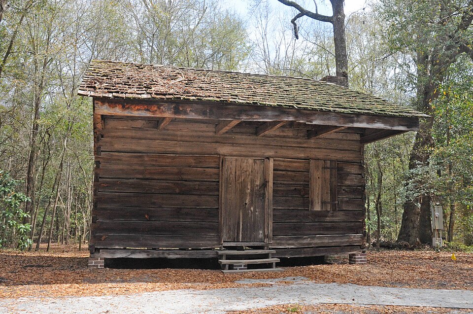
Photograph of Slave Houses, Gregg Plantation
Photograph by JERRYE & ROY KLOTZ, M.D, CC BY-SA 4.0. Via Wikimedia Commons.

Slave Houses, Gregg Plantation

Listed on the National Register of Historic Places in 1974.

From the record

“Slave Houses, Gregg Plantation is a set of two historic log slave cabins located on the campus of Francis Marion University at Mars Bluff, Florence County, South Carolina. There were originally 8 cabins, but only these two remnants survive.”

Wikipedia article Slave Houses, Gregg Plantation, CC BY-SA 4.0.

One of 29 National Register listings published here for Florence County · listed in 1974 · category: Building.

Sources: the Wikipedia article · the case file at the National Archives · the National Register database, National Park Service · the Wikipedia article
The listing

  • What is counted as historic. The nomination lists 2 buildingss as contributing to the listing.
  • Address. Francis Marion College campus, Mars Bluff, 29581
  • When was it listed? July 1974
  • Category. building
  • National Register reference number. 74001856 - the number the National Park Service assigned this property when it was listed, and the key its nomination file is catalogued under at the National Archives.

Storms near this property

13 since 2008

Regional context, not property-specific evidence. The National Weather Service names Mars Bluff, the town this property stands in, in 13 storm reports between 2008 and 2024: 11 thunderstorm wind, 1 flood, 1 flash flood. No death or injury is recorded in these reports. Each account below is quoted exactly as the forecast office filed it, from the NOAA Storm Events Database, and each date opens the federal record of that event.

WhenEvent Place namedHarm What the report says
July 2012Thunderstorm WindMars Bluff$45,000Numerous trees, estimated to be more than 30, were reportedly down along and near U.S. 76 and in the Francis Marion University area. Some of the trees knocked down power lines as they fell. A roof was also reportedly blown off a poorly constructed building.
June 2019Thunderstorm WindMars Bluff$10,000Powerlines were blown down at the intersection of Francis Marion Road and US Route 301/76.
August 2024Flash FloodMars Bluff$2,000Flash flooding was recorded at the Florence Flea Market.
May 2017Thunderstorm WindMars Bluff$2,000Saturated soil and winds estimated to 40 to 50 mph reportedly caused two trees to fall near the intersection of Liberty Chapel Rd. and Francis Marion Rd.
July 2014Thunderstorm WindMars Bluff$2,000Two trees were reported down on E Palmetto Street and Firetower Road. The time was estimated based on radar data.
June 2014Thunderstorm WindMars Bluff$1,500A tree was reported down on Interstate 95 southbound between mile marker 174 and 172. The time was estimated based on radar data.
July 2010Thunderstorm WindMars Bluff$1,500One large tree was down across North Williamson Road.
June 2015Thunderstorm WindMars Bluff$1,000A tree was reportedly down at the intersection of Old Wallace Gregg Road and Francis Marion Road. The time was estimated based on radar data.
July 2015Thunderstorm WindMars Bluff$1,000Power lines were reportedly down at the intersection of E Old Marion Highway and Weatherford Ln. The time was estimated based on radar data.
July 2013FloodMars Bluff-Old Marion Hwy at Hwy 327 was closed due to flooding.
May 2008Thunderstorm WindMars Bluff-One tree, twelve inches in diameter, blew down on the Francis Marion University Campus.
May 2008Thunderstorm WindMars Bluff-Two large trees down one-eighth of a mile north of U.S. Route 76.
August 2008Thunderstorm WindMars Bluff-Two large pine trees were reported down on the Francis Marion University Campus at the corner of Highway 76 and Francis Marion Road.

Every storm recorded in Florence County

Map coverage status

No historic map-sheet match is published for this property yet. That does not mean no map exists. This record needs a coordinate-quality review before it can be joined to a sheet boundary. Browse the county's mapped places while that work is pending.

Listed places nearby

2 within 8 miles

Other National Register properties close enough to walk or drive between, ordered by distance from this one. Both positions come from the same geocoding pass that matched these properties to their map sheets.

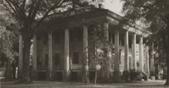
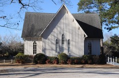
Photograph PropertyDistance Listed
Rankin-Harwell House2.8 miles1974
Christ Episcopal Church4.3 miles1978

Sources for this property

National Archives recordThe nomination case file for reference 74001856 in Record Group 79.
Wikipedia articleCommunity-written account of this property, licensed CC BY-SA.
Florence CountyAll 29 listed properties in this county.

Provenance

  • Listing record. National Park Service National Register of Historic Places, listed-properties dataset, current to 2026-05-22.
  • Map join. Address geocoded through the United States Census geocoder, then tested against the published boundary of every sheet in the USGS Historical Topographic Map Collection.
  • How this page is made. Listing fields come from federal records; map-sheet coverage is a labelled coordinate-to-boundary calculation, not a source-field claim.
  • Storms. NOAA National Centers for Environmental Information, Storm Events Database https://www.ncei.noaa.gov/stormevents/ A work of the United States government, no copyright under 17 U.S.C. 105. Narratives are quoted verbatim from the National Weather Service report and are not edited or summarised.