| November 1995 | Tornado (F1) | Orangeburg | 3 hurt, $200,000 | Tornado destroyed 16 mobile homes, seriously damaged 11 others and one frame home, and took trees down. Most of the damage occurred along U.S. 178. Three people were slightly injured. |
| August 2002 | Thunderstorm Wind | Orangeburg | 1 hurt, $8,000 | Emergency Manager reported tree fell on a home and came through the roof causing one injury. |
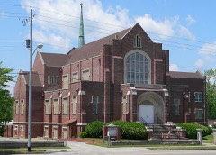
| December 2004 | Tornado (F3) | Orangeburg | 1 hurt | Damage survey found an F3 tornado demolished a brick church, completely destroyed 2 mobile homes and several outbuildings. The main damage occurred on Coulter road. |
| September 2016 | Flash Flood | Orangeburg | $400,000 | Flash Flooding was reported in parts of Orangeburg. The water entered three county buildings, including the library, the courthouse and the law enforcement complex. The emergency manager estimates 40 structures were flooded, with 20 to 25 of them sustaining substantial damage. An apartment complex had 5 buildings with 2 to 3 feet of water in them. A daycare center also had 2 feet of water in the building. Numerous cars were also submerged. |
| July 2022 | Flash Flood | Orangeburg | $300,000 | The broadcast media and local newspaper reported a flash flood at the Malibu Apartments along Malibu Dr between Middleton St and Green St. Ten units flooded with water up to one to two feet. Cars that were parked were also flooded. The nearby Orangeburg water plant reported 3.00 inches of rain, a weather observer along mason drive reported 3.37 inches of rain and a cocorahs observer off jackson drive reported 2.41 inches of rain. Sunnyside Canal, which runs through the complex, rose from 0.54 feet up to 5.31 feet in 45 minutes, cresting at 215 am. |
| August 1996 | Lightning | Orangeburg | $200,000 | no account filed |
| April 2011 | Hail | Orangeburg | $40,000 | Sheriff reported golf ball size hail at FIRE STATION 4 located at Rowesville Road and Prosperity Drive. |
| January 1996 | Tornado (F0) | Orangeburg | $29,000 | no account filed |
| April 2011 | Thunderstorm Wind | Orangeburg | $18,000 | Emergency Manager reported trees down from Cope to Orangeburg. Sheriff also reported a tree down on Hwy 601 by the hospital. |
| July 2024 | Thunderstorm Wind | Orangeburg | $10,000 | Orangeburg County EM reported numerous buildings damaged along a path beginning at the intersection of Russell St and Broughton St to Whaley St and Crystal St and ending on Woodbine Drive where there is a large tree on a house. NWS survey team confirmed a microburst occurred in downtown Orangeburg with estimated wind speeds up to 70 mph. |
| August 2022 | Flash Flood | Orangeburg | $10,000 | Orangeburg Co EM reported flood waters entered 4 apartments at the Malibu Apartments on Malibu Dr. Time estimated. |
| September 2016 | Flash Flood | Orangeburg | $10,000 | County EM reported roadways due to rising water from creeks draining into Caw Caw Swamp Creek. These include Old Riley at Lakeside...Brookside Road...Myers Road at Caw Caw Creek and Railroad Corner Hwy. 601 and Russell Street. |
| October 1995 | Thunderstorm Wind | Orangeburg | $10,000 | no account filed |
| August 2011 | Thunderstorm Wind | Orangeburg | $8,000 | SCEMD reported trees down in Orangeburg. |
| May 2009 | Flash Flood | Orangeburg | $8,000 | Sheriff reported several roads closed due to 1 to 3 feet of water in some areas. Whittaker Parkway, U.S 21, and U.S. 178 were closes as were several roads in Cordova and Cope. |
| June 2009 | Thunderstorm Wind | Orangeburg | $8,000 | Emergency Manager reported numerous trees and powerlines down at SC State University. |
| July 2023 | Flash Flood | Orangeburg | $5,000 | Emergency Manager reported water entered two apartments at Malibu Apartments on Malibu Dr. Times estimated. |
| July 2023 | Flash Flood | Orangeburg | $5,000 | Emergency Manager reported water entered a daycare facility at Belleville Rd and Russell St. Times estimated. |
| June 2011 | Thunderstorm Wind | Orangeburg | $5,000 | Highway Patrol reported trees in the roadway near Presidential Drive and Magnolia road. |
| May 2006 | Thunderstorm Wind | Orangeburg | $5,000 | A microburst blew a tin roof off a horse barn and did minor damage the building. |
| June 2011 | Thunderstorm Wind | Orangeburg | $4,000 | Sheriff reported trees down in north Orangeburg between US 21 and US 601. |
| July 2009 | Thunderstorm Wind | Orangeburg | $4,000 | Sheriff reported trees down along hwy 21 in Orangeburg. |
| October 2016 | Flood | Orangeburg | $3,000 | Reported some minor street flooding in downtown Orangeburg along US 301 John C Calhoun Drive at Sprinkle Street and also along Stonewall Jackson Blvd. |
| June 2015 | Thunderstorm Wind | Orangeburg | $3,000 | Highway Patrol reported trees down on U.S. 301 at U.S 21 in Orangeburg. |
| June 2010 | Thunderstorm Wind | Orangeburg | $3,000 | Emergency Manager reported trees down on Forest Creek Drive. |
| June 2015 | Thunderstorm Wind | Orangeburg | $2,000 | EM reported several trees down in Edisto from thunderstorm winds. |
| July 2013 | Flash Flood | Orangeburg | $2,000 | Highway Patrol reported magnolia Street at Whaley Street closed due to flooding. |
| July 2009 | Thunderstorm Wind | Orangeburg | $2,000 | EM reported several trees down in Edisto. |
| August 2009 | Thunderstorm Wind | Orangeburg | $2,000 | DOT reported several trees down on Partridge Lane road near US 378. |
| May 2002 | Thunderstorm Wind | Orangeburg | $2,000 | Emergency Manager reported a tree fell on a mobile home doing minor damage to the roof. |
| June 2002 | Thunderstorm Wind | Orangeburg | $2,000 | Newspaper reported part of the cinder brick wall of the stands at the football stadium were blown down. |
| August 2022 | Flash Flood | Orangeburg | $1,000 | The Times and Democrat newspaper in Orangeburg relayed a report and photo, via social media, of a flooded vehicle on Frederick St near Chestnut St in the University Village area of SC State Univ. in Orangeburg. Time estimated. |
| November 2020 | Flash Flood | Orangeburg | $1,000 | A flooded and impassable roadway was reported at Brookside Dr and Riverside Dr in Orangeburg. Observations from around the area indicated about 4 to 6 inches of rain fell over this region. Street flooding was also observed in a few other parts of the town of Orangeburg. |
| August 2010 | Thunderstorm Wind | Orangeburg | $1,000 | Sheriff reported a couple of trees down on Bamberg Hwy just southwest of Orangeburg. |
| June 1995 | Thunderstorm Wind | Orangeburg | $1,000 | Thunderstorm winds downed trees in City of Orangeburg. |
| April 2013 | Thunderstorm Wind | Orangeburg | $500 | Highway Patrol reported a tree in the roadway on Columbia road. |
| May 2018 | Flash Flood | Orangeburg | $100 | Road closure at Glover St and Stonewall Jackson Blvd in Orangeburg. |
| May 2018 | Flash Flood | Orangeburg | $100 | Flooding observed at a day care center on Russell St in Orangeburg. Children were rescued. |
| May 2018 | Flash Flood | Orangeburg | $100 | Vehicle stalled in flood waters at Broughton St and Whaley St in Orangeburg. |
| May 2022 | Hail | Orangeburg | $10 | MPING report of pea sized hail. |
| August 2019 | Hail | Orangeburg | $10 | Report of pea size hail received via mPING. |
| May 2025 | Thunderstorm Wind | Orangeburg | - | SC highway patrol reported a tree down on the roadway on Old Edisto Dr. west of Orangeburg. Time estimated by radar. |
| July 2025 | Thunderstorm Wind | Orangeburg | - | Emergency Manager reports roof damage to multiple buildings at 1098 Joe S Jeffords Highway. |
| August 2024 | Thunderstorm Wind | Orangeburg | - | SCHP reported a tree down on Russell St at Old Elloree Rd. |
| August 2024 | Flash Flood | Orangeburg | - | City of Orangeburg has closed portions of Riverside Drive due to flash flooding. |
| August 2024 | Flash Flood | Orangeburg | - | Broadcast media reported via social media that abandoned homes along Waring Street are being flooded. |
| August 2024 | Flash Flood | Orangeburg | - | A SC highway patrol trooper reported a flooded intersection at John C. Calhoun Drive and Sprinkle Avenue. |
| July 2023 | Heavy Rain | Orangeburg | - | USGS rain gage at the US Hwy 301/601 bridge over the North Fork of the Edisto River measured 2.20 inches of rain in one hour from 1730 EDT to 1830 EDT. |
| May 2022 | Thunderstorm Wind | Orangeburg | - | Social media photos show a downed tree near the intersection of Park St and Brantleywood Ln. Time estimated by radar. |
| May 2022 | Thunderstorm Wind | Orangeburg | - | SC Highway Patrol reported a tree in the roadway near the intersection of Hwy 178 and Kennerly Rd. Time estimated. |
| July 2019 | Thunderstorm Wind | Orangeburg | - | A tree fell through a house at 734 Partridge Rd. Time estimated. |
| July 2019 | Thunderstorm Wind | Orangeburg | - | Trees downed in the vicinity of Guinyard St, Garnet St, and Redmon St. |
| June 2019 | Thunderstorm Wind | Orangeburg | - | A thunderstorm downburst with straight-line winds produced extensive damage on the north side of the city of Orangeburg. Tree damage was first observed near Lake Edisto Rd, continuing in a wide path east to east-southeast across North Rd, across |Columbia Rd and ending east of US Hwy 601 south of the Regional Medical Center. Numerous uprooted, snapped and toppled trees were evident, with many structures exhibiting structural and roof damage caused by high wind, downed trees and large downed tree limbs. Several power lines were also down from falling trees|and tree limbs. |
| September 2019 | Thunderstorm Wind | Orangeburg | - | Trees down on Green St in Orangeburg. |
| April 2018 | Thunderstorm Wind | Orangeburg | - | Tree down in roadway Columbia Rd at Sims St. Time estimated. |
| May 2018 | Heavy Rain | Orangeburg | - | The USGS rain gage on the US Hwy 301 bridge over the N. Fork of the Edisto R. recorded 3.24 inches of rain. Most of this rain fell between 1000 am EDT (0900 EST) and 1130 am EDT (1030 EST). |
| May 2018 | Heavy Rain | Orangeburg | - | The NWS COOP observer at the Orangeburg Water Plant recorded 2.88 inches of rain. Most of this rain fell between 1000 am EDT (0900 EST) and 1130 am EDT (1030 EST). Runoff from the heavy rainfall resulted in a nearly 2 foot rise of the N. Fork of the Edisto R. at a gage at the US Hwy 301 bridge. |
| June 2018 | Thunderstorm Wind | Orangeburg | - | SCHP reported trees down on Riverbank Dr at Summer Creek Dr. Time estimated. |
| October 2018 | Tornado (EF0) | Orangeburg | - | A third tornado touchdown occurred near the city of Orangeburg, SC, touching down near Brookside Dr and Pinehill Rd around 2248 EST (2348 EDT). This tornado caused non-continuous damage to large trees as it moved northwestward. It lifted near the Calhoun Co SC line near Providence Rd around 2301 EST on 10/10 (or 00:01 EDT 10/11). |
| June 2016 | Thunderstorm Wind | Orangeburg | - | County Emergency Manager reports numerous trees and power lines down in the city of Orangeburg. |
 Block