| August 1997 | Lightning | Clemson | 1 hurt | no account filed |
| July 2013 | Flash Flood | Clemson | $200,000 | The Clemson Botanical Garden was heavily damaged by flash flooding. Damage to trails, bridges, and other infrastructure was estimated to total 200,000 dollars. Extensive damage was done to the garden's collection of rare plants, though it is difficult to estimate a dollar value for this loss. |
| August 2014 | Thunderstorm Wind | Clemson | $100,000 | EM reported a tree was blown down on a house, causing significant structural damage. |
| August 2014 | Flash Flood | Clemson | $100,000 | Clemson University DPS reported multiple buildings were damaged by flood waters after 3 to 5 inches of rain fell in the area in just a couple of hours. In addition to the flooding resulting from drainage issues, some buildings were damaged by rainwater pouring through leaky roofs. |
| June 1995 | Thunderstorm Wind | Clemson | $25,000 | A microburst blew down a number of trees in a small area of Clemson. Trees fell on apartment buildings causing significant damage. |
| July 2003 | Thunderstorm Wind | Clemson | $20,000 | Camping trailers were overturned and trees blown down at a campground between Clemson and Pendleton. Some trees fell on and damaged vehicles. Tree damage continued east along the Anderson County line toward the Slabtown area. |
| July 2021 | Thunderstorm Wind | Clemson | $10,000 | Public reported (via social media) a tree blown down on two vehicles on Lindsay Rd. |
| October 2015 | Flash Flood | Clemson | $10,000 | Flash flooding developed in the Clemson and Central areas after a slow-moving thunderstorm produced 2 to 4 inches of rain in a short period of time. Small tributaries of Twelve Mile Creek apparently overflowed and flooded roads in the Woodland Heights and Dellwood neighborhoods of Clemson. In Central, Maw Brdige Rd, Blue Jay Rd, Spring Forest Dr and Brock St were all closed due to poor drainage or small stream flooding. |
| June 1997 | Thunderstorm Wind | Clemson | $10,000 | no account filed |
| June 1996 | Thunderstorm Wind | Clemson | $10,000 | no account filed |
| January 1995 | Thunderstorm Wind | Clemson | $10,000 | no account filed |
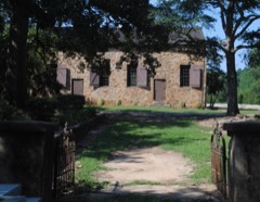
| July 2003 | Thunderstorm Wind | Clemson | $5,000 | Trees and power lines were blown down. Some buildings suffered minor roof damage near Walker Golf Course and Old Stone Church. |
| February 2003 | Heavy Rain | Clemson | $1,000 | Fallen trees and power lines resulting from a combination of heavy rainfall and gusty winds resulted in some power outages. |
| March 2025 | Thunderstorm Wind | Clemson | - | Multiple public reports of blown down trees were received from the Clemson and Central areas. |
| December 2024 | Thunderstorm Wind | Clemson | - | County comms reported scattered trees blown down throughout Pickens County. |
| September 2023 | Hail | Clemson | - | Ham radio operator reported 3/4 inch hail at Highway 76 and Highway 93. |
| May 2020 | Hail | Clemson | - | NWS co-op observer reported penny size hail. |
| April 2020 | Tornado (EF0) | Clemson | - | NWS Storm Survey found a tornado that began in Oconee County moved into Pickens County on Lake Keowee about 2 miles north of Clemson Blvd. Damage in Pickens County was primarily confined to snapped large tree limbs before the tornado lifted in the area around Six Mile Highway and R C Edwards School Rd. |
| August 2019 | Thunderstorm Wind | Clemson | - | Public reported (via Social Media) multiple trees blown down on the campus of Clemson University. |
| July 2016 | Thunderstorm Wind | Clemson | - | Public (via Social Media) and HAM Radio operator reported trees and large limbs blown down along Highway 123 near the Lake Hartwell bridge. |
| July 2013 | Hail | Clemson | - | Quarter size hail near the intersection of highways 123 and 133. |
| August 2010 | Thunderstorm Wind | Clemson | - | Numerous trees were blown down in and around Clemson. |
| June 2009 | Thunderstorm Wind | Clemson | - | Numerous trees were blown down in Clemson and vicinity. |
| August 2008 | Thunderstorm Wind | Clemson | - | Large tree limbs were blown down on Perimeter Rd. |
| August 2008 | Tornado (EF1) | Clemson | - | This tornado tracked from Oconee County into extreme western Pickens County. The tornado lifted just after crossing the campus of Clemson University. The intermittent damage path was mainly limited to downed trees and power lines, although some minor structural damage was noted, especially on the Clemson campus near Memorial Stadium. Some trees and large limbs fell on and damaged automobiles in the Clemson area. |
| August 2008 | Tornado (EF2) | Clemson | - | A tornado damage path extended from northwest Anderson County, into extreme southern Pickens County, affecting the research area on the south side of the Clemson University campus. Damage was limited to downed trees and power lines. Numerous large trees were snapped off on a ridge very close to the Pickens, Anderson County line, where wind speeds were estimated at close to 120 mph, earning the tornado an EF2 rating. |
| May 2006 | Thunderstorm Wind | Clemson | - | A 69 mph gust was measured at the Clemson University Agricultural Weather Office. The top of a maple tree was blown out by the wind. |
| May 2006 | Thunderstorm Wind | Clemson | - | Large tree limbs blown down at Clemson University, some of which fell on vehicles. |
| May 2006 | Hail | Clemson | - | Reported at Clemson University. |
| August 2005 | Hail | Clemson | - | Reported at the intersection of highway 123 and Old Clemson Rd. |
| June 2003 | Flash Flood | Clemson | - | Several creeks flooded, mainly in areas south of Clemson to near Central. |
| July 2001 | Flash Flood | Clemson | - | Small streams and roads flooded during heavy rain. |
| August 2001 | Thunderstorm Wind | Clemson | - | Trees and power lines blown over from western Pickens County, to just east of the city of Pickens. 3000 homes were without power after the storm. |
| November 2000 | Thunderstorm Wind | Clemson | - | Trees were blown down in an area near R.C. Edwards Middle School. Other trees were blown down in and around both Clemson and Central. |
| May 2011 | Hail | Clemson | - | no account filed |
| May 2006 | Hail | Clemson | - | no account filed |
| May 2003 | Hail | Clemson | - | no account filed |
| May 2002 | Hail | Clemson | - | no account filed |
| April 2000 | Tornado (F1) | Clemson | - | no account filed |
| August 1999 | Hail | Clemson | - | no account filed |
| June 1998 | Thunderstorm Wind | Clemson | - | no account filed |
| July 1997 | Heavy Rain | Clemson | - | no account filed |
| August 1997 | Thunderstorm Wind | Clemson | - | no account filed |
| June 1997 | Hail | Clemson | - | no account filed |
| April 1997 | Hail | Clemson | - | no account filed |
 Block