Block
From the record
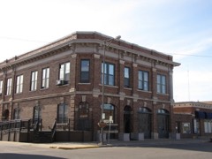
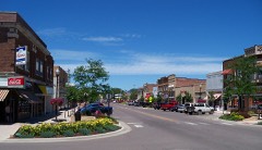
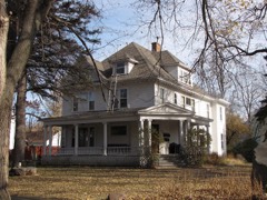
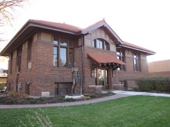
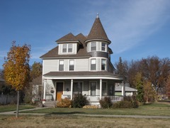
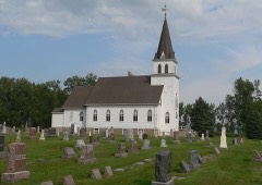
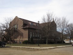
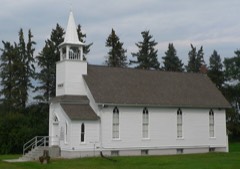
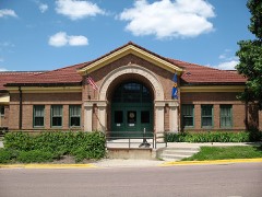
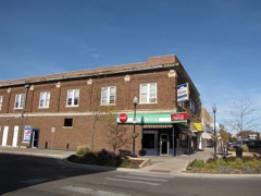
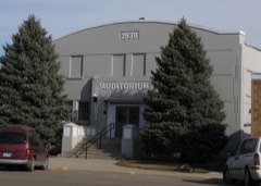
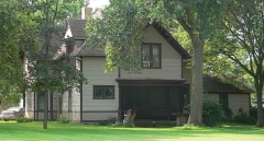
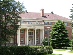
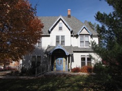
44 National Register listings published here.
Sources: the National Register database, National Park Service
33 topographic sheets cover 18 settlements here, and 44 properties are on the National Register of Historic Places.
44 National Register listings published here.
Sources: the National Register database, National Park Service
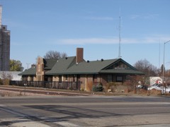
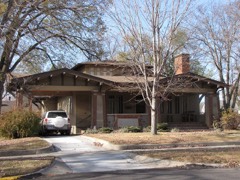
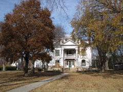
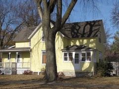
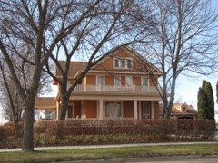
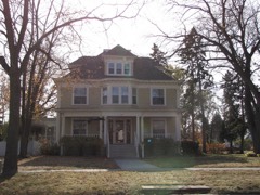
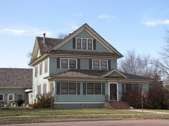
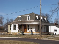
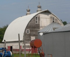
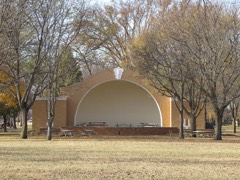
Every property in this county listed on the National Register of Historic Places, with the year it was listed and the federal nomination document.
Every wildfire the federal occurrence database records inside this county: 224 of them, burning about 3,008 acres. 1 started naturally and 5 were recorded as arson. Each settlement page carries the fires within five miles of it.
| Reported cause | Fires |
|---|---|
| Missing data/not specified/undetermined | 93 |
| Debris and open burning | 64 |
| Equipment and vehicle use | 28 |
| Smoking | 8 |
| Fireworks | 7 |
| Misuse of fire by a minor | 6 |
| Power generation/transmission/distribution | 6 |
| Arson/incendiarism | 5 |
| Railroad operations and maintenance | 5 |
| Other causes | 1 |
| Natural | 1 |
The five largest, by the area the report gives. One of them was set deliberately.
| Date | Cause | Size | Reported by | Name on the report |
|---|---|---|---|---|
| 1 April 2003 | Debris and open burning | 355 acres | South Dakota Wildland Fire Suppression | MESSERSCHMIDT |
| 1 April 2003 | Missing data/not specified/undetermined | 350 acres | South Dakota Wildland Fire Suppression | not named |
| 3 April 2003 | Debris and open burning | 350 acres | South Dakota Wildland Fire Suppression | not named |
| 25 March 2000 | Arson/incendiarism | 200 acres | Brookings County | BRAD WINKER |
| 14 April 2009 | Debris and open burning | 147 acres | South Dakota Wildland Fire Suppression | not named |
| 6 March 2003 | Debris and open burning | 122 acres | South Dakota Wildland Fire Suppression | VOSS |
| 26 March 1999 | Misuse of fire by a minor | 100 acres | Brookings County | WATER TREATMENT |
| 24 March 2012 | Missing data/not specified/undetermined | 96 acres | South Dakota Wildland Fire Suppression | WHEELER SLOUGH |
Every settlement page carries the fires within five miles of it - see the settlement index below.
The NOAA Storm Events Database holds 509 reports for this county, causing no deaths, 15 injuries and about $16,616,250 in recorded property damage. Each settlement page carries the reports that name it.
| Kind of event | Reports |
|---|---|
| Thunderstorm Wind | 178 |
| Hail | 163 |
| Flood | 97 |
| Tornado | 32 |
| Flash Flood | 28 |
| Lightning | 8 |
| Funnel Cloud | 3 |
The most serious of them, by death, then injury, then recorded damage. The accounts are quoted exactly as the forecast office filed them.
| When | Event | Place named | Harm | What the report says |
|---|---|---|---|---|
| May 1993 | Thunderstorm Wind | Brookings | 12 hurt, $5,000,000 | Very strong winds, likely the result of a downburst in a severe thunderstorm, destroyed an apartment building, five mobile homes, 15 garages, and 16 vehicles, and damaged many other homes and vehicles. 12 people were treated for minor injuries from the storm. The storm also caused considerable damage to some area farms and the roof of a motel. |
| July 2010 | Thunderstorm Wind | Bruce | 3 hurt, $40,000 | Thunderstorm winds caused widespread tree damage at Oakwood Lakes State Park. A few vehicles were damaged by tree debris, a boat landing was damaged, and a camper was overturned, resulting in minor injuries. |
| July 2002 | Thunderstorm Wind | Sinai | $3,000,000 | Thunderstorm winds caused widespread structural, tree, and power line damage in and near Sinai. The roof was ripped off a mobile home, a well drilling business was destroyed, the siding from another business was ripped off, part of a grain elevator was smashed, several garages were destroyed or heavily damaged, several trees were blown down and widespread tree debris littered the area, and power lines and poles were blown down. Power outages lasted until the next day. At a farm just east of Sinai, five grain bins, a machine shed, and several small shacks were destroyed, and the farmhouse was damaged, with about 300 thousand dollars in damage estimated at this farm alone. Other small farm structures in the area were reported to be destroyed or damaged. Crops in the area were heavily damaged by the wind and accompanying hail, with one witness watching as a bean field "just disappeared." The crop damage was widespread, but the amount of crop damage could not be determined. |
| June 1992 | Tornado (F3) | not stated | $2,500,000 | no account filed |
| June 2001 | Hail | Brookings | $2,000,000 | Large hail falling over an area 20 miles long and almost 5 miles wide caused property and crop damage. The hail damaged siding and windows of homes as well as vehicles. An estimated 60,000 acres of crops were destroyed or damaged. Hail was discovered piled up 6 inches deep in some fields 6 hours after the storm. The affected area included the city of Brookings, where some of the largest hail was reported. |
| April 2011 | Flood | Bruce | $500,000 | Major flooding of the Big Sioux River, as well as flooding of lakes and lowlands in the county, continued through April, though small stream flooding abated. Much farmland remained flooded, both near to and away from the Big Sioux River. Flooding around the south end of Lake Pointsett in the northwest part of the county continued in particular to be damaging. The Big Sioux River crested at 3 feet above flood stage near Brookings on April 6th. Some roads remained closed by the flooding for part of the month. Water was running over other roads, from flooded lowlands, lakes, and the Big Sioux River. Some roads were heavily damaged. Some homes and businesses were still flooded. High water and groundwater levels from record precipitation in the year 2010, a main reason the flooding onset was so fast in March, was also a main reason that the flooding subsided so slowly during April. |
| September 2010 | Flash Flood | Medary | $500,000 | Heavy rainfall of several inches caused flash flooding of numerous streets, basements, fields, and other low areas in and near Brookings. Widespread flash flooding from the overflow of Six Mile Creek was noted in the western and northwestern parts of the city. People in at least 50 houses, mobile homes, and apartments were forced to evacuate, and there was widespread water damage to structures, contents, and vehicles in this area. The widespread flooding from the creek came close to but did not reach the downtown area, although street flooding there was noted. |
| April 2004 | Hail | Brookings | $500,000 | Large hail, accompanied by winds gusting to 50 mph, dented vehicles, cracked and broke windshields and windows, dented siding, and damaged roofs. |
| June 1992 | Tornado (F1) | not stated | $250,000 | no account filed |
| September 2019 | Flood | Sinai | $244,000 | Flooding resulted in damage to public infrastructure including county and township roads and culverts. Flooding also resulted in crop losses across the area. Crop loss estimates provided by the United States Department of Agriculture. |
| July 2000 | Hail | Brookings | $200,000 | Large hail broke windows and otherwise damaged houses and vehicles. The hail also caused significant crop damage. |
| August 1996 | Tornado (F1) | Aurora | $200,000 | no account filed |
| March 2019 | Flood | Medary | $170,000 | Flooding resulted in damage to public infrastructure including county and township roads and culverts. |
| July 2011 | Thunderstorm Wind | Elkton | $100,000 | Thunderstorm winds caused widespread tree damage, including numerous trees blown down. Several houses and garages were damaged by tree debris, and the winds blew shingles off roofs. The winds damaged siding and roofs. Power lines and poles were blown down, resulting in a power outage. Several streets in Elkton were blocked by trees. |
| July 2002 | Thunderstorm Wind | Elkton | $100,000 | Thunderstorm winds caused tree damage, and damage to buildings such as shingles blown off and broken windows from tree debris. The winds caused severe crop damage in the area, especially to corn crops. The amount of crop damage was not known. |
| July 2002 | Hail | Brookings | $100,000 | Large hail, driven by severe winds, damaged vehicles and crops. The amount of crop damage was not known. |
| May 2000 | Thunderstorm Wind | Brookings Arpt | $100,000 | Thunderstorm winds blew off part of a motel roof, overturned two boats, blew a trampoline into a car dealership, and caused tree and some vehicle damage. |
| July 1999 | Thunderstorm Wind | Brookings | $100,000 | no account filed |
| October 1997 | Thunderstorm Wind | Sinai | $100,000 | no account filed |
| August 2015 | Tornado (EF0) | (Bkx)Brookings Muni | $80,000 | A tornado damaged the roof, gutters, and siding of three houses, damaged the roof, patio deck, chimney, and garage of another house, and damaged a fence. |
| April 2001 | Lightning | Elkton | $80,000 | Lightning struck a house, causing a fire which destroyed the house. |
| September 2019 | Flood | White | $50,000 | After excessive two-day rainfall during September 10-12 (5.76 inches 8 miles north of Aurora, 5.41 inches at Brookings), Sixmile Creek above Brookings (gage site SMCS2) reached the highest stage on record of 1.65 feet above flood stage on September 12. Water flooded numerous city streets on the northwest side of Brookings, along with township roads north and northeast of Brookings. |
| June 2016 | Flash Flood | (Bkx)Brookings Muni | $50,000 | Heavy rain caused flash flooding of numerous streets, making some impassable, and stranding several vehicles. |
| June 2013 | Thunderstorm Wind | Brookings | $50,000 | Thunderstorm winds blew down power lines, power poles, and bent other poles and signs. The winds also caused roof damage and extensive tree damage, including numerous branches and at least one large tree blown down. |
| June 2010 | Flash Flood | Brookings | $50,000 | Heavy rain caused widespread street flooding in the city of Brookings. Water on numerous roads was high enough to block the roads, with the water quite deep on several underpasses. Yards, several basements, fields, parks, and part of a golf course were also flooded. . |
| April 2004 | Hail | Volga | $50,000 | Large hail dented vehicles, cracked windows, and damaged siding. |
| July 2002 | Thunderstorm Wind | Brookings | $50,000 | Thunderstorm winds caused tree damage, and damaged the siding of a mobile home. The winds, along with large hail, also damaged crops, but the amount of crop damage was not known. |
| June 1997 | Hail | Bruce | $50,000 | Large hail devastated thousands of acres of corn and soybean crops, broke windows, and damaged siding. The hail fell over most of the northern half of Brookings County. |
| May 1993 | Thunderstorm Wind | White | $50,000 | Thunderstorm winds destroyed a metal machine shed, damaging four tractors and other farm equipment inside. There were other reports of property damage in the White area. |
| June 2001 | Thunderstorm Wind | White | $30,000 | Thunderstorm winds blew down power poles and caused tree damage. The winds also caused damage to farm buildings and equipment and twisted road signs. |
| September 2019 | Flood | Medary | $25,000 | After excessive two-day rainfall during September 10-12 (6.57 inches near Aurora), Medary Creek near Medary (gage site MDYS2) reached the highest stage on record of 3.86 feet above flood stage on September 12. Numerous county and township roads were inundated, along with considerable flooding of agricultural land near the creek. |
| July 2010 | Flash Flood | Brookings | $25,000 | Heavy rain caused flash flooding of several streets and caused water damage to a few businesses. |
| June 1971 | Tornado (F1) | not stated | $25,000 | no account filed |
| June 2010 | Flash Flood | White | $20,000 | Heavy rain caused flooding of rural roads and washed out some of the roads. |
| July 2010 | Thunderstorm Wind | Brookings | $20,000 | Thunderstorm winds blew down power lines and caused tree damage, including several trees blown down. The winds also partially peeled off the roof of a commercial storage building. |
| May 2000 | Thunderstorm Wind | Volga | $20,000 | Thunderstorm winds caused tree and power line damage, causing power outages. |
| August 2015 | Thunderstorm Wind | Brookings Arpt | $15,000 | Thunderstorm winds damaged the roof of a house. |
| July 2010 | Thunderstorm Wind | White | $15,000 | Thunderstorm winds destroyed a pole barn, heavily damaged a metal storage building, and caused tree damage. |
| September 2019 | Flash Flood | Brookings | $10,000 | Several streets around town remained flooded, with the underpass on 6th Avenue pooled to several feet. |
| September 2019 | Flash Flood | Brookings Arpt | $10,000 | Vehicles became stranded in flood waters after a period of intense rainfall. |
| July 2018 | Thunderstorm Wind | Brookings Arpt | $10,000 | Multiple mature trees blown over and bleachers flipped at the Southbrook Softball Complex. Dugouts damaged by blowing debris. Report from social media. |
| May 2000 | Thunderstorm Wind | Elkton | $10,000 | Thunderstorm winds destroyed a barn roof, and damaged another barn. |
| June 1997 | Thunderstorm Wind | White | $10,000 | Thunderstorm winds uprooted a few trees, caused other tree damage, and blew shingles off of roofs. |
| July 1995 | Thunderstorm Wind | Brookings | $10,000 | Thunderstorm winds of unknown speed caused tree damage, with some branches damaging power lines. |
| June 1999 | Thunderstorm Wind | Elkton | $10,000 | no account filed |
| July 1997 | Thunderstorm Wind | Brookings | $10,000 | no account filed |
| June 1995 | Thunderstorm Wind | Aurora | $8,000 | Thunderstorm winds blew down a few trees, one of which damaged the corner of a garage and tore a hole in its roof. Broken tree limbs caused some power outages in the area. |
| August 2020 | Thunderstorm Wind | Ahnberg | $5,000 | Several trees were downed on a property, and one large tree crushed a swing set. Property damage costs are rough estimates. |
| July 2020 | Thunderstorm Wind | Bruce | $5,000 | A large tent was blown over by outflow winds. Property damage costs are rough estimates. |
| August 2015 | Thunderstorm Wind | Brookings Arpt | $5,000 | Thunderstorm winds rolled a manufactured home onto its top, and cause tree damage. |
| May 2009 | Lightning | Brookings | $5,000 | Lightning struck the roof of a house in Brookings, starting a fire which damaged the attic and roof. |
| May 2002 | Lightning | Brookings | $5,000 | Lightning struck the roof of a house, knocking a hole in the roof. The lightning shorted out attic wiring, television sets, and a stove. The lightning also damaged a gas line or meter, causing the house to fill with natural gas. |
| May 2000 | Thunderstorm Wind | White | $5,000 | Thunderstorm winds damaged two farm buildings. |
| July 2000 | Lightning | Bruce | $5,000 | Lightning struck and damaged a tree, and debris from the tree damaged the wall of a home. The force of the lightning strike also broke 6 windows in the home. |
| July 1997 | Thunderstorm Wind | Volga | $5,000 | Thunderstorm winds caused tree damage. |
| September 1997 | Thunderstorm Wind | Bruce | $5,000 | Thunderstorm winds destroyed a pole barn and damaged trees over a small area. |
| July 1998 | Lightning | Volga | $5,000 | no account filed |
| August 2021 | Thunderstorm Wind | Aurora | $3,000 | Thunderstorm wind gusts destroyed a small metal shed. Property damage costs are a rough estimate. |
| August 2020 | Thunderstorm Wind | Bruce | $3,000 | Scattered tree damage was reported in Bruce. Property damage costs are rough estimates. |
| July 2001 | Lightning | Brookings | $3,000 | Lightning struck a garage, causing a fire in the peak of the garage roof which was quickly extinguished. |
The Survey's mineral resources record lists 33 workings inside this county. 9 still produce and 24 are closed or unrecorded. Each settlement page carries the workings within five miles of it.
| Commodity | Workings |
|---|---|
| Sand and Gravel, Construction | 33 |
The least common of them first, because a county's hundredth gravel pit says nothing its first ten did not.
| Where | Site | Commodity | Status | Recorded |
|---|---|---|---|---|
| Brookings Sand & Gravel | Sand and Gravel, Construction | Producer | ||
| County Pit-Brookings | Sand and Gravel, Construction | Past Producer | ||
| Dupraz Pit | Sand and Gravel, Construction | Producer | ||
| Gravel Pit | Sand and Gravel, Construction | Producer | ||
| Highway Pit | Sand and Gravel, Construction | Past Producer | ||
| Klosterman Pit | Sand and Gravel, Construction | Producer | ||
| Mannerud Pit | Sand and Gravel, Construction | Past Producer | ||
| Nelson Sand & Gravel Pit | Sand and Gravel, Construction | Past Producer | ||
| Sand & Gravel | Sand and Gravel, Construction | Past Producer | ||
| Sand & Gravel | Sand and Gravel, Construction | Past Producer | ||
| Sand & Gravel Pit | Sand and Gravel, Construction | Past Producer | ||
| Sand & Gravel Pit | Sand and Gravel, Construction | Past Producer | ||
| Sand & Gravel Pit | Sand and Gravel, Construction | Past Producer | ||
| Sand & Gravel Pit | Sand and Gravel, Construction | Past Producer | ||
| Sand & Gravel Pit | Sand and Gravel, Construction | Producer | ||
| Sand & Gravel Pit | Sand and Gravel, Construction | Producer | ||
| Sand & Gravel Pit | Sand and Gravel, Construction | Past Producer | ||
| Sand & Gravel Pit | Sand and Gravel, Construction | Past Producer | ||
| Sand & Gravel Pit | Sand and Gravel, Construction | Past Producer | ||
| Sand & Gravel Pit | Sand and Gravel, Construction | Past Producer | ||
| Sand & Gravel Pit | Sand and Gravel, Construction | Past Producer | ||
| Sand & Gravel Pit | Sand and Gravel, Construction | Past Producer | ||
| Sand & Gravel Pit | Sand and Gravel, Construction | Past Producer | ||
| Sand & Gravel Pit | Sand and Gravel, Construction | Past Producer | ||
| Sand & Gravel Pit | Sand and Gravel, Construction | Past Producer | ||
| Sand & Gravel Pit | Sand and Gravel, Construction | Past Producer | ||
| Sand & Gravel Pit | Sand and Gravel, Construction | Producer | ||
| Sand & Gravel Pit | Sand and Gravel, Construction | Past Producer | ||
| Sand & Gravel Pit | Sand and Gravel, Construction | Past Producer | ||
| Sand & Gravel Pit | Sand and Gravel, Construction | Past Producer | ||
| Sand & Gravel Pit | Sand and Gravel, Construction | Past Producer | ||
| Wheeler Gravel Pit | Sand and Gravel, Construction | Producer | ||
| Willmott Gravel | Sand and Gravel, Construction | Producer |
Named settlements recorded in the Geographic Names Information System, each with the topographic sheets covering it. Villages, hamlets and abandoned places alike. Each is shown with the nearest named watercourse or landform and the survey quadrangle it falls on.
Medary township · 57006 · On Lake Campbell Outlet · Medary quadrangle
11 sheets, 1953 to 1985