 Block
From the record
One of 44 National Register listings published here for Brookings County · listed in 2005 · category: District.
Sources: the case file at the National Archives · the National Register database, National Park Service
Listed on the National Register of Historic Places in 2005.
One of 44 National Register listings published here for Brookings County · listed in 2005 · category: District.
Sources: the case file at the National Archives · the National Register database, National Park Service
Regional context, not property-specific evidence. The federal wildfire occurrence database lists 56 fires within 5 miles of Vostad Farm between 1999 and 2020, burning about 545 acres in total. None started naturally. None was recorded as arson. Distance is straight-line from the map coordinates, so a fire counted here may appear on a neighbouring settlement's page as well.
| Reported cause | Fires |
|---|---|
| Missing data/not specified/undetermined | 21 |
| Debris and open burning | 15 |
| Equipment and vehicle use | 10 |
| Fireworks | 4 |
| Railroad operations and maintenance | 2 |
| Power generation/transmission/distribution | 2 |
| Misuse of fire by a minor | 1 |
| Smoking | 1 |
The most recent of them, most recent first, with the day each was reported and the service that recorded it.
| Date | Cause | Size | Reported by | Name on the report |
|---|---|---|---|---|
| 4 September 2003 | Debris and open burning | under an acre | South Dakota Wildland Fire Suppression | not named |
| 30 September 2011 | Missing data/not specified/undetermined | under an acre | South Dakota Wildland Fire Suppression | HAYLAND |
| 21 September 2012 | Missing data/not specified/undetermined | 4.3 acres | South Dakota Wildland Fire Suppression | RYKHUS |
| 30 August 2008 | Power generation/transmission/distribution | under an acre | South Dakota Wildland Fire Suppression | not named |
| 1 August 2013 | Missing data/not specified/undetermined | under an acre | Brookings County | WOGAN CENTER |
| 1 August 2012 | Missing data/not specified/undetermined | under an acre | South Dakota Wildland Fire Suppression | SOCCER FIELD |
| 7 July 2012 | Missing data/not specified/undetermined | under an acre | South Dakota Wildland Fire Suppression | 77 INTERSECTION |
| 31 July 2008 | Debris and open burning | 10 acres | South Dakota Wildland Fire Suppression | not named |
Regional context, not property-specific evidence. The federal mineral resources record lists 7 workings within 5 miles of Vostad Farm: 5 past producers, 2 producers. 2 still produce. What was taken out: Sand and Gravel, Construction. Distance is straight-line from the map coordinates, so a quarry counted here may appear on a neighbouring settlement's page as well.
| Where | Site | Commodity | Status | Recorded |
|---|---|---|---|---|
| Brookings Sand & Gravel | Sand and Gravel, Construction | Producer | ||
| County Pit-Brookings | Sand and Gravel, Construction | Past Producer | ||
| Dupraz Pit | Sand and Gravel, Construction | Producer | ||
| Mannerud Pit | Sand and Gravel, Construction | Past Producer | ||
| Nelson Sand & Gravel Pit | Sand and Gravel, Construction | Past Producer | ||
| Sand & Gravel Pit | Sand and Gravel, Construction | Past Producer | ||
| Sand & Gravel Pit | Sand and Gravel, Construction | Past Producer |
Regional context, not property-specific evidence. The National Weather Service names Brookings, the town this property stands in, in 73 storm reports between 1993 and 2025: 29 thunderstorm wind, 25 hail, 8 flash flood, 5 lightning. The reports record 12 injuries. Each account below is quoted exactly as the forecast office filed it, from the NOAA Storm Events Database, and each date opens the federal record of that event.
| When | Event | Place named | Harm | What the report says |
|---|---|---|---|---|
| May 1993 | Thunderstorm Wind | Brookings | 12 hurt, $5,000,000 | Very strong winds, likely the result of a downburst in a severe thunderstorm, destroyed an apartment building, five mobile homes, 15 garages, and 16 vehicles, and damaged many other homes and vehicles. 12 people were treated for minor injuries from the storm. The storm also caused considerable damage to some area farms and the roof of a motel. |
| June 2001 | Hail | Brookings | $2,000,000 | Large hail falling over an area 20 miles long and almost 5 miles wide caused property and crop damage. The hail damaged siding and windows of homes as well as vehicles. An estimated 60,000 acres of crops were destroyed or damaged. Hail was discovered piled up 6 inches deep in some fields 6 hours after the storm. The affected area included the city of Brookings, where some of the largest hail was reported. |
| April 2004 | Hail | Brookings | $500,000 | Large hail, accompanied by winds gusting to 50 mph, dented vehicles, cracked and broke windshields and windows, dented siding, and damaged roofs. |
| July 2000 | Hail | Brookings | $200,000 | Large hail broke windows and otherwise damaged houses and vehicles. The hail also caused significant crop damage. |
| July 2002 | Hail | Brookings | $100,000 | Large hail, driven by severe winds, damaged vehicles and crops. The amount of crop damage was not known. |
| July 1999 | Thunderstorm Wind | Brookings | $100,000 | no account filed |
| June 2013 | Thunderstorm Wind | Brookings | $50,000 | Thunderstorm winds blew down power lines, power poles, and bent other poles and signs. The winds also caused roof damage and extensive tree damage, including numerous branches and at least one large tree blown down. |
| June 2010 | Flash Flood | Brookings | $50,000 | Heavy rain caused widespread street flooding in the city of Brookings. Water on numerous roads was high enough to block the roads, with the water quite deep on several underpasses. Yards, several basements, fields, parks, and part of a golf course were also flooded. . |
| July 2002 | Thunderstorm Wind | Brookings | $50,000 | Thunderstorm winds caused tree damage, and damaged the siding of a mobile home. The winds, along with large hail, also damaged crops, but the amount of crop damage was not known. |
| July 2010 | Flash Flood | Brookings | $25,000 | Heavy rain caused flash flooding of several streets and caused water damage to a few businesses. |
| July 2010 | Thunderstorm Wind | Brookings | $20,000 | Thunderstorm winds blew down power lines and caused tree damage, including several trees blown down. The winds also partially peeled off the roof of a commercial storage building. |
| September 2019 | Flash Flood | Brookings | $10,000 | Several streets around town remained flooded, with the underpass on 6th Avenue pooled to several feet. |
| July 1995 | Thunderstorm Wind | Brookings | $10,000 | Thunderstorm winds of unknown speed caused tree damage, with some branches damaging power lines. |
| July 1997 | Thunderstorm Wind | Brookings | $10,000 | no account filed |
| May 2009 | Lightning | Brookings | $5,000 | Lightning struck the roof of a house in Brookings, starting a fire which damaged the attic and roof. |
| May 2002 | Lightning | Brookings | $5,000 | Lightning struck the roof of a house, knocking a hole in the roof. The lightning shorted out attic wiring, television sets, and a stove. The lightning also damaged a gas line or meter, causing the house to fill with natural gas. |
| July 2001 | Lightning | Brookings | $3,000 | Lightning struck a garage, causing a fire in the peak of the garage roof which was quickly extinguished. |
| July 2001 | Lightning | Brookings | $3,000 | Lightning struck a house, damaging several appliances and lights. |
| July 1995 | Thunderstorm Wind | Brookings | $2,000 | Thunderstorm Winds of unknown speed blew down tree limbs. |
| May 2025 | Thunderstorm Wind | Brookings | - | Three cars suffered broken windows from thunderstorm wind gusts. |
| August 2025 | Thunderstorm Wind | Brookings | - | Thunderstorm winds downed a large tree branch along Faculty Drive. |
| June 2025 | Thunderstorm Wind | Brookings | - | Wind gust measured by South Dakota Mesonet station BKMS2 Brookings 2NE. |
| July 2024 | Thunderstorm Wind | Brookings | - | A tree branch 4 to 6 inches in diameter was downed by thunderstorm winds. |
| July 2024 | Thunderstorm Wind | Brookings | - | Thunderstorm wind gusts downed a large tree limb. |
| June 2022 | Hail | Brookings | - | An extended period of dime to quarter size hail occurred just north of Brookings. |
| May 2022 | Thunderstorm Wind | Brookings | - | The walls of a local business collapsed after the large south-facing doors failed. |
| May 2022 | Thunderstorm Wind | Brookings | - | Numerous vehicles were blown over. Trees were snapped with widespread damage to houses and roofs throughout town, and most without power into the next day. The Brookings Marathon scheduled for a couple days later was cancelled. |
| September 2021 | Thunderstorm Wind | Brookings | - | Thunderstorm wind gust was measured by the South Dakota State Mesonet site 2 miles northeast of Brookings (BKMS2). Crop damage is an estimate from insured losses. Information provided by the United States Department of Agriculture. |
| July 2018 | Flash Flood | Brookings | - | Sixmile Creek at gaging site SMCS2 rapidly rose above flood stage at 0400CST and reached moderate flood stage at 0745CST. Rainfall of 6.83 inches was measured 2 miles northeast of Brookings. Numerous township roads were flooded north of Brookings. |
| July 2018 | Flash Flood | Brookings | - | Multiple streets flooding in Brookings. Rainfall totalled 6.83 inches 2 miles northeast of Brookings, 7.50 inches on the southeast side of Brookings and 9.00 inches at Aurora. |
| July 2016 | Hail | Brookings | - | Large hail caused an unknown amount of crop damage. |
| June 2012 | Thunderstorm Wind | Brookings | - | Thunderstorm winds caused tree damage, including a one foot diameter tree and several branches blown down. |
| August 2010 | Thunderstorm Wind | Brookings | - | Thunderstorm winds caused widespread tree damage, including some trees over 3 feet in diameter blown down. |
| July 2010 | Flash Flood | Brookings | - | Heavy rain caused flash flooding of numerous streets and basements in Brookings. Knee deep water in several streets was slow to recede. |
| July 2010 | Hail | Brookings | - | Hail was accompanied by heavy rain. |
| July 2010 | Thunderstorm Wind | Brookings | - | Thunderstorm winds caused tree damage, including up to 5 inch diameter branches blown down. |
| July 2009 | Hail | Brookings | - | Hail was accompanied by estimated 40 mph wind gusts. |
| June 2008 | Thunderstorm Wind | Brookings | - | Thunderstorm winds caused tree damage, including a few trees uprooted. |
| June 2008 | Thunderstorm Wind | Brookings | - | Thunderstorm winds caused tree damage, including several branches blown down. |
| June 2008 | Thunderstorm Wind | Brookings | - | Thunderstorm winds caused tree damage, including several limbs and branches blown down. |
| June 2008 | Flood | Brookings | - | Heavy rain caused minor flooding of the Big Sioux River for 3 days, with grassland and farmland along the river flooded. |
| April 2007 | Flood | Brookings | - | Heavy rain at the end of March led to minor flooding along the Big Sioux River near Brookings for a few days. The flooding was confined to a few lowlands along the river. |
| March 2007 | Flood | Brookings | - | Warm temperatures caused a rapid snowmelt which caused the Big Sioux River to rise above flood stage for several days. The flooding was minor to moderate and no significant damage was reported. The river crested at 2.9 feet above flood stage near Brookings on March 15th. |
| September 2006 | Tornado (F0) | Brookings | - | A brief tornado caused no reported damage. |
| June 2005 | Flash Flood | Brookings | - | Heavy rain caused street flooding throughout the city of Brookings. Basements and low areas were also flooded. |
| June 2005 | Thunderstorm Wind | Brookings | - | Thunderstorm winds caused tree damage, including several branches blown down. The winds also blew shingles off the roof of a house. |
| May 2004 | Lightning | Brookings | - | Lightning struck an electrical cable, cutting off power to 180 Brookings customers for a half hour. |
| June 2003 | Thunderstorm Wind | Brookings | - | Thunderstorm winds caused tree damage, including at least one large tree blown down. |
| June 2002 | Flash Flood | Brookings | - | Heavy rain caused flooding of roads in Brookings. One vehicle stalled under a railroad underpass and had water up to the windows. |
| July 2002 | Thunderstorm Wind | Brookings | - | Thunderstorm winds damaged a barn, a silo, and tore the roof off a mobile home. The winds also caused tree damage, including fifty to sixty trees blown down on a golf course. |
| June 2001 | Thunderstorm Wind | Brookings | - | Thunderstorm winds caused tree damage, including large branches blown down. |
| June 1997 | Tornado (F0) | Brookings | - | A brief tornado observed by spotters caused no damage. |
| June 2022 | Hail | Brookings | - | no account filed |
| July 2017 | Thunderstorm Wind | Brookings | - | no account filed |
| June 2016 | Hail | Brookings | - | no account filed |
| August 2010 | Hail | Brookings | - | no account filed |
| July 2010 | Hail | Brookings | - | no account filed |
| July 2010 | Hail | Brookings | - | no account filed |
| July 2007 | Hail | Brookings | - | no account filed |
| April 2006 | Flood | Brookings | - | no account filed |
No historic map-sheet match is published for this property yet. That does not mean no map exists. This record needs a coordinate-quality review before it can be joined to a sheet boundary. Browse the county's mapped places while that work is pending.
Other National Register properties close enough to walk or drive between, ordered by distance from this one. Both positions come from the same geocoding pass that matched these properties to their map sheets.
| Photograph | Property | Distance | Listed |
|---|---|---|---|
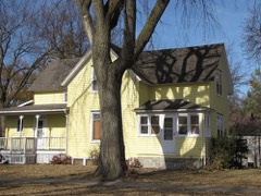 | Graham House | 2.1 miles | 1994 |
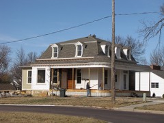 | Lockhart House | 2.3 miles | 2010 |
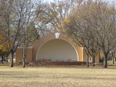 | Pioneer Park Bandshell | 2.3 miles | 2007 |
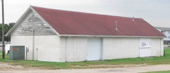 | Experimental Rammed Earth Machine Shed | 2.4 miles | 1993 |
| G. A. Mathews House | 2.5 miles | 1986 | |
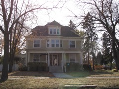 | E.E. Haugen House | 2.5 miles | 2010 |
| National Archives record | The nomination case file for reference 05000283 in Record Group 79. |
| Brookings County | All 44 listed properties in this county. |