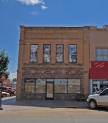
Block
From the record
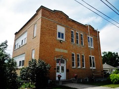
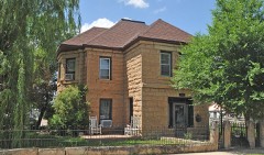
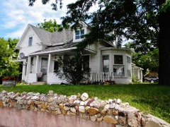
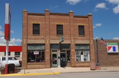
39 National Register listings published here.
Sources: the National Register database, National Park Service
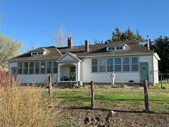
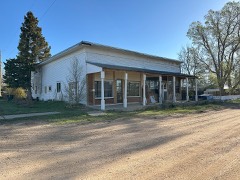
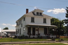
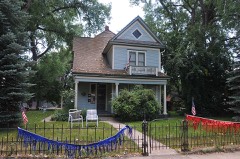
48 topographic sheets cover 11 settlements here, and 39 properties are on the National Register of Historic Places.
39 National Register listings published here.
Sources: the National Register database, National Park Service
Every property in this county listed on the National Register of Historic Places, with the year it was listed and the federal nomination document.
Every wildfire the federal occurrence database records inside this county: 205 of them, burning about 22,041 acres. 57 started naturally and none was recorded as arson. Each settlement page carries the fires within five miles of it.
| Reported cause | Fires |
|---|---|
| Missing data/not specified/undetermined | 100 |
| Natural | 57 |
| Equipment and vehicle use | 22 |
| Debris and open burning | 18 |
| Misuse of fire by a minor | 3 |
| Other causes | 3 |
| Railroad operations and maintenance | 1 |
| Power generation/transmission/distribution | 1 |
The five largest, by the area the report gives. None of them was recorded as arson.
| Date | Cause | Size | Reported by | Name on the report |
|---|---|---|---|---|
| 8 February 2000 | Other causes | 6,500 acres | Newell Volunteer Fire Department | LICKINY |
| 13 August 2003 | Power generation/transmission/distribution | 2,500 acres | South Dakota Wildland Fire Suppression | MILLER RANCH |
| 26 March 2012 | Natural | 1,268 acres | Montana/Dakotas State Office | COUNTY LINE |
| 12 August 2000 | Natural | 950 acres | Edgemont Volunteer Fire Department | CHILSON MT 2 |
| 1 July 2012 | Natural | 714 acres | Montana/Dakotas State Office | NEWELL |
| 12 October 2011 | Missing data/not specified/undetermined | 700 acres | South Dakota Wildland Fire Suppression | PETERSON |
| 12 July 2006 | Natural | 700 acres | South Dakota Wildland Fire Suppression | not named |
| 14 July 2006 | Natural | 640 acres | South Dakota Wildland Fire Suppression | not named |
Every settlement page carries the fires within five miles of it - see the settlement index below.
The NOAA Storm Events Database holds 678 reports for this county, causing 1 death, 14 injuries and about $8,708,050 in recorded property damage. Each settlement page carries the reports that name it.
| Kind of event | Reports |
|---|---|
| Thunderstorm Wind | 318 |
| Hail | 310 |
| Flood | 18 |
| Tornado | 17 |
| Funnel Cloud | 6 |
| Flash Flood | 6 |
| Heavy Rain | 2 |
| Wildfire | 1 |
The most serious of them, by death, then injury, then recorded damage. The accounts are quoted exactly as the forecast office filed them.
| When | Event | Place named | Harm | What the report says |
|---|---|---|---|---|
| June 2014 | Flash Flood | Castle Rock | 1 killed, 1 hurt | Battle Creek flooded US Highway 85 north of Belle Fourche. A vehicle was swept away by the flowing water; one person had minor injuries but walked to the highway, the other was not found and is presumed dead. |
| July 2001 | Thunderstorm Wind | Belle Fourche | 5 hurt, $213,000 | no account filed |
| July 1998 | Hail | Belle Fourche | 3 hurt, $3,000,000 | NEARLY EVERY HOME, BUSINESS AND VECHICLE IN THE CITY WAS BADLY DAMAGED. |
| July 2001 | Hail | Belle Fourche | 2 hurt | no account filed |
| July 2010 | Hail | Castle Rock | 1 hurt, $3,000 | Large hail broke the windows of a pickup and injured a small child. |
| July 1957 | Tornado (F1) | not stated | 1 hurt, $2,500 | no account filed |
| July 2016 | Thunderstorm Wind | Newell | 1 hurt | A pickup truck pulling a horse trailer were blown off Highway 212, injuring one person. A nearby ranch sustained damage to a barn and chimney, a travel trailer was tipped over, and an outbuilding was destroyed. |
| June 2008 | Flood | Castle Rock | $2,000,000 | Levels along the Belle Fourche River were among the highest levels ever recorded. Redwater Creek, Willow Creek, Hay Creek, Indian Creek, and their tributaries flooded. Several stock dams failed and the embankment next to the spillway at Newell Lake nearly eroded. |
| August 2011 | Hail | Belle Fourche | $1,000,000 | no account filed |
| May 2019 | Flood | Belle Fourche Airport | $750,000 | Runoff from heavy rain caused overland flooding and flooding along Belle Fourche River tributaries. Water flooded Kinghorn Road near US Highway 85 in several locations, Old Highway 85, Camp Crook Road, Valley Road 1, Arpan Road, Brooker Road, Crow Creek Road, Capp Road, Taylor Road, Beet Road, Mail Road, Baker Road, Stone Lake Road, Dillinger Road, Hope Road, Youngberg Road, 188th Street, and old US Highway 212 east of Newell. |
| July 1963 | Tornado (F3) | not stated | $250,000 | no account filed |
| June 2013 | Flood | Belle Fourche | $200,000 | Redwater River, Crow Creek, and several small creeks and streams experienced flooding. Water reached the edge of a house along the Redwater River and some low water crossings were flooded. |
| May 2013 | Flash Flood | Belle Fourche Reservoir | $150,000 | Three to five inches of rain fell in a few hours and caused flash flooding in southeastern Butte County. Willow Creek, Horse Creek, Indian Creek, and Whitewood Creek quickly rose over their banks. At least two private stock dams failed southeast of Nisland. Numerous roads, culverts, and fences were damaged. |
| July 2009 | Thunderstorm Wind | Newell | $150,000 | Strong wind gusts uprooted large trees and power poles in Newell. Some buildings and homes in town sustained damage in and around Newell. |
| June 2014 | Flood | Castle Rock | $100,000 | Significant flooding occurred along Battle Creek, Fourmile Creek, Alkali Creek, Indian Creek, and the South Fork of the Moreau River. Several roads were flooded, including US Highway 85 between Belle Fourche and Redig, SD Highway 168, Harding Road, and Camp Crook Road. |
| August 1994 | Thunderstorm Wind | not stated | $100,000 | ,,,,,,,,(G65) ,,,,,,,,Hail(175) Thunderstorm winds blew down power lines and poles and blew down many tree limbs, one of which caused severe damage to a van, and ripped the roof off of a mobile home. Hail caused widespread damage to corn and other crops. |
| July 2010 | Hail | Castle Rock | $75,000 | The combination of hail and wind damaged homes and automobiles in the area and destroyed wheat crops. |
| August 2011 | Thunderstorm Wind | Hoover | $50,000 | Winds blew down a granary, corral, large tree branches, and power lines at Hoover. A roof was blown off a barn. |
| August 2009 | Thunderstorm Wind | Nisland | $50,000 | The combination of large hail and wind gusts to 70 mph damaged crops and property. |
| July 2005 | Thunderstorm Wind | Belle Fourche | $50,000 | Automobiles were blown over on U.S. Highway 85 north of Belle Fourche. |
| July 1994 | Thunderstorm Wind | Belle Fourche | $50,000 | Thunderstorm Winds flipped over a camper, destroyed a barn 3 miles north of Newell, and downed some power lines. |
| May 2013 | Hail | Vale | $50,000 | no account filed |
| July 2019 | Flash Flood | Castle Rock | $40,000 | Runoff from heavy rainfall washed out Highway 79 in two locations at the Frog Creek and Hans Creek crossings. The flooding also damaged Erk Road near Goeringer Road and south of Graf Road at Warren Creek. |
| July 2012 | Thunderstorm Wind | Newell | $40,000 | Some outbuildings and carports were damaged, a roof was blown off one building, and several trees were uprooted by the strong winds. |
| June 2015 | Thunderstorm Wind | Nisland | $25,000 | The combination of very large hail and strong wind gusts caused significant property damage. |
| May 2013 | Flood | Castle Rock | $25,000 | After heavy during the early evening caused flash flooding in south central Butte County, additional rain overnight exacerbated the flooding. High water from several tributaries caused minor flooding along the Belle Fourche River, which was two feet deep over the Bismark Bridge east of Vale. |
| July 2005 | Thunderstorm Wind | Newell | $25,000 | Several trees and many tree limbs were blown down in Newell. A large trailer at a gas station in Newell was tipped over. |
| July 2005 | Thunderstorm Wind | Castle Rock | $25,000 | A brick chimney was blown off a house, an 80 foot by 100 foot barn lost one third of its roof, and a large Cottonwood tree was snapped off near the ground. |
| June 2015 | Hail | Nisland | $25,000 | no account filed |
| June 2014 | Hail | Castle Rock | $25,000 | no account filed |
| September 1986 | Tornado (F1) | not stated | $25,000 | no account filed |
| July 1980 | Tornado (F0) | not stated | $25,000 | no account filed |
| July 2024 | Thunderstorm Wind | Hoover | $20,000 | Many trees were damaged and snapped off. Barn roof was partially torn off. Stockade damage. |
| June 2015 | Thunderstorm Wind | Newell | $20,000 | The combination of softball sized hail and strong wind gust broke several windows and damaged the siding and roof of a house. |
| July 2010 | Thunderstorm Wind | Belle Fourche Airport | $20,000 | The combination of hail and wind damaged automobiles. |
| August 2010 | Thunderstorm Wind | Belle Fourche Airport | $15,000 | The combination of hail and wind damaged a home and automobiles. |
| June 2015 | Thunderstorm Wind | Nisland | $10,000 | Several windows of a house were broken and roof damage occurred from wind-driven hail. |
| July 2012 | Thunderstorm Wind | Belle Fourche Airport | $10,000 | A door was blown off a hangar. |
| July 2005 | Thunderstorm Wind | Newell | $10,000 | Large trees uprooted and grain bins blown over. |
| June 2013 | Hail | Belle Fourche | $10,000 | no account filed |
| August 2011 | Hail | Hoover | $10,000 | no account filed |
| August 2010 | Thunderstorm Wind | Hoover | $7,000 | The combination of hail and wind broke automobile and house windows. |
| May 2020 | Flash Flood | Fruitdale | $5,000 | Runoff from heavy rain flooded Crooked Oaks Road just south of Snoma Road. Gravel was washed off the road and the road was impassable for a couple of hours. |
| July 1999 | Thunderstorm Wind | Vale | $5,000 | Doors torn off a barn. Two horses were killed and another injured. |
| July 1994 | Thunderstorm Wind | Nisland | $5,000 | Thunderstorm Winds ripped the roof off of a shed at a feed lot. |
| August 2013 | Hail | Belle Fourche Airport | $5,000 | no account filed |
| June 2012 | Hail | Nisland | $5,000 | no account filed |
| May 1996 | Hail | Belle Fourche | $5,000 | no account filed |
| June 2015 | Hail | Belle Fourche Reservoir | $3,000 | The combination of hail and strong wind gust broke house windows. |
| June 2001 | Thunderstorm Wind | Newell | $3,000 | Strong winds blew the roof off a garage. The "crows nest" observation tower at high school football stadium was also blown over. |
| July 1977 | Tornado | not stated | $2,500 | no account filed |
| June 1975 | Tornado (F0) | not stated | $2,500 | no account filed |
| May 1961 | Tornado | not stated | $2,500 | no account filed |
| September 1955 | Tornado (F2) | not stated | $2,500 | no account filed |
| June 2014 | Thunderstorm Wind | Hoover | $2,000 | Thunderstorm winds tipped over large farm equipment, downed several trees, and flattened alfalfa crops. |
| May 2018 | Flood | Belle Fourche Airport | $1,000 | Several small streams came out of their banks and overwhelmed culverts, causing minor flooding. There was also minor ponding of water on some streets in Belle Fourche. |
| August 2016 | Thunderstorm Wind | Belle Fourche Reservoir | $1,000 | The roof was blown off a pole barn. |
| July 1999 | Thunderstorm Wind | Belle Fourche | $1,000 | Trees were blown over and sheds and barns had damage. |
| July 1997 | Hail | Belle Fourche | $1,000 | Large hail damaged several cars. |
| August 1993 | Tornado (F0) | Newell | $500 | A severe thunderstorm destroyed crops, especially east of Vale. A likely tornado skimmed the trees near a residence and tore tin from buildings. Southeast of Newell, large driving hail shattered the windows on the trailer. |
The Survey's mineral resources record lists 9 workings inside this county. 5 still produce and 4 are closed or unrecorded. Each settlement page carries the workings within five miles of it.
| Commodity | Workings |
|---|---|
| Sand and Gravel, Construction | 5 |
| Clay | 3 |
| Bentonite | 1 |
The least common of them first, because a county's hundredth gravel pit says nothing its first ten did not.
| Where | Site | Commodity | Status | Recorded |
|---|---|---|---|---|
| Belle Fourche Bentonite Products | Bentonite | Producer | Bentonite | |
| Banato Pit | Clay | Producer | ||
| Belle Fourche Clay Pit | Clay | Producer | ||
| Kinsfather Pit #1 | Clay | Producer | ||
| Barber Pit No 1 | Sand and Gravel, Construction | Past Producer | ||
| Gravel Pit | Sand and Gravel, Construction | Past Producer | ||
| Hayy Pit | Sand and Gravel, Construction | Producer | ||
| State Highway Dept Pit | Sand and Gravel, Construction | Past Producer | ||
| State Highway Dept. Pit | Sand and Gravel, Construction | Past Producer |
Named settlements recorded in the Geographic Names Information System, each with the topographic sheets covering it. Villages, hamlets and abandoned places alike. Each is shown with the nearest named watercourse or landform and the survey quadrangle it falls on.
West Butte unorganized territory · 57717 · On Redwater River · Belle Fourche quadrangle
14 sheets, 1907 to 1983
East Butte unorganized territory · 57760 · Castle Rock quadrangle
8 sheets, 1913 to 1983
Fruitdale town · 57717 · On Crooked Oak Creek · Fruitdale quadrangle
13 sheets, 1905 to 1983
East Butte unorganized territory · 57760 · On Badlands Creek · Hoover quadrangle
6 sheets, 1935 to 1980
West Butte unorganized territory · 57717 · Fruitdale quadrangle
13 sheets, 1905 to 1983
No longer a settlement
East Butte unorganized territory · 57788 · On Cottonwood Creek · Vale quadrangle
13 sheets, 1906 to 1983
The vanished settlements of Butte County: the places named above that are no longer on the map.