 Block
Castle Rock, South Dakota
8 topographic sheets cover this place, the earliest surveyed in 1913 and the latest in 1983. It stands in the East Butte unorganized territory. It lies in ZIP code area 57760. The Survey maps it on the Castle Rock quadrangle.
Topographic sheets covering this place
5 surveys from 8 printed sheetsMatched by testing this settlement's coordinate against the published boundary of every sheet in the United States Geological Survey's historical collection. Each opens the scanned sheet at the Survey.
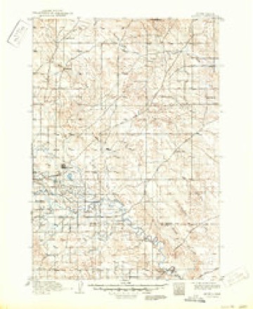
- 1913 USGS Newell quadrangle1:125000, 2 printings
- 1953 USGS Rapid City quadrangle1:250000, 3 printings
- 1957 USGS Rapid City quadrangle1:250000
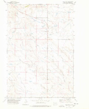
- 1977 USGS Castle Rock quadrangle1:24000
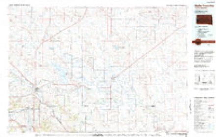
- 1983 USGS Belle Fourche quadrangle1:100000
Fires near this place
3 since 2007Regional context, not property-specific evidence. The federal wildfire occurrence database lists 3 fires within 5 miles of Castle Rock between 2007 and 2020, burning about 732 acres in total. 2 started naturally. None was recorded as arson. Distance is straight-line from the map coordinates, so a fire counted here may appear on a neighbouring settlement's page as well.
| Reported cause | Fires |
|---|---|
| Natural | 2 |
| Equipment and vehicle use | 1 |
The most recent of them, most recent first, with the day each was reported and the service that recorded it.
| Date | Cause | Size | Reported by | Name on the report |
|---|---|---|---|---|
| 14 August 2020 | Equipment and vehicle use | 620 acres | South Dakota Wildland Fire Suppression | TIN CA |
| 7 July 2017 | Natural | 110 acres | South Dakota Wildland Fire Suppression | GRAZING ASSOC |
| 15 July 2007 | Natural | 2.0 acres | South Dakota Wildland Fire Suppression | not named |
Settlements close enough to share some of these fires:
Storms near this place
60 of 91 shownRegional context, not property-specific evidence. The National Weather Service names Castle Rock in 91 storm reports between 2000 and 2025: 51 thunderstorm wind, 27 hail, 8 flood, 2 flash flood. The reports record 1 death and 2 injuries. Each account below is quoted exactly as the forecast office filed it, from the NOAA Storm Events Database, and each date opens the federal record of that event.
| When | Event | Place named | Harm | What the report says |
|---|---|---|---|---|
| June 2014 | Flash Flood | Castle Rock | 1 killed, 1 hurt | Battle Creek flooded US Highway 85 north of Belle Fourche. A vehicle was swept away by the flowing water; one person had minor injuries but walked to the highway, the other was not found and is presumed dead. |
| July 2010 | Hail | Castle Rock | 1 hurt, $3,000 | Large hail broke the windows of a pickup and injured a small child. |
| June 2008 | Flood | Castle Rock | $2,000,000 | Levels along the Belle Fourche River were among the highest levels ever recorded. Redwater Creek, Willow Creek, Hay Creek, Indian Creek, and their tributaries flooded. Several stock dams failed and the embankment next to the spillway at Newell Lake nearly eroded. |
| June 2014 | Flood | Castle Rock | $100,000 | Significant flooding occurred along Battle Creek, Fourmile Creek, Alkali Creek, Indian Creek, and the South Fork of the Moreau River. Several roads were flooded, including US Highway 85 between Belle Fourche and Redig, SD Highway 168, Harding Road, and Camp Crook Road. |
| July 2010 | Hail | Castle Rock | $75,000 | The combination of hail and wind damaged homes and automobiles in the area and destroyed wheat crops. |
| July 2019 | Flash Flood | Castle Rock | $40,000 | Runoff from heavy rainfall washed out Highway 79 in two locations at the Frog Creek and Hans Creek crossings. The flooding also damaged Erk Road near Goeringer Road and south of Graf Road at Warren Creek. |
| May 2013 | Flood | Castle Rock | $25,000 | After heavy during the early evening caused flash flooding in south central Butte County, additional rain overnight exacerbated the flooding. High water from several tributaries caused minor flooding along the Belle Fourche River, which was two feet deep over the Bismark Bridge east of Vale. |
| July 2005 | Thunderstorm Wind | Castle Rock | $25,000 | A brick chimney was blown off a house, an 80 foot by 100 foot barn lost one third of its roof, and a large Cottonwood tree was snapped off near the ground. |
| June 2014 | Hail | Castle Rock | $25,000 | no account filed |
| June 2025 | Thunderstorm Wind | Castle Rock | - | SD mesonet recorded wind gust. |
| July 2025 | Thunderstorm Wind | Castle Rock | - | SD Mesonet measured wind gust. |
| September 2025 | Thunderstorm Wind | Castle Rock | - | SD Mesonet station recorded wind gust. |
| August 2025 | Thunderstorm Wind | Castle Rock | - | SD Mesonet recorded wind gust. |
| July 2024 | Thunderstorm Wind | Castle Rock | - | Gusts of 60 to around 100 mph for at least 15 minutes. |
| July 2020 | Tornado (EF0) | Castle Rock | - | A tornado touched down briefly over prairie land near US Highway 85 west of Castle Rock. |
| July 2020 | Thunderstorm Wind | Castle Rock | - | Dime sized hail also fell with the storm. |
| August 2020 | Thunderstorm Wind | Castle Rock | - | Winds were estimated at 60 mph. |
| June 2019 | Thunderstorm Wind | Castle Rock | - | Wind gusts were estimated at 60 mph. |
| May 2019 | Flood | Castle Rock | - | Runoff from heavy rain on already saturated ground caused minor flooding along the South Fork of the Moreau River around SD Highway 79 near Hoover. |
| July 2019 | Flood | Castle Rock | - | Flooding continued from runoff of heavy rainfall. Highway 79 was flooded in two places at the Frog Creek and Hans Creek Crossings. The flooding also damaged Erk Road near Goeringer Road and south of Graf Road at Warren Creek. |
| June 2018 | Hail | Castle Rock | - | Storm chasers found 2 1/2 to three inch diameter hail stones a half an hour after the storm passed. |
| July 2017 | Thunderstorm Wind | Castle Rock | - | Wind gusts were estimated at 60 mph. |
| June 2016 | Hail | Castle Rock | - | Some hail stones from ping-pong ball to baseball size fell with the storm. Gusts to 40 mph also accompanied the hail. |
| June 2014 | Thunderstorm Wind | Castle Rock | - | Thunderstorm winds drove hail through windows and siding and damaged the roof of a house. |
| June 2014 | Thunderstorm Wind | Castle Rock | - | Wind gusts were estimated at 60 mph. |
| July 2012 | Thunderstorm Wind | Castle Rock | - | Wind gusts were estimated at 60 mph. |
| March 2011 | Flood | Castle Rock | - | Flooding occurred along the South Fork of the Moreau River. |
| June 2011 | Thunderstorm Wind | Castle Rock | - | Wind gusts estimated at 70 mph moved an outhouse 100 yards. |
| August 2011 | Thunderstorm Wind | Castle Rock | - | Wind gusts were estimated at 60 mph. |
| July 2010 | Thunderstorm Wind | Castle Rock | - | Wind gusts were estimated at 70 mph. |
| April 2009 | Flood | Castle Rock | - | Minor flooding occurred in Belle Fourche, Vale, Newell, Nisland, and Hoover. Highway 212 northwest of Belle Fourche was covered with six inches of water. |
| June 2008 | Flood | Castle Rock | - | The South Fork of the Moreau River near Sand Creek was reported to be a mile wide. |
| July 2024 | Thunderstorm Wind | Castle Rock | - | no account filed |
| June 2024 | Thunderstorm Wind | Castle Rock | - | no account filed |
| September 2024 | Thunderstorm Wind | Castle Rock | - | no account filed |
| September 2024 | Hail | Castle Rock | - | no account filed |
| September 2024 | Thunderstorm Wind | Castle Rock | - | no account filed |
| August 2024 | Thunderstorm Wind | Castle Rock | - | no account filed |
| July 2023 | Hail | Castle Rock | - | no account filed |
| June 2023 | Thunderstorm Wind | Castle Rock | - | no account filed |
| May 2022 | Thunderstorm Wind | Castle Rock | - | no account filed |
| July 2022 | Thunderstorm Wind | Castle Rock | - | no account filed |
| June 2022 | Thunderstorm Wind | Castle Rock | - | no account filed |
| June 2022 | Thunderstorm Wind | Castle Rock | - | no account filed |
| June 2022 | Thunderstorm Wind | Castle Rock | - | no account filed |
| June 2021 | Thunderstorm Wind | Castle Rock | - | no account filed |
| July 2021 | Thunderstorm Wind | Castle Rock | - | no account filed |
| July 2021 | Thunderstorm Wind | Castle Rock | - | no account filed |
| August 2021 | Thunderstorm Wind | Castle Rock | - | no account filed |
| August 2021 | Hail | Castle Rock | - | no account filed |
| July 2020 | Funnel Cloud | Castle Rock | - | no account filed |
| July 2020 | Funnel Cloud | Castle Rock | - | no account filed |
| August 2020 | Thunderstorm Wind | Castle Rock | - | no account filed |
| August 2020 | Hail | Castle Rock | - | no account filed |
| August 2020 | Thunderstorm Wind | Castle Rock | - | no account filed |
| August 2020 | Thunderstorm Wind | Castle Rock | - | no account filed |
| June 2020 | Thunderstorm Wind | Castle Rock | - | no account filed |
| June 2020 | Thunderstorm Wind | Castle Rock | - | no account filed |
| August 2018 | Thunderstorm Wind | Castle Rock | - | no account filed |
| July 2017 | Thunderstorm Wind | Castle Rock | - | no account filed |
Nearest settlements
The eight closest, with where each one stands in the county. Distances are straight-line, computed from the Geographic Names Information System coordinates.
Elsewhere
Matched on this settlement's Geographic Names Information System number rather than its name, so it cannot be a different place of the same name in another state.
| Wikipedia article on Castle Rock | An encyclopaedic summary. Its text is share-alike, so it is linked here rather than copied. |
| Wikidata item Q23709334 | The structured record the population and elevation above come from. Public domain (CC0). |
Provenance
This settlement is recorded in the Geographic Names Information System as feature 1260987. The sheet list is computed by point-in-boundary test against the United States Geological Survey's historical topographic inventory. Both are works of the United States government and carry no copyright under 17 U.S.C. 105.
Wildfire. Short, Karen C. 2022. Spatial wildfire occurrence data for the United States, 1992-2020 [FPA_FOD_20221014]. 6th Edition. Fort Collins, CO: Forest Service Research Data Archive. https://doi.org/10.2737/RDS-2013-0009.6 Collected with United States Government funding and usable without additional permissions or fees.
Storms. NOAA National Centers for Environmental Information, Storm Events Database https://www.ncei.noaa.gov/stormevents/ A work of the United States government, no copyright under 17 U.S.C. 105. Narratives are quoted verbatim from the National Weather Service report and are not edited or summarised.