 Block
From the record
12 National Register listings published here.
Sources: the National Register database, National Park Service
52 topographic sheets cover 19 settlements here, and 12 properties are on the National Register of Historic Places.
12 National Register listings published here.
Sources: the National Register database, National Park Service
Every property in this county listed on the National Register of Historic Places, with the year it was listed and the federal nomination document.
| Photograph | Property | Type | Listed | Reference |
|---|---|---|---|---|
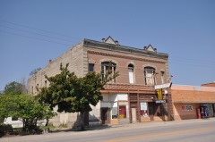 | Bartlett-Myers Building | building | 2006 | 06000457 |
 | Battle Mountain Sanitarium, National Home For Disabled Volunteer Soldiers | district | 2011 | 11000561 |
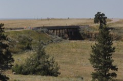 | Chilson Bridge | structure | 1993 | 93001287 |
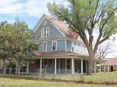 | Arthur and Ellen Colgan House | building | 2017 | 100001398 |
 | Hot Springs High School | building | 1980 | 80003721 |
| Hot Springs Historic District | district | 2018 | 74001890 | |
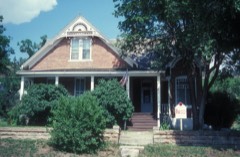 | Governor Leslie Jensen House | building | 1987 | 87001731 |
| Log Cabin Tourist Camp | district | 2004 | 03001525 | |
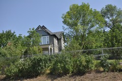 | Petty House | building | 1999 | 99000202 |
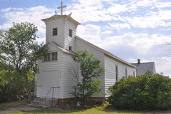 | St. Martin's Catholic Church and Grotto | building | 2005 | 03000764 |
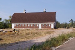 | State Soldiers Home Barn | building | 2009 | 09000446 |
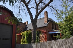 | Phillip Wesch House | building | 1984 | 84003287 |
Every wildfire the federal occurrence database records inside this county: 837 of them, burning about 102,218 acres. 506 started naturally and 4 were recorded as arson. Each settlement page carries the fires within five miles of it.
| Reported cause | Fires |
|---|---|
| Natural | 506 |
| Missing data/not specified/undetermined | 103 |
| Equipment and vehicle use | 82 |
| Debris and open burning | 57 |
| Railroad operations and maintenance | 31 |
| Power generation/transmission/distribution | 24 |
| Misuse of fire by a minor | 10 |
| Fireworks | 6 |
| Recreation and ceremony | 6 |
| Other causes | 5 |
| Arson/incendiarism | 4 |
| Smoking | 3 |
The five largest, by the area the report gives. None of them was recorded as arson.
| Date | Cause | Size | Reported by | Name on the report |
|---|---|---|---|---|
| 16 July 2016 | Natural | 14,318 acres | New Castle Field Office | INDIAN CANYON |
| 26 September 2001 | Power generation/transmission/distribution | 10,547 acres | Black Hills National Forest | WEST HELL CANYON |
| 7 July 2007 | Natural | 10,324 acres | South Dakota Wildland Fire Suppression | ALABAUGH |
| 24 April 2012 | Natural | 9,882 acres | Nebraska National Forest | HAY CANYON |
| 29 June 2012 | Equipment and vehicle use | 9,000 acres | Black Hills National Forest | WHITE DRAW |
| 11 August 2000 | Natural | 7,386 acres | Black Hills National Forest | FLAGPOLE MOUNTAIN |
| 11 August 2011 | Natural | 5,214 acres | Black Hills National Forest | COAL CANYON |
| 21 July 2012 | Natural | 4,300 acres | Nebraska National Forest | MOSS AGATE |
Every settlement page carries the fires within five miles of it - see the settlement index below.
The NOAA Storm Events Database holds 677 reports for this county, causing no deaths, 3 injuries and about $6,757,340 in recorded property damage. Each settlement page carries the reports that name it.
| Kind of event | Reports |
|---|---|
| Hail | 376 |
| Thunderstorm Wind | 235 |
| Tornado | 30 |
| Flash Flood | 16 |
| Flood | 11 |
| Wildfire | 3 |
| Heavy Rain | 3 |
| Funnel Cloud | 2 |
| Lightning | 1 |
The most serious of them, by death, then injury, then recorded damage. The accounts are quoted exactly as the forecast office filed them.
| When | Event | Place named | Harm | What the report says |
|---|---|---|---|---|
| June 1982 | Tornado (F2) | not stated | 1 hurt, $250,000 | no account filed |
| June 1998 | Tornado (F1) | Hot Spgs | 1 hurt, $166,000 | A roof was blown off a house, and two campers and a boat trailer were damaged. A mobile home was also destroyed with a young man on the porch of the house thrown. |
| July 1998 | Tornado (F1) | Hot Spgs | 1 hurt, $150,000 | HOUSE DESTROYED ON PROPERTY OF EMERGENCY MANAGER; NEARBY HOUSES AND OTHER STRUCTURES HAD ROOF DAMAGE. |
| July 2010 | Thunderstorm Wind | Hot Springs | $1,500,000 | Strong winds damaged fences, signs, and buildings in Hot Springs and blew down trees and power poles. Buildings and automobiles were damaged by fallen trees. A mobile home was lifted off the ground and destroyed. A large portion of Hot Springs lost power for several hours. |
| June 2010 | Hail | Hot Springs | $1,000,000 | Two inch diameter hail caused extensive damage to automobiles and some buildings in Hot Springs. |
| June 2014 | Hail | Hot Springs | $500,000 | Golf ball size hail was accompanied by 50 mph wind gusts and heavy rain. |
| June 2012 | Tornado (EF2) | Provo | $500,000 | A tornado touched down just west of the Edgemont Road. It moved eastward and caused damage at a ranch just east of Highway 71 north of Ardmore. A large wooden barn was completely destroyed; its walls and roof were blown more than 100 yards away. Two large sheds lost roofs and walls and smaller sheds were blown apart. The modular house sustained minor damage. |
| June 2013 | Hail | Hot Springs | $300,000 | Hail damaged vehicles in town. |
| August 2013 | Hail | Hot Springs | $250,000 | no account filed |
| May 1991 | Tornado (F1) | not stated | $250,000 | no account filed |
| May 2019 | Flood | Hot Springs | $200,000 | Runoff from heavy rain caused overland flooding east of Hot Springs and south of Buffalo Gap, with flooding along Hat Creek around Ardmore and Horsehead Creek around Oelrichs. Several county roads west of Oelrichs and a road along Beaver Creek south of Buffalo Gap had to be closed. |
| June 2012 | Hail | Edgemont | $100,000 | Hail from golfball to softball size fell. |
| June 2012 | Thunderstorm Wind | Ardmore | $100,000 | Rear flank downdraft winds damaged ranch outbuildings south of the tornado track. |
| June 2015 | Hail | Hot Springs | $100,000 | no account filed |
| June 2008 | Flash Flood | Edgemont | $100,000 | no account filed |
| August 2005 | Hail | Hot Spgs | $100,000 | no account filed |
| June 2003 | Thunderstorm Wind | Hot Spgs | $100,000 | no account filed |
| May 2010 | Flood | Hot Springs | $75,000 | Heavy rain caused flooding along the Fall River, Horsehead Creek, Hat Creek, Beaver Creek, and other smaller creeks and streams in Fall River County. The low water crossings in Hot Springs at South Sixth Street and at Joplin Avenue were flooded as well as several county roads. The creeks and streams were so high that Angostura Reservoir filled up and over 5900 cfs was being released. This was the first time in 10 years that Angostura Reservoir was full. The saturated soil and gusty winds also helped to bring down several large trees in Hot Springs. |
| June 2010 | Hail | Hot Springs | $75,000 | Hail damaged automobiles in Hot Springs. |
| July 2010 | Thunderstorm Wind | Ardmore | $75,000 | Large hail and strong winds broke windows, damaged automobiles, and downed tree branches. |
| June 2015 | Flood | Provo | $65,000 | Widespread flooding was reported along Hat Creek from the South Dakota-Nebraska border to Angostura Reservoir, with the river gauge on Highway 71 measuring a record flow. Several other streams in Fall River County flooded. Indian Creek west of Ardmore was a quarter mile wide with water over the approach on the County Road 5 bridge. Washouts were reported on Hay Canyon Road, North Butte Road, Edgemont Road, and Maitland Road. Horsehead Creek was 200 yards wide north of Oelrichs and covered the northbound lane of US Highway 385 with a foot of water for several hours. Due to the high inflows into Angostura Reservoir, the Bureau of Reclamation increased releases to 18,000 cubic feet per second. |
| July 2019 | Flood | Provo | $50,000 | Runoff from heavy rainfall caused flooding along Hat Creek and its smaller tributaries, Duck Creek, and Plains Creek. The flooding compromised a culvert on Highway 71 about 4 miles north of Ardmore and a county road bridge just east of Ardmore was washed away. |
| July 2008 | Thunderstorm Wind | Edgemont | $50,000 | Thunderstorm winds blew down a cement granary, a 20 foot high barn, and several power poles. |
| June 2005 | Tornado (F1) | Oral | $50,000 | A non-supercell tornado quickly developed and moved across a field, where it destroyed 3 177-foot sections of a new center pivot irrigation system and the roof of a game bird barn. The tornado was followed by wind gusts of 70 mph and golf ball to almost softball sized hail. |
| June 2015 | Flood | Oral | $40,000 | Flooding in Oral occurred after runoff backed up at a plugged culvert along Sand Creek. East Oral Road was underwater, with several homes and businesses in Oral and north of East Oral Road inundated. |
| May 2010 | Hail | Angostura Reservoir | $40,000 | Golfball to softball sized hail fell from Angostura Reservoir to Maverick Junction and damaged vehicles. |
| June 2024 | Thunderstorm Wind | Provo | $30,000 | Combination of large hail and wind damaged siding and broke windows of building. |
| August 2009 | Thunderstorm Wind | Edgemont | $30,000 | Strong wind gusts blew out the doors of an airport hanger and two small planes in the hangar received minor damage. |
| June 2012 | Hail | Provo | $30,000 | no account filed |
| June 2013 | Hail | Oelrichs | $25,000 | Baseball size hail damaged property. |
| June 2010 | Hail | Smithwick | $25,000 | Large hail to tennis ball size damaged a home and automobiles. |
| June 2010 | Hail | Hot Springs | $25,000 | Hail to golf ball size damaged some automobiles along SD Highway 71 south of Hot Springs. |
| June 1983 | Tornado (F2) | not stated | $25,000 | no account filed |
| August 1983 | Tornado (F2) | not stated | $25,000 | no account filed |
| July 1979 | Tornado (F1) | not stated | $25,000 | no account filed |
| July 1969 | Tornado (F2) | not stated | $25,000 | no account filed |
| July 2012 | Thunderstorm Wind | Hot Springs | $20,000 | Strong winds blew out windows, uprooted large trees, and snapped power poles. |
| July 2013 | Hail | Oelrichs | $20,000 | no account filed |
| July 2014 | Hail | Edgemont | $15,000 | Racquet ball sized hail broke windows on a car and damaged siding. |
| June 2013 | Thunderstorm Wind | Angostura Reservoir | $15,000 | Wind-driven hail broke house and car windows. Other minor damage was reported around the area. |
| June 2012 | Thunderstorm Wind | Hot Springs | $15,000 | Two power poles and several trees were blown down by the wind. |
| July 2013 | Hail | Oelrichs | $15,000 | no account filed |
| May 2018 | Flash Flood | Edgemont | $10,000 | Two to four inches of rain in two hours caused minor flooding. Runoff washed gravel off a couple of county roads and water ran over at least one county road when the culvert became plugged with debris. The Cheyenne River at Edgemont quickly rose about 5 feet and peaked around 1700 cfs. |
| May 2018 | Flood | Provo | $10,000 | Widespread flooding occurred across Fall River County. Flooded roads included Edgemont Road northwest of Ardmore, Hard Scrabble Road, Black Banks Road, and Horsehead Road. Numerous small creeks and streams were out of their banks; including Beef Creek, Beaver Creek, Black Banks Creek, Cottonwood Creek, Hat Creek, Plum Creek, Duck Creek, Alkali Creek, Little Cottonwood Creek, and tributaries into Hat Creek, Horsehead Creek, and the Cheyenne River upstream of Angostura Reservoir. Inflows into Angostura Reservoir went from around 250 cubic feet per second (cfs) to over 4500 cfs in just a couple of days. The high inflows raised the water elevation in the reservoir, so releases were increased to around 4000 cfs for a few days. |
| June 2014 | Thunderstorm Wind | Oral | $10,000 | Two large center pivot irrigation systems were mangled by thunderstorm winds. The concrete base of one was pulled from the ground. |
| July 2013 | Flash Flood | Hot Springs | $10,000 | Heavy rain caused flooding along Cold Brook Creek above Cold Brook Reservoir and Cottonwood Springs Creek above Cottonwood Reservoir. Debris flowing down Cold Brook Creek piled up in the channel along Argyle Road, causing water to flow over the road. Along Cottonwood Springs Creek, water created a channel 12 feet wide into Cottonwood Reservoir and washed gravel off rural roads. |
| July 2013 | Thunderstorm Wind | Oral | $10,000 | Grain bins and pivot irrigation systems were blown over by the wind. |
| June 2013 | Hail | Hot Springs | $10,000 | Baseball size hail damaged property. |
| August 2013 | Hail | Hot Springs | $10,000 | Two inch diameter hail damaged property. |
| June 2010 | Hail | Hot Springs Municipal Airport | $10,000 | Golf ball sized hail damaged automobiles. |
| July 2009 | Thunderstorm Wind | Provo | $10,000 | A lambing shed was blown apart and tree branches and power lines were broken by strong wind gusts. |
| July 2003 | Hail | Oral | $10,000 | Large tree limbs were blown down. Large hail also broke windows and damaged the roof of a house. |
| June 2013 | Hail | Oral | $10,000 | no account filed |
| June 2013 | Hail | Smithwick | $10,000 | no account filed |
| June 2010 | Hail | Edgemont | $6,000 | Golf ball sized hail caused minor damage to automobiles. |
| July 2020 | Hail | Edgemont | $5,000 | Hail damaged vehicles. |
| July 2015 | Thunderstorm Wind | Edgemont | $5,000 | Trees and large branches were blown down on every street in town. Shingles were peeled and metal panels were curled off roofs. |
| August 2013 | Flash Flood | Hot Springs | $5,000 | Heavy rain caused flooding in Hot Springs, around Cold Brook Reservoir, and in the Minnekahta Valley area. Six inches of water was flowing down the Highway 18 bypass and water was over street curbs in Hot Springs. Minor flooding occurred in Hot Brook Canyon along Hot Brook Creek. Cold Brook Reservoir reached its second highest pool level at 3585.42 feet. |
| June 2011 | Flash Flood | Oelrichs | $5,000 | At least six inches of water flowed over Chadron Road and washed gravel off it. |
| August 2010 | Thunderstorm Wind | Edgemont | $5,000 | Strong winds downed trees and power poles in Edgemont, with electric service out for as long as 24 hours. |
The Survey's mineral resources record lists 155 workings inside this county. 11 still produce and 144 are closed or unrecorded. Each settlement page carries the workings within five miles of it.
| Commodity | Workings |
|---|---|
| Uranium | 128 |
| Sand and Gravel, Construction | 11 |
| Gypsum-Anhydrite | 5 |
| Stone, Crushed/Broken | 4 |
| Flagstone | 4 |
| Molybdenum, Uranium, Rhenium | 1 |
| Stone, Dimension | 1 |
| Clay | 1 |
The least common of them first, because a county's hundredth gravel pit says nothing its first ten did not.
| Where | Site | Commodity | Status | Recorded |
|---|---|---|---|---|
| Edgemont Quarry | Stone, Dimension | Past Producer | Sandstone | |
| Refinite Corp Bentonite Pit | Clay | Past Producer | ||
| Runge | Molybdenum, Uranium, Rhenium | Occurrence | ||
| Burke Quarry | Stone, Crushed/Broken | Past Producer | 1905 | |
| Burke Quarry | Flagstone | Past Producer | ||
| Edgemont Grindstone Co | Flagstone | Past Producer | ||
| Elm Creek Quarry | Stone, Crushed/Broken | Past Producer | 1895 | |
| Elm Creek Quarry | Flagstone | Past Producer | ||
| Evans Quarry | Stone, Crushed/Broken | Past Producer | 1892, 1942 | |
| Evans Quarry | Flagstone | Past Producer | ||
| Hills Material Quarry | Stone, Crushed/Broken | Producer | ||
| Grant Robinson Mine | Gypsum-Anhydrite | Past Producer | 1893 | |
| Grant Robinson Mine | Gypsum-Anhydrite | Past Producer | ||
| Hot Springs Gypsum | Gypsum-Anhydrite | Past Producer | 1911 | |
| Hot Springs Gypsum Co | Gypsum-Anhydrite | Unknown | ||
| Hot Springs Plaster Co | Gypsum-Anhydrite | Past Producer | ||
| Bell Pit | Sand and Gravel, Construction | Past Producer | ||
| Birdsall Sand & Gravel Co Mine | Sand and Gravel, Construction | Producer | ||
| Fall River County Pit | Sand and Gravel, Construction | Producer | ||
| Gravel Pit | Sand and Gravel, Construction | Producer | ||
| Gravel Pits | Sand and Gravel, Construction | Past Producer | ||
| Gravel Pits | Sand and Gravel, Construction | Past Producer | ||
| Hot Springs City Land Fill | Sand and Gravel, Construction | Past Producer | ||
| Marietta Gravel Deposit | Sand and Gravel, Construction | Past Producer | ||
| Oral Pit | Sand and Gravel, Construction | Producer | ||
| Romey Sand & Gravel Pit | Sand and Gravel, Construction | Past Producer | ||
| Rosebud Sioux L-40 | Sand and Gravel, Construction | Past Producer | ||
| Accidental No. 1 | Uranium | Past Producer | ||
| Accidental No. 10 | Uranium | Past Producer | ||
| Accidental No. 3 | Uranium | Occurrence | ||
| Acme | Uranium | Occurrence | ||
| Alice | Uranium | Occurrence | ||
| Amy No. 1 | Uranium | Past Producer | ||
| Apple Pie | Uranium | Past Producer | ||
| B and H Nos. 1-6 | Uranium | Past Producer | ||
| Barber | Uranium | Past Producer | ||
| Barker and Howell | Uranium | Past Producer | ||
| Baxter | Uranium | Past Producer | ||
| Beadle Group | Uranium | Past Producer | ||
| Bear Lodge | Uranium | Past Producer | ||
| Bits | Uranium | Past Producer | ||
| Blue Chip | Uranium | Occurrence | ||
| Blue Note | Uranium | Past Producer | ||
| Carabou | Uranium | Past Producer | ||
| Carnotite Cave | Uranium | Occurrence | ||
| Chilson Canyon No. 1 | Uranium | Past Producer | ||
| Clarabell Nos. 1-5 | Uranium | Past Producer | ||
| Coal Canyon 6de | Uranium | Past Producer | ||
| Coal Canyon Lode | Uranium | Past Producer | ||
| Coal Canyon No. 1 | Uranium | Past Producer | ||
| Coal Canyon No. 4 | Uranium | Past Producer | ||
| Cram Lease | Uranium | Past Producer | ||
| Crandal Group | Uranium | Past Producer | ||
| Cycad No. 1 | Uranium | Past Producer | ||
| Dagmar | Uranium | Occurrence | ||
| Dakota | Uranium | Past Producer | ||
| Dakota Flat | Uranium | Past Producer | ||
| Damsite | Uranium | Past Producer | ||
| Darrow #3 Pit | Uranium | Producer | ||
| Darrow Lease | Uranium | Producer | ||
| Darrow Lease | Uranium | Past Producer | ||
| Diana A | Uranium | Past Producer | ||
| Eagle Eyrie | Uranium | Occurrence | ||
| Edgemont 1-6 | Uranium | Past Producer | ||
| Eunice | Uranium | Occurrence | ||
| Flora | Uranium | Past Producer | ||
| Freezeout No. 3 | Uranium | Past Producer | ||
| Gertrude | Uranium | Past Producer | ||
| Get Me Rich No. 1 | Uranium | Past Producer | ||
| Gould Lease | Uranium | Past Producer | ||
| Green Acre | Uranium | Occurrence | ||
| Green Acre No. 3 | Uranium | Past Producer | ||
| Greenslipper | Uranium | Past Producer | ||
| Greenslipper 1 | Uranium | Past Producer | ||
| Greenslipper 2 | Uranium | Past Producer | ||
| Greenslipper 3 | Uranium | Past Producer | ||
| Gull | Uranium | Past Producer | ||
| Gull Leases 1 and 3 | Uranium | Past Producer | ||
| Heck Lease | Uranium | Producer | ||
| Helen | Uranium | Past Producer | ||
| Hell's Canyon | Uranium | Past Producer | ||
| Hey and Fay | Uranium | Past Producer | ||
| Hi Pockets | Uranium | Occurrence | ||
| Holdup No. 15 | Uranium | Past Producer | ||
| Holdup No. 17 | Uranium | Past Producer | ||
| Holdup No. 2 | Uranium | Past Producer | ||
| Hot Point | Uranium | Occurrence | ||
| Imogene | Uranium | Past Producer | ||
| Jackpine | Uranium | Past Producer | ||
| Jo Ann | Uranium | Past Producer | ||
| Johnson-Starlite | Uranium | Past Producer | ||
| King Mine | Uranium | Past Producer | ||
| Kl-15 | Uranium | Past Producer | ||
| Koller | Uranium | Past Producer | ||
| Lazyman | Uranium | Past Producer | ||
| Lion | Uranium | Past Producer | ||
| Lion #2 Pit | Uranium | Producer | ||
| Little Ann | Uranium | Past Producer | ||
| Little Windy | Uranium | Occurrence | ||
| Lo Ra No. 1 | Uranium | Producer | ||
| Lucky No. 1 | Uranium | Past Producer | ||
| Lucky Strike | Uranium | Past Producer | ||
| Lucky Toss | Uranium | Past Producer | ||
| Lucy | Uranium | Occurrence | ||
| Martinson | Uranium | Past Producer | ||
| Marty's Timber Claim | Uranium | Past Producer | ||
| Mary Jac No.9 | Uranium | Past Producer | ||
| Matias Peak | Uranium | Past Producer | ||
| McKnight | Uranium | Past Producer | ||
| Negro Gulch | Uranium | Past Producer | ||
| Ophelia | Uranium | Past Producer | ||
| Pabst No. 3 | Uranium | Occurrence | ||
| Pat 2 | Uranium | Past Producer | ||
| Patsy | Uranium | Past Producer | ||
| Payday | Uranium | Past Producer | ||
| Pee Wee | Uranium | Past Producer | ||
| Pennywitt | Uranium | Past Producer | ||
| Peterson Lease | Uranium | Producer | ||
| Pictograph | Uranium | Past Producer | ||
| Ram 1 | Uranium | Past Producer | ||
| Reutter Group | Uranium | Past Producer | ||
| Ridge Runner No. 1a | Uranium | Occurrence | ||
| Ridge Runner No. 3 | Uranium | Past Producer | ||
| Ridge Runner No. 4 | Uranium | Past Producer | ||
| Rip Snorter | Uranium | Past Producer | ||
| Road Hog 1a | Uranium | Past Producer | ||
| Road Hog 3a | Uranium | Past Producer | ||
| Rowena | Uranium | Past Producer | ||
| Runge | Uranium | Past Producer | ||
| Runge East | Uranium | Past Producer | ||
| Runge West | Uranium | Past Producer | ||
| Sec. 36-8s-3e | Uranium | Past Producer | ||
| Shamrock Group | Uranium | Past Producer | ||
| Sheep Canyon | Uranium | Occurrence | ||
| Shelton-Warren | Uranium | Past Producer | ||
| Skinny Sob | Uranium | Past Producer | ||
| Skipper No. 4 | Uranium | Past Producer | ||
| South View No. 3 | Uranium | Past Producer | ||
| Taylor Lease | Uranium | Past Producer | ||
| Tess | Uranium | Past Producer | ||
| Tin Shack | Uranium | Past Producer | ||
| Too Late | Uranium | Past Producer | ||
| Trail Wind | Uranium | Past Producer | ||
| Traill Fraction | Uranium | Past Producer | ||
| Unknown | Uranium | Occurrence | ||
| Uranium No.1 | Uranium | Past Producer | ||
| Valley View | Uranium | Occurrence | ||
| Valley View No. 6 | Uranium | Past Producer | ||
| Verde | Uranium | Past Producer | ||
| Virginia C | Uranium | Past Producer | ||
| Wakan | Uranium | Past Producer | ||
| Washboard | Uranium | Past Producer | ||
| Western Edge | Uranium | Occurrence | ||
| Yellow Cat | Uranium | Occurrence | ||
| Yellowcat 1 | Uranium | Past Producer |
Named settlements recorded in the Geographic Names Information System, each with the topographic sheets covering it. Villages, hamlets and abandoned places alike. Each is shown with the nearest named watercourse or landform and the survey quadrangle it falls on.
Northeast Fall River unorganized territory · 57747 · On Horsehead Creek · Angostura Reservoir quadrangle
16 sheets, 1896 to 1993
Southwest Fall River unorganized territory · 57735 · On Short Branch Creek · Ardmore quadrangle
13 sheets, 1902 to 1993
Northeast Fall River unorganized territory · 57747 · Near Alabaugh Canyon · Cascade Springs quadrangle
15 sheets, 1902 to 1993
Southwest Fall River unorganized territory · 57735 · On Coal Creek · Edgemont quadrangle
16 sheets, 1902 to 1993
Southwest Fall River unorganized territory · 57735 · On Cottonwood Creek · Edgemont quadrangle
16 sheets, 1902 to 1993
Northeast Fall River unorganized territory · 57747 · On Cottonwood Springs Creek · Minnekahta NE quadrangle
14 sheets, 1902 to 1993
Northeast Fall River unorganized territory · 57747 · Heppner quadrangle
14 sheets, 1902 to 1993
Hot Springs city · 57747 · On Hot Brook · Hot Springs quadrangle
19 sheets, 1896 to 1993
Southwest Fall River unorganized territory · 57735 · Near Bennett Canyon · Burdock quadrangle
14 sheets, 1902 to 1993
Northeast Fall River unorganized territory · 57747 · Near Bradley Flats · Minnekahta quadrangle
15 sheets, 1902 to 1993
Northeast Fall River unorganized territory · 57766 · On Sand Creek · Buffalo Gap quadrangle
16 sheets, 1896 to 1993
Northeast Fall River unorganized territory · 57747 · Near Sorghum Flat · Cascade Springs quadrangle
15 sheets, 1902 to 1993
Southwest Fall River unorganized territory · 57735 · On Cow Creek · Rumford quadrangle
15 sheets, 1902 to 1993
Northeast Fall River unorganized territory · 57782 · Smithwick quadrangle
14 sheets, 1896 to 1993