 Block
From the record
One of 12 National Register listings published here for Fall River County · listed in 2004 · category: District.
Sources: the case file at the National Archives · the National Register database, National Park Service
Listed on the National Register of Historic Places in 2004.
One of 12 National Register listings published here for Fall River County · listed in 2004 · category: District.
Sources: the case file at the National Archives · the National Register database, National Park Service
Regional context, not property-specific evidence. The federal wildfire occurrence database lists 158 fires within 5 miles of Log Cabin Tourist Camp between 1993 and 2020, burning about 1,064 acres in total. 79 started naturally. 2 were recorded as arson. Distance is straight-line from the map coordinates, so a fire counted here may appear on a neighbouring settlement's page as well.
| Reported cause | Fires |
|---|---|
| Natural | 79 |
| Missing data/not specified/undetermined | 30 |
| Debris and open burning | 23 |
| Equipment and vehicle use | 11 |
| Other causes | 4 |
| Recreation and ceremony | 4 |
| Misuse of fire by a minor | 3 |
| Arson/incendiarism | 2 |
| Power generation/transmission/distribution | 1 |
| Smoking | 1 |
The most recent of them, most recent first, with the day each was reported and the service that recorded it.
| Date | Cause | Size | Reported by | Name on the report |
|---|---|---|---|---|
| 8 September 2002 | Natural | under an acre | South Dakota Wildland Fire Suppression | HAGEN CANYON 2 |
| 7 September 2003 | Natural | under an acre | Black Hills National Forest | FLY AWAY |
| 7 September 2002 | Natural | 2.0 acres | South Dakota Wildland Fire Suppression | BATTLE MT |
| 5 September 2018 | Debris and open burning | under an acre | South Dakota Wildland Fire Suppression | KOA |
| 5 September 2018 | Recreation and ceremony | under an acre | South Dakota Wildland Fire Suppression | CAMPGROUND |
| 5 September 2002 | Natural | 5.0 acres | South Dakota Wildland Fire Suppression | ARGYLE RD |
| 25 September 2010 | Equipment and vehicle use | under an acre | South Dakota Wildland Fire Suppression | BALE |
| 2 September 2000 | Natural | under an acre | South Dakota Wildland Fire Suppression | SATURDAY |
Regional context, not property-specific evidence. The federal mineral resources record lists 14 workings within 5 miles of Log Cabin Tourist Camp: 11 past producers, 2 producers, 1 unknown. 2 still produce. What was taken out: Gypsum-Anhydrite, Stone, Crushed/Broken, Sand and Gravel, Construction, Flagstone. Distance is straight-line from the map coordinates, so a quarry counted here may appear on a neighbouring settlement's page as well.
| Where | Site | Commodity | Status | Recorded |
|---|---|---|---|---|
| Diana A | Uranium | Past Producer | ||
| Burke Quarry | Flagstone | Past Producer | ||
| Evans Quarry | Flagstone | Past Producer | ||
| Burke Quarry | Stone, Crushed/Broken | Past Producer | 1905 | |
| Evans Quarry | Stone, Crushed/Broken | Past Producer | 1892, 1942 | |
| Fall River County Pit | Sand and Gravel, Construction | Producer | ||
| Hills Material Quarry | Stone, Crushed/Broken | Producer | ||
| Hot Springs City Land Fill | Sand and Gravel, Construction | Past Producer | ||
| Romey Sand & Gravel Pit | Sand and Gravel, Construction | Past Producer | ||
| Grant Robinson Mine | Gypsum-Anhydrite | Past Producer | 1893 |
Regional context, not property-specific evidence. The National Weather Service names Hot Springs, the town this property stands in, in 106 storm reports between 1993 and 2025: 70 hail, 24 thunderstorm wind, 7 flash flood, 4 flood. No death or injury is recorded in these reports. Each account below is quoted exactly as the forecast office filed it, from the NOAA Storm Events Database, and each date opens the federal record of that event.
| When | Event | Place named | Harm | What the report says |
|---|---|---|---|---|
| July 2010 | Thunderstorm Wind | Hot Springs | $1,500,000 | Strong winds damaged fences, signs, and buildings in Hot Springs and blew down trees and power poles. Buildings and automobiles were damaged by fallen trees. A mobile home was lifted off the ground and destroyed. A large portion of Hot Springs lost power for several hours. |
| June 2010 | Hail | Hot Springs | $1,000,000 | Two inch diameter hail caused extensive damage to automobiles and some buildings in Hot Springs. |
| June 2014 | Hail | Hot Springs | $500,000 | Golf ball size hail was accompanied by 50 mph wind gusts and heavy rain. |
| June 2013 | Hail | Hot Springs | $300,000 | Hail damaged vehicles in town. |
| August 2013 | Hail | Hot Springs | $250,000 | no account filed |
| May 2019 | Flood | Hot Springs | $200,000 | Runoff from heavy rain caused overland flooding east of Hot Springs and south of Buffalo Gap, with flooding along Hat Creek around Ardmore and Horsehead Creek around Oelrichs. Several county roads west of Oelrichs and a road along Beaver Creek south of Buffalo Gap had to be closed. |
| June 2015 | Hail | Hot Springs | $100,000 | no account filed |
| May 2010 | Flood | Hot Springs | $75,000 | Heavy rain caused flooding along the Fall River, Horsehead Creek, Hat Creek, Beaver Creek, and other smaller creeks and streams in Fall River County. The low water crossings in Hot Springs at South Sixth Street and at Joplin Avenue were flooded as well as several county roads. The creeks and streams were so high that Angostura Reservoir filled up and over 5900 cfs was being released. This was the first time in 10 years that Angostura Reservoir was full. The saturated soil and gusty winds also helped to bring down several large trees in Hot Springs. |
| June 2010 | Hail | Hot Springs | $75,000 | Hail damaged automobiles in Hot Springs. |
| June 2010 | Hail | Hot Springs | $25,000 | Hail to golf ball size damaged some automobiles along SD Highway 71 south of Hot Springs. |
| July 2012 | Thunderstorm Wind | Hot Springs | $20,000 | Strong winds blew out windows, uprooted large trees, and snapped power poles. |
| June 2012 | Thunderstorm Wind | Hot Springs | $15,000 | Two power poles and several trees were blown down by the wind. |
| July 2013 | Flash Flood | Hot Springs | $10,000 | Heavy rain caused flooding along Cold Brook Creek above Cold Brook Reservoir and Cottonwood Springs Creek above Cottonwood Reservoir. Debris flowing down Cold Brook Creek piled up in the channel along Argyle Road, causing water to flow over the road. Along Cottonwood Springs Creek, water created a channel 12 feet wide into Cottonwood Reservoir and washed gravel off rural roads. |
| June 2013 | Hail | Hot Springs | $10,000 | Baseball size hail damaged property. |
| August 2013 | Hail | Hot Springs | $10,000 | Two inch diameter hail damaged property. |
| August 2013 | Flash Flood | Hot Springs | $5,000 | Heavy rain caused flooding in Hot Springs, around Cold Brook Reservoir, and in the Minnekahta Valley area. Six inches of water was flowing down the Highway 18 bypass and water was over street curbs in Hot Springs. Minor flooding occurred in Hot Brook Canyon along Hot Brook Creek. Cold Brook Reservoir reached its second highest pool level at 3585.42 feet. |
| June 2007 | Hail | Hot Springs | $5,000 | Baseball sized hail broke windows in several automobiles at Coldbrook Dam. |
| June 2016 | Hail | Hot Springs | $2,000 | Cars were dented from the hail. |
| August 2013 | Hail | Hot Springs | $2,000 | Golf ball size hail broke a pickup truck window at the Cold Brook Reservoir campground. |
| July 2007 | Hail | Hot Springs | $2,000 | Automobile windshields were broken by large hail. |
| July 2025 | Hail | Hot Springs | - | Public submitted report. |
| July 2025 | Hail | Hot Springs | - | Quarter size hail report. |
| July 2025 | Hail | Hot Springs | - | Public reported hail. |
| July 2025 | Hail | Hot Springs | - | Public report. |
| July 2025 | Thunderstorm Wind | Hot Springs | - | SD Mesonet measured wind gust. |
| August 2025 | Hail | Hot Springs | - | Dime to Quarter hail report from trained spotter. |
| August 2025 | Hail | Hot Springs | - | Received an mPING report of sub severe hail. |
| June 2023 | Hail | Hot Springs | - | Hail to quarter size covered the ground. |
| July 2023 | Thunderstorm Wind | Hot Springs | - | Wind gusts were estimated at 60 mph. |
| July 2023 | Thunderstorm Wind | Hot Springs | - | The spotter estimated wind gusts around 60 mph. |
| July 2023 | Hail | Hot Springs | - | Several reports of nickel sized hail in Hot Springs were received. |
| June 2020 | Thunderstorm Wind | Hot Springs | - | Wind gusts were estimated at 60 mph. |
| June 2017 | Thunderstorm Wind | Hot Springs | - | Wind gusts were estimated around 60 mph. |
| July 2016 | Thunderstorm Wind | Hot Springs | - | Wind gusts were estimated at 60 mph. |
| July 2016 | Hail | Hot Springs | - | Large hail and gusty winds on the north side of Hot Springs damaged vehicles and broke house windows. |
| June 2015 | Hail | Hot Springs | - | Golf ball sized hail was reported at Cottonwood Springs Dam. |
| August 2014 | Flash Flood | Hot Springs | - | Runoff from heavy rain caused flooding on Cold Brook Creek. Argyle Road and a few camp sites at Cold Brook Reservoir Campground were flooded, and the main road near Cold Brook Reservoir was underwater for a few hours. |
| August 2013 | Heavy Rain | Hot Springs | - | Almost an inch of rain fell in 30 minutes just north of Hot Springs, with 0.75 inches falling in fifteen minutes. The heavy rain caused water to briefly cover the two low water crossings in Hot Springs. Cold Brook Creek backed up behind Argyle Road and covered the campground road with a few inches of water at Cold Brook Reservoir. |
| June 2011 | Flash Flood | Hot Springs | - | Fall River flooded the low water crossing at South 6th Street with six to seven inches of water. |
| July 2011 | Thunderstorm Wind | Hot Springs | - | Wind gusts were estimated at 60 mph. |
| July 2011 | Thunderstorm Wind | Hot Springs | - | Wind gusts were estimated at 60 mph. |
| June 2010 | Flood | Hot Springs | - | Beaver Creek flowed over Beaver Creek Road. The river gauge four miles south of Buffalo Gap crested at 7.54 feet, above its flood stage of 7.5 feet, at 945 AM MST. |
| July 2009 | Thunderstorm Wind | Hot Springs | - | Wind gusts over Coldbrook Reservoir capsized a kayak, causing the occupant to drown. |
| June 2009 | Flash Flood | Hot Springs | - | Two inches of rain fell in an hour and caused flash flooding in Hot Springs. Low water crossings at Joplin Avenue and South Sixth Street were under water. Six inches of water flowed down Minnekahta Avenue. |
| July 2008 | Hail | Hot Springs | - | Hail was six to seven inches deep along Highway 71 from Cascade Falls to Hot Springs. |
| July 2008 | Flash Flood | Hot Springs | - | Water flowed over Joplin and South Sixth Streets in Hot Springs. |
| July 2007 | Flood | Hot Springs | - | Heavy rain in a short period of time caused minor flooding on the Fall River through Hot Springs. Water flowed over low water crossings on South Sixth Street and Joplin Avenue. |
| August 2024 | Thunderstorm Wind | Hot Springs | - | no account filed |
| July 2024 | Hail | Hot Springs | - | no account filed |
| April 2024 | Thunderstorm Wind | Hot Springs | - | no account filed |
| July 2023 | Thunderstorm Wind | Hot Springs | - | no account filed |
| July 2023 | Thunderstorm Wind | Hot Springs | - | no account filed |
| July 2023 | Hail | Hot Springs | - | no account filed |
| July 2023 | Hail | Hot Springs | - | no account filed |
| July 2023 | Hail | Hot Springs | - | no account filed |
| July 2023 | Hail | Hot Springs | - | no account filed |
| July 2023 | Hail | Hot Springs | - | no account filed |
| July 2023 | Thunderstorm Wind | Hot Springs | - | no account filed |
| July 2023 | Hail | Hot Springs | - | no account filed |
| July 2023 | Hail | Hot Springs | - | no account filed |
No historic map-sheet match is published for this property yet. That does not mean no map exists. This record needs a coordinate-quality review before it can be joined to a sheet boundary. Browse the county's mapped places while that work is pending.
Other National Register properties close enough to walk or drive between, ordered by distance from this one. Both positions come from the same geocoding pass that matched these properties to their map sheets.
| Photograph | Property | Distance | Listed |
|---|---|---|---|
 | Battle Mountain Sanitarium, National Home For Disabled Volunteer Soldiers | 0.4 miles | 2011 |
| Hot Springs Historic District | 0.7 miles | 2018 | |
 | Petty House | 0.8 miles | 1999 |
 | Phillip Wesch House | 0.8 miles | 1984 |
 | Hot Springs High School | 1.0 miles | 1980 |
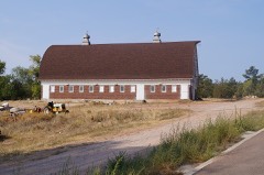 | State Soldiers Home Barn | 1.0 miles | 2009 |
| National Archives record | The nomination case file for reference 03001525 in Record Group 79. |
| Fall River County | All 12 listed properties in this county. |