 Block
From the record
6 National Register listings published here.
Sources: the National Register database, National Park Service
22 topographic sheets cover 15 settlements here, and 6 properties are on the National Register of Historic Places.
6 National Register listings published here.
Sources: the National Register database, National Park Service
Every property in this county listed on the National Register of Historic Places, with the year it was listed and the federal nomination document.
| Photograph | Property | Type | Listed | Reference |
|---|---|---|---|---|
 | Britton Clinic and Hospital | building | 2008 | 08000051 |
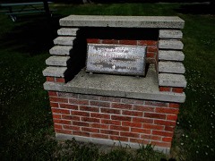 | First Presbyterian Church of Langford | building | 1991 | 91001616 |
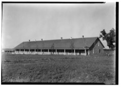 | Fort Sisseton | district | 1973 | 73001745 |
 | William T. and Rebecca Glendenning House | building | 2008 | 08000052 |
 | Marshall County Courthouse | building | 2006 | 06000047 |
 | Palestine Evangelical Lutheran Church | building | 1982 | 82003931 |
Every wildfire the federal occurrence database records inside this county: 100 of them, burning about 4,015 acres. 1 started naturally and 1 was recorded as arson. Each settlement page carries the fires within five miles of it.
| Reported cause | Fires |
|---|---|
| Missing data/not specified/undetermined | 50 |
| Debris and open burning | 28 |
| Equipment and vehicle use | 10 |
| Misuse of fire by a minor | 4 |
| Recreation and ceremony | 2 |
| Railroad operations and maintenance | 2 |
| Arson/incendiarism | 1 |
| Fireworks | 1 |
| Smoking | 1 |
| Natural | 1 |
The five largest, by the area the report gives. None of them was recorded as arson.
| Date | Cause | Size | Reported by | Name on the report |
|---|---|---|---|---|
| 3 May 2008 | Missing data/not specified/undetermined | 650 acres | South Dakota Wildland Fire Suppression | BRITTON |
| 30 September 2020 | Equipment and vehicle use | 450 acres | South Dakota Wildland Fire Suppression | HABITAT FOREVER |
| 30 April 1992 | Debris and open burning | 400 acres | Sisseton Agency | not named |
| 5 May 2008 | Debris and open burning | 214 acres | South Dakota Wildland Fire Suppression | not named |
| 19 April 2008 | Debris and open burning | 208 acres | Sisseton Agency | SOUTH RED IRON |
| 12 April 2012 | Missing data/not specified/undetermined | 200 acres | South Dakota Wildland Fire Suppression | SUNSET COLONY |
| 11 May 2009 | Debris and open burning | 150 acres | South Dakota Wildland Fire Suppression | not named |
| 14 September 2013 | Debris and open burning | 150 acres | Marshall | ART BOTTOM |
Every settlement page carries the fires within five miles of it - see the settlement index below.
The NOAA Storm Events Database holds 346 reports for this county, causing no deaths, 1 injury and about $1,311,860 in recorded property damage. Each settlement page carries the reports that name it.
| Kind of event | Reports |
|---|---|
| Hail | 161 |
| Thunderstorm Wind | 130 |
| Tornado | 22 |
| Flood | 15 |
| Flash Flood | 12 |
| Lightning | 5 |
| Funnel Cloud | 1 |
The most serious of them, by death, then injury, then recorded damage. The accounts are quoted exactly as the forecast office filed them.
| When | Event | Place named | Harm | What the report says |
|---|---|---|---|---|
| June 1968 | Tornado (F2) | not stated | 1 hurt, $250,000 | no account filed |
| June 1978 | Tornado | not stated | $250,000 | no account filed |
| June 1961 | Tornado (F2) | not stated | $250,000 | no account filed |
| April 2023 | Flood | Newark | $150,000 | Many roadways were flooded, including Marshall County Road 11 south of Amherst. |
| April 2019 | Flood | Newark | $143,300 | no account filed |
| March 2011 | Flood | Newark | $100,000 | Snow melt brought flooding across much of Marshall county. Many roads along with crop and pastureland were flooded. The lake levels also rose across the county. In the early morning hours of March 18th, the creek northeast of Langford became blocked by snow and ice, causing water to run into Langford streets and the house basements. Some people had a couple of feet of water in their basements. The basements of at least two homes in Langford had collapsed. The water receded during the late afternoon. |
| May 2011 | Thunderstorm Wind | Spain | $80,000 | Eighty mph winds damaged a home and equipment on a farm. |
| August 1999 | Lightning | Langford | $50,000 | Lightning struck the steeple of the Lutheran Church starting a fire. As a result, the church and most of its contents were destroyed. |
| June 1981 | Tornado (F1) | not stated | $25,000 | no account filed |
| August 2014 | Flash Flood | Langford | $5,000 | Very heavy rains caused flash flooding which washed out a culvert resulting in a road closure. |
| May 1994 | Hail | Hillhead | $5,000 | no account filed |
| July 1964 | Tornado (F1) | not stated | $2,500 | no account filed |
| August 2014 | Flash Flood | Langford | $1,000 | Nearly 6 inches of rain resulted in water in the basement along with a large amount of standing water in the fields. |
| June 1957 | Tornado (F0) | not stated | $30 | no account filed |
| August 1957 | Tornado | not stated | $30 | no account filed |
| June 2025 | Flash Flood | Lake City | - | Marshall county emergency management reports at least 8 cases of water over the roadways across southern Marshall county. |
| August 2025 | Thunderstorm Wind | Newark | - | A farmer reported that thunderstorm winds caused a large limb to fall from his tree. |
| August 2025 | Flash Flood | Amherst | - | The Marshall county Emergency Manager reported street flooding in and around Britton. The CoCoRaHS observer 1 mile south southwest of Kidder recorded 3.31 inches of moisture. |
| August 2025 | Thunderstorm Wind | Amherst | - | Branches were reported down by thunderstorm winds west of Britton. |
| August 2025 | Flash Flood | Britton | - | Total rainfall in Britton over a 48-hour period exceeded 4.5 inches, overwhelming city drainage systems. This caused flooding in town, with up to six inches of water moving over roads and into some buildings and basements. |
| August 2025 | Thunderstorm Wind | Amherst | - | Winds in excess of 70 mph were measured at Sunset Colony. |
| August 2025 | Hail | Britton | - | Hail up to 1.5 inches in diameter was reported. |
| August 2025 | Flood | Langford | - | Marshall County Emergency Management relayed that multiple rural roads and intersections have running water across them from recent heavy rainfall in and around the towns of Langford, Amherst, Britton and Newport Colony. |
| July 2024 | Thunderstorm Wind | Britton | - | Emergency management reported that a tower had collapsed at the ballpark. |
| July 2024 | Thunderstorm Wind | Lake City | - | Emergency management reported crop damage due to thunderstorm winds. |
| July 2024 | Thunderstorm Wind | Veblen | - | Emergency management reported damage to a dairy barn roof due to thunderstorm winds. |
| July 2024 | Thunderstorm Wind | Lake City | - | A resident estimated 70 mph thunderstorm wind gusts at their home. |
| June 2023 | Thunderstorm Wind | Lake City | - | A weather station from the South Dakota Department of Transportation measured a wind gust of 60 mph at Lake City. |
| July 2023 | Hail | Eden | - | Hail, some larger than a quarter size, nearly covered the ground. |
| August 2023 | Thunderstorm Wind | Lake City | - | A member of the public was contacted and they estimated the wind speed at 65 mph. |
| August 2023 | Thunderstorm Wind | Lake City | - | The individual reported an estimated peak thunderstorm wind speed of 60 mph. |
| July 2022 | Thunderstorm Wind | Lake City | - | A trained spotter reported quarter size hail. |
| July 2021 | Thunderstorm Wind | Britton | - | Estimated 65 mph winds toppled a tree over. |
| July 2021 | Thunderstorm Wind | Lake City | - | Several large branches were downed at Roy Lake by estimated 60 mph winds. |
| October 2021 | Tornado (EF0) | Langford | - | The tornado touched down very briefly. |
| August 2020 | Tornado (EF0) | Lake City | - | A tornado touched down briefly on Roy Lake. |
| August 2020 | Thunderstorm Wind | Lake City | - | Sixty mph winds were estimated. |
| June 2020 | Thunderstorm Wind | Kidder | - | Sixty mph winds were estimated. |
| March 2019 | Flood | Newark | - | Several county and township roads were flooded and closed. Three homes in Langford ended up with water in their basements due to a fast rising creek. |
| July 2019 | Hail | Lake City | - | Quarter size hail broke through the skylight of a camper. |
| August 2019 | Tornado (EF0) | Lake City | - | A tornado developed over Roy Lake and came onshore on the southeast side of the lake. The tornado flipped over a pontoon, broke several tree branches, and split a couple trees. It then caused minor damage to an outbuilding before producing extensive tree damage on the south side of a golf course. One piece of lawn furniture was found in a tree over 150 yards away from the original location. Large tree branches were also tossed over 60 yards across fairways on the golf course. In addition to the tornado damage, straight line winds tipped over a camper and caused tree damage in other locations in and around the golf course. |
| July 2019 | Thunderstorm Wind | Spain | - | Estimated sixty mph winds downed several branches. |
| June 2017 | Tornado (EF0) | Eden | - | A brief tornado touched down and caused the collapse of the entire roof of a barn. Debris was lofted 500 feet to the northeast. Minor roof damage also occurred to a second outbuilding along with minor tree damage and damage to the siding of a house. |
| August 2016 | Thunderstorm Wind | Hillhead | - | Estimated ninety mph winds broke off many trees along with collapsing a barn. |
| August 2016 | Thunderstorm Wind | Veblen | - | Sixty mph winds brought several tree branches down. |
| August 2016 | Thunderstorm Wind | Hillhead | - | Ninety mph winds brought down nine power poles. |
| July 2015 | Thunderstorm Wind | Lake City | - | Sixty mph winds were estimated. |
| July 2015 | Tornado (EF0) | Langford | - | A tornado touched down east northeast of Langford. The tornado damaged a cornfield and moved many hay bales. |
| June 2014 | Tornado (EF1) | Spain | - | A tornado touched down about 9 miles northeast of Langford with a large metal garage sustaining roof damage with a large section of the southern roof blown off. A separate smaller and older wooden garage was almost completely destroyed with debris blown up to 100 yards to the east and southeast. A few trees also sustained broken limbs. |
| June 2013 | Flash Flood | Veblen | - | Heavy rain of three to four inches brought many flooded roads in and around Veblen. |
| June 2013 | Flash Flood | Hillhead | - | The road west of Veblen had water flowing over it with one section covered up to 100 feet. |
| September 2013 | Thunderstorm Wind | Newark | - | A 40 foot tall tree was snapped at the base and corn was flattened by seventy mph winds. |
| July 2011 | Flash Flood | Marlow | - | Heavy rain flooded several roads and washed out a culvert. |
| July 2011 | Tornado (EF0) | Spain | - | A tornado touched downed about seven miles southeast of Britton. The tornado downed many trees as it tracked east northeast for about a mile. |
| July 2011 | Thunderstorm Wind | Lake City | - | A large tree was downed by seventy mph winds. |
| July 2011 | Thunderstorm Wind | Marlow | - | Sixty mph winds downed several large tree limbs. |
| July 2011 | Thunderstorm Wind | Britton Muni Arpt | - | Eighty mph winds downed four large evergreens along with downing many large tree branches. Also, a shed was destroyed with another one damaged. |
| July 2011 | Thunderstorm Wind | Spain | - | Eighty mph winds downed several trees, moved many hay bales, and damaged the shingles on the home. |
| June 2011 | Tornado (EF0) | Eden | - | A tornado touched down briefly northeast of Eden. No damaged was reported. |
| July 2011 | Thunderstorm Wind | Britton | - | Seventy mph winds downed several trees in Britton. The grain elevator was also damaged in Britton. |
The Survey's mineral resources record lists 2 workings inside this county. 1 still produces and 1 is closed or unrecorded. Each settlement page carries the workings within five miles of it.
| Commodity | Workings |
|---|---|
| Sand and Gravel, Construction | 2 |
The least common of them first, because a county's hundredth gravel pit says nothing its first ten did not.
| Where | Site | Commodity | Status | Recorded |
|---|---|---|---|---|
| Benke Pit | Sand and Gravel, Construction | Producer | ||
| Vrchota Sand & Gravel Pit | Sand and Gravel, Construction | Past Producer |
Named settlements recorded in the Geographic Names Information System, each with the topographic sheets covering it. Villages, hamlets and abandoned places alike. Each is shown with the nearest named watercourse or landform and the survey quadrangle it falls on.