Block
From the record
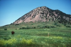
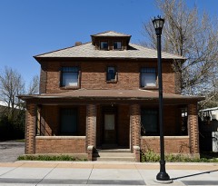
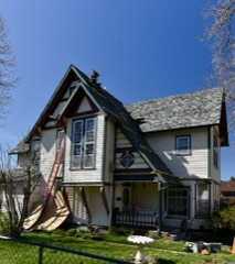
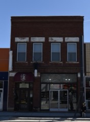
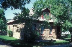
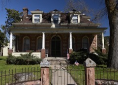
27 National Register listings published here, 1 of them a National Historic Landmark.
Sources: the National Register database, National Park Service
99 topographic sheets cover 37 settlements here, and 27 properties are on the National Register of Historic Places.
27 National Register listings published here, 1 of them a National Historic Landmark.
Sources: the National Register database, National Park Service
Every property in this county listed on the National Register of Historic Places, with the year it was listed and the federal nomination document.
Every wildfire the federal occurrence database records inside this county: 936 of them, burning about 123,031 acres. 377 started naturally and 11 were recorded as arson. Each settlement page carries the fires within five miles of it.
| Reported cause | Fires |
|---|---|
| Natural | 377 |
| Equipment and vehicle use | 156 |
| Missing data/not specified/undetermined | 135 |
| Debris and open burning | 127 |
| Recreation and ceremony | 37 |
| Fireworks | 23 |
| Misuse of fire by a minor | 19 |
| Power generation/transmission/distribution | 18 |
| Railroad operations and maintenance | 17 |
| Arson/incendiarism | 11 |
| Smoking | 10 |
| Other causes | 5 |
| Firearms and explosives use | 1 |
The five largest, by the area the report gives. None of them was recorded as arson.
| Date | Cause | Size | Reported by | Name on the report |
|---|---|---|---|---|
| 3 August 2006 | Natural | 21,314 acres | Montana/Dakotas State Office | WHITE OWL |
| 31 October 1999 | Power generation/transmission/distribution | 12,000 acres | South Dakota Wildland Fire Suppression | AVANCE |
| 7 July 2007 | Natural | 5,000 acres | South Dakota Wildland Fire Suppression | not named |
| 3 August 2006 | Natural | 4,500 acres | South Dakota Wildland Fire Suppression | WILCOX |
| 3 August 2006 | Natural | 4,000 acres | South Dakota Wildland Fire Suppression | not named |
| 8 July 2005 | Natural | 3,959 acres | Black Hills National Forest | RICCO |
| 29 August 2001 | Equipment and vehicle use | 3,600 acres | Enning Volunteer Fire Department | GRUEB |
| 29 August 2001 | Equipment and vehicle use | 3,500 acres | Opal Volunteer Fire Department | LEMON BUTTE |
Every settlement page carries the fires within five miles of it - see the settlement index below.
The NOAA Storm Events Database holds 1,584 reports for this county, causing no deaths, 57 injuries and about $15,655,590 in recorded property damage. Each settlement page carries the reports that name it.
| Kind of event | Reports |
|---|---|
| Hail | 871 |
| Thunderstorm Wind | 603 |
| Tornado | 46 |
| Flood | 28 |
| Flash Flood | 21 |
| Heavy Rain | 6 |
| Funnel Cloud | 4 |
| Wildfire | 2 |
| Lightning | 2 |
| Dust Devil | 1 |
The most serious of them, by death, then injury, then recorded damage. The accounts are quoted exactly as the forecast office filed them.
| When | Event | Place named | Harm | What the report says |
|---|---|---|---|---|
| May 1991 | Tornado (F3) | not stated | 20 hurt, $2,500,000 | no account filed |
| June 1986 | Hail | not stated | 20 hurt | no account filed |
| May 1991 | Tornado (F2) | not stated | 5 hurt, $250,000 | no account filed |
| June 1989 | Tornado (F1) | not stated | 4 hurt, $250,000 | no account filed |
| August 2008 | Lightning | Sturgis | 3 hurt | Three people were injured by lightning at the Glencoe Camp Resort ticket booth. |
| August 2000 | Thunderstorm Wind | Sturgis | 2 hurt, $500,000 | no account filed |
| August 2008 | Thunderstorm Wind | Sturgis Muni Arpt | 1 hurt | A man was injured when he was struck by a pole holding a large banner at a convenience store east of Sturgis. |
| May 1999 | Hail | Tilford | 1 hurt | 1" to 1.5" hail...up to 6 inches deep on Interstate 90. A 5 car pile up left one person injured after several vehicles slid through the hail. |
| June 1998 | Hail | Howes | 1 hurt | A motorist was injured by broken glass and hail. |
| June 2008 | Flash Flood | (Rca)Ellsworth Afb | $1,000,000 | no account filed |
| August 2007 | Hail | Piedmont | $1,000,000 | no account filed |
| May 2019 | Flash Flood | Sturgis | $800,000 | Heavy rain and hail caused flooding in the Sturgis area. Several road crossings across Bear Butte Creek and Deadman Gulch were inundated; including 7th Street, 9th Street, 15th Street, Raccoon Road, and Sly Street. |
| May 2019 | Flash Flood | Maurine | $800,000 | Three to four inches of rain in an hour and three to five inches of rain in two hours over parts of northeastern Meade County caused rapid rises on small creeks and overland flooding of rural areas. The flooding compromised five culverts and a bridge on county roads. |
| July 2019 | Flash Flood | Sturgis | $639,000 | Extensive flooding occurred along Bear Butte Creek in Boulder Canyon through Sturgis to Fort Meade. Highway 34 was covered with water at the S-curve between Sturgis and Fort Meade, the Sturgis city park was completely underwater, and the 7th Street bridge at Bear Butte Creek was inundated. The Sly Street crossing, West Woodland Drive, and Blanche Street were damaged, as well as almost all the other crossings over Bear Butte Creek in Sturgis. |
| June 2015 | Hail | Piedmont | $500,000 | Tennis ball to softball sized hail pummeled Piedmont. |
| June 2008 | Flood | Howes | $500,000 | Elk Creek, Alkali Creek, Antelope Creek, the Belle Fourche River and their tributaries flooded from east of Piedmont to Viewfield and Elm Springs. |
| July 1998 | Thunderstorm Wind | Faith | $500,000 | MANY TREES AND STRUCTURAL DAMAGE. |
| May 2019 | Flash Flood | Sturgis | $300,000 | Runoff from heavy rain on saturated ground caused flash flooding in the Sturgis, Fort Meade, and Pleasant Valley areas for the second time in a week. Several roads across Bear Butte Creek were covered with water or were washed out; including 7th Street, 9th Street, 15th Street, Raccoon Road, Sly Street, and SD Highway 34, Fort Meade Way, and Pleasant Valley Drive. |
| July 2022 | Flash Flood | Ellsworth Afb | $250,000 | Over three inches of rain fell in an hour over Ellsworth Air Force Base and parts of Box Elder. Runoff from heavy rain flooded streets, homes, and businesses. Several streets were flooded on Ellsworth Air Force Base, Antelope Ridge, and throughout northern and eastern portions of Box Elder. |
| May 2019 | Flood | Elm Springs | $250,000 | Runoff from heavy rain caused flooding throughout Meade County. Moderate flooding was reported along Elk Creek from north of Rapid City downstream to Elm Springs; which inundated portions of Elk Creek Road, Antelope Creek Road, and Wicksville Road. Minor flooding of agricultural land occurred along the Belle Fourche River, which crested at 19.5 feet, just above flood stage of 19 feet, with a peak flow around 32,200 cfs, at SD Highway 34 east of Sturgis. |
| August 2007 | Flash Flood | Tilford | $250,000 | An estimated four to six inches of rain and hail to the size of baseballs caused localized flooding between Piedmont and Tilford, especially near poor drainage areas and at a barricade along a frontage road. The water washed over several roads and was several inches deep over Interstate 90, forcing law enforcement officials to close it for a couple of hours. |
| August 2006 | Thunderstorm Wind | Faith | $250,000 | Power lines were downed by winds. Several homes were damaged and 2 mobile homes were destroyed by high winds. |
| June 2003 | Hail | Faith | $250,000 | Large hail damaged homes and automobiles in Faith. |
| June 1996 | Flash Flood | Sturgis | $250,000 | no account filed |
| July 1996 | Thunderstorm Wind | Rapid City | $250,000 | no account filed |
| July 1979 | Tornado (F1) | not stated | $250,000 | no account filed |
| June 2009 | Hail | Sturgis | $200,000 | Golf ball sized hail damaged automobiles in Sturgis and Bear Butte State Park. |
| August 2009 | Hail | Sturgis | $200,000 | Large hail damaged automobiles and property. |
| August 2009 | Thunderstorm Wind | Hereford | $200,000 | The combination of strong wind and large hail damaged automobiles, buildings, and crops around Hereford. |
| June 2015 | Hail | Black Hawk | $200,000 | no account filed |
| June 2015 | Thunderstorm Wind | Hereford | $150,000 | Rear flank downdraft wind gusts estimated over 100 mph blew down a half mile of a large electrical transmission line. |
| May 2014 | Flash Flood | Sturgis Muni Arpt | $150,000 | Runoff from heavy rain flooded streets and several basements in Sturgis. A drainage channel on the south side of Sturgis filled with water and flooded Harmon Street and Hillside Drive. Minor flooding was reported along Spring Creek at SD Highway 34 about 12 miles northeast of Sturgis. |
| May 2010 | Flash Flood | Piedmont | $150,000 | Heavy rain caused flash flooding in southern Meade County from Black Hawk to Elm Springs. Flash flooding was reported along Elk Creek, Antelope Creek, and Box Elder Creek. A few homes reported water in their basements and several county roads were flooded. |
| June 2006 | Thunderstorm Wind | Faith | $150,000 | Strong winds tore half the roof off a house and blew down two outbuildings on the south side of Faith. Several empty truck trailers were tipped over and large trees throughout town were broken and blown over. Several power poles were downed, causing the loss of electric service for about 36 hours in much of the town. Hail accumulated to a depth of 12 inches. |
| July 2013 | Hail | Union Center | $150,000 | no account filed |
| July 2013 | Hail | Enning | $150,000 | no account filed |
| September 2000 | Thunderstorm Wind | Union Center | $115,000 | Strong downburst winds flattened a post frame building for a ranch supply business. Two barns and a garage near the business also had their roofs blown off. The winds left a path of damage about 200 yards wide. |
| June 2015 | Hail | Black Hawk | $100,000 | Hail up to baseball size fell for approximately 30 minutes. |
| July 2015 | Thunderstorm Wind | Black Hawk | $100,000 | Property damage was reported in the Golden Valley subdivision. |
| June 2015 | Tornado (EF2) | Hereford | $100,000 | A tornado touched down in rural southern Meade County, damaging buildings and tossing equipment at two ranches. |
| May 2010 | Tornado (EF2) | Plainview | $100,000 | A tornado touched down south of Plainview and traveled more than 22 miles to (). It damaged a manufactured home shortly after it formed, tearing off its roof and blowing over its walls. It also destroyed an old, abandoned house and pole barn and tossed a combine, hay swather, and van. |
| July 2010 | Thunderstorm Wind | Union Center | $100,000 | The combination of hail and wind broke windows and damaged siding in Union Center. Wheat and alfalfa crops were destroyed. |
| June 2009 | Hail | Ellsworth Afb | $100,000 | Hail to the size of baseballs fell. |
| August 2006 | Thunderstorm Wind | Black Hawk | $100,000 | A 40 foot by 60 foot pole barn was destroyed and windows were broken out of house. Large wind driven hail broke windows and destroyed vinyl siding on 16 houses in a subdivision. |
| May 2004 | Hail | Black Hawk | $100,000 | Quarter to Baseball sized hail fell for several minutes causing automobile accidents and hail damage to automobiles. |
| June 2015 | Hail | Piedmont | $100,000 | no account filed |
| September 2013 | Hail | Piedmont | $100,000 | no account filed |
| July 2000 | Hail | Fairpt | $100,000 | no account filed |
| May 2013 | Flash Flood | Sturgis | $50,000 | Three to five inches of rain fell in a few hours and caused flash flooding east of Interstate 90 in southwestern Meade County. Street flooding was reported in Sturgis and several rural roads north of Sturgis were inundated. |
| September 2013 | Hail | Piedmont | $50,000 | Minor property damage occurred in the area. |
| October 2013 | Flood | Tilford | $50,000 | Water covered Elk Creek Road and Antelope Creek Road north of Box Elder, Curlew Road and Pioneer Road north of New Underwood, and Coyote Lane and Golden Valley Drive north of Rapid City. Some fields and pastures in southern Meade County also flooded. The river gauge on Elk Creek at Elk Vale Road north of Rapid City reached a height of 12.6 feet, which is 3.6 feet over flood stage. |
| August 2011 | Thunderstorm Wind | (D07)Faith Arpt | $50,000 | Minor wind damage occurred around Faith. |
| July 2010 | Thunderstorm Wind | (Rca)Ellsworth Afb | $50,000 | Around 25 power poles and trees were blown down near the intersection of Elk Vale and Elk Creek Roads. A silo and other outbuildings were toppled just north of the intersection. |
| July 2010 | Thunderstorm Wind | Sturgis | $50,000 | Hail damaged automobiles and broke house windows. |
| June 1994 | Hail | not stated | $50,000 | The hail caused extensive damage to vehicles. |
| June 2015 | Hail | Piedmont | $50,000 | no account filed |
| June 2014 | Hail | Piedmont | $50,000 | no account filed |
| May 2004 | Thunderstorm Wind | Union Center | $50,000 | no account filed |
| July 2019 | Flood | (Rca)Ellsworth Afb | $35,000 | Flooding occurred along Boxelder Creek around Black Hawk and along Elk Creek north of Ellsworth Air Force Base. Water inundated Peaceful Pines Road between Deadwood Avenue and Interstate 90, 143rd Avenue east of Nike Road, Antelope Creek Road around Elk Creek and Antelope Creek, Elk Creek Road between Elk Vale and Antelope Creek Roads, Elk Vale Road north of Elk Creek Road, and Horseshoe Road south of Elk Creek Road. |
| June 2024 | Tornado (EF2) | Maurine | $30,000 | A tornado developed about 17 miles west of Faith, just north of Highway 212. As the tornado moved southeast and crossed Highway 212, numerous power poles were downed and broken. Some trees were also snapped off near the trunk and large branches broken off of other trees in this area. Additional trees were downed further southeast, before the tornado dissipated. The tornado did not impact any buildings or property along its path. The tornado traveled about 4 miles and was rated an EF-2, with wind speeds as high as 118 mph. |
The Survey's mineral resources record lists 14 workings inside this county. 3 still produce and 11 are closed or unrecorded. Each settlement page carries the workings within five miles of it.
| Commodity | Workings |
|---|---|
| Gypsum-Anhydrite | 6 |
| Sand and Gravel, Construction | 3 |
| Calcium | 2 |
| Limestone, General | 1 |
| Stone, Crushed/Broken | 1 |
| Gold | 1 |
The least common of them first, because a county's hundredth gravel pit says nothing its first ten did not.
| Where | Site | Commodity | Status | Recorded |
|---|---|---|---|---|
| Homestake Limestone Quarry Mine | Limestone, General | Past Producer | 1904 | |
| Sturgis Sandstone Quarry | Stone, Crushed/Broken | Past Producer | Sandstone | |
| Whitewood Creek | Gold | Past Producer | ||
| Doyle Lime Plant and Quarry | Calcium | Past Producer | ||
| Homestake Min Co Limestone Quarry | Calcium | Past Producer | ||
| Alverson Pit | Sand and Gravel, Construction | Producer | ||
| Bruch Pit | Sand and Gravel, Construction | Producer | ||
| Gravel Pit | Sand and Gravel, Construction | Past Producer | ||
| Dakota Plaster Co Pit | Gypsum-Anhydrite | Past Producer | ||
| S Dak Cement Comm Gyp Quarry | Gypsum-Anhydrite | Producer | ||
| Tilford Mine | Gypsum-Anhydrite | Past Producer | Gypsum | |
| U S Gypsum Co Piedmont Operation | Gypsum-Anhydrite | Past Producer | ||
| U.S. Gypsum | Gypsum-Anhydrite | Past Producer | Gypsum | |
| Ugsgypsum Tilford Operation | Gypsum-Anhydrite | Past Producer |
Named settlements recorded in the Geographic Names Information System, each with the topographic sheets covering it. Villages, hamlets and abandoned places alike. Each is shown with the nearest named watercourse or landform and the survey quadrangle it falls on.
North Meade unorganized territory · 57626 · Avance quadrangle
7 sheets, 1953 to 1984
No longer a settlement
Belle Fourche-Cheyenne Valleys unorganized territory · 57785 · On Spring Creek · Fort Meade NE quadrangle
14 sheets, 1893 to 1957
Belle Fourche-Cheyenne Valleys unorganized territory · 57719 · Bend quadrangle
14 sheets, 1893 to 1957
Southwest Meade unorganized territory · 57718 · Near Wards Canyon · Blackhawk quadrangle
16 sheets, 1893 to 1957
Belle Fourche-Cheyenne Valleys unorganized territory · 57791 · On West Bull Creek · Boneita Springs quadrangle
7 sheets, 1953 to 1984
Southwest Meade unorganized territory · 57785 · Fort Meade quadrangle
17 sheets, 1893 to 1957
Southwest Meade unorganized territory · 57769 · Near Stagebarn Ridge · Piedmont quadrangle
18 sheets, 1893 to 1958
No longer a settlement
North Meade unorganized territory · 57626 · Cedar Canyon quadrangle
8 sheets, 1951 to 1984
Belle Fourche-Cheyenne Valleys unorganized territory · 57787 · Fairpoint SE quadrangle
8 sheets, 1953 to 1984
Belle Fourche-Cheyenne Valleys unorganized territory · 57791 · Dalzell quadrangle
7 sheets, 1953 to 1984
Belle Fourche-Cheyenne Valleys unorganized territory · 57791 · Elm Springs quadrangle
7 sheets, 1953 to 1984
Belle Fourche-Cheyenne Valleys unorganized territory · 57787 · Enning quadrangle
8 sheets, 1953 to 1984
North Meade unorganized territory · 57626 · On Fox Ridge · Opal West quadrangle
6 sheets, 1953 to 1984
Southwest Meade unorganized territory · 57718 · Near South Stagebarn Canyon · Piedmont quadrangle
18 sheets, 1893 to 1958
No longer a settlement
Belle Fourche-Cheyenne Valleys unorganized territory · 57761 · Haydraw quadrangle
8 sheets, 1953 to 1984
Belle Fourche-Cheyenne Valleys unorganized territory · 57785 · Hereford quadrangle
7 sheets, 1953 to 1984
Belle Fourche-Cheyenne Valleys unorganized territory · 57792 · On Spring Creek · Marcus quadrangle
7 sheets, 1953 to 1984
Belle Fourche-Cheyenne Valleys unorganized territory · 57787 · On Indian Creek · Redowl quadrangle
7 sheets, 1953 to 1984
Southwest Meade unorganized territory · 57769 · On Meadow Creek · Deadman Mountain quadrangle
20 sheets, 1894 to 1957
No longer a settlement
Southwest Meade unorganized territory · 57785 · On Vanocker Creek · Sturgis quadrangle
18 sheets, 1894 to 1957
Southwest Meade unorganized territory · 57718 · Blackhawk quadrangle
16 sheets, 1893 to 1957
Southwest Meade unorganized territory · 57769 · In Tilford Gulch · Tilford quadrangle
16 sheets, 1893 to 1957
Belle Fourche-Cheyenne Valleys unorganized territory · 57787 · Union Center quadrangle
7 sheets, 1953 to 1984
Belle Fourche-Cheyenne Valleys unorganized territory · 57785 · On Bear Butte Creek · Volunteer quadrangle
10 sheets, 1913 to 1983
Belle Fourche-Cheyenne Valleys unorganized territory · 57792 · White Owl quadrangle
7 sheets, 1953 to 1984
Southwest Meade unorganized territory · 57718 · Near Stagebarn Canyon · Blackhawk quadrangle
16 sheets, 1893 to 1957
The vanished settlements of Meade County: the places named above that are no longer on the map.