Block
From the record
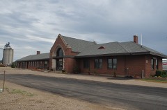
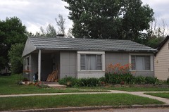
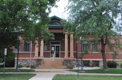
22 National Register listings published here.
Sources: the National Register database, National Park Service
50 topographic sheets cover 23 settlements here, and 22 properties are on the National Register of Historic Places.
22 National Register listings published here.
Sources: the National Register database, National Park Service
Every property in this county listed on the National Register of Historic Places, with the year it was listed and the federal nomination document.
Every wildfire the federal occurrence database records inside this county: 163 of them, burning about 9,843 acres. 11 started naturally and 2 were recorded as arson. Each settlement page carries the fires within five miles of it.
| Reported cause | Fires |
|---|---|
| Debris and open burning | 54 |
| Missing data/not specified/undetermined | 50 |
| Equipment and vehicle use | 31 |
| Natural | 11 |
| Smoking | 5 |
| Railroad operations and maintenance | 4 |
| Other causes | 3 |
| Arson/incendiarism | 2 |
| Power generation/transmission/distribution | 2 |
| Fireworks | 1 |
The five largest, by the area the report gives. None of them was recorded as arson.
| Date | Cause | Size | Reported by | Name on the report |
|---|---|---|---|---|
| 5 April 2000 | Debris and open burning | 3,200 acres | Ashton Volunteer Fire Department | MIKE JUNGWIRTH |
| 10 September 1999 | Debris and open burning | 1,100 acres | Conde Volunteer Fire Department | SANDERSON |
| 8 April 2005 | Debris and open burning | 800 acres | South Dakota Wildland Fire Suppression | LITTLE RIVER BURN |
| 20 April 2010 | Missing data/not specified/undetermined | 600 acres | South Dakota Wildland Fire Suppression | BNSF |
| 9 August 1999 | Debris and open burning | 320 acres | Conde Volunteer Fire Department | ROGER BALL |
| 3 October 2008 | Equipment and vehicle use | 250 acres | South Dakota Wildland Fire Suppression | not named |
| 27 September 2002 | Equipment and vehicle use | 200 acres | Conde Volunteer Fire Department | BOB MEYER |
| 25 March 1999 | Debris and open burning | 160 acres | Conde Volunteer Fire Department | DANNY MILES |
Every settlement page carries the fires within five miles of it - see the settlement index below.
The NOAA Storm Events Database holds 595 reports for this county, causing 2 deaths, no injuries and about $1,532,560 in recorded property damage. Each settlement page carries the reports that name it.
| Kind of event | Reports |
|---|---|
| Hail | 261 |
| Thunderstorm Wind | 187 |
| Flood | 92 |
| Tornado | 43 |
| Flash Flood | 8 |
| Funnel Cloud | 3 |
| Lightning | 1 |
The most serious of them, by death, then injury, then recorded damage. The accounts are quoted exactly as the forecast office filed them.
| When | Event | Place named | Harm | What the report says |
|---|---|---|---|---|
| June 1957 | Tornado (F2) | not stated | 1 killed, $25,000 | no account filed |
| July 2022 | Flood | Brentford | 1 killed | On Friday, July 22nd, a 13-year-old girl was swept downstream while swimming in the James River near Frankfort. The search was postponed around 11:30 p.m. Friday due to the dangers of the current and the inability to see in the dark. The girl's body was found around 9:25 a.m. on Saturday. |
| April 2019 | Flood | Mansfield | $1,280,000 | no account filed |
| April 2009 | Flood | Ashton | $50,000 | no account filed |
| June 1991 | Tornado (F0) | not stated | $25,000 | no account filed |
| April 1967 | Tornado (F1) | not stated | $25,000 | no account filed |
| July 1964 | Tornado (F2) | not stated | $25,000 | no account filed |
| July 1959 | Tornado (F2) | not stated | $25,000 | no account filed |
| June 1954 | Tornado (F1) | not stated | $25,000 | no account filed |
| May 1953 | Tornado (F1) | not stated | $25,000 | no account filed |
| April 2006 | Flash Flood | Doland | $15,000 | no account filed |
| September 2013 | Flash Flood | Frankfort | $5,000 | A section of a gravel driveway was washed out requiring some repairs. |
| July 1994 | Thunderstorm Wind | Doland | $5,000 | Thunderstorm Winds blew down many branches and large limbs from trees. |
| June 1966 | Tornado | not stated | $2,500 | no account filed |
| June 1982 | Tornado (F0) | not stated | $30 | no account filed |
| September 1957 | Tornado (F0) | not stated | $30 | no account filed |
| June 2025 | Thunderstorm Wind | Mansfield | - | Strong thunderstorm winds, estimated at 60 mph, and hail between the size of nickels and pennies would damage siding and shingles at a residence near Mansfield. |
| June 2025 | Tornado (EF0) | Bloomfield | - | A storm chaser spotted a brief, weak tornado with this storm. No damage was noted. |
| July 2025 | Thunderstorm Wind | Conde | - | Several branches were broken near the tops of three separate cottonwood trees four miles north-northwest of Crandall. A cattle lick tub filled with rocks was also shifted approximately 30 to 40 feet. |
| July 2024 | Thunderstorm Wind | Redfield | - | The public reported branches and powerlines were knocked down due to thunderstorm winds gusts in Redfield. |
| July 2024 | Thunderstorm Wind | Frankfort | - | A trained spotter reported numerous tree branches downed by thunderstorm winds. |
| August 2024 | Thunderstorm Wind | Conde | - | A large tree fell over onto a garage in Conde. |
| April 2023 | Flood | Brentford | - | The James River near Ashton peaked well above major flood stage at 19.91 feet on April 21st, which overtopped one of the bridges and impacted another near the gauge site. |
| April 2023 | Flood | Ashton | - | The James River near Redfield peaked at 22.3 feet on April 22nd, just above moderate flood stage with significant amounts of agricultural and wooded areas flooded. |
| April 2023 | Flood | Ashton | - | Snowmelt resulted in flooding along Snake Creek. The river gauge near Ashton peaked at Moderate flood stage of 15.12 on 4/19. At its peak, the creek would have nearly overtopped two nearby bridges. The main impact is the flooding of agricultural lands. |
| May 2023 | Flood | Brentford | - | The James River near Ashton was initially in decline at the start of the month which lasted through May 4th, though a second crest was observed on May 17th at 16.71 feet, followed again by a steady decline that lasted through the end of May. With this May crest, the main impact is to agricultural lands, however a bridge near the gauge site has been under water for most of the month. |
| April 2023 | Flood | Redfield | - | Snowmelt resulted in flooding along Turtle Creek. The river gauge at Redfield peaked at 9.90 on 4/19. This flooding mainly affected agricultural lands. |
| June 2023 | Thunderstorm Wind | Mellette | - | The South Dakota Department of Transportation weather station near Mellette recorded a wind gust of 63 mph. |
| June 2023 | Thunderstorm Wind | Bloomfield | - | The South Dakota Department of Transportation weather station 9 miles east of Hitchcock measured a wind gust of 61 mph. |
| June 2023 | Flood | Brentford | - | The James River near Ashton, ATNS2, started the month in moderate flood stage at 15.42 feet, then steadily dropped through the month. It reached minor flood stage of <14 feet on June 12th, and then remained there through the rest of the month. Significant amounts of farm land were flooded, including crop and pasture land. |
| July 2023 | Flood | Brentford | - | The James River near Ashton, ATNS2, started the month in minor flood stage at 13.1 feet before falling below flood stage at 5:45 AM on July 2nd. The flooding affected some cropland and pastures in low-lying areas. |
| September 2023 | Thunderstorm Wind | Redfield Arpt | - | Thunderstorm winds blew building material off a trailer and scattered it across the property. |
| June 2022 | Flood | Brentford | - | The James River near Ashton began the month in major flood stage, and crested at 17.51 feet at 10:30am on June 9th. It dropped into moderate flood stage during the early morning hours of June 21st, and remained there through the rest of the month. |
| May 2022 | Funnel Cloud | Ashton | - | A brief funnel cloud was reported by an emergency manager. |
| July 2022 | Thunderstorm Wind | Turton | - | A CO-OP observer reported a grain leg at the local grain elevator was tipped over due to high winds. |
| August 2021 | Thunderstorm Wind | Tulare | - | A tree trunk was split with multiple branches downed as well by estimated 70 mph winds. |
| August 2021 | Thunderstorm Wind | Redfield Arpt | - | Several branches were downed by estimated 60 mph winds. |
| August 2021 | Thunderstorm Wind | Doland | - | Eight power poles were snapped or tipped by estimated 75 mph winds. |
| August 2021 | Thunderstorm Wind | Doland | - | Estimated seventy mph winds snapped a small tree and damaged a nearby grain elevator. |
| October 2021 | Tornado (EF0) | Brentford | - | The tornado briefly touched down in an open field, rolling 12 large hay bales, some of them over a fence. The tornado also was visibile as a tornadic debris signature on radar due to the lofting of corn stubble into the air. The track of the tornado was also visible on high resolution satellite data several days after the event. |
| October 2021 | Thunderstorm Wind | Conde | - | A trained spotter estimated wind gusts of 75 mph. |
| July 2020 | Hail | Doland | - | A car was damaged from nickel size hail. |
| August 2020 | Tornado (EF1) | Redfield | - | A tornado touched down on the east side of Redfield in the early morning hours. First indications of damage occurred in a corn field west of 386th avenue. Damage was then noted on east 8th avenue where several vehicles had windows damaged and a trailer was flipped into a corn field across the street. Trees along the property line with Farmers Meat Processing were damaged, one tree having landed facing west. Farmers Meat Processing signage was also torn out of the ground. The tornado path became clearly evident in the corn field across east 12th avenue. The tornado then traveled northeast into the Blume Seed Building which lost the west side doors and suffered significant wall damage, with the north wall destroyed. Seed silos on the west side of the building also buckled. The tornado spread debris from the Blume Seed building northeast into the adjacent grass field. A tree on the northeast side of this grass field toppled to the north with tree debris extending across U.S. Highway 212. The circulation from the tornado persisted through several soybean and corn fields and resulted in tree damage near 387th Avenue. The final crop damage was noted just south of 172nd Street. |
| August 2020 | Tornado (EF0) | Redfield | - | The tornado track started 2 miles east of Redfield near South Dakota Highway 212. The track was evident through multiple corn fields with the corn completely leveled in some spots. The tornado crossed 172nd street and traveled through a bean field before dissipating. |
| August 2020 | Thunderstorm Wind | Redfield | - | Estimated seventy mph winds took a 2 foot diameter tree down. |
| June 2020 | Tornado (EF0) | Turton | - | A tornado touched down briefly east southeast of Turton with no damage occurring. |
| March 2019 | Flood | Mansfield | - | Some snowmelt flooding began at the end of March covering several roads. |
| March 2019 | Flood | Tulare | - | Turtle Creek flooded Highway 26 between Twin Lakes and Cottonwood Lake closing it down for a time. |
| April 2019 | Flood | Duxbury | - | The James River flooded across Spink county throughout April at both gauging sites of Redfield and Ashton. Flooding on the James River near Redfield in late March continued to rise above the flood stage of 20 feet throughout April to major flood stage, nearly 27 feet, by April 22nd. The James River near Ashton rose above the flood stage of 13 feet on April 1st to major flood stage of 23.20 feet on April 23rd. Agricultural land along with several roads along the river were flooded. |
| July 2019 | Thunderstorm Wind | Tulare | - | Estimated sixty mph winds brought down some large tree branches. |
| April 2019 | Flood | Mansfield | - | Flooding on Turtle Creek in late March continued throughout April. The creek rose above the flood stage of 7 feet to major stage of 15.5 feet on April 1st. Snake Creek near Ashton rose above the flood stage of 11.5 feet on April 3rd to major stage of 16.3 feet by April 22nd. Both the Turtle and Snake Creeks continued to flood into May. Agricultural land along with several roads were flooded. |
| July 2019 | Thunderstorm Wind | Turton | - | Estimated sixty mph winds took some shingles off a building and caused some minor corn damage. |
| July 2019 | Thunderstorm Wind | Glendale Colony | - | Sixty mph winds brought down some branches. |
| May 2019 | Flood | Duxbury | - | The James River at Ashton flooded throughout May while the James River at Redfield flooded early on in May and again in late May. The highest stages at both locations occurred in late April. The James River at Redfield rose to nearly 27 feet in late April while the James River at Ashton rose to just over 23 feet in late April. The flood stage at Redfield is 20 feet and 13 feet at Ashton. |
| June 2018 | Thunderstorm Wind | Conde | - | Estimated seventy mph winds damaged some outdoor decking along with a swing set. |
| June 2018 | Thunderstorm Wind | Mansfield | - | A grain bin roof was torn off along with several trees and numerous tree branches downed by eighty mph winds. |
| May 2017 | Hail | Turton | - | Some golf ball hail fell east of Turton. |
| June 2017 | Thunderstorm Wind | Brentford | - | Sixty mph winds downed some large tree limbs. |
| June 2017 | Thunderstorm Wind | Brentford | - | A power pole was snapped by estimated seventy mph winds. |
| September 2017 | Tornado (EF1) | Tulare | - | A tornado touched down 5.5 miles south southwest of Tulare, uprooting a large cottonwood tree in a field. The tornado then passed over pasture and cropland before reaching a residence about 3 miles southwest of Tulare. Large tree branches were broke around the farm yard. On the north side of the farm an outbuilding had significant structural and roof damage with tin from the roof lofted over a half mile to the north. Additionally, two trees were uprooted along the north edge of the property. The tornado continued to track through a soybean field with slight crop damage and debris evident along the path. About 2.8 miles southwest of Tulare an irrigation unit was toppled and the corn crop was leveled before the tornado lifted. |
The Survey's mineral resources record lists 2 workings inside this county. 1 still produces and 1 is closed or unrecorded. Each settlement page carries the workings within five miles of it.
| Commodity | Workings |
|---|---|
| Sand and Gravel, Construction | 2 |
The least common of them first, because a county's hundredth gravel pit says nothing its first ten did not.
| Where | Site | Commodity | Status | Recorded |
|---|---|---|---|---|
| Harms Pit | Sand and Gravel, Construction | Producer | ||
| Odland Pit #1 | Sand and Gravel, Construction | Past Producer |
Named settlements recorded in the Geographic Names Information System, each with the topographic sheets covering it. Villages, hamlets and abandoned places alike. Each is shown with the nearest named watercourse or landform and the survey quadrangle it falls on.
Lincoln township · 57440 · On Timber Creek · Glendale Colony quadrangle
10 sheets, 1895 to 1985