 Block
From the record
One of 22 National Register listings published here for Spink County · listed in 1993 · category: Structure · built in 1912.
Sources: the case file at the National Archives · the National Register database, National Park Service
Built in 1912. Listed on the National Register of Historic Places in 1993.
One of 22 National Register listings published here for Spink County · listed in 1993 · category: Structure · built in 1912.
Sources: the case file at the National Archives · the National Register database, National Park Service
Regional context, not property-specific evidence. The federal wildfire occurrence database lists 4 fires within 5 miles of South Dakota Dept. of Transportation Bridge No. 58-062-270 between 1999 and 2020, burning about 94 acres in total. None started naturally. None was recorded as arson. Distance is straight-line from the map coordinates, so a fire counted here may appear on a neighbouring settlement's page as well.
| Reported cause | Fires |
|---|---|
| Railroad operations and maintenance | 2 |
| Smoking | 1 |
| Missing data/not specified/undetermined | 1 |
The most recent of them, most recent first, with the day each was reported and the service that recorded it.
| Date | Cause | Size | Reported by | Name on the report |
|---|---|---|---|---|
| 13 August 1999 | Missing data/not specified/undetermined | 4.0 acres | Murdo Volunteer Fire Department | STOTTS |
| 18 April 2005 | Railroad operations and maintenance | 10 acres | South Dakota Wildland Fire Suppression | not named |
| 18 April 2005 | Smoking | 80 acres | South Dakota Wildland Fire Suppression | not named |
| 13 January 2020 | Railroad operations and maintenance | under an acre | South Dakota Wildland Fire Suppression | CLEBERG |
Regional context, not property-specific evidence. The federal mineral resources record lists 2 workings within 5 miles of South Dakota Dept. of Transportation Bridge No. 58-062-270: 1 producer, 1 past producer. 1 still produces. What was taken out: Sand and Gravel, Construction. Distance is straight-line from the map coordinates, so a quarry counted here may appear on a neighbouring settlement's page as well.
| Where | Site | Commodity | Status | Recorded |
|---|---|---|---|---|
| Harms Pit | Sand and Gravel, Construction | Producer | ||
| Odland Pit #1 | Sand and Gravel, Construction | Past Producer |
Regional context, not property-specific evidence. The National Weather Service names Redfield, the town this property stands in, in 48 storm reports between 1993 and 2025: 21 hail, 20 thunderstorm wind, 3 tornado, 3 flood. No death or injury is recorded in these reports. Each account below is quoted exactly as the forecast office filed it, from the NOAA Storm Events Database, and each date opens the federal record of that event.
| When | Event | Place named | Harm | What the report says |
|---|---|---|---|---|
| July 2024 | Thunderstorm Wind | Redfield | - | The public reported branches and powerlines were knocked down due to thunderstorm winds gusts in Redfield. |
| April 2023 | Flood | Redfield | - | Snowmelt resulted in flooding along Turtle Creek. The river gauge at Redfield peaked at 9.90 on 4/19. This flooding mainly affected agricultural lands. |
| August 2020 | Tornado (EF1) | Redfield | - | A tornado touched down on the east side of Redfield in the early morning hours. First indications of damage occurred in a corn field west of 386th avenue. Damage was then noted on east 8th avenue where several vehicles had windows damaged and a trailer was flipped into a corn field across the street. Trees along the property line with Farmers Meat Processing were damaged, one tree having landed facing west. Farmers Meat Processing signage was also torn out of the ground. The tornado path became clearly evident in the corn field across east 12th avenue. The tornado then traveled northeast into the Blume Seed Building which lost the west side doors and suffered significant wall damage, with the north wall destroyed. Seed silos on the west side of the building also buckled. The tornado spread debris from the Blume Seed building northeast into the adjacent grass field. A tree on the northeast side of this grass field toppled to the north with tree debris extending across U.S. Highway 212. The circulation from the tornado persisted through several soybean and corn fields and resulted in tree damage near 387th Avenue. The final crop damage was noted just south of 172nd Street. |
| August 2020 | Tornado (EF0) | Redfield | - | The tornado track started 2 miles east of Redfield near South Dakota Highway 212. The track was evident through multiple corn fields with the corn completely leveled in some spots. The tornado crossed 172nd street and traveled through a bean field before dissipating. |
| August 2020 | Thunderstorm Wind | Redfield | - | Estimated seventy mph winds took a 2 foot diameter tree down. |
| July 2017 | Thunderstorm Wind | Redfield | - | Winds gusted to over seventy mph in Redfield. |
| June 2015 | Thunderstorm Wind | Redfield | - | Sixty mph winds were estimated. |
| August 2015 | Thunderstorm Wind | Redfield | - | Seventy mph winds downed a tree in Redfield. |
| July 2015 | Thunderstorm Wind | Redfield | - | Seventy mph winds brought down a light pole, downed many branches, and damaged a metal shed. |
| August 2012 | Thunderstorm Wind | Redfield | - | The emergency manager reported large branches downed due to estimated wind gusts of seventy to eighty mph. |
| August 2011 | Thunderstorm Wind | Redfield | - | Seventy mph winds downed a tree along with many large tree branches. Also, the metal on a roof was peeled back. |
| July 2010 | Thunderstorm Wind | Redfield | - | Sixty mph winds took down some large tree branches in Redfield. |
| July 2003 | Thunderstorm Wind | Redfield | - | Winds of 70 to over 100 mph caused a lot of damage in and around Redfield east to Frankfort and south to Tulare. The winds and hail damaged many roofs, crops, outbuildings, downed power lines and poles, and also downed many branches and trees. In Redfield, a trailer home with two occupants, was rolled three to four times over 75 feet. The trailer home rolled over a pickup truck and damaged it. Much of the contents in the trailer home was damaged and the trailer home itself was a total loss. The people inside received minor injuries. A garage was also blown apart in Redfield with the car damaged inside. At the grain elevator in Redfield, several vehicle's windows were broke out by airborne sand and rocks. A street light was ripped from the concrete in Redfield. East of Redfield, a 70 foot silo of over 70 tons was crumbled to the ground and a large tractor shed was blown apart with damage to the contents. |
| July 2003 | Tornado (F0) | Redfield | - | A tornado touched down briefly in Redfield while a damaging straight line wind event was occurring. |
| July 2003 | Thunderstorm Wind | Redfield | - | Wind equipment by Redfield measured winds at 106 mph before the power went out. |
| August 2002 | Thunderstorm Wind | Redfield | - | Seventy mph winds brought down a power pole, some trees, and many tree branches. |
| July 1995 | Hail | Redfield | - | Large hail caused extensive damage to beans, sunflowers, and corn near Redfield. |
| July 1995 | Hail | Redfield | - | Hail covered the ground one to two inches deep in places. |
| July 1995 | Thunderstorm Wind | Redfield | - | Some large tree limbs were downed in Redfield as a result of the 80 mph winds. Some vehicles sustained damage as a result of tree limbs falling onto them. |
| August 1995 | Thunderstorm Wind | Redfield | - | High winds blew down an old farm building outside of Redfield. |
| June 2025 | Hail | Redfield | - | no account filed |
| July 2024 | Hail | Redfield | - | no account filed |
| March 2019 | Flood | Redfield | - | no account filed |
| September 2016 | Hail | Redfield | - | no account filed |
| September 2013 | Hail | Redfield | - | no account filed |
| August 2012 | Hail | Redfield | - | no account filed |
| August 2011 | Hail | Redfield | - | no account filed |
| August 2011 | Hail | Redfield | - | no account filed |
| May 2010 | Hail | Redfield | - | no account filed |
| May 2009 | Flood | Redfield | - | no account filed |
| July 2006 | Hail | Redfield | - | no account filed |
| July 2006 | Hail | Redfield | - | no account filed |
| July 2005 | Thunderstorm Wind | Redfield | - | no account filed |
| July 2004 | Hail | Redfield | - | no account filed |
| July 2003 | Thunderstorm Wind | Redfield | - | no account filed |
| July 2002 | Hail | Redfield | - | no account filed |
| August 2002 | Hail | Redfield | - | no account filed |
| July 2001 | Hail | Redfield | - | no account filed |
| July 1999 | Hail | Redfield | - | no account filed |
| June 1997 | Hail | Redfield | - | no account filed |
| June 1997 | Hail | Redfield | - | no account filed |
| June 1997 | Thunderstorm Wind | Redfield | - | no account filed |
| May 1996 | Thunderstorm Wind | Redfield | - | no account filed |
| October 1996 | Lightning | Redfield | - | no account filed |
| July 1995 | Thunderstorm Wind | Redfield | - | no account filed |
| July 1995 | Hail | Redfield | - | no account filed |
| July 1995 | Thunderstorm Wind | Redfield | - | no account filed |
| August 1993 | Hail | Redfield | - | no account filed |
No historic map-sheet match is published for this property yet. That does not mean no map exists. This record needs a coordinate-quality review before it can be joined to a sheet boundary. Browse the county's mapped places while that work is pending.
Other National Register properties close enough to walk or drive between, ordered by distance from this one. Both positions come from the same geocoding pass that matched these properties to their map sheets.
| Photograph | Property | Distance | Listed |
|---|---|---|---|
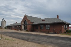 | Chicago and Northwestern Depot | 3.4 miles | 1980 |
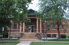 | Redfield Carnegie Library | 3.4 miles | 1978 |
| Norbeck-Nicholson Carriage House | 3.6 miles | 2015 | |
| Redfield Light Plant and Fire Station | 3.6 miles | 1978 | |
 | Spink County Courthouse | 3.7 miles | 2001 |
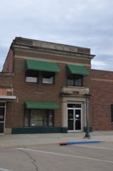 | Redfield City Hall, Old | 3.8 miles | 1997 |
| National Archives record | The nomination case file for reference 93001316 in Record Group 79. |
| Spink County | All 22 listed properties in this county. |