 Block
Dixon, South Dakota
8 topographic sheets cover this place, the earliest surveyed in 1955 and the latest in 1990. It stands in Dixon Township. It lies in ZIP code area 57533. The Survey maps it on the Dixon quadrangle.
On record in Dixon
Buildings and businesses the archive holds for this place. Each opens its own page, with the source record it came from.
On the National Register 1 record
- Pocahontas Schoolhouselisted 1973
Topographic sheets covering this place
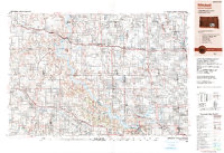
5 surveys from 8 printed sheetsMatched by testing this settlement's coordinate against the published boundary of every sheet in the United States Geological Survey's historical collection. Each opens the scanned sheet at the Survey.
- 1955 USGS Mitchell quadrangle1:250000, 2 printings
- 1959 USGS Mitchell quadrangle1:250000, 2 printings
- 1971 USGS Dixon quadrangle1:24000
- 1986 USGS Winner quadrangle1:100000, 2 printings
- 1990 USGS Mitchell quadrangle1:250000
Fires near this place
12 since 2000Regional context, not property-specific evidence. The federal wildfire occurrence database lists 12 fires within 5 miles of Dixon between 2000 and 2018, burning about 83 acres in total. 1 started naturally. None was recorded as arson. Distance is straight-line from the map coordinates, so a fire counted here may appear on a neighbouring settlement's page as well.
| Reported cause | Fires |
|---|---|
| Debris and open burning | 4 |
| Missing data/not specified/undetermined | 3 |
| Equipment and vehicle use | 3 |
| Smoking | 1 |
| Natural | 1 |
The most recent of them, most recent first, with the day each was reported and the service that recorded it.
| Date | Cause | Size | Reported by | Name on the report |
|---|---|---|---|---|
| 19 August 2008 | Equipment and vehicle use | under an acre | South Dakota Wildland Fire Suppression | not named |
| 30 July 2008 | Natural | under an acre | South Dakota Wildland Fire Suppression | not named |
| 22 July 2008 | Equipment and vehicle use | 1.0 acres | South Dakota Wildland Fire Suppression | not named |
| 21 July 2015 | Equipment and vehicle use | 2.5 acres | South Dakota Wildland Fire Suppression | COKE WHEAT FIELD |
| 8 May 2018 | Debris and open burning | under an acre | South Dakota Wildland Fire Suppression | TRASH FIRE |
| 30 May 2014 | Missing data/not specified/undetermined | 2.0 acres | South Dakota Wildland Fire Suppression | HCFD7300 |
| 10 May 2011 | Missing data/not specified/undetermined | 1.0 acres | South Dakota Wildland Fire Suppression | LINDQUIST |
| 15 April 2002 | Missing data/not specified/undetermined | under an acre | Gregory Volunteer Fire Department | DIXON DAM |
Storms near this place
52 since 1996Regional context, not property-specific evidence. The National Weather Service names Dixon in 52 storm reports between 1996 and 2025: 32 hail, 15 thunderstorm wind, 3 flood, 1 flash flood. No death or injury is recorded in these reports. Each account below is quoted exactly as the forecast office filed it, from the NOAA Storm Events Database, and each date opens the federal record of that event.
| When | Event | Place named | Harm | What the report says |
|---|---|---|---|---|
| August 2009 | Hail | Dixon | $2,000,000 | Large hail, up to two inches in diameter, fell in a swath a few miles wide from northwestern to south central Gregory County. The hail broke numerous windows, severely damaged siding and roofs of homes and other buildings, and severely damaged vehicles, while covering the ground in several places. Property damage was especially severe in the town of Gregory. Crop damage was also severe along the swath, with corn crops in some areas destroyed to the point of only small stubble left. |
| August 2019 | Flash Flood | Dixon | $630,000 | Numerous county roads were damaged with culverts or roads washed out. |
| August 2019 | Hail | Dixon | $5,000 | Hail destroyed a car windshield and headlights. |
| July 2008 | Thunderstorm Wind | Dixon | $5,000 | Thunderstorm winds destroyed a farm building and blew the debris across a road. The winds also blew down power lines. |
| July 2025 | Thunderstorm Wind | Dixon | - | Thunderstorm wind gusts were measured by a Road Weather Information System sensor 2 miles east of Dixon. |
| August 2025 | Thunderstorm Wind | Dixon | - | Thunderstorm wind gusts were measured by South Dakota Mesonet station GRMS2 Gregory 16N. |
| August 2025 | Thunderstorm Wind | Dixon | - | Thunderstorm wind gusts were measured by a Road Weather Information System sensor 2 miles east of Dixon. |
| August 2025 | Thunderstorm Wind | Dixon | - | Thunderstorm wind gusts were measured by South Dakota Mesonet station GRMS2 Gregory 16N. |
| July 2025 | Tornado (EF1) | Dixon | - | A storm chaser documented the initial touchdown of a tornado a little over a mile to the northwest of Dixon, SD just north of 276th Street in an open field. The tornado traveled to the east-southeast for around 2 miles before it impacted the north side of a farmstead where it damaged the shelter belt and destroyed an older outbuilding. As it continued along the path, it crossed near the intersection of SD 47 and SD 44 where it downed power poles and twisted a couple of SDDOT truck shelters. The tornado then traveled over mainly open fields for another 2 to 3 miles before taking a slight turn more to the southeast. After around 5 more miles on a southeastward path, the tornado lifted in an area of more uneven terrain. The tornado was rated EF1 with an estimated maximum wind gust of 110 mph. The average path width was around 100 yards. |
| June 2025 | Thunderstorm Wind | Dixon | - | Winds measured by South Dakota Mesonet station Gregory 16N. |
| July 2024 | Thunderstorm Wind | Dixon | - | An extended duration of strong to severe winds gusted at times to 61 mph at the SDSU mesonet station 16 miles north of Gregory. |
| July 2024 | Thunderstorm Wind | Dixon | - | Thunderstorm wind gusts reached severe levels at the South Dakota Road Weather Information System site near Dixon, then attained a peak of 72 mph at 223 am CST. |
| June 2022 | Thunderstorm Wind | Dixon | - | A thunderstorm wind gust of 58 mph was measured by South Dakota Road Weather Information System site SD589 2 miles east of Dixon. |
| June 2019 | Hail | Dixon | - | Quarter size hail, along with a lot of smaller hail, covered the ground. |
| July 2019 | Thunderstorm Wind | Dixon | - | Twelve foot length of a six inch diameter branch broken off a tree. |
| July 2015 | Thunderstorm Wind | Dixon | - | Thunderstorm winds caused tree damage, including branches blown down. |
| June 2011 | Flood | Dixon | - | Flooding from upstream spring snowmelt and subsequent heavy rain, affecting mainly the east shore of the Missouri River, also came to effect the Gregory County shore as it increased. A few roads and recreation areas near the river were flooded. |
| July 2011 | Flood | Dixon | - | Flooding from upstream spring snowmelt and subsequent heavy rain, affecting mainly the east shore of the Missouri River, also continued to affect parts of the Gregory County shore. A few roads and recreation areas near the river remained flooded. |
| August 2011 | Flood | Dixon | - | Flooding from upstream spring snowmelt and subsequent heavy rain, affecting mainly the east shore of the Missouri River, also continued to affect parts of the Gregory County shore early in the month. A few roads and recreational areas near the river remained flooded. |
| May 2010 | Thunderstorm Wind | Dixon | - | Thunderstorm winds caused tree damage, including several branches blown down. |
| May 2010 | Thunderstorm Wind | Dixon | - | Thunderstorm winds caused an unknown amount of tree damage. |
| August 2009 | Thunderstorm Wind | Dixon | - | Thunderstorm wind gusts to 60 mph were accompanied by nickel size hail. |
| August 2009 | Hail | Dixon | - | Large hail was accompanied by wind gusts up to 50 mph. The hail damaged vehicles, cracked windows, and damaged roofs and siding on buildings. The hail also caused crop damage in the area. The amount of local property and crop damage was not known, with the hail causing severe damage in a long swath over part of the county. |
| August 2009 | Hail | Dixon | - | Nickel size hail was accompanied by 60 mph wind gusts. |
| August 2003 | Thunderstorm Wind | Dixon | - | Thunderstorm winds caused tree damage, including many small branches down. |
| June 2019 | Hail | Dixon | - | no account filed |
| July 2019 | Hail | Dixon | - | no account filed |
| August 2019 | Hail | Dixon | - | no account filed |
| May 2016 | Hail | Dixon | - | no account filed |
| May 2012 | Hail | Dixon | - | no account filed |
| May 2010 | Hail | Dixon | - | no account filed |
| May 2010 | Hail | Dixon | - | no account filed |
| July 2009 | Hail | Dixon | - | no account filed |
| July 2008 | Hail | Dixon | - | no account filed |
| June 2008 | Hail | Dixon | - | no account filed |
| June 2007 | Hail | Dixon | - | no account filed |
| April 2007 | Hail | Dixon | - | no account filed |
| June 2005 | Hail | Dixon | - | no account filed |
| August 2005 | Hail | Dixon | - | no account filed |
| August 2005 | Hail | Dixon | - | no account filed |
| June 2003 | Hail | Dixon | - | no account filed |
| July 1999 | Hail | Dixon | - | no account filed |
| June 1999 | Hail | Dixon | - | no account filed |
| June 1999 | Hail | Dixon | - | no account filed |
| June 1999 | Hail | Dixon | - | no account filed |
| June 1999 | Hail | Dixon | - | no account filed |
| June 1999 | Hail | Dixon | - | no account filed |
| June 1999 | Hail | Dixon | - | no account filed |
| June 1999 | Hail | Dixon | - | no account filed |
| May 1998 | Hail | Dixon | - | no account filed |
| May 1998 | Hail | Dixon | - | no account filed |
| August 1996 | Hail | Dixon | - | no account filed |
Nearest settlements
The eight closest, with where each one stands in the county. Distances are straight-line, computed from the Geographic Names Information System coordinates.
Provenance
This settlement is recorded in the Geographic Names Information System as feature 1254704. The sheet list is computed by point-in-boundary test against the United States Geological Survey's historical topographic inventory. Both are works of the United States government and carry no copyright under 17 U.S.C. 105.
Wildfire. Short, Karen C. 2022. Spatial wildfire occurrence data for the United States, 1992-2020 [FPA_FOD_20221014]. 6th Edition. Fort Collins, CO: Forest Service Research Data Archive. https://doi.org/10.2737/RDS-2013-0009.6 Collected with United States Government funding and usable without additional permissions or fees.
Storms. NOAA National Centers for Environmental Information, Storm Events Database https://www.ncei.noaa.gov/stormevents/ A work of the United States government, no copyright under 17 U.S.C. 105. Narratives are quoted verbatim from the National Weather Service report and are not edited or summarised.