 Block
Ellis, South Dakota
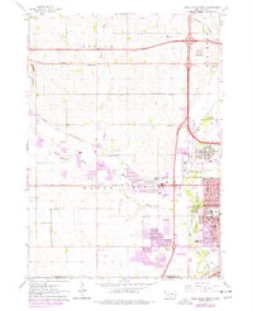
9 topographic sheets cover this place, the earliest surveyed in 1955 and the latest in 1985. It stands in Wayne Township. It lies in ZIP code area 57107. It stands on Willow Creek. The Survey maps it on the Sioux Falls West quadrangle.
Topographic sheets covering this place
4 surveys from 9 printed sheetsMatched by testing this settlement's coordinate against the published boundary of every sheet in the United States Geological Survey's historical collection. Each opens the scanned sheet at the Survey.
- 1955 USGS Sioux Falls quadrangle1:250000, 3 printings
- 1958 USGS Sioux Falls quadrangle1:250000
- 1962 USGS Sioux Falls West quadrangle1:24000, 3 printings
- 1985 USGS Sioux Falls quadrangle1:100000, 2 printings
Fires near this place
35 since 1999Regional context, not property-specific evidence. The federal wildfire occurrence database lists 35 fires within 5 miles of Ellis between 1999 and 2020, burning about 148 acres in total. 5 started naturally. None was recorded as arson. Distance is straight-line from the map coordinates, so a fire counted here may appear on a neighbouring settlement's page as well.
| Reported cause | Fires |
|---|---|
| Missing data/not specified/undetermined | 17 |
| Natural | 5 |
| Fireworks | 3 |
| Debris and open burning | 3 |
| Equipment and vehicle use | 3 |
| Smoking | 2 |
| Power generation/transmission/distribution | 1 |
| Railroad operations and maintenance | 1 |
The most recent of them, most recent first, with the day each was reported and the service that recorded it.
| Date | Cause | Size | Reported by | Name on the report |
|---|---|---|---|---|
| 6 August 2020 | Natural | 1.0 acres | South Dakota Wildland Fire Suppression | N. KIWANIS FIRE |
| 2 August 2007 | Missing data/not specified/undetermined | under an acre | South Dakota Wildland Fire Suppression | not named |
| 19 August 2008 | Equipment and vehicle use | 1.0 acres | South Dakota Wildland Fire Suppression | not named |
| 11 August 1999 | Natural | 1.0 acres | Mound City Volunteer Fire Department | KON THORSTENSON |
| 4 July 2011 | Missing data/not specified/undetermined | under an acre | South Dakota Wildland Fire Suppression | SANDS |
| 4 July 2007 | Fireworks | 1.0 acres | South Dakota Wildland Fire Suppression | not named |
| 2 July 1999 | Natural | under an acre | Long Valley Volunteer Fire Department | LANG VALLEY |
| 15 July 1999 | Natural | 80 acres | Murdo Volunteer Fire Department | HERMAN RANCH |
Settlements close enough to share some of these fires:
Mines and quarries near this place
8 within 5 milesRegional context, not property-specific evidence. The federal mineral resources record lists 8 workings within 5 miles of Ellis: 4 producers, 3 unknowns, 1 past producer. 4 still produce. What was taken out: Sand and Gravel, Construction, Stone, Crushed/Broken. Distance is straight-line from the map coordinates, so a quarry counted here may appear on a neighbouring settlement's page as well.
| Where | Site | Commodity | Status | Recorded |
|---|---|---|---|---|
| Concrete Materials Co Quarry | Stone, Crushed/Broken | Producer | ||
| Concrete Materials Company Quarry | Stone, Crushed/Broken | Producer | ||
| Quartzite Quarry | Stone, Crushed/Broken | Unknown | ||
| Bill Gage Gravel Pit | Sand and Gravel, Construction | Past Producer | ||
| Carey Gravel Pit | Sand and Gravel, Construction | Unknown | ||
| Fodness Sand and Gravel Pit | Sand and Gravel, Construction | Producer | ||
| Friessens West Pit | Sand and Gravel, Construction | Producer | ||
| Vincent Gravel Pit | Sand and Gravel, Construction | Unknown |
Storms near this place
60 of 64 shownRegional context, not property-specific evidence. The National Weather Service names Ellis in 64 storm reports between 1999 and 2025: 29 hail, 21 thunderstorm wind, 9 flash flood, 2 flood. No death or injury is recorded in these reports. Each account below is quoted exactly as the forecast office filed it, from the NOAA Storm Events Database, and each date opens the federal record of that event.
| When | Event | Place named | Harm | What the report says |
|---|---|---|---|---|
| June 2010 | Thunderstorm Wind | Ellis | $500,000 | Thunderstorm winds caused widespread damage in the Sioux Falls area. Wood and siding were blown off a new house and a nearby fence was blown over. The winds caused tree damage, including 2 to 3 foot diameter trees blown down. Debris from the tree damage blocked several roads. Garages were blown off three homes which were next to each other, and other nearby homes suffered significant damage in an area on West Eli Court which was subjected to the strongest winds, estimated at 100 mph. Windows were blown out in several of these homes, and a large camper was overturned in the same area. A wind gust of 74 mph was measured elsewhere in the city. The winds blew down out power lines in parts of the city. |
| August 2015 | Flash Flood | Ellis | $300,000 | Heavy rainfall of 3 to 8 inches caused widespread flooding of streets, parking lots, parks, ditches, basements and ground floors of homes and businesses, and other low areas. Water several feet deep on roads stalled numerous vehicles. Several vehicles had to be abandoned, some of which became completely submerged. Windows, flooring, and walls in some of the flooded homes and businesses were damaged, causing additional flooding in the affected buildings. Some residents were displaced from their homes by the flooding. The area suffering the worst flooding was in the southwestern corner of Sioux Falls, between 41st and 57th Streets, including the Empire Mall area. The flash flooding included a brief rise in the Big Sioux River at Western Avenue to 3 feet above flood stage. |
| June 2014 | Flash Flood | Ellis | $100,000 | Heavy rain caused flash flooding of streets, including numerous urban streets in Sioux Falls, basements, and other low areas including parkland. |
| August 2010 | Thunderstorm Wind | Ellis | $5,000 | Thunderstorm winds blew down power lines and caused tree damage. |
| May 2010 | Thunderstorm Wind | Ellis | $5,000 | Thunderstorm wind gusts were measured by a hand held device. The winds blew shingles off new homes in the area and caused tree damage. |
| July 2008 | Thunderstorm Wind | Ellis | $5,000 | Thunderstorm winds tore siding off a house, damaged a garage door, blew down an 18 inch diameter tree, and split a 10 to 12 inch diameter tree. |
| July 2025 | Thunderstorm Wind | Ellis | - | Thunderstorm wind gusts were measured by a personal weather station. |
| July 2025 | Thunderstorm Wind | Ellis | - | Thunderstorm winds resulted in significant tree and fence damage on the west side of Sioux Falls. |
| June 2025 | Thunderstorm Wind | Ellis | - | A couple of birch trees were knocked over by thunderstorm winds, with other large tree limbs down. |
| July 2025 | Thunderstorm Wind | Ellis | - | Thunderstorm wind gusts were measured by a personal weather station. |
| July 2023 | Thunderstorm Wind | Ellis | - | Thunderstorm winds were measured on a personal weather station 5 miles west of Sioux Falls. |
| June 2023 | Thunderstorm Wind | Ellis | - | Up to three inch diameter branches were broken by thunderstorm wind gusts. |
| May 2022 | Hail | Ellis | - | Crop damage is an estimate from insured losses. Information provided by the United States Department of Agriculture. |
| May 2022 | Thunderstorm Wind | Ellis | - | Numerous 3 inch tree limbs were broken off by thunderstorm winds. |
| May 2022 | Thunderstorm Wind | Ellis | - | A thunderstorm wind gust of 72 mph was measured by South Dakota State University mesonet site SFWS2 3 miles southeast of Wall Lake. |
| May 2022 | Thunderstorm Wind | Ellis | - | Several 3 inch tree branches were downed by thunderstorm winds. |
| June 2022 | Thunderstorm Wind | Ellis | - | A wind gust of 58 mph was measured by a personal weather station. |
| July 2021 | Hail | Ellis | - | Hail was mostly dime to nickel sized, with a few stones as large as quarters. |
| July 2021 | Thunderstorm Wind | Ellis | - | Thunderstorm wind gusts downed several 6 inch tree limbs. |
| August 2021 | Flash Flood | Ellis | - | Ponding of water caused water to reach basements. |
| August 2021 | Flash Flood | Ellis | - | Significant ponding of water resulted in some basement flooding. |
| August 2021 | Flash Flood | Ellis | - | Significant ponding and flooding of a small creek resulted in some basement flooding in lower spots. |
| September 2019 | Thunderstorm Wind | Ellis | - | Limbs up to 3 inches were broken from trees by strong thunderstorm winds. |
| July 2018 | Funnel Cloud | Ellis | - | Funnel cloud was observed from the NWS office out the west window for a couple of minutes. |
| July 2018 | Tornado (EF0) | Ellis | - | Brief touchdown in open area. No damage. |
| September 2018 | Flood | Ellis | - | Water was flowing over Madison Street at a depth of 8 to 10 inches east of La Mesa Drive. |
| September 2018 | Flood | Ellis | - | Much of Ellis has standing water, and water flowing over gravel roads west of Ellis. |
| August 2018 | Hail | Ellis | - | Hail stripped leaves from trees, seen on social media video. |
| June 2017 | Thunderstorm Wind | Ellis | - | Tree downed. |
| August 2017 | Heavy Rain | Ellis | - | Intersection at 26 and Stebben flooded. |
| May 2016 | Thunderstorm Wind | Ellis | - | Thunderstorm winds caused tree damage, including a large tree blown down. |
| June 2015 | Thunderstorm Wind | Ellis | - | Thunderstorm winds caused tree damage. |
| June 2014 | Flash Flood | Ellis | - | Heavy rainfall caused flash flooding of several streets in Sioux Falls. |
| June 2014 | Thunderstorm Wind | Ellis | - | Damaging thunderstorm winds were accompanied by golf ball size hail. The winds contributed to vehicle, home, and window damage. |
| June 2014 | Hail | Ellis | - | Golf ball size hail, accompanied by damaging winds, dented vehicles, damaged siding & roofs, and broke windows on vehicles and buildings. The amount of damage was not known. |
| June 2010 | Flash Flood | Ellis | - | Heavy rain caused flash flooding of several streets in the southern part of Sioux Falls, with water up to two feet deep. Basement flooding was also reported. |
| July 2010 | Flash Flood | Ellis | - | Heavy rainfall of up to 4 inches caused flash flooding of numerous streets in Sioux Falls. Water was high enough to cause several vehicles to stall out. |
| July 2010 | Flash Flood | Ellis | - | Heavy rain on saturated ground caused flash flooding of numerous roads, parking areas, basements, and other low areas. |
| July 2002 | Thunderstorm Wind | Ellis | - | Thunderstorm winds caused tree damage, including one tree which fell on a power line, causing a power outage. |
| July 2025 | Hail | Ellis | - | no account filed |
| July 2025 | Hail | Ellis | - | no account filed |
| May 2022 | Hail | Ellis | - | no account filed |
| May 2022 | Hail | Ellis | - | no account filed |
| May 2022 | Hail | Ellis | - | no account filed |
| May 2022 | Hail | Ellis | - | no account filed |
| May 2022 | Hail | Ellis | - | no account filed |
| May 2022 | Hail | Ellis | - | no account filed |
| May 2022 | Hail | Ellis | - | no account filed |
| June 2022 | Hail | Ellis | - | no account filed |
| June 2022 | Hail | Ellis | - | no account filed |
| June 2020 | Hail | Ellis | - | no account filed |
| August 2018 | Hail | Ellis | - | no account filed |
| August 2018 | Hail | Ellis | - | no account filed |
| August 2018 | Hail | Ellis | - | no account filed |
| August 2018 | Hail | Ellis | - | no account filed |
| June 2017 | Hail | Ellis | - | no account filed |
| June 2014 | Hail | Ellis | - | no account filed |
| June 2014 | Hail | Ellis | - | no account filed |
| June 2014 | Hail | Ellis | - | no account filed |
| June 2014 | Hail | Ellis | - | no account filed |
Nearest settlements
The eight closest, with where each one stands in the county. Distances are straight-line, computed from the Geographic Names Information System coordinates.
| Map | Place | Distance | Sheets |
|---|---|---|---|
| Webster Grove Addition | 1.4 miles | 9 | |
| Reppert Addition | 2.0 miles | 9 | |
| West Acres Development | 2.2 miles | 9 | |
| Silver Valley Addition | 2.3 miles | 9 | |
| Hayward Addition | 2.6 miles | 9 | |
| Ellis Corner | 2.7 miles | 9 | |
| Martindale Addition | 3.9 miles | 9 | |
| Skyline Heights | 4.8 miles | 9 |
Elsewhere
Matched on this settlement's Geographic Names Information System number rather than its name, so it cannot be a different place of the same name in another state.
| Wikipedia article on Ellis | An encyclopaedic summary. Its text is share-alike, so it is linked here rather than copied. |
| Wikidata item Q5365820 | The structured record the population and elevation above come from. Public domain (CC0). |
Provenance
This settlement is recorded in the Geographic Names Information System as feature 1265637. The sheet list is computed by point-in-boundary test against the United States Geological Survey's historical topographic inventory. Both are works of the United States government and carry no copyright under 17 U.S.C. 105.
Wildfire. Short, Karen C. 2022. Spatial wildfire occurrence data for the United States, 1992-2020 [FPA_FOD_20221014]. 6th Edition. Fort Collins, CO: Forest Service Research Data Archive. https://doi.org/10.2737/RDS-2013-0009.6 Collected with United States Government funding and usable without additional permissions or fees.
Mines and quarries. USGS Mineral Resources Data System (MRDS) https://mrdata.usgs.gov/mrds/ A work of the United States government, no copyright under 17 U.S.C. 105.
Storms. NOAA National Centers for Environmental Information, Storm Events Database https://www.ncei.noaa.gov/stormevents/ A work of the United States government, no copyright under 17 U.S.C. 105. Narratives are quoted verbatim from the National Weather Service report and are not edited or summarised.