Block
From the record
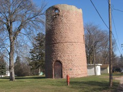
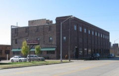
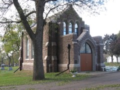
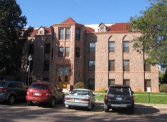
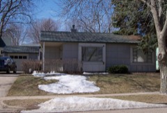
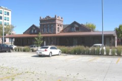
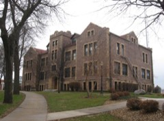
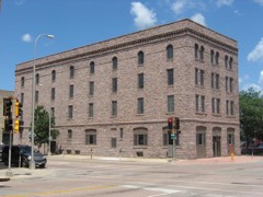
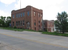
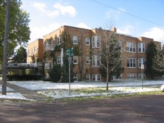
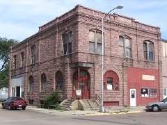
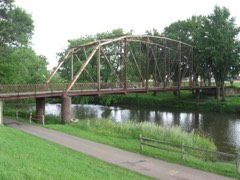
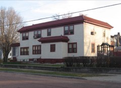
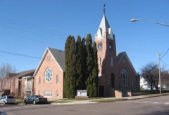
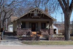
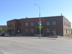
107 National Register listings published here.
Sources: the county history on the Internet Archive · the National Register database, National Park Service
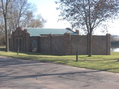
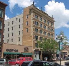
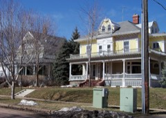
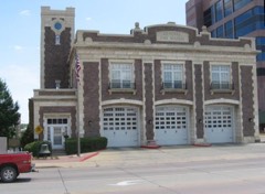
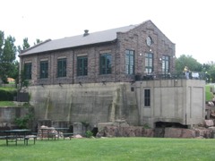
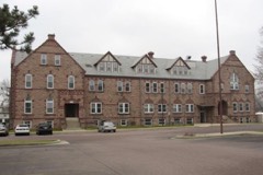
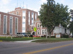
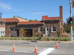
32 topographic sheets cover 51 settlements here, and 107 properties are on the National Register of Historic Places.
107 National Register listings published here.
Sources: the county history on the Internet Archive · the National Register database, National Park Service
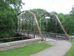
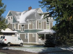
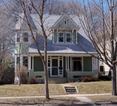
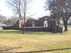
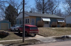
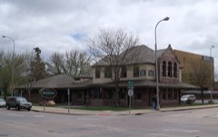
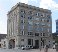
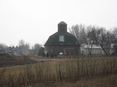
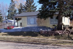
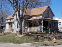
Every property in this county listed on the National Register of Historic Places, with the year it was listed and the federal nomination document.
Every wildfire the federal occurrence database records inside this county: 338 of them, burning about 3,420 acres. 8 started naturally and 6 were recorded as arson. Each settlement page carries the fires within five miles of it.
| Reported cause | Fires |
|---|---|
| Missing data/not specified/undetermined | 194 |
| Debris and open burning | 52 |
| Equipment and vehicle use | 20 |
| Fireworks | 15 |
| Smoking | 15 |
| Misuse of fire by a minor | 10 |
| Natural | 8 |
| Railroad operations and maintenance | 8 |
| Recreation and ceremony | 7 |
| Arson/incendiarism | 6 |
| Power generation/transmission/distribution | 3 |
The five largest, by the area the report gives. None of them was recorded as arson.
| Date | Cause | Size | Reported by | Name on the report |
|---|---|---|---|---|
| 6 March 2000 | Smoking | 1,500 acres | Brandon Volunteer Fire Department | I90 MM 405 |
| 21 April 2009 | Debris and open burning | 425 acres | South Dakota Wildland Fire Suppression | not named |
| 15 October 2014 | Missing data/not specified/undetermined | 95 acres | South Dakota Wildland Fire Suppression | JUSTIN GRAVES |
| 3 April 2009 | Missing data/not specified/undetermined | 72 acres | South Dakota Wildland Fire Suppression | not named |
| 24 March 2012 | Missing data/not specified/undetermined | 70 acres | South Dakota Wildland Fire Suppression | VAN DER VLIET |
| 8 October 2020 | Equipment and vehicle use | 50 acres | South Dakota Wildland Fire Suppression | INC # 112 10/8/2020 |
| 20 July 2012 | Missing data/not specified/undetermined | 45 acres | South Dakota Wildland Fire Suppression | GRASS FIRE |
| 29 September 2020 | Equipment and vehicle use | 40 acres | South Dakota Wildland Fire Suppression | INC # 106 9/29/2020 |
Every settlement page carries the fires within five miles of it - see the settlement index below.
The NOAA Storm Events Database holds 1,164 reports for this county, causing 5 deaths, 12 injuries and about $79,383,030 in recorded property damage. Each settlement page carries the reports that name it.
| Kind of event | Reports |
|---|---|
| Hail | 494 |
| Thunderstorm Wind | 374 |
| Flood | 157 |
| Flash Flood | 67 |
| Tornado | 46 |
| Heavy Rain | 11 |
| Lightning | 7 |
| Funnel Cloud | 7 |
| Wildfire | 1 |
The most serious of them, by death, then injury, then recorded damage. The accounts are quoted exactly as the forecast office filed them.
| When | Event | Place named | Harm | What the report says |
|---|---|---|---|---|
| June 1984 | Thunderstorm Wind | not stated | 2 killed | no account filed |
| May 1993 | Thunderstorm Wind | Dell Rapids and | 1 killed, 1 hurt, $500,000 | High winds destroyed several farm buildings in the Baltic and Dell Rapids area. There were also numerous reports of funnel clouds in the area. The storm was blamed for a two vehicle crash on a road west of Interstate 29 killing one driver and injuring the other. Roads were closed afterwards because of flooding caused by the torrential rains. (M51V) |
| May 2022 | Thunderstorm Wind | Colton | 1 killed | A thunderstorm wind gust of 81 mph was measured by South Dakota State University mesonet site CTNS2 2 miles east-southeast of Colton. Wind-driven debris went through the windshield of a vehicle and caused the (direct) fatality to the passenger near Colton. |
| May 2022 | Thunderstorm Wind | Sioux Falls | 1 killed | A tree was blown down onto a house. A large tree was also blown down on a car which resulted in the fatality of the driver. |
| June 2003 | Tornado (F1) | Pumpkin Center | 3 hurt, $500,000 | A tornado damaged several homes just west of Wall Lake. Two residents were injured and hospitalized when the tornado pushed one home off its foundation, tilting it on its side. Another resident received minor injuries. |
| July 2008 | Lightning | East Sioux Falls | 2 hurt | A lightning strike at a construction site on the east side of Sioux Falls injured two male workers who had just begun their shift. One of the workers was hospitalized. |
| August 2013 | Hail | South Sioux Falls | 1 hurt, $1,000,000 | Large hail damaged numerous vehicles and broke windows. A woman suffered minor injuries from the hail after taking refuge in a vehicle. |
| September 2019 | Thunderstorm Wind | South Sioux Falls | 1 hurt, $750,000 | Significant damaging winds impacted areas for several blocks around 41st Street and Glendale Avenue. Two apartment buildings had roofs torn off. One injury resulted from roof debris collapsing on a person in a single-family home. The fabric portion of an inflatable sports dome was destroyed by the strong winds. Numerous large trees were uprooted or snapped, blocking roadways and damaging a few homes. |
| July 1989 | Tornado (F1) | not stated | 1 hurt, $250,000 | no account filed |
| June 1998 | Thunderstorm Wind | Hartford | 1 hurt, $200,000 | no account filed |
| June 2003 | Thunderstorm Wind | Sioux Falls | 1 hurt, $10,000 | Thunderstorm winds blew a truck off Interstate 29, injuring the driver. The winds also blew the roof off a garage. |
| April 2001 | Lightning | Sioux Falls | 1 hurt, $5,000 | Lightning struck a house, injuring a man standing in the wet basement of the house. The lightning also damaged the roof and a wall of the house. |
| June 2004 | Flash Flood | Sioux Falls | $10,000,000 | Rainfall of 3 to 8 inches caused flooding of numerous basements. Structural damaged was caused to several of the basements as walls caved in. Ground floors of several residences, businesses, and schools were flooded, including a dentists office. There was significant damage to contents in the flooded buildings, including carpets, furniture, clothing, electronic equipment, and electric wiring. A mobile home park was especially hard hit, with all 37 units in the park flooded, and some units completely washed out. Many roads were flooded, and several were partly washed out, mainly at intersections. One parking lot caved in, with a driver barely escaping in his vehicle. Water and sewer lines were damaged during the cave-ins of the lot and of the basements. Several vehicles were damaged by flooding. Several parks in the city were flooded and closed, as was the zoo. |
| June 2001 | Flash Flood | Valley Spgs | $5,000,000 | Flash flooding of streams, roads, lowlands, homes, and other buildings was especially severe in the Valley Springs area. Most of the town was flooded, with widespread damage to basements and first floors of homes. The flooding left a layer of mud over much of the town. The sewer system backed up, leaving sewage in several houses and apartments.. A mobile home park was hard hit, with damage to the mobile home structures as well as the contents. Flooding and debris left some roads in the area closed for three days. Vehicles were damaged. The flooding in Valley Springs was caused by four to seven inches of rain falling in one to two hours. Damage outside the Valley Springs area was less severe, but stream and lowland flooding caused damage, especially in the Dell Rapids area. The Rocky Run Creek flooded a local golf course.The flooding damaged crops as well as property, but the amount of crop damage was not known. |
| May 1993 | Hail | not stated | $5,000,000 | Nearly stationary thunderstorms dumped five to seven one-half inches of rain and hail within three hours on the southwest side of Sioux Falls causing major urban flooding and a flash flood on an area creek. At least 200 basements were flooded by water and sewage as the storm and sewer systems backed up. Water came up to the rooftops of many cars in the Empire Mall area. Power was knocked out at the Empire Mall and to 2600 other customers in southwest Sioux Falls. Rainwater came through the roof of the Empire Mall causing damage to some stores. Hail up to an inch in diameter fell continuously for up to one and one-half hours in parts of southwest Sioux Falls causing considerable damage to hundreds of roofs, trees, and gardens. Thousands of cars received damage from hail or water in Sioux Falls. In the Silver Glen area a flash flood turned a normally three foot wide creek to a hundred feet wide in places. At least five houses near this creek had severe damage caused by the rushing waters. The flash flood also tore out a section of road adjacent to the creek, buckled sidewalks, tore away 100 year old trees, and floated a 5500 lb. truck down the road. |
| August 2013 | Hail | West Sioux Falls | $4,000,000 | Large hail broke windows and damaged many vehicles, as well as siding and roofs. One automobile dealer with a large temporary outdoor display reported four thousand vehicles were damaged. |
| September 2019 | Tornado (EF2) | South Sioux Falls | $3,000,000 | Shortly after touchdown just southeast of O'Gorman High School, the tornado struck a multi-story apartment building and removed a majority of the roof. Numerous trees were uprooted in residential areas north of 41st Street as the tornado continued in a general southeast direction. The tornado crossed 41st Street into a more commercial district, causing significant structural damage to several businesses, including the removal of the roof from one strip mall and exterior walls from another building. After another quarter mile of travel to the southeast, the tornado destroyed an apartment building garage. The tornado lifted before reaching the corner of 49th Street and Western Avenue. Average path width was 50 yards. Property damage costs are rough estimates. |
| June 2014 | Hail | South Sioux Falls | $3,000,000 | Large hail caused widespread damage to vehicles, windows, roofs, and siding. |
| March 2019 | Flood | Pumpkin Center | $2,510,000 | Numerous flooding reports across the city of Sioux Falls and Minnehaha County, with several closed roads. Reports through social media as well as law enforcement. Other flooding resulted in extensive damage to public infrastructure including numerous county and township roads, culverts, and some bridges. |
| June 2003 | Tornado (F1) | Hartford | $2,500,000 | A tornado heavily damaged 20 or more homes in the Hartford Heights development east of Hartford. Roofs were removed from houses and garages were destroyed. The tornado uprooted large trees. Many of the homes had to be destroyed afterwards due to the amount of damage they received. |
| June 1992 | Tornado (F2) | not stated | $2,500,000 | no account filed |
| June 1979 | Tornado (F1) | not stated | $2,500,000 | no account filed |
| June 1979 | Tornado (F1) | not stated | $2,500,000 | no account filed |
| June 2001 | Hail | Sioux Falls | $2,000,000 | Large hail severely damaged vehicles and also broke windows and damaged siding in some buildings. The hail was reported at several places around the city, but the damage was greatest in the southeast part of Sioux Falls.One insurance company expected about three thousand claims from vehicle owners. |
| June 2001 | Hail | Sioux Falls | $2,000,000 | no account filed |
| June 2001 | Hail | Sioux Falls | $2,000,000 | no account filed |
| June 2001 | Hail | Sioux Falls | $2,000,000 | no account filed |
| June 2001 | Hail | Sioux Falls | $2,000,000 | no account filed |
| June 2001 | Hail | Sioux Falls | $2,000,000 | no account filed |
| June 2001 | Hail | Sioux Falls | $2,000,000 | no account filed |
| June 2001 | Hail | Sioux Falls | $2,000,000 | no account filed |
| July 1997 | Hail | Hartford | $2,000,000 | no account filed |
| June 2015 | Thunderstorm Wind | Garretson | $1,500,000 | Thunderstorm winds estimated at 100 mph caused widespread damage to trees and power lines and damaged several homes. Many trees were blown over or completely uprooted. At least one house was completely destroyed, and others had parts of their roofs blown off. Windows were broken and a large camper was rolled several times and torn apart. Other vehicles were damaged, some severely by garage debris or falling trees. Grandstands at a baseball field were damaged. At least one barn and several silos and smaller structures at area farms were destroyed. The elevator in town was severely damaged. No injuries were reported. |
| March 2019 | Flood | South Sioux Falls | $1,450,000 | Snow melt and heavy rainfall (measured 2.74 inches at Hartford, 2.25 inches at Colton, and 2.49 inches at Sioux Falls) resulted in extensive flooding of the Sioux Falls park system near the natural channel of the Big Sioux River around the southern side of Sioux Falls. Water, and the broken ice cover from the river system, caused extensive damage to city property with numerous bridges and buildings completely destroyed, equipment damaged, and miles of bike trail washed out. Around 80 homes were inundated by floodwater with evacuation of 17 residents and their pets, as water reached the highest levels since construction of the homes. Water filled the tunnel on 57th Street under Interstate 229, flowed onto several portions of Interstate 229, and over 26th Street east of Interstate 229 and Cliff Avenue south of I-229. The Big Sioux River at Western Avenue (gage site WAVS2) reached the highest stage on record cresting 9.15 feet above flood stage on March 14. The river remained at minor flood stage at the end of the month. Property damage costs are rough estimates. |
| May 2004 | Flash Flood | South Portion | $1,000,000 | 3 to 6 inches of rain caused flooding of basements, and resulted in damage to contents, especially in Sioux Falls. Several apartments and duplexes were also flooded on the lower levels. The damage included waterlogged carpets, furniture, clothing, and television sets. At least 17 families were forced to move temporarily, according to the Red Cross, who aided the families. Flooding damaged roads in Sioux Falls, and made some roads impassable for several hours. Elsewhere over the southern part of the county, roads and fields were flooded. Crop damage was suspected from the field flooding, but the amount of damage was not known. |
| August 2004 | Thunderstorm Wind | Garretson | $1,000,000 | Thunderstorm winds severely damaged a large metal framed storage building, destroyed a 50 thousand bushel grain elevator, and destroyed the press box at a football field. the winds also severely damaged a large recreational building, blew down road signs, and damaged siding and roofs. Holes were left in several homes and city buildings. A brick wall of the old part of the Garretson School was damaged along its length. The winds caused widespread tree damage. Tree debris blocked most roads in Garretson. Power lines and poles were blown down, resulting in power outages which affected both the town and nearby rural areas. Several vehicles were damaged by flying or falling debris. The winds caused widespread crop damage in the area, but the amount of crop damage could not be determined. |
| June 2024 | Flood | Pumpkin Center | $939,000 | Rainfall amounts across Minnehaha County from June 20-22 ranged from 5 to 10 inches. Overland flooding ensued with additional moderate to major flooding along rivers across the county including Skunk Creek, Willow Creek, and the Big Sioux River. Numerous gravel roads and culverts washed out across the county and many homes took on water in their basements. Preliminary damage assessments estimate loss to public infrastructure across the county to be nearly 939 thousand dollars.||Within the city of Sioux Falls, numerous roads and intersections were closed due to flood water. Thirteen parks adjacent to the Big Sioux River and Skunk Creek were also inundated with water and closed. Emergency services conducted 9 water rescues, 6 of which were within city limits. Thirty stalled vehicles were reported and 5 vehicles became stranded. Flood waters greatly threatened the city's wastewater treatment system, requiring the discharge of 32 million gallons of untreated water into the Big Sioux River.||The majority of overland flooding subsided by June 25, but river flooding continued through the end of the month. For additional information on river flooding, please see other flood entries for Minnehaha County. |
| September 2019 | Flood | Pumpkin Center | $881,000 | Flooding resulted in crop losses and damage to public infrastructure including numerous county and township roads, culverts, and some bridges. Crop loss estimates provided by the United States Department of Agriculture. |
| September 2019 | Flood | Dell Rapids | $750,000 | After excessive two-day rainfall during September 10-12 (8.74 inches at Flandreau, 7.81 inches at Dell Rapids), the Big Sioux River above Dell Rapids (gage site DBRS2) reached the highest stage on record of 9.00 feet above flood stage on September 13. Extensive flooding of homes occurred in Dell Rapids, some as far as three city blocks from the river. A dozen homes were deemed to have substantial damage, and removed after being flooded. Jasper Road east of Dell Rapids was closed due to water over the roadway. |
| August 2021 | Hail | Renner | $500,000 | Large hail produced significant roof damage along a path from south of Dell Rapids to Renner to near Brandon. The most significant damage occurred near Renner where 2 to 3.5 inch hail was reported. Property damage costs are a rough estimate. Crop damage is an estimate from insured losses. Information provided by the United States Department of Agriculture. |
| September 2021 | Thunderstorm Wind | Humboldt | $500,000 | Thunderstorm winds damaged grain elevator bins. Property damage costs are a rough estimate. |
| June 2014 | Flood | Buffalo Trading Post | $500,000 | Persistent moderate to heavy rain caused flooding of fields and other lowlands, including several roads, homes, and businesses. This flooding lasted for almost two days, and was aggravated locally by additional storms during that time. Some roads were damaged or washed out. |
| June 2010 | Thunderstorm Wind | Ellis | $500,000 | Thunderstorm winds caused widespread damage in the Sioux Falls area. Wood and siding were blown off a new house and a nearby fence was blown over. The winds caused tree damage, including 2 to 3 foot diameter trees blown down. Debris from the tree damage blocked several roads. Garages were blown off three homes which were next to each other, and other nearby homes suffered significant damage in an area on West Eli Court which was subjected to the strongest winds, estimated at 100 mph. Windows were blown out in several of these homes, and a large camper was overturned in the same area. A wind gust of 74 mph was measured elsewhere in the city. The winds blew down out power lines in parts of the city. |
| August 2002 | Thunderstorm Wind | (Fsd)Joe Foss Fld Si | $500,000 | Thunderstorm winds flipped two airplanes, destroying one and causing fuel spills. The winds also tore part of a wall from an aircraft maintenance building. The winds caused tree damage, including large trees blown down, one of which severely damaged the roof of a house. Other tree debris damaged vehicles. Power lines and some poles were blown down, causing power outages. |
| May 1993 | Tornado (F2) | Rowena to | $500,000 | A tornado destroyed numerous buildings on five farms as it moved north from the Iowa border to near Interstate 90 northwest of Valley Springs. Power lines were also torn down east of Rowena by the tornado. |
| May 1993 | Hail | Sioux Falls | $500,000 | Large hail dented many cars on the east side of Sioux Falls. |
| August 2015 | Flash Flood | Ellis | $300,000 | Heavy rainfall of 3 to 8 inches caused widespread flooding of streets, parking lots, parks, ditches, basements and ground floors of homes and businesses, and other low areas. Water several feet deep on roads stalled numerous vehicles. Several vehicles had to be abandoned, some of which became completely submerged. Windows, flooring, and walls in some of the flooded homes and businesses were damaged, causing additional flooding in the affected buildings. Some residents were displaced from their homes by the flooding. The area suffering the worst flooding was in the southwestern corner of Sioux Falls, between 41st and 57th Streets, including the Empire Mall area. The flash flooding included a brief rise in the Big Sioux River at Western Avenue to 3 feet above flood stage. |
| September 2019 | Flood | Renner | $250,000 | After excessive two-day rainfall during September 10-12 (6.01 inches 7 miles west of Garretson, 3.99 inches 6 miles north of Sioux Falls), Silver Creek at Sioux Falls (gage site AGCS2) reached the highest stage on record of 3.60 feet above flood stage on September 14. Water inundated 60th Street North for the first time and caused minor damage to the bridge over Silver Creek. The city of Renner suffered extensive flooding with water inundating several homes and causing evacuation of seven residents. |
| September 2019 | Flash Flood | Colton | $250,000 | After 3.85 inches rainfall in the six hours prior to 0000CST September 12, significant flooding in Colton resulted in evacuation of several residences. |
| June 1961 | Tornado (F3) | not stated | $250,000 | no account filed |
| September 2019 | Flood | Dell Rapids | $200,000 | After excessive two-day rainfall during September 10-12 (8.74 inches at Flandreau, 7.81 inches at Dell Rapids), the Big Sioux River below Dell Rapids (gage site DERS2) reached the highest stage on record of 4.72 feet above flood stage on September 13. Numerous county roads were inundated, and flood waters cut off all access to the city of Baltic except one. |
| September 2019 | Flood | Renner | $200,000 | After excessive two-day rainfall during September 10-12 (8.74 inches at Flandreau, 7.81 inches at Dell Rapids), the Big Sioux River at Sioux Falls I-90 (gage site SFLS2) reached the second highest stage on record of 6.91 feet above flood stage on September 14. Extensive flooding of homes occurred in Renner, with seven people evacuated due to high water. |
| July 1998 | Thunderstorm Wind | Hartford | $200,000 | no account filed |
| July 2002 | Flash Flood | Sioux Falls | $150,000 | Heavy rain caused flooding of numerous streets, and caused sewers to back up in a four block area. At least 60 homes suffered significant damage from the flooding of basements by the sewer backup. |
| September 2019 | Flood | Garretson | $100,000 | After excessive two-day rainfall during September 10-12 (record 2-day rainfall of 6.75 inches at Pipestone, 4.37 inches near Garretson), Split Rock Creek near Corson (gage site COSS2) reached the highest stage on record of 10.20 feet above flood stage on September 12. Flood waters completely inundated the Brandon golf course, with State Highway 11 closed in multiple locations. Numerous homes were inundated by water.||Numerous county roads were under water near Sherman, including 250th Street. |
| June 2014 | Tornado (EF2) | Pumpkin Center | $100,000 | A tornado blew down the exterior walls of a house, in which a family escaped injury by taking shelter in the basement. The tornado also tore the roof off a farm storage building, tore the metal roof off a metal building, blew down electrical poles, and caused tree damage, including several trees snapped off at the trunks. |
| June 2014 | Flash Flood | Ellis | $100,000 | Heavy rain caused flash flooding of streets, including numerous urban streets in Sioux Falls, basements, and other low areas including parkland. |
| August 2013 | Hail | Sioux Falls | $100,000 | Large hail, driven by estimated 55 mph winds, damaged vehicles, broke windows, and damaged siding. |
| August 2013 | Thunderstorm Wind | South Sioux Falls | $100,000 | Thunderstorm winds damaged several businesses, including a large retail store which was also struck by lightning. The large store lost part of its roof, while the stockroom of the same store and its contents were also damaged. A canopy type tent was destroyed, and a 20 foot retaining wall was blown down. The winds caused extensive tree damage, including several trees blown down, one of which blocked a major intersection when it fell. |
| August 2013 | Hail | South Sioux Falls | $100,000 | Large hail was accompanied by estimated 55 mph winds. The hail damaged vehicles in the area. |
The Survey's mineral resources record lists 72 workings inside this county. 14 still produce and 58 are closed or unrecorded. Each settlement page carries the workings within five miles of it.
| Commodity | Workings |
|---|---|
| Sand and Gravel, Construction | 62 |
| Stone, Crushed/Broken | 10 |
The least common of them first, because a county's hundredth gravel pit says nothing its first ten did not.
| Where | Site | Commodity | Status | Recorded |
|---|---|---|---|---|
| Concrete Materials Co Quarry | Stone, Crushed/Broken | Producer | ||
| Concrete Materials Company Quarry | Stone, Crushed/Broken | Producer | ||
| Dell Rapids Quarry | Stone, Crushed/Broken | Producer | ||
| Quartzite Quarry | Stone, Crushed/Broken | Past Producer | ||
| Quartzite Quarry | Stone, Crushed/Broken | Unknown | ||
| Quartzite Quarry | Stone, Crushed/Broken | Past Producer | ||
| Quartzite Quarry | Stone, Crushed/Broken | Past Producer | ||
| Quartzite Quarry | Stone, Crushed/Broken | Past Producer | ||
| Quartzite Quarry | Stone, Crushed/Broken | Unknown | ||
| Wisconsin Granite Co. | Stone, Crushed/Broken | Past Producer | ||
| Albert Anderson Sand Pit | Sand and Gravel, Construction | Past Producer | ||
| Arnold Gravel Pit | Sand and Gravel, Construction | Unknown | ||
| Baker's Gravel Pit | Sand and Gravel, Construction | Past Producer | ||
| Beckman Sand and Gravel Pit | Sand and Gravel, Construction | Producer | ||
| Bill Gage Gravel Pit | Sand and Gravel, Construction | Past Producer | ||
| Brandie Gravel Pit | Sand and Gravel, Construction | Past Producer | ||
| Brandon City Pit | Sand and Gravel, Construction | Past Producer | ||
| Brandon Materials | Sand and Gravel, Construction | Producer | ||
| Carey Gravel Pit | Sand and Gravel, Construction | Unknown | ||
| City of Sioux Falls Gravel Pit | Sand and Gravel, Construction | Producer | ||
| Daggett Gravel Pit | Sand and Gravel, Construction | Unknown | ||
| Duane Bly Pit | Sand and Gravel, Construction | Past Producer | ||
| Dubbelde Gravel Pit Nw | Sand and Gravel, Construction | Unknown | ||
| Dubbelde Gravel Pit Se | Sand and Gravel, Construction | Unknown | ||
| Eagle Materials Co Cactus Hills | Sand and Gravel, Construction | Producer | ||
| Eagle Sand and Gravel Co. | Sand and Gravel, Construction | Unknown | ||
| Flanagan Gravel Pit | Sand and Gravel, Construction | Producer | ||
| Fodness Sand and Gravel Pit | Sand and Gravel, Construction | Producer | ||
| Friessen Sand and Gravel Pit | Sand and Gravel, Construction | Producer | ||
| Friessens West Pit | Sand and Gravel, Construction | Producer | ||
| Gran Sand and Gravel Pit | Sand and Gravel, Construction | Past Producer | ||
| Gravel Pit | Sand and Gravel, Construction | Past Producer | ||
| Harnack Sand Pit | Sand and Gravel, Construction | Unknown | ||
| Hayes Standard Gravel Co. | Sand and Gravel, Construction | Unknown | ||
| Heller Sand Pit | Sand and Gravel, Construction | Past Producer | ||
| Highway Gravel Pit | Sand and Gravel, Construction | Unknown | ||
| Highway Pit | Sand and Gravel, Construction | Past Producer | ||
| Highway Pit | Sand and Gravel, Construction | Unknown | ||
| Highway Pit | Sand and Gravel, Construction | Past Producer | ||
| Hillcrest Pit | Sand and Gravel, Construction | Unknown | ||
| Johnson Gravel Pit | Sand and Gravel, Construction | Unknown | ||
| Johnson Pit | Sand and Gravel, Construction | Past Producer | ||
| Julson Gravel Pit | Sand and Gravel, Construction | Unknown | ||
| L.G.Everist Sand Pit. | Sand and Gravel, Construction | Producer | ||
| Limburger Gravel Pit | Sand and Gravel, Construction | Unknown | ||
| Martin Sand and Gravel Pit. | Sand and Gravel, Construction | Unknown | ||
| Miller Gravel Pit | Sand and Gravel, Construction | Unknown | ||
| Mousee Pit | Sand and Gravel, Construction | Unknown | ||
| Nelson Gravel Pit | Sand and Gravel, Construction | Past Producer | ||
| Nelson Sand Pit | Sand and Gravel, Construction | Unknown | ||
| Old Lake Gravel Pit | Sand and Gravel, Construction | Past Producer | ||
| Pat Kinney Gravel Pit | Sand and Gravel, Construction | Unknown | ||
| Railroad Pit | Sand and Gravel, Construction | Past Producer | ||
| Reynolds Sand and Gravel Pit | Sand and Gravel, Construction | Producer | ||
| Rovac Gravel Pit | Sand and Gravel, Construction | Unknown | ||
| Scholten Pit | Sand and Gravel, Construction | Unknown | ||
| School House Pit | Sand and Gravel, Construction | Unknown | ||
| Scott Gravel Pit | Sand and Gravel, Construction | Past Producer | ||
| Shay Gravel Pit | Sand and Gravel, Construction | Unknown | ||
| Sherman Gravel Pit | Sand and Gravel, Construction | Producer | ||
| Swanson Gravel Pit | Sand and Gravel, Construction | Unknown | ||
| Swenson Gravel Pit | Sand and Gravel, Construction | Past Producer | ||
| Swift Gravel Pit | Sand and Gravel, Construction | Unknown | ||
| Tolverson Gravel Pit | Sand and Gravel, Construction | Past Producer | ||
| Twin Mounds Gravel Pit - Ne | Sand and Gravel, Construction | Unknown | ||
| Twin Mounds Gravel Pit - Sw | Sand and Gravel, Construction | Unknown | ||
| Ulvio Gravel Pit | Sand and Gravel, Construction | Unknown | ||
| Vandersnick Pit | Sand and Gravel, Construction | Past Producer | ||
| Victor Hanson Pit | Sand and Gravel, Construction | Past Producer | ||
| Vincent Gravel Pit | Sand and Gravel, Construction | Unknown | ||
| Webster Gravel Pit | Sand and Gravel, Construction | Unknown | ||
| Woolridge Railroad Pit | Sand and Gravel, Construction | Past Producer |
History of Minnehaha County, South Dakota. Containing an Account of Its Settlements, Growth, Development and Resources ... Synopsis of Public Records, Biographical Sketches .. devotes a chapter to each township: its boundaries and streams, who settled it and when, the mills, the schools and the churches. All 5 are reproduced here in full. Each row shows the township's own shape and where it lies in the county, drawn from the Census Bureau's boundary. Which settlements belong to which township is computed from that same boundary, not taken from the book.
| Shape and position in the county | Township | Settlements in it | Length | Sections |
|---|---|---|---|---|
| Dell Rapids City | Dell Rapids | 26,908 words | 8 | |
| Garretson City | Garretson | 38,671 words | 6 | |
| Hartford City | Hartford | 5,293 words | 1 | |
| Sioux Falls City | Cactus Heights, East Sioux Falls, Froelich Addition, Hayward Addition, Ingberg Tracts, Martindale Addition, Norton Acres, Reppert Addition, Silver Valley Addition, Sioux Falls, Skyline Heights, South Sioux Falls, Split Rock Heights, Webster Grove Addition | 79,863 words | 17 | |
| Valley Springs Township | Benclare, Valley Springs | 15,502 words | 5 |
One book written about this county, cut here where the book itself is cut, at its printed chapters: 14 chapters in all. Every chapter is public domain, machine-read from the scan and reproduced complete. A chapter already given under one of the county's towns is not repeated in this list.
Named settlements recorded in the Geographic Names Information System, each with the topographic sheets covering it. Villages, hamlets and abandoned places alike. Each is shown with the nearest named watercourse or landform and the survey quadrangle it falls on.
Dell Rapids city · 57022 · By Dells of the Sioux River · Dell Rapids quadrangle
8 sheets, 1955 to 1985
Sioux Falls city · 57104 · On Silver Creek · Sioux Falls East quadrangle
9 sheets, 1955 to 1985
Garretson city · 57030 · Near Devils Gulch · Garretson West quadrangle
8 sheets, 1955 to 1985
Sioux Falls city · 57106 · On Skunk Creek · Sioux Falls West quadrangle
9 sheets, 1955 to 1985
Split Rock township · 57110 · Sioux Falls East quadrangle
9 sheets, 1955 to 1985
Palisade township · 57030 · Near Devils Gulch · Garretson East quadrangle
7 sheets, 1955 to 1985
Split Rock township · 57110 · Sioux Falls East quadrangle
9 sheets, 1955 to 1985
Sioux Falls city · 57106 · Sioux Falls West quadrangle
9 sheets, 1955 to 1985
Sioux Falls city · 57105 · Sioux Falls East quadrangle
9 sheets, 1955 to 1985
No longer a settlement
Valley Springs city · 57068 · On Annie Anderson Creek · Valley Springs quadrangle
8 sheets, 1955 to 1985
Sioux Falls city · 57107 · On Willow Creek · Sioux Falls West quadrangle
9 sheets, 1955 to 1985
The vanished settlements of Minnehaha County: the places named above that are no longer on the map.