 Block
Hitchcock, South Dakota
10 topographic sheets cover this place, the earliest surveyed in 1895 and the latest in 1985. It stands in Hitchcock town. It lies in ZIP code area 57348. The Survey maps it on the Hitchcock quadrangle. 112 people lived here at the 2020 count. It stands 1,339 feet above sea level.
On record in Hitchcock
Buildings and businesses the archive holds for this place. Each opens its own page, with the source record it came from.
On the National Register 1 record
- Anderson Barnlisted 2003
Population over time
2 figuresHitchcock grew from 91 to 112 between 2010 and 2020. These are the recorded population figures Wikidata holds for this place, reached through the Geographic Names Information System number this page is keyed on rather than by name, so they belong to this place and not to another of the same name. Most are census counts, but not all are: an early figure may be a founding or settlement estimate, and an estimate published within five years of a census is left out. The change column is computed, and is left blank where more than 20 years separate a figure from the one before it, because a gap that long is not a change between two counts.
| Year | People | Change |
|---|---|---|
| 2010 | 91 | |
| 2020 | 112 | +21 (+23%) |
Topographic sheets covering this place
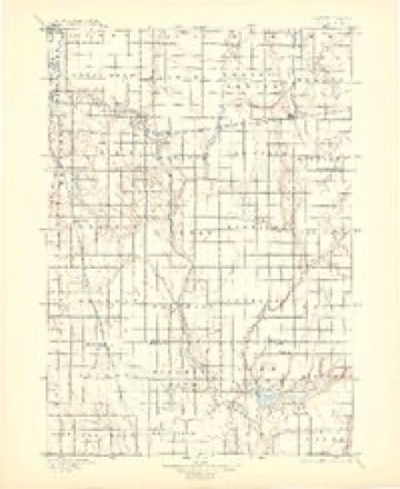
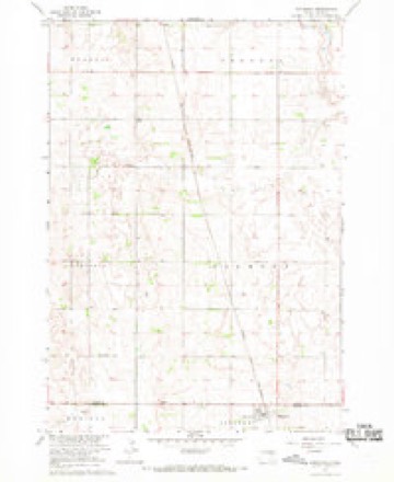
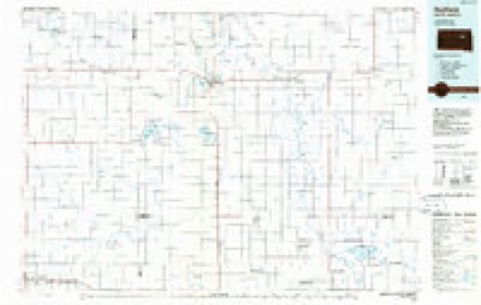
5 surveys from 10 printed sheetsMatched by testing this settlement's coordinate against the published boundary of every sheet in the United States Geological Survey's historical collection. Each opens the scanned sheet at the Survey.
- 1895 USGS Byron quadrangle1:125000, 4 printings
- 1953 USGS Huron quadrangle1:250000, 3 printings
- 1954 USGS Huron quadrangle1:250000
- 1967 USGS Hitchcock quadrangle1:24000
- 1985 USGS Redfield quadrangle1:100000
Fires near this place
1 since 2000Regional context, not property-specific evidence. The federal wildfire occurrence database lists 1 fire within 5 miles of Hitchcock in 2000, burning about 20 acres in total. None started naturally. None was recorded as arson. Distance is straight-line from the map coordinates, so a fire counted here may appear on a neighbouring settlement's page as well.
| Reported cause | Fires |
|---|---|
| Smoking | 1 |
The most recent of them, most recent first, with the day each was reported and the service that recorded it.
| Date | Cause | Size | Reported by | Name on the report |
|---|---|---|---|---|
| 6 March 2000 | Smoking | 20 acres | Hitchcock Volunteer Fire Department | SKARIN |
Storms near this place
60 of 69 shownRegional context, not property-specific evidence. The National Weather Service names Hitchcock in 69 storm reports between 1995 and 2025: 47 flood, 12 thunderstorm wind, 8 hail, 1 lightning. No death or injury is recorded in these reports. Each account below is quoted exactly as the forecast office filed it, from the NOAA Storm Events Database, and each date opens the federal record of that event.
| When | Event | Place named | Harm | What the report says |
|---|---|---|---|---|
| August 2019 | Flood | Hitchcock | $10,000 | A continuation of flooding from July, the James River at Huron (gage site HURS2) crested 4.40 feet above flood stage on August 5. Many rural roads near the river were inundated, with continued flooding of significant amounts of agricultural land. Minor flooding continued at the end of the month. |
| September 2019 | Flood | Hitchcock | $10,000 | A continuation of minor flooding from August, the James River at Huron (gage site HURS2) responded rapidly mid-month to 2 to 3 inches of rainfall from September 10-12 near and upstream of Beadle County to crest 3.95 feet above flood stage on September 17. Many rural roads near the river remained inundated, with continued flooding of significant amounts of agricultural land. Minor flooding continued at the end of the month. |
| October 2019 | Flood | Hitchcock | $5,000 | A continuation of minor flooding from September, the James River at Huron (gage site HURS2) started the month at 1.23 feet above flood stage on October 1. Significant amounts of agricultural land remained flooded. Minor flooding persisted at the end of the month. Property damage costs are rough estimates. |
| May 2013 | Thunderstorm Wind | Hitchcock | $5,000 | Thunderstorm winds blew a large metal bin into a mobile home. |
| August 2004 | Lightning | Hitchcock | $5,000 | Lightning struck two large trees. Debris from the trees knocked down power lines, causing a power outage. |
| May 2009 | Thunderstorm Wind | Hitchcock | $2,000 | Thunderstorm winds damaged a mobile home, with a few pieces of siding being removed. |
| August 2025 | Flood | Hitchcock | - | The James River at Huron rose above flood stage on the morning of August 22nd, cresting around 0.48 feet above flood stage (11.98 ft) on August 23rd. The river then fell below flood stage on the morning of August 24th. |
| August 2025 | Flash Flood | Hitchcock | - | A couple feet of water inundated County Road 6 (193rd Street) east of 394th Avenue. |
| June 2023 | Flood | Hitchcock | - | Flooding continued from May along the James River near Huron, SD with very slowly falling levels through the month. The peak river level was 0.83 feet above flood stage (11.83 ft) occurring early in the day on the 1st, slowly falling for the remainder of the month. Flooding continued into June. |
| July 2023 | Flood | Hitchcock | - | The James River near Huron, SD briefly rose into Minor Flood Stage on July 4th cresting 0.04 ft above flood stage (11.04 ft). The river then fell back below flood stage by the end of the day, remaining elevated in Action Stage through the remainder of the month. |
| May 2023 | Flood | Hitchcock | - | Flooding continued from April along the James River near Huron, SD with very slowly falling levels through the month. Flood levels were in the Moderate category for 3 days and Minor stage for 31 days. Flooding continued into June. |
| August 2023 | Flood | Hitchcock | - | The James River at Huron rose above flood stage on the morning of the 6th before cresting 0.41 ft above flood stage (11.41 ft) on the 19th. The river then fell below flood stage on the morning of the 27th. |
| April 2023 | Flood | Hitchcock | - | The James River near Huron, SD rose above flood stage around midday on April 12th before cresting around 4.85 feet above flood stage (15.85 feet) on April 24th, which is in the Major category. The river was above Minor flood stage at this location for 19 days, above Moderate stage for 17 days, and above Major stage for 8 days. Flooding continued into May. |
| July 2022 | Flood | Hitchcock | - | Minor flooding was ongoing at the start of July 2022 on the James River at Huron (gage site HURS2). Five to seven inches of rainfall the first seven days of July in a small area at and north of Huron resulted in a crest at 1.70 feet above flood stage on July 17. A significant amount of rural land was flooded. The river remained at minor flood stage at the end of the month. |
| May 2022 | Flood | Hitchcock | - | As water from early spring rains and late winter snowmelt in North Dakota and far northern South Dakota routed downstream, the James River at Huron (gage site HURS2) climbed into minor flood stage on May 9, and reached 1.85 feet above flood stage at the end of the month. Significant amounts of agricultural land were inundated. Minor flooding continued at the end of the month. |
| June 2022 | Flood | Hitchcock | - | Moderate flooding was ongoing at the start of June 2022 on the James River at Huron (gage site HURS2), with a crest at 2.16 feet above flood stage on June 13. The river fell back to minor flood stage on June 15. A significant amount of rural land was flooded. The river remained at minor flood stage at the end of the month. |
| August 2022 | Flood | Hitchcock | - | Minor flooding was ongoing at the start of August 2022, with the James River at Huron (gage site HURS2) at 0.35 feet above flood stage on August 1. A significant amount of rural land was flooded until the river dropped below flood stage late on August 19. |
| January 2020 | Flood | Hitchcock | - | A continuation of minor flooding from December, the James River at Huron (gage site HURS2) spent the entire month at minor flood levels. The highest stage was measured at the start of the month at 1.98 feet above flood stage, but a secondary crest of 1.40 feet above flood stage occurred on January 18. Significant amounts of agricultural land remained flooded, along with several county and township roads near the river. Minor flooding persisted at the end of the month. |
| February 2020 | Flood | Hitchcock | - | A continuation of flooding from January, the James River at Huron (HURS2) began the month at 0.49 feet above flood stage. Minor flooding of rural areas upstream of the gage slowly ended as river levels dropped below flood stage by mid-month. |
| May 2020 | Flood | Hitchcock | - | A continuation of flooding from April, the James River at Huron (gage site HURS2) resided in moderate flood stage most of the month, with a peak on May 17 at 2.78 feet above flood stage. Several county and township roads remained inundated. The river remained in minor flood stage at the end of the month. |
| June 2020 | Flood | Hitchcock | - | A continuation of flooding from May, the James River at Huron (gage site HURS2) resided in minor flood stage during the month, with a peak on June 23 at 1.16 feet above flood stage. Large tracts of agricultural land remained under water through the month. The river remained in minor flood stage at the end of the month. |
| March 2020 | Flood | Hitchcock | - | The James River at Huron (gage site HURS2) returned to flood on March 5, and crested in major flood stage on March 21, 5.86 feet above flood stage. Numerous county and township roads were inundated along with considerable agricultural land near the river in Beadle County. Several roads in Huron (Jersey Ave., Riverside Ave., Sherman Ave. 3rd Street, Hwy 14 bypass) all experienced closure due to flooding. The river remained in moderate flood stage at the end of the month. |
| July 2020 | Flood | Hitchcock | - | A continuation of flooding from June, the James River at Huron (gage site HURS2) started the month within a half foot of flood stage before rainfall of one to two inches upstream pushed levels to a crest at 1.90 feet above flood stage on July 12. Significant amounts of agricultural land remained inundated through the month. The river remained at minor flood stage at the end of the month. |
| August 2020 | Flood | Hitchcock | - | The James River at Huron (gage site HURS2) began the month at 0.1 feet above flood stage, and fell below flood stage on August 2. Minor flooding of agricultural areas was the main impact. |
| April 2020 | Flood | Hitchcock | - | A continuation of flooding from March, the James River at Huron (gage site HURS2) remained in moderate flood stage through the month, with the peak stage on April 1 at 3.48 feet above flood stage. Several county and township roads remained inundated. The river remained in moderate flood stage at the end of the month. |
| June 2019 | Flood | Hitchcock | - | A continuation of flooding from May, the James River at Huron (gage site HURS2) crested 3.72 feet above flood stage on June 1. Many rural roads near the river were inundated, with continued flooding of significant amounts of agricultural land. Minor flooding continued at the end of the month. |
| November 2019 | Flood | Hitchcock | - | A continuation of minor flooding from October, the James River at Huron (gage site HURS2) crested at 2.46 feet above flood stage on November 26. Significant amounts of agricultural land remained flooded. Moderate flooding persisted at the end of the month. |
| March 2019 | Flood | Hitchcock | - | Snow melt and heavy rainfall (measured 1.60 inches at Huron) resulted in extensive flooding of agricultural land and numerous township and county roads. The James River at Huron (gage site HURS2) reached a crest of 4.27 feet above flood stage on March 31. The river remained at major flood stage at the end of the month. |
| July 2019 | Flood | Hitchcock | - | A continuation of flooding from June, the James River at Huron (gage site HURS2) crested 3.65 feet above flood stage on July 9. Many rural roads near the river were inundated, with continued flooding of significant amounts of agricultural land. Moderate flooding continued at the end of the month. |
| May 2019 | Flood | Hitchcock | - | This is a continuation of flooding from April. The James River at Huron (gage site HURS2) crested at major flood stage twice during the month. The first occurred on May 1 when levels crested at 5.26 feet above flood stage. Additional rainfall mid to late month resulted in a secondary crest of 4.35 feet above flood stage on May 28. Numerous county and township roads remained under water, as well as several streets near Huron. The river remained in moderate flood stage at the end of the month. |
| December 2019 | Flood | Hitchcock | - | A continuation of minor flooding from November, the James River at Huron (gage site HURS2) spent nearly the entire month at moderate flood levels, with a crest at 3.72 feet above flood stage on December 16. Significant amounts of agricultural land remained flooded, along with several county and township roads near the river. Moderate flooding persisted at the end of the month. |
| April 2019 | Flood | Hitchcock | - | Runoff from occasional precipitation in late March and April maintained major flooding of county and township roads near the James River throughout Beadle county. A few streets were impacted by water on the east side of Huron including 3rd Street and the Highway 14 bypass. The James River at Huron (gage site HURS2) crested at 6.44 feet above flood stage on April 25, the sixth highest crest on record. Major flooding continued at the end of the month. |
| August 2018 | Thunderstorm Wind | Hitchcock | - | Tree branches up to two inches in diameter were broken from trees. |
| June 2018 | Thunderstorm Wind | Hitchcock | - | While the main core of the storm remained north of the area, outflow winds swept through the far northern portions of the county with some minor tree damage around Hitchcock. |
| July 2017 | Thunderstorm Wind | Hitchcock | - | Tree branches downed. |
| July 2016 | Hail | Hitchcock | - | Large hail caused damage to vehicles and crops. The amount of damage was not known. |
| June 2013 | Flood | Hitchcock | - | Heavy rain caused minor lowland flooding along the James River. The river crested at 0.3 foot above flood stage at Huron on June 26th. |
| May 2011 | Flood | Hitchcock | - | Moderate to major flooding of the James River, ongoing since the snowmelt season in March, continued through May but slowly subsided. Farmland and other lowlands near the river remained flooded. With the river subsiding slowly, no new flooding was reported, although some additional road damage became apparent as water slowly receded. The highest stage at Huron was 7.2 feet above flood stage at the start of the month. |
| June 2011 | Flood | Hitchcock | - | Moderate to major flooding of the James River, ongoing since the snowmelt season in March, continued through June. Farmland and other lowlands near the river remained flooded, with the water level first falling slowly, then rising due to runoff from heavy rain. The highest stage at Huron was 5.9 feet above flood stage at the end of the month, though this was still over a foot below the peak stage in May. |
| August 2011 | Flood | Hitchcock | - | Moderate to major flooding of the James River, ongoing since the snowmelt season in March, continued into early August, with the flooding continuing but very slowly abating through the month. Flooding of farmland and other lowlands near the river very slowly abated. The highest stage at Huron was 5.9 feet above flood stage on August 1st. |
| July 2011 | Flood | Hitchcock | - | Moderate to major flooding of the James River, ongoing since the snowmelt season in March, continued through July. Farmland and other lowlands near the river remained flooded, with the water level varying slightly up and down due to sporadic heavy rainfall. The highest stage at Huron was 6.3 feet above flood stage on July 27th, a little higher than the peak stage of June, but not as high as peak levels earlier in the Spring. |
| September 2011 | Flood | Hitchcock | - | Flooding of the James River, ongoing since the snowmelt season in March, abated very slowly through September. Flooding of farmland and other lowlands steadily decreased, and very few roads continued to be affected. The highest stage at Huron was 1.8 feet above flood stage on September 1st. |
| May 2010 | Flood | Hitchcock | - | Flooding of the James River continued from March and April through all of May. The river fell very slowly, with some farmland and roads remaining flooded. |
| August 2010 | Flood | Hitchcock | - | Moderate to major flooding along the James River continued into the start of August, but the river fell steadily after the first couple of days, falling below flood stage at Huron on August 10th. Flooding abated quickly on affected roads, and more slowly on fields. |
| March 2010 | Flood | Hitchcock | - | Melting of a heavy winter snowpack caused flooding of the James River which became major during the middle and late part of the month. Numerous fields and roads were flooded, and emergency management reported that some roads were washed out. The river crested at 8.8 feet above flood stage at Huron on March 24th. |
| April 2010 | Flood | Hitchcock | - | Flooding of the James River continued from March through all of April. The river fell slowly during the month, with no new flooding, but farmland and some roads remained flooded. The river fell from 7.6 feet above flood stage at Huron at the start of April to 4 feet above flood stage at the end of the month. |
| June 2010 | Flood | Hitchcock | - | Moderate to major flooding of the James River was observed for most of the month. The river, which has been slowly falling before June, rose again due to heavy rain, and the number of fields and roads flooded increased again. Several roads in Huron were closed, and a swimming pool was closed due to the river flooding the parking lot. The river crested at near 5.7 feet above flood stage at Huron, or about 3 feet below the March crest. |
| July 2010 | Flood | Hitchcock | - | Moderate to major flooding along the James River continued, with numerous fields and some roads remaining covered. The river rose near the end of the month, when some of the heaviest rain fell, but remained below its peak March crest at Huron. |
| September 2010 | Flood | Hitchcock | - | Heavy rain caused minor flooding along the James River, with mainly unfarmed lowlands affected. The river at Huron crested at less than a foot above flood stage on September 21st. |
| June 2009 | Flood | Hitchcock | - | Moderate flooding along the James River decreased very slowly during June, although the river remained above flood stage at the end of the month. The highest stage at Huron was 2.3 feet above flood stage at the start of the month. The lingering flooding affected farmland and pastureland near the river, while flooding of low lying roads slowly decreased. |
| March 2009 | Flood | Hitchcock | - | Moderate flooding along the James River resulted from the melting of snow. Farmland and several county roads near the river were flooded. The highest reading from the Huron gage was 3.3 feet above flood stage, recorded on March 30th. |
| April 2009 | Flood | Hitchcock | - | Moderate to major flooding continued along the James River. The river rose during all of April, reaching a level 5.6 feet above flood stage at Huron at the end of the month. Increasing numbers of roads were closed, and pastureland and farmland along the river was flooded. |
| May 2009 | Flood | Hitchcock | - | Moderate to major flooding continued along the James River. The river crested early in the month at 5.6 feet above flood stage at Huron on May 4th. The river then began a very slow fall. Several roads remained closed, and pastureland and farmland along the river remained flooded. |
| July 2009 | Flood | Hitchcock | - | Minor flooding along the James River continued from June. The river fell slowly at the start and end of the month, but rose for a while in mid and late July due to heavy rains. The flooding continued to affect farmland and pastureland near the river, with flooding of some low lying roads also continuing. The river crested at 0.7 foot above flood stage at Huron on July 25th. |
| August 2009 | Flood | Hitchcock | - | Lingering minor James River flooding of farmland and pastureland ended early in the month, with the river at Huron falling below flood stage on the 4th. |
| August 2007 | Hail | Hitchcock | - | Large hail was accompanied by rain heavy enough to produce standing water. |
| September 2006 | Thunderstorm Wind | Hitchcock | - | Thunderstorm winds were accompanied by very heavy rain, with visibility lowered to 150 feet. |
| August 2006 | Thunderstorm Wind | Hitchcock | - | Thunderstorm winds were accompanied by very heavy rain, with visibility reduced to 150 feet. |
| June 2020 | Hail | Hitchcock | - | no account filed |
| July 2016 | Hail | Hitchcock | - | no account filed |
Nearest settlements
The eight closest, with where each one stands in the county. Distances are straight-line, computed from the Geographic Names Information System coordinates.
| Map | Place | Distance | Sheets |
|---|---|---|---|
| Bonilla | 5.8 miles | 10 | |
| Broadland | 10.0 miles | 9 | |
| Huron Colony | 11.7 miles | 11 | |
| Wolsey | 15.7 miles | 9 | |
| Riverside Colony | 17.4 miles | 10 | |
| James Valley Junction | 18.2 miles | 9 | |
| Wessington | 19.5 miles | 9 | |
| Huron | 21.1 miles | 10 |
Elsewhere
Matched on this settlement's Geographic Names Information System number rather than its name, so it cannot be a different place of the same name in another state.
| Wikipedia article on Hitchcock | An encyclopaedic summary. Its text is share-alike, so it is linked here rather than copied. |
| Wikidata item Q977063 | The structured record the population and elevation above come from. Public domain (CC0). |
Provenance
This settlement is recorded in the Geographic Names Information System as feature 1265251. The sheet list is computed by point-in-boundary test against the United States Geological Survey's historical topographic inventory. Both are works of the United States government and carry no copyright under 17 U.S.C. 105.
Wildfire. Short, Karen C. 2022. Spatial wildfire occurrence data for the United States, 1992-2020 [FPA_FOD_20221014]. 6th Edition. Fort Collins, CO: Forest Service Research Data Archive. https://doi.org/10.2737/RDS-2013-0009.6 Collected with United States Government funding and usable without additional permissions or fees.
Storms. NOAA National Centers for Environmental Information, Storm Events Database https://www.ncei.noaa.gov/stormevents/ A work of the United States government, no copyright under 17 U.S.C. 105. Narratives are quoted verbatim from the National Weather Service report and are not edited or summarised.