 Block
Rauville, South Dakota
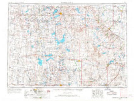
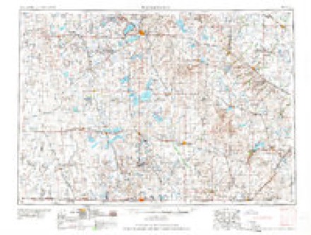
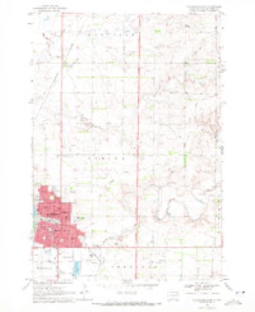
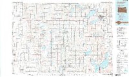
8 topographic sheets cover this place, the earliest surveyed in 1953 and the latest in 1985. It stands in Rauville Township. It lies in ZIP code area 57201. The Survey maps it on the Watertown East quadrangle.
Topographic sheets covering this place
4 surveys from 8 printed sheetsMatched by testing this settlement's coordinate against the published boundary of every sheet in the United States Geological Survey's historical collection. Each opens the scanned sheet at the Survey.
- 1953 USGS Watertown quadrangle1:250000, 3 printings
- 1958 USGS Watertown quadrangle1:250000, 2 printings
- 1969 USGS Watertown East quadrangle1:24000
- 1985 USGS Watertown quadrangle1:100000, 2 printings
Fires near this place
29 since 1999Regional context, not property-specific evidence. The federal wildfire occurrence database lists 29 fires within 5 miles of Rauville between 1999 and 2014, burning about 206 acres in total. None started naturally. 2 were recorded as arson. Distance is straight-line from the map coordinates, so a fire counted here may appear on a neighbouring settlement's page as well.
| Reported cause | Fires |
|---|---|
| Missing data/not specified/undetermined | 14 |
| Debris and open burning | 7 |
| Equipment and vehicle use | 4 |
| Arson/incendiarism | 2 |
| Misuse of fire by a minor | 1 |
| Fireworks | 1 |
The most recent of them, most recent first, with the day each was reported and the service that recorded it.
| Date | Cause | Size | Reported by | Name on the report |
|---|---|---|---|---|
| 3 September 2011 | Arson/incendiarism | 1.0 acres | South Dakota Wildland Fire Suppression | I-29 MM 171 |
| 29 September 2011 | Missing data/not specified/undetermined | 4.0 acres | South Dakota Wildland Fire Suppression | RAUVILLE |
| 19 September 2012 | Equipment and vehicle use | 1.0 acres | South Dakota Wildland Fire Suppression | 128TH AND 458TH |
| 5 August 2012 | Missing data/not specified/undetermined | 2.0 acres | South Dakota Wildland Fire Suppression | SCHMEICHEL |
| 25 August 2003 | Missing data/not specified/undetermined | under an acre | South Dakota Wildland Fire Suppression | not named |
| 9 July 2008 | Misuse of fire by a minor | 1.0 acres | South Dakota Wildland Fire Suppression | not named |
| 5 July 2006 | Fireworks | 2.0 acres | South Dakota Wildland Fire Suppression | not named |
| 15 July 2005 | Debris and open burning | under an acre | South Dakota Wildland Fire Suppression | not named |
Settlements close enough to share some of these fires:
Mines and quarries near this place
4 within 5 milesRegional context, not property-specific evidence. The federal mineral resources record lists 4 workings within 5 miles of Rauville: 4 past producers. None of them still produces. What was taken out: Sand and Gravel, Construction. Distance is straight-line from the map coordinates, so a quarry counted here may appear on a neighbouring settlement's page as well.
| Where | Site | Commodity | Status | Recorded |
|---|---|---|---|---|
| Gravel Pit | Sand and Gravel, Construction | Past Producer | ||
| Gravel Pit | Sand and Gravel, Construction | Past Producer | ||
| Gravel Pit | Sand and Gravel, Construction | Past Producer | ||
| Gravel Pit | Sand and Gravel, Construction | Past Producer |
Storms near this place
44 since 1996Regional context, not property-specific evidence. The National Weather Service names Rauville in 44 storm reports between 1996 and 2025: 28 flood, 9 hail, 3 thunderstorm wind, 2 tornado. No death or injury is recorded in these reports. Each account below is quoted exactly as the forecast office filed it, from the NOAA Storm Events Database, and each date opens the federal record of that event.
| When | Event | Place named | Harm | What the report says |
|---|---|---|---|---|
| October 1997 | Thunderstorm Wind | Rauville | $25,000 | A 32 by 120 foot shelter was destroyed. |
| July 2025 | Flood | Rauville | - | Due to heavy rainfall from persistent thunderstorms, the South Branch Tributary of Mud Creek near Rauville went into flood and crested at 5.13 feet, 1.13 feet above flood stage. This was the 5th highest crest on record for this location. The COOP observer in Rauville measured 3.68 inches of rain. |
| July 2025 | Flood | Rauville | - | Mud Creek near Rauville would briefly flood on the morning of July 28th, cresting at 9.15 or 0.15 inches above flood stage, before quickly dropping below flood stage. |
| July 2025 | Flood | Rauville | - | Willow Creek near Watertown would go into flood due to heavy rain from persistent thunderstorms. The creek would crest July 28th during the mid-morning hours, dropping below flood during the afternoon of the same day. A crest of 10.64 feet was observed, 0.64 feet above flood stage. |
| July 2025 | Flood | Rauville | - | Following 1.22 inches of rainfall measured by the COOP observer in Watertown, the South Branch Tributary of Mud Creek near Rauville rose above flood stage. The river crested at 4.55 feet before falling back below flood stage during the evening of July 24th. |
| August 2025 | Flood | Rauville | - | The Big Sioux River at Watertown Sioux Conifer Road gauge briefly hit flood stage for a few hours on the morning of August 23rd. |
| August 2025 | Flood | Rauville | - | The South Branch Tributary of Mud Creek near Rauville went into flood during the morning hours of August 6th. A peak crest of 4.91 feet was recorded at 1045 am CST on August 6th, with the creek falling below flood stage on the afternoon of August 7th. |
| August 2025 | Flood | Rauville | - | Willow Creek near Watertown would go into flood on the morning of August 6th, cresting at 10.88 feet, or 0.88 above flood stage by the afternoon, and drop below flood stage by that evening. |
| August 2025 | Flood | Rauville | - | Mud Creek at Rauville would go into flood during the early morning hours of August 6th, cresting in the late morning 1.34 feet above flood stage, before dropping below flood on August 7th in the afternoon. |
| August 2025 | Flood | Rauville | - | The portion of the Big Sioux River at Watertown Sioux Conifer Road went into flood at 845 am CST August 7th, cresting at 9.15 feet, or 0.15 feet above flood stage. The river fell below flood at 9 pm CST August 7th with the flooding primarily limited to low spots. |
| August 2025 | Flood | Rauville | - | The South Branch Tributary Mud Creek near Rauville went into flood during the early morning hours of August 22nd, cresting at 4.91 feet, 0.91 feet above flood stage around mid-day. The creek would remain in flood through the early afternoon of August 23rd. |
| August 2025 | Flood | Rauville | - | Willow Creek near Watertown went into flood on the evening of August 21st, topping out at 12.86 feet, or 2.86 feet above flood stage during the early morning hours of August 22nd before slowly falling, dropping below flood stage at 1230 AM August 23rd. |
| July 2024 | Flood | Rauville | - | The South Branch Tributary Mud Creek near Rauville rose above flood stage during the early morning hours of July 5th, peaking at 4.64 feet at 1015am CST, which is 0.64 feet above flood stage, before falling back below flood stage on July 6th at 345am CST. |
| July 2024 | Thunderstorm Wind | Rauville | - | A trained spotter indicated wind gusts from storms had reached 60 mph. |
| July 2024 | Flood | Rauville | - | Mud Creek near Rauville rose above flood stage on July 5th at 1145am CST, cresting at 9.30 feet, or 0.3 feet above flood stage on July 5th at 5pm, before slowly falling below flood stage on July 6th at 330am CST. |
| April 2023 | Flood | Rauville | - | The Big Sioux river gauge in Watertown at Sioux Conifer Road peaked on the afternoon of April 12th at 10.9 which is moderate flood stage. This only affected pasture land in the area. |
| April 2023 | Flood | Rauville | - | Mud Creek near Rauville peaked at 10.46 feet, 1.46 feet above flood stage. |
| April 2023 | Flood | Rauville | - | The South Branch Tributary Mud Creek near Rauville crested at 4.54 feet. The main impact was inundation of agricultural lands. |
| April 2023 | Flood | Rauville | - | Willow Creek near Watertown hit flood stage in the early afternoon of April 11th, increasing to 15.90 feet later during the overnight hours. This is 5.9 feet above flood stage and mainly affected agricultural lands. |
| May 2022 | Tornado (EF1) | Rauville | - | A tornado occurred 4 miles north of Lake Kampeska. The tornado|hit the northeast side of a house and removed the the garage from|the house, along with part of the roof. The garage was tossed to|the north. An outbuilding to the north of the house was also|destroyed and thrown to the north and northwest. The debris was|scattered at least a half mile north and northwest of the|location of the house. The family sought shelter in the basement|of the home and they were safe. |
| July 2009 | Thunderstorm Wind | Rauville | - | A large tree was downed by an estimated seventy mph wind. |
| June 2025 | Flood | Rauville | - | no account filed |
| July 2025 | Hail | Rauville | - | no account filed |
| June 2024 | Flood | Rauville | - | no account filed |
| June 2024 | Flood | Rauville | - | no account filed |
| June 2024 | Flood | Rauville | - | no account filed |
| May 2022 | Flood | Rauville | - | no account filed |
| September 2022 | Hail | Rauville | - | no account filed |
| June 2020 | Funnel Cloud | Rauville | - | no account filed |
| June 2020 | Funnel Cloud | Rauville | - | no account filed |
| March 2019 | Flood | Rauville | - | no account filed |
| April 2019 | Flood | Rauville | - | no account filed |
| August 2019 | Flood | Rauville | - | no account filed |
| August 2019 | Flood | Rauville | - | no account filed |
| September 2019 | Flood | Rauville | - | no account filed |
| August 2017 | Hail | Rauville | - | no account filed |
| August 2016 | Hail | Rauville | - | no account filed |
| July 2011 | Hail | Rauville | - | no account filed |
| March 2009 | Flood | Rauville | - | no account filed |
| July 2008 | Hail | Rauville | - | no account filed |
| July 2007 | Hail | Rauville | - | no account filed |
| July 2007 | Hail | Rauville | - | no account filed |
| July 2001 | Hail | Rauville | - | no account filed |
| May 1996 | Tornado (F0) | Rauville | - | no account filed |
Nearest settlements
The eight closest, with where each one stands in the county. Distances are straight-line, computed from the Geographic Names Information System coordinates.
| Map | Place | Distance | Sheets |
|---|---|---|---|
| Green Trees Subdivision | 3.5 miles | 8 | |
| Watertown | 5.6 miles | 8 | |
| North Shore | 5.8 miles | 8 | |
| Waverly | 7.2 miles | 8 | |
| Foley | 9.9 miles | 8 | |
| Kampeska | 11.0 miles | 8 | |
| Kranzburg | 11.6 miles | 8 | |
| Appleby | 11.6 miles | 8 |
Elsewhere
Matched on this settlement's Geographic Names Information System number rather than its name, so it cannot be a different place of the same name in another state.
| Wikidata item Q122549832 | The structured record the population and elevation above come from. Public domain (CC0). |
Provenance
This settlement is recorded in the Geographic Names Information System as feature 1261132. The sheet list is computed by point-in-boundary test against the United States Geological Survey's historical topographic inventory. Both are works of the United States government and carry no copyright under 17 U.S.C. 105.
Wildfire. Short, Karen C. 2022. Spatial wildfire occurrence data for the United States, 1992-2020 [FPA_FOD_20221014]. 6th Edition. Fort Collins, CO: Forest Service Research Data Archive. https://doi.org/10.2737/RDS-2013-0009.6 Collected with United States Government funding and usable without additional permissions or fees.
Mines and quarries. USGS Mineral Resources Data System (MRDS) https://mrdata.usgs.gov/mrds/ A work of the United States government, no copyright under 17 U.S.C. 105.
Storms. NOAA National Centers for Environmental Information, Storm Events Database https://www.ncei.noaa.gov/stormevents/ A work of the United States government, no copyright under 17 U.S.C. 105. Narratives are quoted verbatim from the National Weather Service report and are not edited or summarised.