 Block
Red Elm, South Dakota
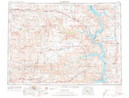
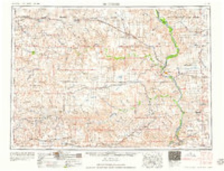
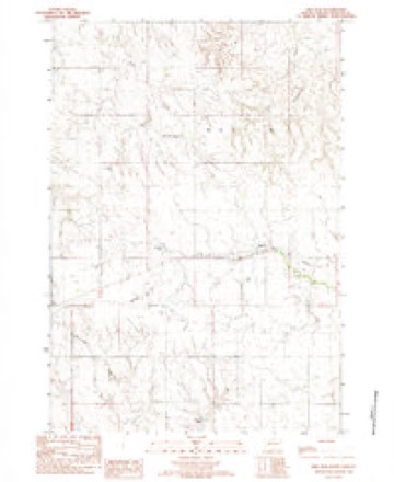
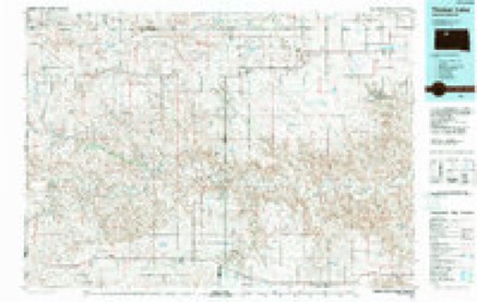
7 topographic sheets cover this place, the earliest surveyed in 1953 and the latest in 1986. It stands in the South Ziebach unorganized territory. It lies in ZIP code area 57623. The Survey maps it on the Red Elm quadrangle.
Topographic sheets covering this place
4 surveys from 7 printed sheetsMatched by testing this settlement's coordinate against the published boundary of every sheet in the United States Geological Survey's historical collection. Each opens the scanned sheet at the Survey.
- 1953 USGS McIntosh quadrangle1:250000, 3 printings
- 1958 USGS McIntosh quadrangle1:250000
- 1982 USGS Red Elm quadrangle1:24000
- 1986 USGS Timber Lake quadrangle1:100000, 2 printings
Fires near this place
35 since 1996Regional context, not property-specific evidence. The federal wildfire occurrence database lists 35 fires within 5 miles of Red Elm between 1996 and 2020, burning about 526 acres in total. 9 started naturally. 2 were recorded as arson. Distance is straight-line from the map coordinates, so a fire counted here may appear on a neighbouring settlement's page as well.
| Reported cause | Fires |
|---|---|
| Equipment and vehicle use | 10 |
| Natural | 9 |
| Missing data/not specified/undetermined | 7 |
| Power generation/transmission/distribution | 3 |
| Other causes | 2 |
| Arson/incendiarism | 2 |
| Debris and open burning | 2 |
The most recent of them, most recent first, with the day each was reported and the service that recorded it.
| Date | Cause | Size | Reported by | Name on the report |
|---|---|---|---|---|
| 9 September 1998 | Natural | 53 acres | Cheyenne River Agency | RUSS |
| 9 September 1998 | Natural | 54 acres | Cheyenne River Agency | BIGLER |
| 5 September 2000 | Natural | 23 acres | Cheyenne River Agency | SHOWER2 |
| 5 September 2000 | Natural | 1.4 acres | Cheyenne River Agency | SHOWER1 |
| 5 September 1996 | Natural | under an acre | Cheyenne River Agency | EATONS |
| 25 September 2017 | Missing data/not specified/undetermined | under an acre | South Dakota Wildland Fire Suppression | HOT BALE FIRE |
| 19 September 2005 | Missing data/not specified/undetermined | 160 acres | South Dakota Wildland Fire Suppression | not named |
| 15 September 2017 | Other causes | under an acre | Cheyenne River Agency | HOT BALE |
Settlements close enough to share some of these fires:
Storms near this place
60 of 91 shownRegional context, not property-specific evidence. The National Weather Service names Red Elm in 91 storm reports between 2002 and 2024: 45 thunderstorm wind, 35 hail, 7 tornado, 2 flood. No death or injury is recorded in these reports. Each account below is quoted exactly as the forecast office filed it, from the NOAA Storm Events Database, and each date opens the federal record of that event.
| When | Event | Place named | Harm | What the report says |
|---|---|---|---|---|
| May 2019 | Flash Flood | Red Elm | $750,000 | Three to five inches of rain fell in about two hours over portions of southern Ziebach County, causing rapid rises on small creeks and overland flooding of rural areas. Several county and BIA roads were washed out, including Dupree Road and BIA 9. US Highway 212 near mile marker 121 was also inundated. |
| May 2009 | Tornado (EF1) | Red Elm | $100,000 | A tornado touched down west of Dupree and tracked eastward before dissipating northeast of Dupree. It dented several grain bins, blew over a small mobile home and semi trailer truck, tore sheet metal off sheds, and toppled a large communications tower. |
| June 2012 | Thunderstorm Wind | Red Elm | $10,000 | The combination of hail and wind damaged a house and vehicles. |
| June 2010 | Tornado (EF1) | Red Elm | $10,000 | Another tornado touched down southwest of Dupree and crossed U.S. Highway 212. It blew down several power poles. A small satellite tornado was observed at 1730 MST. |
| June 2012 | Hail | Red Elm | $10,000 | no account filed |
| August 2011 | Thunderstorm Wind | Red Elm | $5,000 | A spotter estimated wind gusts reached 80 mph. |
| June 2012 | Hail | Red Elm | $5,000 | no account filed |
| July 2012 | Thunderstorm Wind | Red Elm | $2,000 | Large tree branches were downed by the wind and steel siding was ripped off a barn. |
| June 2024 | Thunderstorm Wind | Red Elm | - | The spotter estimated wind gusts at 60 mph. |
| June 2023 | Flash Flood | Red Elm | - | Four to six inches of rain fell in three hours between Red Elm and Dupree. The water quickly entered Bear Creek, which became about a quarter mile wide; inundating roads, fields, crops, and outbuildings. Water approached a residence near Red Elm and a home near Dupree. Water covered portions of 216th Avenue and 217th Avenue. |
| June 2023 | Flood | Red Elm | - | The flash flooding transitioned to flooding as high flows continued on Bear Creek after four to six inches of rain fell in three hours between Red Elm and Dupree. Bear Creek was reported to be a quarter mile wide in spots; which inundated roads, fields, crops, and outbuildings. Water approached a residence near Red Elm and a home near Dupree. Water covered portions of 216th Avenue and 217th Avenue. |
| May 2022 | Thunderstorm Wind | Red Elm | - | The spotter estimated wind gusts near 70 mph. |
| June 2021 | Thunderstorm Wind | Red Elm | - | The spotter estimated wind gusts at near 80 mph. |
| May 2021 | Thunderstorm Wind | Red Elm | - | The spotter estimated wind gusts at 60 mph. |
| June 2020 | Thunderstorm Wind | Red Elm | - | The spotter estimated wind gusts at 60 mph. |
| June 2020 | Thunderstorm Wind | Red Elm | - | Wind gusts were estimated at 60 mph. |
| May 2019 | Flood | Red Elm | - | As the flash flooding ended, minor flooding continued along area creeks, with overland flooding of rural areas. |
| July 2019 | Thunderstorm Wind | Red Elm | - | The spotter estimated wind gusts at 60 mph. |
| September 2019 | Thunderstorm Wind | Red Elm | - | The spotter estimated gusts at 60 mph. |
| August 2016 | Thunderstorm Wind | Red Elm | - | The spotter estimated wind gusts reached 60 mph. |
| June 2012 | Thunderstorm Wind | Red Elm | - | Wind gusts were estimated around 60 mph. |
| June 2012 | Thunderstorm Wind | Red Elm | - | The spotter estimated wind gusts at 60 mph. |
| July 2012 | Thunderstorm Wind | Red Elm | - | Wind gusts were estimated at 70 mph. |
| July 2012 | Thunderstorm Wind | Red Elm | - | Wind gusts were estimated at 60 mph. |
| August 2011 | Thunderstorm Wind | Red Elm | - | Wind gusts were estimated at 70 mph. |
| April 2010 | Thunderstorm Wind | Red Elm | - | Wind gusts were estimated at 60 mph. |
| June 2010 | Hail | Red Elm | - | A storm chaser observed half dollar sized hail, with some stones the size of tennis balls. |
| June 2010 | Tornado (EF0) | Red Elm | - | A small tornado briefly touched down south of Red Elm. |
| June 2010 | Tornado (EF0) | Red Elm | - | A small tornado briefly touched down southwest of Dupree. Two small needle-shaped satellite tornadoes were observed in the same area at 1640 MST and 1641 MST. |
| May 2009 | Tornado (EF0) | Red Elm | - | A storm chaser briefly observed a small tornado before rain obscured his view. Its location, length, and width were estimated. No damage was reported. |
| July 2008 | Tornado (EF1) | Red Elm | - | A tornado touched down just east of Rattlesnake Butte in western Ziebach County. It traveled southeastward across open range and dissipated near Cherry Creek Road south of Dupree. The tornado caused no damage, but apparently picked up several cattle that were killed when they hit the ground. Several more cattle were injured. |
| July 2008 | Tornado (EF0) | Red Elm | - | A smaller rope tornado developed behind the large tornado. Its path location, length, and width were estimated from spotter reports and photographs. |
| June 2021 | Thunderstorm Wind | Red Elm | - | no account filed |
| June 2021 | Thunderstorm Wind | Red Elm | - | no account filed |
| June 2021 | Thunderstorm Wind | Red Elm | - | no account filed |
| June 2021 | Thunderstorm Wind | Red Elm | - | no account filed |
| July 2021 | Thunderstorm Wind | Red Elm | - | no account filed |
| August 2021 | Hail | Red Elm | - | no account filed |
| July 2020 | Hail | Red Elm | - | no account filed |
| June 2020 | Thunderstorm Wind | Red Elm | - | no account filed |
| June 2020 | Thunderstorm Wind | Red Elm | - | no account filed |
| June 2019 | Thunderstorm Wind | Red Elm | - | no account filed |
| June 2019 | Thunderstorm Wind | Red Elm | - | no account filed |
| July 2019 | Thunderstorm Wind | Red Elm | - | no account filed |
| May 2018 | Thunderstorm Wind | Red Elm | - | no account filed |
| May 2018 | Thunderstorm Wind | Red Elm | - | no account filed |
| August 2018 | Thunderstorm Wind | Red Elm | - | no account filed |
| June 2018 | Thunderstorm Wind | Red Elm | - | no account filed |
| July 2016 | Thunderstorm Wind | Red Elm | - | no account filed |
| July 2015 | Thunderstorm Wind | Red Elm | - | no account filed |
| June 2014 | Thunderstorm Wind | Red Elm | - | no account filed |
| May 2013 | Hail | Red Elm | - | no account filed |
| May 2013 | Hail | Red Elm | - | no account filed |
| May 2013 | Hail | Red Elm | - | no account filed |
| May 2013 | Hail | Red Elm | - | no account filed |
| June 2013 | Thunderstorm Wind | Red Elm | - | no account filed |
| June 2012 | Hail | Red Elm | - | no account filed |
| June 2012 | Hail | Red Elm | - | no account filed |
| July 2012 | Hail | Red Elm | - | no account filed |
| July 2012 | Hail | Red Elm | - | no account filed |
Nearest settlements
The eight closest, with where each one stands in the county. Distances are straight-line, computed from the Geographic Names Information System coordinates.
| Map | Place | Distance | Sheets |
|---|---|---|---|
| Iron Lightning | 9.2 miles | 7 | |
| Dupree | 9.7 miles | 7 | |
| Chase | 11.4 miles | 6 | |
| Allison Crossing | 12.2 miles | 7 | |
| Thunder Butte | 12.4 miles | 8 | |
| Red Scaffold | 20.1 miles | 6 | |
| Glad Valley | 23.7 miles | 8 | |
| Cherry Creek | 34.5 miles | 8 |
Provenance
This settlement is recorded in the Geographic Names Information System as feature 1257307. The sheet list is computed by point-in-boundary test against the United States Geological Survey's historical topographic inventory. Both are works of the United States government and carry no copyright under 17 U.S.C. 105.
Wildfire. Short, Karen C. 2022. Spatial wildfire occurrence data for the United States, 1992-2020 [FPA_FOD_20221014]. 6th Edition. Fort Collins, CO: Forest Service Research Data Archive. https://doi.org/10.2737/RDS-2013-0009.6 Collected with United States Government funding and usable without additional permissions or fees.
Storms. NOAA National Centers for Environmental Information, Storm Events Database https://www.ncei.noaa.gov/stormevents/ A work of the United States government, no copyright under 17 U.S.C. 105. Narratives are quoted verbatim from the National Weather Service report and are not edited or summarised.