 Block
From the record
One of 107 National Register listings published here for Minnehaha County · listed in 2000 · category: District.
Sources: the case file at the National Archives · the National Register database, National Park Service
Listed on the National Register of Historic Places in 2000.
One of 107 National Register listings published here for Minnehaha County · listed in 2000 · category: District.
Sources: the case file at the National Archives · the National Register database, National Park Service
The chapter on Dell Rapids City in History of Minnehaha County, South Dakota. Containing an Account of Its Settlements, Growth, Development and Resources ... Synopsis of Public Records, Biographical Sketches .., published 1899 names Dell Rapids. This is what it says, exactly as the scans read.
The citv of Dell Rapids located on the Big- Sioux River, in the northern part of the county, is one of the most attractive and substantial cities in the state." Its development has been the outgrowth of a demand for a commercial center in one of the richest agricultural sections of the Big Sioux Valley. It fortunately has had no boom, and hence has escaped the blig-hting- effect that is sure to follow such a visitation. Business failures have been few and far between, and dilapidated structures and unoccupied buildings are not to be seen at Dell Rapids.
Passage source: History of Minnehaha County, South Dakota. Containing an Account of Its Settlements, Growth, Development and Resources ... Synopsis of Public Records, Biographical Sketches .., published 1899.
At first the place was known as Dell City, and among- the early enterprises was the publication of the Dell City Journal by J. C. Ervin in the spring- of 1872. On June 11, of that year, Mr. Ervin was married to Miss Clara Wyatt, the Rev. C. M. Allen, a Presbyterian clerg-ymen, performing- the marriag-e cermony. Their daug-hter Pearl was the first child born in Dell Rapids and the principal business street was named for her.
Passage source: History of Minnehaha County, South Dakota. Containing an Account of Its Settlements, Growth, Development and Resources ... Synopsis of Public Records, Biographical Sketches .., published 1899.
Machine-read from a century-old scan, so expect the errors a machine makes: misspelled names, dropped words, stray characters.
Read the whole chapter on Dell Rapids City - 26,908 words on its settlement, mills, schools and churches.
Regional context, not property-specific evidence. The federal wildfire occurrence database lists 9 fires within 5 miles of Dell Rapids Residential Historic District between 2003 and 2014, burning about 56 acres in total. None started naturally. None was recorded as arson. Distance is straight-line from the map coordinates, so a fire counted here may appear on a neighbouring settlement's page as well.
| Reported cause | Fires |
|---|---|
| Missing data/not specified/undetermined | 3 |
| Smoking | 3 |
| Equipment and vehicle use | 2 |
| Debris and open burning | 1 |
The most recent of them, most recent first, with the day each was reported and the service that recorded it.
| Date | Cause | Size | Reported by | Name on the report |
|---|---|---|---|---|
| 4 September 2014 | Missing data/not specified/undetermined | 25 acres | South Dakota Wildland Fire Suppression | DOUG KOUPAL SR. |
| 1 August 2012 | Equipment and vehicle use | 2.0 acres | South Dakota Wildland Fire Suppression | I-29 MM100 |
| 21 July 2006 | Smoking | 1.0 acres | South Dakota Wildland Fire Suppression | not named |
| 27 April 2007 | Smoking | 12 acres | South Dakota Wildland Fire Suppression | not named |
| 27 April 2007 | Smoking | 12 acres | South Dakota Wildland Fire Suppression | not named |
| 22 April 2008 | Missing data/not specified/undetermined | 1.5 acres | South Dakota Wildland Fire Suppression | not named |
| 19 March 2012 | Equipment and vehicle use | 2.0 acres | South Dakota Wildland Fire Suppression | MLS |
| 17 March 2003 | Missing data/not specified/undetermined | under an acre | South Dakota Wildland Fire Suppression | not named |
Regional context, not property-specific evidence. The federal mineral resources record lists 3 workings within 5 miles of Dell Rapids Residential Historic District: 1 past producer, 1 producer, 1 unknown. 1 still produces. What was taken out: Sand and Gravel, Construction, Stone, Crushed/Broken. Distance is straight-line from the map coordinates, so a quarry counted here may appear on a neighbouring settlement's page as well.
| Where | Site | Commodity | Status | Recorded |
|---|---|---|---|---|
| Dell Rapids Quarry | Stone, Crushed/Broken | Producer | ||
| Gravel Pit | Sand and Gravel, Construction | Unknown | ||
| Nelson Gravel Pit | Sand and Gravel, Construction | Past Producer |
Regional context, not property-specific evidence. The National Weather Service names Dell Rapids, the town this property stands in, in 61 storm reports between 2000 and 2025: 29 flood, 18 hail, 13 thunderstorm wind, 1 flash flood. No death or injury is recorded in these reports. Each account below is quoted exactly as the forecast office filed it, from the NOAA Storm Events Database, and each date opens the federal record of that event.
| When | Event | Place named | Harm | What the report says |
|---|---|---|---|---|
| September 2019 | Flood | Dell Rapids | $750,000 | After excessive two-day rainfall during September 10-12 (8.74 inches at Flandreau, 7.81 inches at Dell Rapids), the Big Sioux River above Dell Rapids (gage site DBRS2) reached the highest stage on record of 9.00 feet above flood stage on September 13. Extensive flooding of homes occurred in Dell Rapids, some as far as three city blocks from the river. A dozen homes were deemed to have substantial damage, and removed after being flooded. Jasper Road east of Dell Rapids was closed due to water over the roadway. |
| September 2019 | Flood | Dell Rapids | $200,000 | After excessive two-day rainfall during September 10-12 (8.74 inches at Flandreau, 7.81 inches at Dell Rapids), the Big Sioux River below Dell Rapids (gage site DERS2) reached the highest stage on record of 4.72 feet above flood stage on September 13. Numerous county roads were inundated, and flood waters cut off all access to the city of Baltic except one. |
| September 2010 | Flood | Dell Rapids | $100,000 | Widespread heavy rain, combined with saturated ground, caused a fairly rapid rise of the Big Sioux River to moderate to major flooding levels. Roads and numerous agricultural land near the river were flooded, as well as a several homes, especially near Dell Rapids. Parkland in Sioux Falls was also flooded. The river crested at 5.59 feet above flood stage at the North Cliff Avenue gage in Sioux Falls on September 27th. |
| April 2001 | Thunderstorm Wind | Dell Rapids | $20,000 | no account filed |
| September 2005 | Thunderstorm Wind | Dell Rapids | $10,000 | Thunderstorm winds flattened two grain bins and also caused tree and power line damage, resulting in a power outage. A few trees were blown down, with at least one house sustaining minor damage from tree debris. |
| July 2025 | Thunderstorm Wind | Dell Rapids | - | Thunderstorm winds caused a wood frame on new outbuilding construction to collapse. |
| July 2024 | Flood | Dell Rapids | - | Flooding continued from June on the Big Sioux River near Dell Rapids, with declining river levels. The river fell below flood stage on the afternoon of July 1st. |
| June 2024 | Flood | Dell Rapids | - | The Big Sioux River above Dell Rapids rose above flood stage the afternoon of June 22nd, cresting around 1.29 feet above flood stage (1482.29 feet) on June 24th. The river then fell below flood stage on the evening of June 26th. For a more comprehensive description of flood damage, please see other entries for Minnehaha County. |
| June 2024 | Flood | Dell Rapids | - | The Big Sioux River below Dell Rapids rose above flood stage the evening of June 22nd, cresting around 1.82 feet above flood stage (13.82 feet) on June 24th. The river stayed above flood stage into July. For a more comprehensive description of flood damage, please see other entries for Minnehaha County. |
| April 2023 | Flood | Dell Rapids | - | The Big Sioux River above Dell Rapids, SD rose above flood stage on the evening of April 9th before cresting around 0.62 feet above flood stage (1481.62 feet) on April 10th. The river then fell below flood stage on the evening of April 10th. |
| April 2023 | Flood | Dell Rapids | - | The Big Sioux River near Dell Rapids, SD rose back above flood stage around midday of April 13th before falling back below flood stage around midday of April 17th. |
| April 2023 | Flood | Dell Rapids | - | The Big Sioux River near Dell Rapids, SD rose above flood stage on the evening of April 9th before cresting around 1.33 feet above flood stage (13.33 feet) on April 10th. The river then fell below flood stage on the afternoon of April 11th before then rising back above flood stage on April 13th. |
| May 2022 | Thunderstorm Wind | Dell Rapids | - | Highway patrol reported a semi-trailer flipped one mile north of Dell Rapids. |
| May 2022 | Thunderstorm Wind | Dell Rapids | - | A thunderstorm wind gust of 65 mph was measured by South Dakota Road Weather Information System site SD520 3 miles west of Dell Rapids. |
| May 2022 | Thunderstorm Wind | Dell Rapids | - | A thunderstorm wind gust of 58 mph was measured by the South Dakota Road Weather Information System site SD520 3 miles west of Dell Rapids. |
| July 2022 | Thunderstorm Wind | Dell Rapids | - | Multiple trees and large branches downed by thunderstorm wind gusts. |
| May 2022 | Thunderstorm Wind | Dell Rapids | - | Thunderstorm winds downed several trees and damaged an outbuilding at the high school. |
| May 2022 | Thunderstorm Wind | Dell Rapids | - | A large farm outbuilding lost a significant portion of its roof, allowing the walls to collapse. Three nearby grain bins were also damaged. |
| August 2021 | Thunderstorm Wind | Dell Rapids | - | Thunderstorm wind gusts were measured by a South Dakota RWIS station 3 miles west of Dell Rapids, before structural damage rendered the wind gauge inoperable. Crop damage is an estimate from insured losses. Information provided by the United States Department of Agriculture. |
| March 2020 | Flood | Dell Rapids | - | With rainfall of 1.55 inches 14 miles north northeast of Sioux Falls, the Big Sioux River below Dell Rapids (gage site DERS2) returned to flood late month. The river crested at 0.13 feet above flood stage with flooding of agricultural lands near the river. The river remained at minor flood stage at the end of the month. |
| March 2020 | Flood | Dell Rapids | - | The Big Sioux River below Dell Rapids (gage site DERS2) rose above flood stage on March 9 and crested 1.33 feet above flood stage on March 14. Impacts were limited to flooding of agricultural lands between Renner and Dell Rapids. |
| April 2020 | Flood | Dell Rapids | - | A continuation of flooding from March, the Big Sioux River below Dell Rapids (gage site DERS2) began the month 0.16 feet above flood stage, and slowly fell below flood stage by April 4. Main impact continued to be flooding of agricultural lands near the river. |
| March 2019 | Flood | Dell Rapids | - | Snow melt and heavy rainfall (measured 2.01 inches 7 miles west of Garretson and 2.25 inches at Colton) resulted in extensive flooding of agricultural lands and inundation of city and township roads in and near Dell Rapids, Baltic and Renner. The Big Sioux River near Dell Rapids (gage site DERS2) reached the 4th highest stage on record cresting 4.92 feet above flood stage on March 24. The river remained at moderate flood stage at the end of the month. |
| June 2019 | Flood | Dell Rapids | - | A continuation of flooding from May, the Big Sioux River above Dell Rapids (gage site DBRS2) began the month at 1.45 feet above flood stage. Significant amounts of agricultural land remained flooded, and further impeded spring planting. |
| June 2019 | Flood | Dell Rapids | - | A continuation of flooding from May, the Big Sioux River near Dell Rapids (gage site DERS2) began the month at 1.52 feet above flood stage. Significant amounts of agricultural land remained flooded, and further impeded spring planting. |
| July 2019 | Flood | Dell Rapids | - | The Big Sioux River above Dell Rapids (gage site DBRS2) crested 1.16 feet above flood stage on July 16, resulting in significant flooding of agricultural land upstream of Dell Rapids, and inundating sections of the city park along the river. |
| July 2019 | Flood | Dell Rapids | - | The Big Sioux River below Dell Rapids (gage site DERS2) crested 1.38 feet above flood stage on July 16, flooding significant amounts of agricultural land. |
| July 2019 | Thunderstorm Wind | Dell Rapids | - | Measured by RWIS station. |
| May 2019 | Flood | Dell Rapids | - | This is a continuation of flooding from April. The Big Sioux River above Dell Rapids (gage site DBRS2) spent all but a brief period from May 17-20 in flood. Late month rains pushed the river to a crest into moderate flood stage at 3.04 feet above flood stage on May 29. Significant agricultural flooding persisted, with no opportunity for spring planting throughout the flood plain. Recreational areas at Dell Rapids along the river were inundated. The river remained at minor flood stage at the end of the month. |
| May 2019 | Flood | Dell Rapids | - | This is a continuation of flooding from April. The Big Sioux River near Dell Rapids (gage site DERS2) remained in flood stage through the month. A period of heavier rainfall late month pushed the river to briefly crest at moderate flood stage, 2.14 feet above flood stage on May 29. Significant agricultural flooding persisted, with no opportunity for spring planting throughout the flood plain. Recreational areas at Dell Rapids along the river were inundated. The river remained at minor flood stage at the end of the month. |
| April 2019 | Flood | Dell Rapids | - | Runoff from occasional precipitation in late March and April maintained significant flooding of agricultural and pasture lands near the Big Sioux River. Numerous county and township roads were flooded near the river, including 250th Street west of Baltic. The Big Sioux River near Dell Rapids (gage site DERS2) crested twice at moderate flood stage during the month. The first crest was 2.82 feet above flood stage on April 1, with a second crest at 2.47 feet above flood stage on April 20. Minor flooding continued at the end of the month. |
| April 2018 | Flood | Dell Rapids | - | Snow melt and runoff from periods of heavier rainfall produced moderate flooding which produced significant impact to lowland agricultural areas and the city park in Dell Rapids. River levels reached 2.2 feet above flood stage at Dell Rapids (gage site DERS2) on April 27. The river remained at minor flood stage at the end of the month. |
| July 2018 | Flood | Dell Rapids | - | Significant amounts of crop and pasture land were impacted by minor flooding as river levels climbed to 0.1 foot above flood stage near Dell Rapids (gage site DERS2) on July 25. |
| March 2018 | Flood | Dell Rapids | - | Runoff from rainfall, snow melt, and ice breakup caused minor flooding of lowland agricultural areas along middle portions of the Big Sioux River. The river reached a crest of 0.9 feet above flood stage near Dell Rapids (gage site DERS2) on March 24. |
| September 2017 | Thunderstorm Wind | Dell Rapids | - | Tree Damage. |
| June 2015 | Hail | Dell Rapids | - | Large hail caused an unknown amount of damage to vehicles. |
| May 2012 | Flood | Dell Rapids | - | Minor to moderate flooding of the Big Sioux River affected some farmland, parkland, and a few roads. The river crested at 2.03 feet above flood stage at Dell Rapids on May 7th, and at 1.49 feet above flood stage in Sioux Falls on May 9th. |
| July 2011 | Flood | Dell Rapids | - | Minor flooding redeveloped along the Big Sioux River, then subsided during the month. A few lowlands along the river were flooded, including some parkland in Sioux Falls. The highest stages were 1.7 feet above flood stage at Dell Rapids, and 2.0 feet above flood stage at the Sioux Falls North Cliff Avenue gage. |
| March 2010 | Flood | Dell Rapids | - | Rapid melting of a heavy winter snowpack caused flooding of the Big Sioux River which resulted in moderate flooding. Several fields and roads were flooded. The river crested at around 3 feet above flood stage near Dell Rapids on March 176th, and at 3.4 feet above flood stage at North Cliff Avenue in Sioux Falls on the same day. |
| October 2010 | Flood | Dell Rapids | - | Minor to moderate flooding of the Big Sioux River steadily abated and ended during the first few days of the month. Some roads and riverside lowlands including agricultural land and a Sioux Falls park were still flooded at the start of the month. |
| June 2010 | Flood | Dell Rapids | - | Recurring heavy rain cause minor flooding of the Big Sioux River. A few lowland areas along the river sustained minor flooding. The river crested at less than a foot over flood stage at Dell Rapids and Sioux Falls. |
| July 2009 | Hail | Dell Rapids | - | Large hail accumulated to a depth of up to 2 inches. The hail severely damaged soybean crops and caused lesser damage to corn crops. The amount of crop damage was not known. |
| March 2007 | Flood | Dell Rapids | - | Warm temperatures caused a rapid snowmelt which caused the Big Sioux River to rise above flood stage for several days. The flooding was minor to moderate and no significant damage was reported. The river crested at 4 feet above flood stage at Dell rapids on March 16th. The snowmelt also caused brief flooding on Split Rock creek near Corson, which crested at 1.4 feet above flood stage on March 12th. |
| July 2007 | Thunderstorm Wind | Dell Rapids | - | Thunderstorm winds damaged corn crops, The amount of crop damage was not known. |
| June 2005 | Flash Flood | Dell Rapids | - | Heavy rain caused widespread street flooding. |
| July 2002 | Hail | Dell Rapids | - | Large hail caused crop and vehicle damage. The amount of damage was not known. |
| July 2023 | Hail | Dell Rapids | - | no account filed |
| August 2021 | Hail | Dell Rapids | - | no account filed |
| June 2015 | Hail | Dell Rapids | - | no account filed |
| May 2014 | Hail | Dell Rapids | - | no account filed |
| August 2011 | Hail | Dell Rapids | - | no account filed |
| July 2009 | Hail | Dell Rapids | - | no account filed |
| July 2005 | Hail | Dell Rapids | - | no account filed |
| August 2005 | Hail | Dell Rapids | - | no account filed |
| September 2005 | Hail | Dell Rapids | - | no account filed |
| May 2004 | Hail | Dell Rapids | - | no account filed |
| April 2002 | Hail | Dell Rapids | - | no account filed |
| April 2002 | Hail | Dell Rapids | - | no account filed |
| April 2002 | Hail | Dell Rapids | - | no account filed |
| June 2001 | Hail | Dell Rapids | - | no account filed |
No historic map-sheet match is published for this property yet. That does not mean no map exists. This record needs a coordinate-quality review before it can be joined to a sheet boundary. Browse the county's mapped places while that work is pending.
Other National Register properties close enough to walk or drive between, ordered by distance from this one. Both positions come from the same geocoding pass that matched these properties to their map sheets.
| Photograph | Property | Distance | Listed |
|---|---|---|---|
 | Carnegie Free Public Library | 0.2 miles | 1973 |
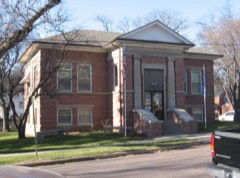 | Carnegie Public Library | 0.2 miles | 1986 |
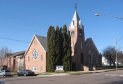 | St. Peter's Lutheran Church | 0.3 miles | 2002 |
| Grand Opera House | 0.3 miles | 1978 | |
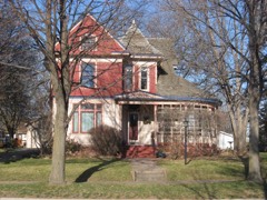 | William G. Milne House | 0.3 miles | 1994 |
| Dell Rapids Warming House | 0.3 miles | 2017 |
| National Archives record | The nomination case file for reference 00001224 in Record Group 79. |
| Minnehaha County | All 107 listed properties in this county. |