 Block
From the record
One of 23 National Register listings published here for Kingsbury County · listed in 2002 · category: Structure.
Sources: the case file at the National Archives · the National Register database, National Park Service
Listed on the National Register of Historic Places in 2002.
One of 23 National Register listings published here for Kingsbury County · listed in 2002 · category: Structure.
Sources: the case file at the National Archives · the National Register database, National Park Service
Regional context, not property-specific evidence. The federal wildfire occurrence database lists 10 fires within 5 miles of Central Dakota Flouring Mill Grain Elevator between 1999 and 2016, burning about 263 acres in total. None started naturally. None was recorded as arson. Distance is straight-line from the map coordinates, so a fire counted here may appear on a neighbouring settlement's page as well.
| Reported cause | Fires |
|---|---|
| Missing data/not specified/undetermined | 5 |
| Debris and open burning | 4 |
| Railroad operations and maintenance | 1 |
The most recent of them, most recent first, with the day each was reported and the service that recorded it.
| Date | Cause | Size | Reported by | Name on the report |
|---|---|---|---|---|
| 15 September 2012 | Missing data/not specified/undetermined | 85 acres | South Dakota Wildland Fire Suppression | HWY !4 CRP |
| 11 September 2011 | Missing data/not specified/undetermined | 2.0 acres | South Dakota Wildland Fire Suppression | DALE ROYER |
| 10 May 2004 | Railroad operations and maintenance | 31 acres | Madison Wetland Management District | DRY LAKE 04 |
| 5 April 2010 | Missing data/not specified/undetermined | 2.0 acres | South Dakota Wildland Fire Suppression | DENNIS CONVERSE FIRE |
| 28 April 2009 | Debris and open burning | 86 acres | South Dakota Wildland Fire Suppression | not named |
| 13 April 2010 | Missing data/not specified/undetermined | 4.0 acres | South Dakota Wildland Fire Suppression | DM&E ROW |
| 30 March 1999 | Debris and open burning | 20 acres | Volin Volunteer Fire Department | JOE LAQUE |
| 20 March 2016 | Debris and open burning | 3.0 acres | South Dakota Wildland Fire Suppression | OLD CAR GUY FIRE |
Regional context, not property-specific evidence. The National Weather Service names Arlington, the town this property stands in, in 31 storm reports between 1997 and 2025: 15 hail, 11 thunderstorm wind, 2 tornado, 1 lightning. No death or injury is recorded in these reports. Each account below is quoted exactly as the forecast office filed it, from the NOAA Storm Events Database, and each date opens the federal record of that event.
| When | Event | Place named | Harm | What the report says |
|---|---|---|---|---|
| July 1997 | Thunderstorm Wind | Arlington | $200,000 | Thunderstorm winds caused widespread tree, power line, and pole damage. The winds also damaged a car wash under construction, blew down road signs, and broke windows. Some vehicles were damaged, mainly by trees or tree debris. |
| June 2001 | Thunderstorm Wind | Arlington | $10,000 | Thunderstorm winds caused tree damage, breaking limbs of all sizes off trees. One tree was knocked into an electrical wire, causing a power outage which lasted several hours. |
| May 2000 | Thunderstorm Wind | Arlington | $10,000 | Thunderstorm winds caused tree damage. Trees greater than one foot in diameter were blown down. |
| August 2021 | Thunderstorm Wind | Arlington | $5,000 | Thunderstorm wind gusts caused a tree to fall on a car. Property damage costs are a rough estimate. |
| August 2002 | Lightning | Arlington | $2,000 | Lightning struck a mobile home and started a small fire. A VCR and a computer were destroyed, and a water heater was damaged. |
| August 2025 | Thunderstorm Wind | Arlington | - | Thunderstorm wind gusts were measured by a Road Weather Information System sensor 4 miles south of Arlington. |
| May 2022 | Thunderstorm Wind | Arlington | - | A thunderstorm wind gust of 73 mph was measured by the South Dakota Road Weather Information System site SD504 4 miles south of Arlington. |
| May 2022 | Thunderstorm Wind | Arlington | - | The tops of two grain silos were ripped off and crushed in. Portions of roofs were peeled off downtown, with multiple trees down throughout town. |
| August 2022 | Thunderstorm Wind | Arlington | - | Thunderstorm winds downed several limbs up to 4 inches in diameter, as well as a 12-inch diameter tree. |
| June 2022 | Thunderstorm Wind | Arlington | - | A thunderstorm wind gust of 58 mph was measured South Dakota Road Weather Information System site SD504 4 miles south of Arlington. Crop damage is an estimate from insured losses. Information provided by the United States Department of Agriculture. |
| June 2010 | Hail | Arlington | - | Hail was mostly small with a few stones up to golf ball size. |
| July 2010 | Hail | Arlington | - | Large hail stripped a few leaves off trees. |
| March 2009 | Flash Flood | Arlington | - | Rainfall of around 4 inches caused flash flooding of low areas. Parts of Highway 14 west of Arlington and Highway 81 north of Arlington were under water. Residual flooding with standing water continued into the following morning. |
| March 2009 | Flood | Arlington | - | Flooding of low areas and roads from standing water, including Highway 14 west of Arlington and Highway 81 north of Arlington, from standing water continued through most of the morning hours after heavy rain caused flash flooding in the area. |
| July 2004 | Thunderstorm Wind | Arlington | - | Thunderstorm winds caused tree damage, including numerous large branches blown down just north of State highway 14. |
| June 2004 | Thunderstorm Wind | Arlington | - | Thunderstorm winds caused tree damage, including numerous branches down. |
| July 2000 | Tornado (F0) | Arlington | - | A brief tornado caused no reported damage. |
| July 2000 | Tornado (F0) | Arlington | - | A brief tornado caused no reported damage. |
| August 2025 | Hail | Arlington | - | no account filed |
| October 2022 | Hail | Arlington | - | no account filed |
| May 2012 | Hail | Arlington | - | no account filed |
| July 2010 | Hail | Arlington | - | no account filed |
| June 2008 | Hail | Arlington | - | no account filed |
| May 2005 | Hail | Arlington | - | no account filed |
| September 2005 | Hail | Arlington | - | no account filed |
| May 2004 | Hail | Arlington | - | no account filed |
| May 2004 | Hail | Arlington | - | no account filed |
| July 2000 | Hail | Arlington | - | no account filed |
| September 1997 | Hail | Arlington | - | no account filed |
| September 1997 | Hail | Arlington | - | no account filed |
| September 1997 | Hail | Arlington | - | no account filed |
No historic map-sheet match is published for this property yet. That does not mean no map exists. This record needs a coordinate-quality review before it can be joined to a sheet boundary. Browse the county's mapped places while that work is pending.
Other National Register properties close enough to walk or drive between, ordered by distance from this one. Both positions come from the same geocoding pass that matched these properties to their map sheets.
| Photograph | Property | Distance | Listed |
|---|---|---|---|
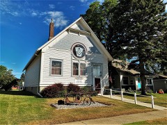 | Arlington Masonic Temple | 0.2 miles | 2017 |
 | Stark and Blanch Garage | 0.3 miles | 2007 |
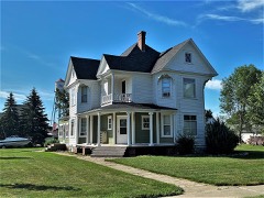 | Adam and Minnie Royhl House | 0.3 miles | 2001 |
| Hetland School | 5.3 miles | 2002 | |
| Omdalen Barn | 6.4 miles | 2006 |
| National Archives record | The nomination case file for reference 02000573 in Record Group 79. |
| Kingsbury County | All 23 listed properties in this county. |