Block
From the record
23 National Register listings published here.
Sources: the National Register database, National Park Service
22 topographic sheets cover 14 settlements here, and 23 properties are on the National Register of Historic Places.
23 National Register listings published here.
Sources: the National Register database, National Park Service
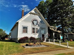
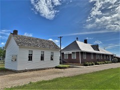
Every property in this county listed on the National Register of Historic Places, with the year it was listed and the federal nomination document.
Every wildfire the federal occurrence database records inside this county: 103 of them, burning about 1,894 acres. 3 started naturally and none was recorded as arson. Each settlement page carries the fires within five miles of it.
| Reported cause | Fires |
|---|---|
| Missing data/not specified/undetermined | 33 |
| Debris and open burning | 24 |
| Equipment and vehicle use | 23 |
| Railroad operations and maintenance | 6 |
| Smoking | 5 |
| Other causes | 4 |
| Natural | 3 |
| Recreation and ceremony | 3 |
| Misuse of fire by a minor | 1 |
| Power generation/transmission/distribution | 1 |
The five largest, by the area the report gives. None of them was recorded as arson.
| Date | Cause | Size | Reported by | Name on the report |
|---|---|---|---|---|
| 15 October 2008 | Equipment and vehicle use | 280 acres | South Dakota Wildland Fire Suppression | not named |
| 18 March 2012 | Missing data/not specified/undetermined | 250 acres | South Dakota Wildland Fire Suppression | DS03182012 |
| 17 September 2009 | Debris and open burning | 140 acres | South Dakota Wildland Fire Suppression | not named |
| 5 April 2000 | Debris and open burning | 99 acres | Desmet Volunteer Fire Department | INCIDENT #669 |
| 10 May 1999 | Debris and open burning | 90 acres | Huron Volunteer Fire Dept. | CLYDE #20 |
| 15 September 2012 | Missing data/not specified/undetermined | 85 acres | South Dakota Wildland Fire Suppression | HWY !4 CRP |
| 10 October 2000 | Equipment and vehicle use | 80 acres | Desmet Volunteer Fire Department | INDICENT #681 EXP. #4 |
| 6 September 2000 | Natural | 75 acres | Waubay Volunteer Fire Department | SOUTH OF JOE BUTLER |
Every settlement page carries the fires within five miles of it - see the settlement index below.
The NOAA Storm Events Database holds 383 reports for this county, causing no deaths, 6 injuries and about $12,742,000 in recorded property damage. Each settlement page carries the reports that name it.
| Kind of event | Reports |
|---|---|
| Hail | 186 |
| Thunderstorm Wind | 125 |
| Tornado | 47 |
| Flash Flood | 10 |
| Flood | 6 |
| Lightning | 5 |
| Heavy Rain | 4 |
The most serious of them, by death, then injury, then recorded damage. The accounts are quoted exactly as the forecast office filed them.
| When | Event | Place named | Harm | What the report says |
|---|---|---|---|---|
| June 2003 | Tornado (F4) | Esmond | 4 hurt, $3,000,000 | A tornado destroyed or heavily damaged all buildings, other structures, and vehicles in the small town of Manchester. Propane and fuel oil tanks were destroyed. Many homes were stripped to the foundation. Of the six residents of the town, four were injured and were transported to hospitals. Three were deemed to be seriously injured, but non of the injuries were life threatening. One of the injured was in a basement, one was blown out of the home on the way to the same basement, and two were in a mobile home which was destroyed. The tornado damaged crops, trees, and power lines south of Manchester prior to reaching the town. The tornado also heavily damaged several farms north of Manchester, including two farms on which several buildings including the homes were destroyed. One of the farms was a "Centennial Farm". About 12 cattle were killed and others injured. The amount of crop damage was not known. During its path, the tornado was observed to have multiple vortices. The tornado was observed and video taped by numerous storm chasers and researchers. Researchers also deployed weather sensors around the town of Manchester. One of these sensors recorded a 100 millibar pressure drop as the tornado passed. |
| July 2002 | Hail | Lake Preston | 2 hurt, $500,000 | Large hail broke windows, and heavily damaged vehicles and boats. Holes were punched by the hail in some of the boats. Two boaters on Lake Thompson were injured by the hail. One was taken to the hospital with a head injury, and the other suffered several welts on the back from hailstone hits. Crop damage also occurred, but the amount of crop damage was not known. |
| June 1992 | Tornado (F3) | not stated | $2,500,000 | no account filed |
| May 2000 | Hail | Lake Preston | $2,000,000 | Large hail caused extenseive broken windows to both buildings and vehicles, dented many vehicles, and damaged roofs and sidings of homes. Crop damage was also reported, but the amount of the damage could not be determined. |
| April 2011 | Flood | Osceola | $1,000,000 | Flooding of lakes and lowlands, including farmland, continued in the county through April. While flooding of small streams abated, lake flooding, particularly of Lakes Thompson and Henry, worsened. Numerous roads remained flooded and several were closed. Several homes were flooded, especially along Lake Thompson. High water and groundwater levels resulting from record precipitation in the previous year was the main reason that the flooding either grew worse or improved so slowly. |
| July 2002 | Hail | Oldham | $500,000 | Large hail broke numerous windows in buildings and vehicles in Oldham and rural areas nearby, and caused other damage to vehicles. The hail also caused or along with severe winds contributed to widespread crop damage in the area, with some crops totally destroyed. The amount of crop damage, as well as the part of the crop damage due to hail, could not be determined. However, thousands of acres were believed to be affected. |
| March 2019 | Flood | Esmond | $370,000 | Flooding resulted in damage to public infrastructure including county and township roads and culverts. |
| June 2010 | Hail | De Smet | $300,000 | Widespread large hail, with numerous stones to baseball size, fell along a narrow path several miles long which included the town of De Smet. The hail heavily damaged numerous vehicles, denting vehicle bodies and smashing or cracking windows, and also heavily damaged roofs on homes and other buildings. Damage to siding and to windows on buildings was limited because the hail was accompanied by light winds. The hail damaged lights at the Laura Ingalls Wilder Pageant site. One large hailstone punched a hole in the roof of a metal building. Crop damage was suspected in the area, but the amount of crop damage was not known. |
| September 1977 | Tornado (F1) | not stated | $250,000 | no account filed |
| July 1976 | Tornado (F1) | not stated | $250,000 | no account filed |
| June 1961 | Tornado (F3) | not stated | $250,000 | no account filed |
| May 2005 | Lightning | De Smet | $200,000 | Lightning struck a house, starting a fire which destroyed the house and its contents. |
| June 2003 | Tornado (F2) | Manchester | $200,000 | A tornado caused heavy damage to farm buildings including homes. |
| July 2002 | Thunderstorm Wind | Oldham | $200,000 | Thunderstorm winds caused widespread tree damage. The winds also blew down power lines and poles, including many in the town of Oldham. The winds, along with large hail, contributed to widespread crop damage, with some corn and soybean crops totally destroyed. The amount of crop damage, as well as the part due to the winds, could not be determined. However, thousands of acres were believed to be affected. |
| July 1997 | Thunderstorm Wind | Arlington | $200,000 | Thunderstorm winds caused widespread tree, power line, and pole damage. The winds also damaged a car wash under construction, blew down road signs, and broke windows. Some vehicles were damaged, mainly by trees or tree debris. |
| July 2002 | Hail | Lake Preston | $100,000 | Large hail broke windows in homes and vehicles, and otherwise damaged vehicles. The hail also caused crop damage, but the amount of crop damage was not known. |
| May 2000 | Hail | De Smet | $100,000 | Large hail broke windows and damaged vehicles. |
| July 1999 | Thunderstorm Wind | De Smet | $100,000 | no account filed |
| March 1998 | Thunderstorm Wind | Iroquois | $100,000 | no account filed |
| August 2020 | Tornado (EF1) | De Smet | $75,000 | A tornado spun up west of 432nd Avenue and north of 211th Street. As the tornado traveled generally eastward, ground scour was noted to crops. The greatest damage occurred mid-track where a barn collapsed, with the debris blown downstream into another building. A few other outbuildings were also damaged. Large branches in tree breaks were snapped and the upper half of a concrete silo collapsed. The tornado dissipated one quarter mile east of 432nd Avenue around 3 miles south-southwest of De Smet. Property damage costs are rough estimates. |
| September 2019 | Flood | Esmond | $52,000 | Flooding resulted in crop losses and damage to public infrastructure including county and township roads and culverts. Crop loss estimates provided by the United States Department of Agriculture. |
| May 2006 | Tornado (F1) | Lake Preston | $50,000 | A tornado destroyed three calf shelters and two hog shelters, killing two cows and about a dozen hogs. The tornado also lifted a calf feeder 50 feet and rolled it 200 yards, and damaged grain bins. The tornado was well observed and photographed, and was classified as a landspout type of tornado. |
| July 1995 | Hail | Badger to 2 N | $50,000 | Large hail caused extensive crop damage, with hail falling continuously for as long as 45 minutes. One farmer lost 740 acres of corn, beans, and wheat. The hail also broke some windows and otherwise damaged cars. |
| May 1996 | Thunderstorm Wind | Oldham | $50,000 | no account filed |
| May 2000 | Thunderstorm Wind | Badger | $30,000 | Thunderstorm winds destroyed a mobile home near Lake Poinsett. |
| August 2023 | Flash Flood | Eiwin | $25,000 | Heavy rainfall damaged and partially washed out 437th Avenue. Property damage costs are rough estimates. |
| August 2023 | Flash Flood | De Smet Muni Arpt | $25,000 | Heavy rainfall washed out 202nd Street. Property damage costs are rough estimates. |
| August 2020 | Thunderstorm Wind | Lake Preston Arpt | $20,000 | Strong winds collapsed part of a concrete silo and severely damaged the roof and walls of an old barn and another farm outbuilding. Several large trees were snapped by thunderstorm wind. Property damage costs are rough estimates. |
| June 2001 | Thunderstorm Wind | Oldham | $20,000 | Thunderstorm winds blew down numerous trees. |
| May 2000 | Thunderstorm Wind | De Smet | $20,000 | Thunderstorm winds caused tree damage, blew down a pole barn, and damaged outbuildings. |
| July 1995 | Thunderstorm Wind | De Smet/Arlington | $20,000 | Thunderstorm winds of unknown speed damaged trees and power lines. |
| July 1999 | Thunderstorm Wind | Badger | $20,000 | no account filed |
| August 2021 | Thunderstorm Wind | De Smet | $12,000 | Short-lived thunderstorm wind gusts rolled a semi-truck over on U.S. Highway 14 just west of De Smet, and resulted in a few trees down around town. Property damage costs are a rough estimate. |
| June 2013 | Thunderstorm Wind | Iroquois | $10,000 | Thunderstorm winds blew power poles and wires down, and destroyed two metal sheds. The winds also caused extensive tree damage, including numerous large branches blown down. |
| June 2010 | Thunderstorm Wind | Iroquois | $10,000 | Thunderstorm winds damaged shingles on a few homes and caused tree damage, including several trees blown down. |
| July 2002 | Lightning | De Smet | $10,000 | Lightning struck a livestock barn on the Laura Ingalls Wilder homestead and killed two carriage horses inside. The barn suffered minor damage. |
| July 2002 | Tornado (F0) | Lake Preston | $10,000 | A brief tornado damaged several farm buildings. |
| June 2001 | Thunderstorm Wind | Arlington | $10,000 | Thunderstorm winds caused tree damage, breaking limbs of all sizes off trees. One tree was knocked into an electrical wire, causing a power outage which lasted several hours. |
| May 2000 | Thunderstorm Wind | Arlington | $10,000 | Thunderstorm winds caused tree damage. Trees greater than one foot in diameter were blown down. |
| July 1997 | Thunderstorm Wind | Lake Preston | $10,000 | Thunderstorm winds blew down power lines and caused tree damage. |
| August 1998 | Thunderstorm Wind | Lake Preston | $10,000 | no account filed |
| October 1996 | Thunderstorm Wind | Osceola | $10,000 | no account filed |
| August 2021 | Thunderstorm Wind | Arlington | $5,000 | Thunderstorm wind gusts caused a tree to fall on a car. Property damage costs are a rough estimate. |
| August 2020 | Thunderstorm Wind | De Smet Muni Arpt | $5,000 | Winds tipped over a trailer and ripped siding off a tin shed. Several trees had broken limbs. Property damage costs are rough estimates. |
| September 2009 | Flash Flood | Lake Preston Arpt | $5,000 | Heavy rainfall, measured at 5.13 inches, caused flash flooding of a garage, a kitchen, and outdoor low areas. |
| May 2007 | Thunderstorm Wind | Manchester | $5,000 | Thunderstorm winds damaged an empty silo and caused tree damage, including a few small trees blown down. |
| May 2007 | Thunderstorm Wind | Esmond | $5,000 | Thunderstorm winds damaged a barn and caused tree damage. |
| August 2004 | Hail | Iroquois | $5,000 | Large hail dented vehicles. |
| June 2001 | Thunderstorm Wind | Oldham | $5,000 | Thunderstorm winds blew down six to eight inch diameter tree limbs. Some of the limbs fell on garages and trucks, and knocked down at least one television antenna. A power outage was also caused by debris falling on power lines. |
| July 1997 | Thunderstorm Wind | Oldham | $5,000 | Thunderstorm winds caused tree damage. |
| August 1995 | Thunderstorm Wind | Lake Preston | $5,000 | Thunderstorm winds blew down a large tree on to a house, knocking a brick chimney onto a car. Minor tree damage, mainly downed branches, occurred elsewhere in the town. |
| June 1984 | Tornado (F1) | not stated | $2,500 | no account filed |
| August 1966 | Tornado (F1) | not stated | $2,500 | no account filed |
| August 2020 | Thunderstorm Wind | Badger | $2,000 | Tree branches from 2 to 6 inches in diameter were removed by thunderstorm winds. Property damage costs are rough estimates. |
| August 2002 | Lightning | Arlington | $2,000 | Lightning struck a mobile home and started a small fire. A VCR and a computer were destroyed, and a water heater was damaged. |
| July 1997 | Tornado (F0) | Lake Preston | $2,000 | A brief tornado caused minor damage to a home. |
| June 1999 | Lightning | De Smet | $2,000 | no account filed |
| May 1996 | Lightning | Lake Preston | $2,000 | no account filed |
| June 2021 | Thunderstorm Wind | De Smet | $1,000 | Thunderstorm winds downed several tree branches in De Smet, including a limb from 6 to 8 inches in diameter. Property damage costs are a rough estimate. |
| May 2011 | Hail | Esmond | $1,000 | Large hail, driven by less than severe winds, broke a few windows. |
The Survey's mineral resources record lists 6 workings inside this county. 5 still produce and 1 is closed or unrecorded. Each settlement page carries the workings within five miles of it.
| Commodity | Workings |
|---|---|
| Sand and Gravel, Construction | 6 |
The least common of them first, because a county's hundredth gravel pit says nothing its first ten did not.
| Where | Site | Commodity | Status | Recorded |
|---|---|---|---|---|
| Bitner S & G Pit | Sand and Gravel, Construction | Producer | ||
| Braun Sand & Gravel | Sand and Gravel, Construction | Producer | ||
| Close Pit | Sand and Gravel, Construction | Producer | ||
| Evans Pit | Sand and Gravel, Construction | Producer | ||
| Johnson Pit | Sand and Gravel, Construction | Past Producer | ||
| Spader Pit | Sand and Gravel, Construction | Producer |
Named settlements recorded in the Geographic Names Information System, each with the topographic sheets covering it. Villages, hamlets and abandoned places alike. Each is shown with the nearest named watercourse or landform and the survey quadrangle it falls on.
Manchester township · 57231 · Bancroft East quadrangle
11 sheets, 1899 to 1985
No longer a settlement
The vanished settlements of Kingsbury County: the places named above that are no longer on the map.