 Block
From the record
One of 43 National Register listings published here for Codington County · listed in 2005 · category: District.
Sources: the case file at the National Archives · the National Register database, National Park Service
Listed on the National Register of Historic Places in 2005.
One of 43 National Register listings published here for Codington County · listed in 2005 · category: District.
Sources: the case file at the National Archives · the National Register database, National Park Service
Regional context, not property-specific evidence. The federal wildfire occurrence database lists 14 fires within 5 miles of Barr Farmstead between 2002 and 2015, burning about 64 acres in total. None started naturally. None was recorded as arson. Distance is straight-line from the map coordinates, so a fire counted here may appear on a neighbouring settlement's page as well.
| Reported cause | Fires |
|---|---|
| Missing data/not specified/undetermined | 8 |
| Debris and open burning | 4 |
| Recreation and ceremony | 1 |
| Equipment and vehicle use | 1 |
The most recent of them, most recent first, with the day each was reported and the service that recorded it.
| Date | Cause | Size | Reported by | Name on the report |
|---|---|---|---|---|
| 28 September 2011 | Missing data/not specified/undetermined | under an acre | South Dakota Wildland Fire Suppression | UNKNOWN |
| 30 July 2007 | Equipment and vehicle use | 5.0 acres | South Dakota Wildland Fire Suppression | not named |
| 4 May 2015 | Debris and open burning | 5.0 acres | South Dakota Wildland Fire Suppression | KORNMANN |
| 9 April 2006 | Debris and open burning | 2.0 acres | South Dakota Wildland Fire Suppression | not named |
| 30 April 2013 | Missing data/not specified/undetermined | 5.0 acres | Codington County | ORTHAUS |
| 3 April 2015 | Missing data/not specified/undetermined | 3.0 acres | South Dakota Wildland Fire Suppression | SCHWINGER |
| 29 April 2015 | Recreation and ceremony | 1.8 acres | Waubay Wetland Management District | HUPPLER WF |
| 27 April 2015 | Missing data/not specified/undetermined | 4.0 acres | South Dakota Wildland Fire Suppression | RILEY |
Regional context, not property-specific evidence. The federal mineral resources record lists 1 working within 5 miles of Barr Farmstead: 1 past producer. None of them still produces. What was taken out: Sand and Gravel, Construction. Distance is straight-line from the map coordinates, so a quarry counted here may appear on a neighbouring settlement's page as well.
| Where | Site | Commodity | Status | Recorded |
|---|---|---|---|---|
| Gravel Pit | Sand and Gravel, Construction | Past Producer |
Regional context, not property-specific evidence. The National Weather Service names Florence, the town this property stands in, in 36 storm reports between 1995 and 2025: 14 hail, 12 thunderstorm wind, 8 flood, 1 tornado. No death or injury is recorded in these reports. Each account below is quoted exactly as the forecast office filed it, from the NOAA Storm Events Database, and each date opens the federal record of that event.
| When | Event | Place named | Harm | What the report says |
|---|---|---|---|---|
| August 2025 | Flood | Florence | - | The Big Sioux River near Watertown would go into flood around mid-day on August 6th, reaching 10.65 feet, or 0.65 feet above flood stage on the evening of the 6th. This portion of the river would remain in flood through the morning of the 7th. Flooding would mainly impact agricultural lands. |
| August 2024 | Hail | Florence | - | A trained spotter reported a 3/4 mile swath of crop damage from estimated quarter to golfball sized hail. |
| April 2023 | Flood | Florence | - | The Big Sioux river near Watertown peaked at 11.81 feet in moderate flood stage on the morning of April 13th, however only agricultural lands are impacted at this level. |
| June 2022 | Flood | Florence | - | The Big Sioux River at Broadway Avenue in Watertown was in minor flood stage from the end of May through the morning of June 1st. It crested at 10.62 feet at midnight on June 1st. |
| July 2022 | Thunderstorm Wind | Florence | - | The broadcast media reported an estimated wind gust of 60 mph. |
| July 2021 | Thunderstorm Wind | Florence | - | Estimated eighty mph winds caused an outbuilding to collapse. |
| June 2020 | Thunderstorm Wind | Florence | - | Several trees were downed by estimated seventy-five mph winds. |
| June 2017 | Thunderstorm Wind | Florence | - | Sixty mph winds were estimated. |
| April 2011 | Flood | Florence | - | The Big Sioux River flooding from March continued through much of April as more snowmelt runoff occurred early in the month. The Big Sioux at and below Watertown went below flood stage in the third week of April while the Big Sioux above Watertown continued to flood into May. Crop and pastureland were flooded along with a few roads. |
| July 2009 | Thunderstorm Wind | Florence | - | Sixty mph winds were estimated by the public. |
| May 2005 | Thunderstorm Wind | Florence | - | Winds downed several trees and damaged a few buildings in Florence. Outside of Florence, a cow barn, a garage and many calf shelters were severely damaged. |
| June 1999 | Thunderstorm Wind | Florence | - | Near Florence, winds to 80 mph tipped over and damaged a small shed, destroyed another storage shed, and also completely demolished a three stall garage. Also near Florence, a large barn was blown down. |
| July 2023 | Hail | Florence | - | no account filed |
| July 2021 | Hail | Florence | - | no account filed |
| July 2021 | Hail | Florence | - | no account filed |
| March 2019 | Flood | Florence | - | no account filed |
| April 2018 | Flood | Florence | - | no account filed |
| May 2018 | Flood | Florence | - | no account filed |
| June 2017 | Funnel Cloud | Florence | - | no account filed |
| May 2012 | Hail | Florence | - | no account filed |
| August 2012 | Hail | Florence | - | no account filed |
| July 2010 | Hail | Florence | - | no account filed |
| March 2010 | Flood | Florence | - | no account filed |
| June 2009 | Hail | Florence | - | no account filed |
| June 2009 | Hail | Florence | - | no account filed |
| July 2008 | Hail | Florence | - | no account filed |
| June 2005 | Thunderstorm Wind | Florence | - | no account filed |
| June 2004 | Hail | Florence | - | no account filed |
| July 2002 | Thunderstorm Wind | Florence | - | no account filed |
| June 2001 | Thunderstorm Wind | Florence | - | no account filed |
| July 2001 | Hail | Florence | - | no account filed |
| July 1997 | Thunderstorm Wind | Florence | - | no account filed |
| July 1997 | Hail | Florence | - | no account filed |
| May 1996 | Tornado (F0) | Florence | - | no account filed |
| October 1996 | Hail | Florence | - | no account filed |
| July 1995 | Thunderstorm Wind | Florence | - | no account filed |
No historic map-sheet match is published for this property yet. That does not mean no map exists. This record needs a coordinate-quality review before it can be joined to a sheet boundary. Browse the county's mapped places while that work is pending.
Other National Register properties close enough to walk or drive between, ordered by distance from this one. Both positions come from the same geocoding pass that matched these properties to their map sheets.
| Photograph | Property | Distance | Listed |
|---|---|---|---|
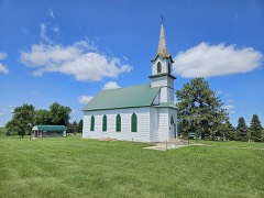 | Goodhue Lutheran Church | 3.0 miles | 1996 |
| Florence Methodist Church | 5.4 miles | 1991 |
| National Archives record | The nomination case file for reference 05000831 in Record Group 79. |
| Codington County | All 43 listed properties in this county. |