 Block
From the record
One of 57 National Register listings published here for Lawrence County · listed in 2023 · category: Building.
Sources: the National Register database, National Park Service
Listed on the National Register of Historic Places in 2023.
One of 57 National Register listings published here for Lawrence County · listed in 2023 · category: Building.
Sources: the National Register database, National Park Service
Regional context, not property-specific evidence. The federal wildfire occurrence database lists 122 fires within 5 miles of Homestake Mining Company Hydroelectric Plant No. 2 between 1992 and 2020, burning about 1,022 acres in total. 43 started naturally. None was recorded as arson. Distance is straight-line from the map coordinates, so a fire counted here may appear on a neighbouring settlement's page as well.
| Reported cause | Fires |
|---|---|
| Natural | 43 |
| Recreation and ceremony | 41 |
| Debris and open burning | 12 |
| Missing data/not specified/undetermined | 9 |
| Power generation/transmission/distribution | 7 |
| Equipment and vehicle use | 6 |
| Smoking | 2 |
| Misuse of fire by a minor | 1 |
| Firearms and explosives use | 1 |
The most recent of them, most recent first, with the day each was reported and the service that recorded it.
| Date | Cause | Size | Reported by | Name on the report |
|---|---|---|---|---|
| 9 September 2000 | Power generation/transmission/distribution | under an acre | South Dakota Wildland Fire Suppression | WAR EAGLE 2 |
| 7 September 2019 | Equipment and vehicle use | under an acre | Montana/Dakotas State Office | SHEEPTAIL GULCH |
| 6 September 2009 | Missing data/not specified/undetermined | 1.5 acres | Black Hills National Forest | RIM ROCK |
| 5 September 2016 | Natural | under an acre | Black Hills National Forest | BIG SPRING |
| 4 September 1994 | Recreation and ceremony | under an acre | Black Hills National Forest | EIGHT BALL |
| 30 September 1993 | Recreation and ceremony | under an acre | Black Hills National Forest | SWARM |
| 2 September 2000 | Recreation and ceremony | under an acre | Black Hills National Forest | NORBERT |
| 19 September 1999 | Recreation and ceremony | under an acre | South Dakota Wildland Fire Suppression | TERRY |
Regional context, not property-specific evidence. The federal mineral resources record lists 103 workings within 5 miles of Homestake Mining Company Hydroelectric Plant No. 2: 75 past producers, 15 unknowns, 6 occurrences, 3 producers. 6 still produce. What was taken out: Gold, Silver, Gold, Silver, Fluorine-Fluorite. Distance is straight-line from the map coordinates, so a quarry counted here may appear on a neighbouring settlement's page as well.
| Where | Site | Commodity | Status | Recorded |
|---|---|---|---|---|
| Iron Hill | Zinc, Silver, Silica, Manganese, Lead, Iron, Gold, Sulfur, Phosphorus-Phosphates | Past Producer | 1881, 1885 | |
| Iron Hill Mine | Gold, Silver, Lead, Manganese | Past Producer | Gold, Vanadinite | |
| Lewis Lime Plant | Calcium | Past Producer | ||
| Lewis Lime Quarry | Limestone, General | Past Producer | 1900 | |
| Moores, False Bottom Creek | Molybdenum | Occurrence | Molybdenite | |
| Adelphia | Manganese, Lead, Gold, Silver | Past Producer | 1881, 1882 | |
| Crown Hill Mine | Silver, Gold | Past Producer | Replacement | |
| Minnesota Group | Silver, Gold | Past Producer | Replacement | |
| Spanish R | Manganese, Lead, Gold, Silver | Past Producer | 1881, 1882 | |
| Seabury-Calkins | Silver, Manganese, Lead, Gold | Past Producer | 1881, 1882 |
Regional context, not property-specific evidence. The National Weather Service names Spearfish, the town this property stands in, in 195 storm reports between 1993 and 2025: 135 hail, 43 thunderstorm wind, 5 flood, 4 lightning. The reports record 1 death and 7 injuries. Each account below is quoted exactly as the forecast office filed it, from the NOAA Storm Events Database, and each date opens the federal record of that event.
| When | Event | Place named | Harm | What the report says |
|---|---|---|---|---|
| July 2015 | Lightning | Spearfish | 1 killed, 1 hurt | no account filed |
| August 2000 | Thunderstorm Wind | Spearfish | 6 hurt, $9,500,000 | no account filed |
| July 2011 | Hail | Spearfish | $2,000,000 | Large hail damaged vehicles and buildings in Spearfish. |
| June 2003 | Hail | Spearfish | $1,000,000 | Some hail damage to homes and automobiles in Spearfish. |
| June 2013 | Hail | Spearfish | $500,000 | Hail damage occurred in Spearfish, including broken skylights in a large discount store. |
| August 2008 | Hail | Spearfish | $100,000 | Golf ball sized hail was 12 inches deep on road and accumulated two feet deep in ditches. The combination of hail and strong winds broke windows and siding on a house. |
| June 2013 | Flood | Spearfish | $50,000 | Redwater River, Spearfish Creek, False Bottom Creek, and other streams in the Spearfish area experienced flooding. Minor flooding occurred in the Spearfish City Park. Red Hill Road at Crow Creek, Sanford Road into Beulah, and Homestake Road at the Bear Creek Bridge were flooded and several culverts were damaged. |
| August 2008 | Hail | Spearfish | $50,000 | Wind gusts were measured at 54 mph. |
| June 2013 | Hail | Spearfish | $30,000 | no account filed |
| June 2013 | Thunderstorm Wind | Spearfish | $20,000 | Large pine trees, spruce trees, and power poles were broken along the eastern rim of Spearfish Canyon. The worst damage occurred from Bridal Veil Falls to Victoria Lane. |
| April 2002 | Thunderstorm Wind | Spearfish | $5,000 | A local radio station reported several reports of tree limbs down and shingles blown off roofs in town. One window was broken by flying debris. |
| May 2007 | Hail | Spearfish | $2,000 | Hail damaged vehicles and trash cans. |
| June 2013 | Hail | Spearfish | $2,000 | no account filed |
| August 2008 | Thunderstorm Wind | Spearfish | $1,000 | no account filed |
| July 2025 | Thunderstorm Wind | Spearfish | - | Public measured wind gust. |
| June 2023 | Flash Flood | Spearfish | - | Runoff from heavy rain caused considerable damage in Spearfish. Numerous roads flooded and asphalt buckled on portions of Main Street and Jackson Boulevard. The USGS gage, Spearfish Creek at Spearfish, recorded its fifth highest level since 1947 with a flow of 1900 cfs. Damage was reported at several locations, including the DC Booth National Fish Hatchery and a private apartment complex. |
| June 2023 | Flood | Spearfish | - | Runoff from heavy rain caused considerable damage in Spearfish. Numerous roads flooded and asphalt buckled on portions of Main Street and Jackson Boulevard. The USGS gage, Spearfish Creek at Spearfish, recorded its fifth highest level since 1947 with a flow of 1900 cfs. Damage was reported at several locations, including the DC Booth National Fish Hatchery and a private apartment complex. |
| May 2022 | Hail | Spearfish | - | The ground was covered with hail, mostly dime size or less. |
| May 2022 | Hail | Spearfish | - | A lot of marble sized hail, with a few near ping pong ball size. |
| July 2022 | Hail | Spearfish | - | Windows were broken by the combination of large hail and wind. |
| July 2021 | Thunderstorm Wind | Spearfish | - | Half inch sized hail also fell with the storm. |
| June 2020 | Thunderstorm Wind | Spearfish | - | Time estimated from radar. |
| June 2020 | Thunderstorm Wind | Spearfish | - | The roof was partially torn off a house, windows were broken, and trees were damaged. |
| July 2019 | Hail | Spearfish | - | Hail to baseball size fell over a 15 minute period. |
| July 2018 | Thunderstorm Wind | Spearfish | - | Wind gusts were estimated near 60 mph. |
| July 2018 | Thunderstorm Wind | Spearfish | - | Wind gusts were estimated at near 70 mph. |
| July 2018 | Flash Flood | Spearfish | - | Flash flooding occurred west of Spearfish and on the Redwater River along the Butte-Lawrence County line. A river gauge on Redwater Creek at the Wyoming and South Dakota border recorded an increase in flow by over 1000 cfs in two hours. Several normally dry drainage areas quickly filled with water. Precipitation reports indicated two to three inches of rain fell in an hour. |
| July 2018 | Hail | Spearfish | - | The combination of large hail and gusty winds broke windows in a home and vehicles. |
| July 2018 | Thunderstorm Wind | Spearfish | - | Many trees were blown down in Spearfish Canyon along US Highway 14A from Cleopatra Lane to around two miles south. |
| July 2018 | Thunderstorm Wind | Spearfish | - | Small tree branches were downed by the wind. |
| August 2016 | Hail | Spearfish | - | A wind gust of 53 mph was recorded as well with the storm. |
| August 2016 | Thunderstorm Wind | Spearfish | - | Wind gusts were estimated at 60 mph. |
| June 2015 | Thunderstorm Wind | Spearfish | - | Tree limbs were blown down. |
| June 2015 | Flash Flood | Spearfish | - | Water covered US Highway 14 between mileposts 1 and 2 between Spearfish and Beulah. |
| June 2015 | Thunderstorm Wind | Spearfish | - | The windows of a shed were blown out by the strong winds. |
| July 2011 | Thunderstorm Wind | Spearfish | - | Wind gusts were estimated at 60 mph. |
| May 2011 | Flood | Spearfish | - | Several small streams and creeks flooded roads around Spearfish and the northern Black Hills. |
| May 2011 | Flood | Spearfish | - | Several small creeks and streams flooded roads around Spearfish and in northern Lawrence County. |
| June 2010 | Thunderstorm Wind | Spearfish | - | Wind gusts were estimated at 60 mph. |
| July 2008 | Thunderstorm Wind | Spearfish | - | Two center pivot irrigation systems were blown over, a trailer house was blown off its foundation, and ten to 12 inch diameter tree branches were broken by the wind gusts. |
| June 2007 | Flood | Spearfish | - | Heavy rains flooded several roads in and around town. |
| June 2001 | Thunderstorm Wind | Spearfish | - | A storm spotter measured a 58 mph wind gust during an early morning thunderstorm. |
| August 2000 | Wildfire | Spearfish | - | A ten acre fire started by lightning threatened Spearfish Canyon. Nine other small fires, each less than two acres in size, were also ignited throughout Lawrence County, but were extinguished within 24-48 hours. |
| June 1999 | Tornado (F1) | Spearfish | - | The tornado knocked several trees into a home, destroyed a chicken coop and damaged a rental car which had a tree fall on it. Numerous trees around the property were also blown down. |
| May 1999 | Tornado (F0) | Spearfish | - | Brief Touchdown. Moved into Butte County. |
| July 1998 | Lightning | Spearfish | - | LIGHTNING STRIKE CAUSE HOUSE FIRE. |
| July 1995 | Thunderstorm Wind | Spearfish | - | Strong winds caused some trees to be downed. |
| June 1995 | Hail | Spearfish | - | Stripped trees and damaged automobiles. |
| July 1995 | Thunderstorm Wind | Spearfish | - | Winds gusted to 60 mph and caused many trees to be downed or damaged. Power was out for two to three hours due to tree branches lying on power lines. |
| July 2024 | Hail | Spearfish | - | no account filed |
| July 2024 | Thunderstorm Wind | Spearfish | - | no account filed |
| August 2024 | Hail | Spearfish | - | no account filed |
| June 2023 | Hail | Spearfish | - | no account filed |
| May 2023 | Hail | Spearfish | - | no account filed |
| May 2023 | Hail | Spearfish | - | no account filed |
| May 2023 | Hail | Spearfish | - | no account filed |
| July 2023 | Hail | Spearfish | - | no account filed |
| July 2023 | Hail | Spearfish | - | no account filed |
| June 2023 | Hail | Spearfish | - | no account filed |
| June 2023 | Hail | Spearfish | - | no account filed |
No historic map-sheet match is published for this property yet. That does not mean no map exists. This record needs a coordinate-quality review before it can be joined to a sheet boundary. Browse the county's mapped places while that work is pending.
Other National Register properties close enough to walk or drive between, ordered by distance from this one. Both positions come from the same geocoding pass that matched these properties to their map sheets.
| Photograph | Property | Distance | Listed |
|---|---|---|---|
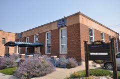 | Spearfish Post Office (Old) | 5.4 miles | 1999 |
| Hatchery Building and Visitor Center | 6.1 miles | 1993 | |
 | Spearfish Fisheries Center | 6.1 miles | 1978 |
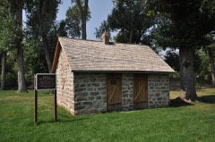 | Kroll Meat Market and Slaughterhouse | 6.3 miles | 1988 |
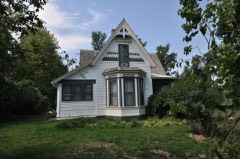 | William D. Driskill House | 6.4 miles | 1989 |
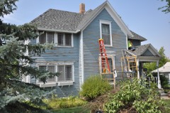 | Henry Court House | 6.5 miles | 1990 |
| National Archives record | The nomination case file for reference 100008619 in Record Group 79. |
| Lawrence County | All 57 listed properties in this county. |