 Block
From the record
One of 42 National Register listings published here for Brown County · listed in 1973 · category: Building.
Sources: the case file at the National Archives · the National Register database, National Park Service
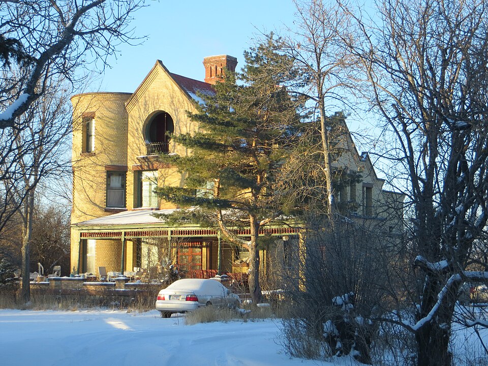
Listed on the National Register of Historic Places in 1973.
One of 42 National Register listings published here for Brown County · listed in 1973 · category: Building.
Sources: the case file at the National Archives · the National Register database, National Park Service
Regional context, not property-specific evidence. The federal wildfire occurrence database lists 78 fires within 5 miles of Easton's Castle between 2001 and 2020, burning about 651 acres in total. 1 started naturally. 3 were recorded as arson. Distance is straight-line from the map coordinates, so a fire counted here may appear on a neighbouring settlement's page as well.
| Reported cause | Fires |
|---|---|
| Missing data/not specified/undetermined | 42 |
| Equipment and vehicle use | 9 |
| Smoking | 5 |
| Railroad operations and maintenance | 4 |
| Misuse of fire by a minor | 4 |
| Debris and open burning | 4 |
| Arson/incendiarism | 3 |
| Recreation and ceremony | 3 |
| Fireworks | 3 |
| Natural | 1 |
The most recent of them, most recent first, with the day each was reported and the service that recorded it.
| Date | Cause | Size | Reported by | Name on the report |
|---|---|---|---|---|
| 7 September 2018 | Equipment and vehicle use | under an acre | South Dakota Wildland Fire Suppression | LOCOMOTIVE |
| 23 September 2011 | Missing data/not specified/undetermined | under an acre | South Dakota Wildland Fire Suppression | AIRPORT |
| 21 September 2020 | Missing data/not specified/undetermined | under an acre | South Dakota Wildland Fire Suppression | CATTAIL BALE |
| 30 August 2010 | Missing data/not specified/undetermined | 1.0 acres | South Dakota Wildland Fire Suppression | BRAUN |
| 24 August 2011 | Missing data/not specified/undetermined | under an acre | South Dakota Wildland Fire Suppression | HOLDING POND |
| 2 August 2008 | Missing data/not specified/undetermined | 20 acres | South Dakota Wildland Fire Suppression | not named |
| 17 August 2014 | Missing data/not specified/undetermined | 20 acres | South Dakota Wildland Fire Suppression | TED BALE |
| 11 August 2015 | Smoking | under an acre | South Dakota Wildland Fire Suppression | ARFF 8/11/15 |
Regional context, not property-specific evidence. The federal mineral resources record lists 9 workings within 5 miles of Easton's Castle: 5 past producers, 4 producers. 4 still produce. What was taken out: Sand and Gravel, Construction. Distance is straight-line from the map coordinates, so a quarry counted here may appear on a neighbouring settlement's page as well.
| Where | Site | Commodity | Status | Recorded |
|---|---|---|---|---|
| Brown County Highway Dept Pit | Sand and Gravel, Construction | Past Producer | ||
| Eyestone Pit | Sand and Gravel, Construction | Past Producer | ||
| Grebein Pit | Sand and Gravel, Construction | Past Producer | ||
| Jacobs Pit | Sand and Gravel, Construction | Past Producer | ||
| Lindsey Pit | Sand and Gravel, Construction | Producer | ||
| Mc Neary Pit | Sand and Gravel, Construction | Producer | ||
| Orlin Pit | Sand and Gravel, Construction | Past Producer | ||
| Pickus Sand & Gravel Pit | Sand and Gravel, Construction | Producer | ||
| Westport Pit | Sand and Gravel, Construction | Producer |
Regional context, not property-specific evidence. The National Weather Service names Aberdeen, the town this property stands in, in 145 storm reports between 1993 and 2025: 71 hail, 51 thunderstorm wind, 10 tornado, 8 flash flood. The reports record 1 injury. Each account below is quoted exactly as the forecast office filed it, from the NOAA Storm Events Database, and each date opens the federal record of that event.
| When | Event | Place named | Harm | What the report says |
|---|---|---|---|---|
| May 1996 | Tornado (F3) | Aberdeen | 1 hurt, $750,000 | no account filed |
| June 2009 | Flash Flood | Aberdeen | $100,000 | Slow moving thunderstorms brought very heavy rains of 2 to 4 inches in and around Aberdeen causing extensive road flooding throughout the city. Dozens of basements were flooded and damaged along with some sewer backups. Many vehicles became stalled with the police sent out to direct traffic. There were also some power outages. |
| July 1994 | Thunderstorm Wind | Aberdeen | $5,000 | Thunderstorm Winds downed some trees and power lines. |
| September 1999 | Flash Flood | Aberdeen | $5,000 | no account filed |
| June 2014 | Lightning | Aberdeen | $2,000 | no account filed |
| June 2025 | Thunderstorm Wind | Aberdeen | - | An NWS employee observed 2 large limbs that had come down on the south side of town associated with thunderstorm winds. |
| July 2025 | Flash Flood | Aberdeen | - | Rainfall intensity overwhelmed the city drainage system in Aberdeen, leading to a street closure and stranded vehicles. The Aberdeen Regional Airport ASOS recorded 1.51 inches of rainfall in an hour and a half. |
| July 2025 | Flood | Aberdeen | - | An NWS employee reported that 3rd Avenue between Penn Street and South State Street in Aberdeen was closed due to flooding. A CoCoRaHS observer 1.5 miles south-southwest of downtown recorded 2.28 inches of rainfall. |
| July 2025 | Thunderstorm Wind | Aberdeen | - | A 62 mph gust was recorded by a South Dakota Department of Transportation mesonet station two miles east-northeast of Aberdeen. |
| July 2025 | Thunderstorm Wind | Aberdeen | - | The caller stated that an estimated 60 mph wind caused a large branch to break off of their tree. |
| August 2025 | Thunderstorm Wind | Aberdeen | - | A caller stated that multiple large tree branches had come down at Lee Park golf course. |
| June 2023 | Thunderstorm Wind | Aberdeen | - | Wind tipped a trailer on US Highway 281, 2 miles south of Aberdeen. |
| May 2022 | Tornado (EF0) | Aberdeen | - | A security camera captured a brief tornado touchdown in an open field. |
| August 2022 | Thunderstorm Wind | Aberdeen | - | A large tree branch was downed by estimated 60 mph winds. |
| September 2022 | Thunderstorm Wind | Aberdeen | - | The Brown County Emergency Manager reported damage around the fairgrounds, and a social media report with photos depicted tree damage at Rolling Meadows Drive, both on the north side of Aberdeen. The time of the damage is radar estimated. |
| August 2021 | Thunderstorm Wind | Aberdeen | - | Power lines were downed on the northeast side of Aberdeen by estimated 70 mph winds. |
| June 2020 | Thunderstorm Wind | Aberdeen | - | A couple tree limbs were downed by an estimated sixty mph wind. |
| June 2020 | Thunderstorm Wind | Aberdeen | - | Some tree limbs were downed along with a few shingles taken off the roof by estimated sixty mph winds. |
| June 2020 | Thunderstorm Wind | Aberdeen | - | Sixty mph winds were estimated. |
| July 2019 | Thunderstorm Wind | Aberdeen | - | In Aberdeen, a store marquee sign was torn down and pieces tossed a block away, framing for new construction was flattened, and significant shingle damage occurred near the intersection of 6th Avenue and South 2nd St. Several trees were also downed in town. Winds were estimated at 80 to 90 mph. |
| July 2019 | Thunderstorm Wind | Aberdeen | - | A few large branches were downed in Aberdeen. |
| June 2017 | Thunderstorm Wind | Aberdeen | - | Several trees were downed by estimated seventy mph winds. |
| June 2017 | Thunderstorm Wind | Aberdeen | - | Some large branches were downed by sixty mph winds. |
| June 2017 | Thunderstorm Wind | Aberdeen | - | Estimated sixty mph winds brought some large tree limbs down in Aberdeen. |
| July 2016 | Thunderstorm Wind | Aberdeen | - | Several trees along with some power lines were downed mainly in southwest Aberdeen. A hanger at the airport was also damaged. |
| July 2015 | Thunderstorm Wind | Aberdeen | - | Sixty-five mph winds caused extensive damage to two boats, three boat lifts, and the main electrical box at Dahme Lake south of Aberdeen. |
| July 2015 | Thunderstorm Wind | Aberdeen | - | Sixty mph winds downed a tree, flipped a camper onto its roof, and moved a 2500 gallon tank into a ditch. |
| August 2014 | Flash Flood | Aberdeen | - | Several thunderstorms developed and tracked over the Aberdeen area bringing very heavy rains of 2 to over 4 inches. This resulted in flash flooding in and east of Aberdeen with many roads flooded. There were many stranded vehicles with some rescues occurring. |
| September 2013 | Hail | Aberdeen | - | Golf ball size hail caused damage to many vehicles in north Aberdeen along with a few structures receiving some siding and roof damage. |
| July 2011 | Flash Flood | Aberdeen | - | Heavy rains of 3 to 5 inches brought flash flooding of many roads in Aberdeen. |
| July 2011 | Thunderstorm Wind | Aberdeen | - | Seventy mph winds took the roof off of a trailer house. |
| July 2011 | Flash Flood | Aberdeen | - | Heavy rain caused flash flooding of several roads in Aberdeen. |
| July 2011 | Thunderstorm Wind | Aberdeen | - | Sixty mph winds were estimated north of Aberdeen. |
| July 2010 | Hail | Aberdeen | - | Golfball to baseball size hail fell at the National Weather Service office causing damage to several vehicles. The rear window was broken out of one of the vehicles. |
| July 2008 | Thunderstorm Wind | Aberdeen | - | Sixty mph winds brought down some large branches in south Aberdeen. |
| July 2008 | Thunderstorm Wind | Aberdeen | - | A large evergreen tree and an apple tree were toppled by the winds along with numerous large tree branches. |
| June 2008 | Funnel Cloud | Aberdeen | - | Several funnel cloud reports were received from this storm. |
| August 2008 | Tornado (EF0) | Aberdeen | - | A tornado touched down briefly at the Brown County fairgrounds, blowing over several tents and awnings. |
| July 2008 | Thunderstorm Wind | Aberdeen | - | Eighty mph winds downed many trees and large tree branches throughout Aberdeen. One tree fell onto a car and another fell onto a house causing extensive damage. |
| September 2005 | Thunderstorm Wind | Aberdeen | - | Many large branches were downed. |
| August 2002 | Flash Flood | Aberdeen | - | Heavy rains of 2 to 3 inches fell in an around Aberdeen and caused numerous roads to be flooded with a few cars stalling. Also, some buildings had water in them up to 2 inches deep. |
| August 2000 | Thunderstorm Wind | Aberdeen | - | High winds brought down some tree branches along with a large tree in Aberdeen. |
| October 2000 | Flash Flood | Aberdeen | - | Very heavy rains of 3 to 4 inches caused flooding in and around Aberdeen. The flooding resulted in several stalled vehicles along with some damage to basements and streets. Some streets had to be closed until the water went down. The Aberdeen Central High School had many leaks and received water damage to several walls. Water had to be pumped out of the Civic Theaters Orchestra pit. The 3.75 inches of rain that fell at the Aberdeen National Weather Service was the fourth greatest calender day total since 1932. The greatest 2 hour and 3 hour rainfall rate records were also set on this day. |
| July 2000 | Tornado (F0) | Aberdeen | - | A small tornado touched downed briefly south of Aberdeen. No damage occurred. |
| July 2000 | Thunderstorm Wind | Aberdeen | - | Winds to 80 mph uprooted and split many trees in southern Aberdeen. There was also many branches downed by the high winds and a quonset hut was destroyed. |
| July 2000 | Thunderstorm Wind | Aberdeen | - | Winds to 65 mph brought down several tree branches and a few trees in Aberdeen. |
| July 1999 | Thunderstorm Wind | Aberdeen | - | Winds from 60 to 70 mph brought down many large tree branches along with a few trees in Aberdeen. Power lines were also downed resulting in power outages for many homes and businesses for several hours. A semi trailer was also turned onto its side by the high winds. |
| July 1999 | Thunderstorm Wind | Aberdeen | - | Winds gusting to 70 mph brought down some large tree branches along with some power lines west of Aberdeen. |
| June 1998 | Thunderstorm Wind | Aberdeen | - | Several trees were downed in Aberdeen along with a lot of branches. As a result, four streets were blocked for a time and three cars were damaged. Also, a tree fell on a house causing some damage. |
| June 1998 | Thunderstorm Wind | Aberdeen | - | Winds gusting to 60 mph partially removed the roof off a business in Aberdeen. |
| July 1997 | Thunderstorm Wind | Aberdeen | - | Thunderstorm winds and small hail damaged about 3 to 4 acres of sunflowers. |
| August 1997 | Thunderstorm Wind | Aberdeen | - | Strong thunderstorm winds ripped out the awning hardware on a trailer and blew a 4 by 4 out from under a stabilizing jack. |
| July 1995 | Tornado (F0) | Aberdeen | - | A narrow path tornado touched down 5 W and 2 N of Claremont and stayed on the ground for ten minutes before dissipating. |
| July 1995 | Thunderstorm Wind | Aberdeen | - | Some four-inch diameter tree branches were downed in southern Aberdeen. |
| August 1993 | Hail | Aberdeen | - | A severe thunderstorm hit Groton with hail, damaging lightning, and 3.43 inches of rain which flooded some basements. At a high school, lightning split a 30-foot chimney which fell through a large skylight and sections of the roof. This resulted in extensive water damage to ceiling tiles in classrooms, due to the heavy rains. |
| July 2025 | Hail | Aberdeen | - | no account filed |
| July 2025 | Hail | Aberdeen | - | no account filed |
| August 2025 | Thunderstorm Wind | Aberdeen | - | no account filed |
| August 2025 | Flood | Aberdeen | - | no account filed |
| May 2024 | Hail | Aberdeen | - | no account filed |
No historic map-sheet match is published for this property yet. That does not mean no map exists. This record needs a coordinate-quality review before it can be joined to a sheet boundary. Browse the county's mapped places while that work is pending.
Other National Register properties close enough to walk or drive between, ordered by distance from this one. Both positions come from the same geocoding pass that matched these properties to their map sheets.
| Photograph | Property | Distance | Listed |
|---|---|---|---|
 | Milwaukee Chicago St. Paul and Pacific Railroad Depot | 0.8 miles | 1977 |
 | Alonzo Ward Hotel | 0.8 miles | 1982 |
 | Western Union Building | 0.9 miles | 1976 |
 | Aberdeen Commercial Historic District | 0.9 miles | 1988 |
 | Brown County Courthouse | 0.9 miles | 1976 |
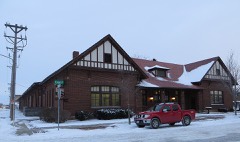 | Great Northern Railway Passenger and Freight Depot | 0.9 miles | 1983 |
| National Archives record | The nomination case file for reference 73001736 in Record Group 79. |
| Brown County | All 42 listed properties in this county. |