Block
From the record
42 National Register listings published here.
Sources: the National Register database, National Park Service
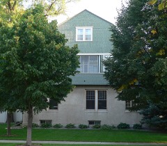
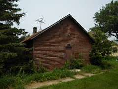
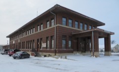
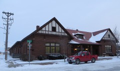
61 topographic sheets cover 40 settlements here, and 42 properties are on the National Register of Historic Places.
42 National Register listings published here.
Sources: the National Register database, National Park Service
Every property in this county listed on the National Register of Historic Places, with the year it was listed and the federal nomination document.
Every wildfire the federal occurrence database records inside this county: 325 of them, burning about 20,224 acres. 10 started naturally and 7 were recorded as arson. Each settlement page carries the fires within five miles of it.
| Reported cause | Fires |
|---|---|
| Missing data/not specified/undetermined | 158 |
| Equipment and vehicle use | 57 |
| Debris and open burning | 51 |
| Smoking | 11 |
| Natural | 10 |
| Railroad operations and maintenance | 8 |
| Arson/incendiarism | 7 |
| Misuse of fire by a minor | 7 |
| Fireworks | 6 |
| Other causes | 5 |
| Recreation and ceremony | 5 |
The five largest, by the area the report gives. None of them was recorded as arson.
| Date | Cause | Size | Reported by | Name on the report |
|---|---|---|---|---|
| 10 April 2003 | Missing data/not specified/undetermined | 4,258 acres | South Dakota Wildland Fire Suppression | JIM RIVER |
| 2 April 2004 | Missing data/not specified/undetermined | 1,400 acres | South Dakota Wildland Fire Suppression | TACOMA PARK PLACE |
| 11 May 2004 | Natural | 1,200 acres | South Dakota Wildland Fire Suppression | RIVER BOTTOM |
| 11 April 2015 | Equipment and vehicle use | 1,200 acres | South Dakota Wildland Fire Suppression | HECLA |
| 21 May 2002 | Debris and open burning | 1,000 acres | South Dakota Wildland Fire Suppression | HANSON |
| 11 May 2004 | Natural | 900 acres | South Dakota Wildland Fire Suppression | SEC 18 |
| 31 October 2008 | Debris and open burning | 850 acres | South Dakota Wildland Fire Suppression | not named |
| 28 October 2016 | Equipment and vehicle use | 750 acres | South Dakota Wildland Fire Suppression | BRAUN |
Every settlement page carries the fires within five miles of it - see the settlement index below.
The NOAA Storm Events Database holds 1,102 reports for this county, causing 4 deaths, 33 injuries and about $10,628,720 in recorded property damage. Each settlement page carries the reports that name it.
| Kind of event | Reports |
|---|---|
| Hail | 437 |
| Thunderstorm Wind | 404 |
| Flood | 140 |
| Tornado | 84 |
| Flash Flood | 22 |
| Funnel Cloud | 9 |
| Wildfire | 5 |
| Lightning | 1 |
The most serious of them, by death, then injury, then recorded damage. The accounts are quoted exactly as the forecast office filed them.
| When | Event | Place named | Harm | What the report says |
|---|---|---|---|---|
| September 1986 | Thunderstorm Wind | not stated | 2 killed, 5 hurt | no account filed |
| July 1966 | Tornado (F2) | not stated | 1 killed, 3 hurt, $250,000 | no account filed |
| July 1973 | Tornado (F3) | not stated | 1 killed, 3 hurt, $25,000 | no account filed |
| June 1978 | Tornado (F2) | not stated | 15 hurt, $250,000 | no account filed |
| June 1969 | Tornado (F3) | not stated | 6 hurt, $250,000 | no account filed |
| May 1996 | Tornado (F3) | Aberdeen | 1 hurt, $750,000 | no account filed |
| May 2007 | Flash Flood | Warner | $5,000,000 | Very heavy rains of 5 to nearly 10 inches fell within a 6 to 10 hour period across most of Brown county causing widespread flash flooding. Most of the cities affected included Aberdeen, Warner, Columbia, Hecla, Groton, Barnard, Bath, and Stratford. Several hundred homes, some businesses, and countless roads were affected by the flooding. Aberdeen received the most extensive damage, especially the north side of Aberdeen. Seventy-five percent of the homes in Aberdeen received some water in their basements. Basement water levels ranged from a few inches to very deep water all the way up to the first floor of homes. Several homes had basement walls that collapsed. The overwhelming load on the drainage system caused sewage to back up into many homes. The National Guard brought large generators and pumps to Aberdeen to alleviate pressure on the storm system. A school in north Aberdeen was closed for several days because in was surrounded by water. Also, many vehicles stalled on the roads and power outages occurred, mainly in northern Aberdeen, as transformers went under water. Many cars were also damaged by the flooding. Over thirty families in Aberdeen were displaced from their homes with many living in emergency shelters.||Over one-hundred homes in Aberdeen were condemned with nearly fifty considered as unlivable. Thousands of acres of crops were flooded and damaged with many seeds and large quantities of fertilizer washed away. ||An emergency operations center was operated in Aberdeen for several days to coordinate all emergency activities. Hundreds of volunteers helped with the cleanup. Over 2500 tons of flooding debris was taken to the landfill in Aberdeen. The Governor was in Aberdeen and declared a state of emergency for Brown county. ||Groton, Stratford, Bath, Claremont, and Columbia also had flooded homes and basements. Thirty percent of Columbia's homes had some water in them with two collapsed basement walls. Eighty percent of Groton's homes had water in their basement with half having sewer backups. Sixty homes in Groton had major damage. Many sewer backups also occurred in Claremont.||Senator John Thune and representative Stephanie Herseth came to Brown County to survey the damage. Brown County was declared a disaster area by President Bush with disaster recovery and community assistance centers opened. Eight damage assessment teams from local, state, and FEMA came to Brown and other counties.||Rainfall amounts included 4.99 inches at Westport, 7.49 inches at Stratford, 7.97 inches at Aberdeen, 8.07 inches at Sand Lake Wildlife Refuge, 8.73 inches at Columbia, and 8.74 inches at Groton. Adding in the previous days rain, Aberdeen received 9.00 inches, Columbia received 10.19 inches, with 10.74 inches at Groton. The 8.74 inches of rainfall at Groton set a new 24 hour state rainfall record. |
| June 1979 | Tornado (F1) | not stated | $2,500,000 | no account filed |
| April 2019 | Flood | Winship | $745,300 | no account filed |
| March 2009 | Flood | Westport | $200,000 | no account filed |
| April 2023 | Flood | Winship | $150,000 | no account filed |
| June 2009 | Flash Flood | Aberdeen | $100,000 | Slow moving thunderstorms brought very heavy rains of 2 to 4 inches in and around Aberdeen causing extensive road flooding throughout the city. Dozens of basements were flooded and damaged along with some sewer backups. Many vehicles became stalled with the police sent out to direct traffic. There were also some power outages. |
| March 2009 | Flood | Frederick | $75,000 | no account filed |
| April 2009 | Flood | Columbia | $75,000 | no account filed |
| June 2009 | Flash Flood | Stratford | $25,000 | Heavy rains from 3 to 6 inches fell across southeast Brown county bringing flash flooding. Many roads were flooded and damaged along with many acres of cropland. |
| August 1984 | Tornado (F1) | not stated | $25,000 | no account filed |
| August 1980 | Tornado (F0) | not stated | $25,000 | no account filed |
| June 1975 | Tornado (F1) | not stated | $25,000 | no account filed |
| June 1973 | Tornado (F1) | not stated | $25,000 | no account filed |
| June 1966 | Tornado (F1) | not stated | $25,000 | no account filed |
| May 1965 | Tornado (F3) | not stated | $25,000 | no account filed |
| June 1955 | Tornado (F2) | not stated | $25,000 | no account filed |
| August 2009 | Flash Flood | Winship | $15,000 | Numerous county roads and area fields were overrun with flowing water. The level of Richmond Lake rose nearly a foot a day after the event from high inflows. This rapid rise in the lake level resulted in numerous boat and fishing docks being submerged. Several boats were also trapped under lift canopies due to the high water. There were reports of several boats breaking free of their mooring and floating toward the spillway. |
| August 2009 | Flash Flood | Aberdeen Thorson Arp | $15,000 | no account filed |
| July 1994 | Thunderstorm Wind | Aberdeen | $5,000 | Thunderstorm Winds downed some trees and power lines. |
| August 1993 | Hail | to 4 NW | $5,000 | A severe hailstorm with hail up to baseball size damaged a home and at least 160 acres of wheat and corn seven miles west of Barnard. Windows were knocked out on several other homes and farm buildings in the area. Most of the hail was from 0.75 to 1.75 of an inch in diameter. |
| September 1999 | Flash Flood | Aberdeen | $5,000 | no account filed |
| June 1975 | Tornado (F0) | not stated | $2,500 | no account filed |
| June 1973 | Tornado (F1) | not stated | $2,500 | no account filed |
| June 1961 | Tornado (F3) | not stated | $2,500 | no account filed |
| June 1960 | Tornado (F0) | not stated | $2,500 | no account filed |
| June 2014 | Lightning | Aberdeen | $2,000 | no account filed |
| May 1994 | Thunderstorm Wind | Claremont | $500 | Several tree limbs were broken and a few trees were uprooted. |
| August 1993 | Hail | Leola | $500 | no account filed |
| April 1955 | Tornado (F2) | not stated | $250 | no account filed |
| August 1993 | Hail | Groton | $50 | A severe thunderstorm hit Groton with hail, damaging lightning, and 3.43 inches of rain which flooded some basements. At a high school, lightning split a 30-foot chimney which fell through a large skylight and sections of the roof. This resulted in extensive water damage to ceiling tiles in classrooms, due to the heavy rains. |
| June 1982 | Tornado (F0) | not stated | $30 | no account filed |
| June 1957 | Tornado (F0) | not stated | $30 | no account filed |
| June 1957 | Tornado (F0) | not stated | $30 | no account filed |
| June 1957 | Tornado (F0) | not stated | $30 | no account filed |
| June 2025 | Thunderstorm Wind | Aberdeen | - | An NWS employee observed 2 large limbs that had come down on the south side of town associated with thunderstorm winds. |
| July 2025 | Tornado (EF0) | Nahon | - | A weak tornado touched down four miles southeast of the Aberdeen Regional Airport. It blew apart a swing set and launched a trampoline into a nearby cornfield. Spotty damage to the corn crop was also noted. |
| July 2025 | Funnel Cloud | (Abr)Aberdeen Rgnl A | - | A funnel cloud was observed from the National Weather Service office in Aberdeen. |
| July 2025 | Hail | Winship | - | A caller stated the storm produced dime to penny sized hail, and that the hail had damaged crops. |
| July 2025 | Thunderstorm Wind | (Abr)Aberdeen Rgnl A | - | A thunderstorm produced a measured wind gust of 81 mph at the Aberdeen Regional Airport Automated Surface Observing System (ASOS). |
| July 2025 | Flash Flood | Aberdeen | - | Rainfall intensity overwhelmed the city drainage system in Aberdeen, leading to a street closure and stranded vehicles. The Aberdeen Regional Airport ASOS recorded 1.51 inches of rainfall in an hour and a half. |
| July 2025 | Thunderstorm Wind | Hecla | - | A member of the public reported that their fertilizer bin had been tipped over by estimated 70 mph winds, with the combination of winds and small hail responsible for crop damage. |
| July 2025 | Flood | Aberdeen | - | An NWS employee reported that 3rd Avenue between Penn Street and South State Street in Aberdeen was closed due to flooding. A CoCoRaHS observer 1.5 miles south-southwest of downtown recorded 2.28 inches of rainfall. |
| July 2025 | Thunderstorm Wind | Aberdeen | - | A 62 mph gust was recorded by a South Dakota Department of Transportation mesonet station two miles east-northeast of Aberdeen. |
| July 2025 | Thunderstorm Wind | Aberdeen | - | The caller stated that an estimated 60 mph wind caused a large branch to break off of their tree. |
| July 2025 | Thunderstorm Wind | Frederick | - | A caller near the town of Frederick estimated a thunderstorm wind gust of 60 mph. No damage was noted. |
| August 2025 | Flood | Putney | - | The river would top out at 14.64 feet, or 0.64 feet above flood stage, at the end of the month. The flooding mainly impacted adjacent agricultural lands. |
| August 2025 | Thunderstorm Wind | Groton | - | A trained spotter reported that hay bales had rolled across highway 12 due to thunderstorm winds. |
| August 2025 | Thunderstorm Wind | Groton | - | Public reported tree damage by estimated thunderstorm winds around 60 mph. |
| August 2025 | Thunderstorm Wind | (Abr)Aberdeen Rgnl A | - | The Aberdeen Regional Airport Automated Surface Observing System (ASOS) recorded a peak gust of 60 mph. |
| August 2025 | Flood | Plana | - | The river near Columbia went into flood at 9:15 p.m. CST on August 10th and remained in flood through the rest of the month. It crested at 15.15 feet, which is 2.15 feet above flood stage, primarily impacting agricultural lands. |
| August 2025 | Thunderstorm Wind | Aberdeen | - | A caller stated that multiple large tree branches had come down at Lee Park golf course. |
| August 2025 | Thunderstorm Wind | Westport | - | Photos sent by the public included several large tree limbs down and plants in the garden flattened. |
| October 2025 | Flood | Mellette | - | The James River remained above flood stage from the beginning of the month until the early morning hours of October 20th. This was a continuation of flooding that began in August. |
| September 2025 | Flood | Putney | - | The James River near Stratford started the month in flood, cresting at 15.39, or 1.39 feet above flood stage on September 24th. The river would remain in flood through the end of the month, mainly impacting agricultural bottomlands. |
The Survey's mineral resources record lists 11 workings inside this county. 5 still produce and 6 are closed or unrecorded. Each settlement page carries the workings within five miles of it.
| Commodity | Workings |
|---|---|
| Sand and Gravel, Construction | 11 |
The least common of them first, because a county's hundredth gravel pit says nothing its first ten did not.
| Where | Site | Commodity | Status | Recorded |
|---|---|---|---|---|
| Brown County Highway Dept Pit | Sand and Gravel, Construction | Past Producer | ||
| Eyestone Pit | Sand and Gravel, Construction | Past Producer | ||
| Grebein Pit | Sand and Gravel, Construction | Past Producer | ||
| Jacobs Pit | Sand and Gravel, Construction | Past Producer | ||
| Lindsey Pit | Sand and Gravel, Construction | Producer | ||
| Mc Neary Pit | Sand and Gravel, Construction | Producer | ||
| Orlin Pit | Sand and Gravel, Construction | Past Producer | ||
| Pickus Sand & Gravel Pit | Sand and Gravel, Construction | Producer | ||
| Schlosser Pit | Sand and Gravel, Construction | Producer | ||
| Schwab Pit | Sand and Gravel, Construction | Past Producer | ||
| Westport Pit | Sand and Gravel, Construction | Producer |
Named settlements recorded in the Geographic Names Information System, each with the topographic sheets covering it. Villages, hamlets and abandoned places alike. Each is shown with the nearest named watercourse or landform and the survey quadrangle it falls on.
Lincoln township · 57401 · Richmond quadrangle
8 sheets, 1899 to 1985
Cambria township · 57433 · Near Putney Slough · Putney quadrangle
9 sheets, 1896 to 1985
Osceola township · 58436 · On Sewer Branch · Ellendale South quadrangle
11 sheets, 1894 to 1985