 Block
From the record
One of 5 National Register listings published here for Tripp County · listed in 1983 · category: Building · built in 1911.
Sources: the case file at the National Archives · the National Register database, National Park Service
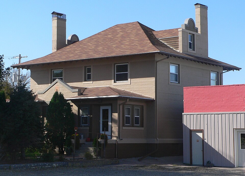
Built in 1911. Listed on the National Register of Historic Places in 1983.
One of 5 National Register listings published here for Tripp County · listed in 1983 · category: Building · built in 1911.
Sources: the case file at the National Archives · the National Register database, National Park Service
Regional context, not property-specific evidence. The federal wildfire occurrence database lists 40 fires within 5 miles of E. G. Barnum House between 1997 and 2012, burning about 325 acres in total. 1 started naturally. None was recorded as arson. Distance is straight-line from the map coordinates, so a fire counted here may appear on a neighbouring settlement's page as well.
| Reported cause | Fires |
|---|---|
| Missing data/not specified/undetermined | 16 |
| Misuse of fire by a minor | 8 |
| Debris and open burning | 6 |
| Fireworks | 6 |
| Equipment and vehicle use | 2 |
| Power generation/transmission/distribution | 1 |
| Natural | 1 |
The most recent of them, most recent first, with the day each was reported and the service that recorded it.
| Date | Cause | Size | Reported by | Name on the report |
|---|---|---|---|---|
| 29 September 2010 | Missing data/not specified/undetermined | 30 acres | South Dakota Wildland Fire Suppression | WATZEL/THEIMAN929 |
| 26 September 2000 | Equipment and vehicle use | 2.0 acres | Colome Volunteer Fire Department | JOEL KEIRLEBER |
| 24 September 1997 | Misuse of fire by a minor | under an acre | Rosebud Agency | WINNER |
| 14 September 2000 | Debris and open burning | 3.0 acres | Winner Volunteer Fire Department | DEAN LEWIS |
| 11 September 2000 | Missing data/not specified/undetermined | 25 acres | Winner Volunteer Fire Department | GEORGE AND JOE VAVRA |
| 3 August 2009 | Missing data/not specified/undetermined | 1.5 acres | South Dakota Wildland Fire Suppression | not named |
| 28 August 2003 | Missing data/not specified/undetermined | 5.0 acres | South Dakota Wildland Fire Suppression | not named |
| 24 August 1999 | Power generation/transmission/distribution | 1.0 acres | Winner Volunteer Fire Department | STEVE NOVOTNY |
Regional context, not property-specific evidence. The National Weather Service names Winner, the town this property stands in, in 91 storm reports between 1994 and 2024: 53 hail, 28 thunderstorm wind, 7 tornado, 2 funnel cloud. The reports record 1 injury. Each account below is quoted exactly as the forecast office filed it, from the NOAA Storm Events Database, and each date opens the federal record of that event.
| When | Event | Place named | Harm | What the report says |
|---|---|---|---|---|
| July 1998 | Funnel Cloud | Winner | 1 hurt | FUNNEL CLOUDS CONTINUED AS THE STORMS MOVED INTO TRIPP COUNTY. |
| June 1994 | Thunderstorm Wind | Winner | $500,000 | Several structures were damaged with broken windows and shingles torn off. The roof was blown off a bingo hall, and a mobile home was destroyed. |
| June 2009 | Thunderstorm Wind | Winner | $300,000 | Wind gusts to 75 mph downed numerous power poles and trees across south central Tripp County. A few small barns and sheds were also blown over by the wind. The combination of hail and wind destroyed siding on a house south of Winner and flattened crops. |
| June 2004 | Flash Flood | Winner | $200,000 | no account filed |
| August 2003 | Thunderstorm Wind | Winner | $100,000 | no account filed |
| May 2010 | Tornado (EF2) | Winner | $80,000 | A tornado tracked along East 3rd Street in Winner, blowing down carports, trees, and tractor-trailers. A large barn was destroyed east of Winner; the curved roof was blown off in one piece and tossed across a corral. Another machine shed was blown apart. Based on the extent of the damage, wind speeds were estimated around 75 mph through town with peak winds 95 to 115 mph. |
| June 2003 | Hail | Winner | $50,000 | Large hail broke car windows. |
| June 2006 | Thunderstorm Wind | Winner | $10,000 | 3 power poles were downed in Winner. |
| July 1999 | Thunderstorm Wind | Winner | $10,000 | Nine power poles and several large trees were blown down. |
| June 1999 | Thunderstorm Wind | Winner | $5,000 | Wind damage from a thunderstorm. A convenience store roof was damaged, power lines were down and several large trees were blown over. |
| June 2003 | Tornado (F1) | Winner | $5,000 | no account filed |
| June 2001 | Tornado (F1) | Winner | $5,000 | no account filed |
| September 2000 | Thunderstorm Wind | Winner | $2,000 | An awning was torn off a building in Winner. |
| August 2024 | Thunderstorm Wind | Winner | $1,000 | Shingles were blown off of roof and five inch diameter tree branches broken off of trees. |
| August 2017 | Hail | Winner | $1,000 | The combination of hail and wind broke a window in a home. |
| July 2001 | Thunderstorm Wind | Winner | $500 | A thunderstorm over Winner produced a heat burst with damaging winds. Temperatures at the Winner airport jumped to 92F. One power pole was blown down. |
| July 2024 | Thunderstorm Wind | Winner | - | Numerous reports of wind damage in Winner, with about a dozen power poles down. The screen at the Winner Drive-in was destroyed. |
| May 2021 | Thunderstorm Wind | Winner | - | Wind gusts around 60 mph caused power outages in Winner. |
| August 2020 | Tornado (EF0) | Winner | - | A brief tornado touched down in an open area, causing no damage. |
| July 2019 | Thunderstorm Wind | Winner | - | The spotter estimated wind gusts at 60 mph. |
| July 2015 | Thunderstorm Wind | Winner | - | Wind gusts were estimated at 60 mph. |
| July 2012 | Thunderstorm Wind | Winner | - | Wind gusts were estimated at 60 mph south of Winner. |
| May 2010 | Thunderstorm Wind | Winner | - | Wind gusts were estimated at 60 mph. |
| May 2010 | Thunderstorm Wind | Winner | - | A storm chaser estimated wind gusts around 75 mph from a thunderstorm rear flank downdraft. |
| July 2010 | Thunderstorm Wind | Winner | - | Wind gusts were estimated at 60 mph. |
| July 2009 | Thunderstorm Wind | Winner | - | Wind gusts were estimated at 60 mph. |
| June 2001 | Tornado (F0) | Winner | - | A tornado was on the ground for one minute, but caused no damage. |
| July 2001 | Funnel Cloud | Winner | - | A few funnel clouds were reported by public. |
| May 1999 | Tornado (F0) | Winner | - | Brief Touchdown. Tornado path and width estimated |
| July 1998 | Tornado (F0) | Winner | - | BRIEF TOUCHDOWN NEAR LONG VALLEY. |
| June 1995 | Thunderstorm Wind | Winner | - | Winds gusted at the winner ASOS site to 69 mph. |
| August 2024 | Hail | Winner | - | no account filed |
| August 2024 | Hail | Winner | - | no account filed |
| May 2022 | Hail | Winner | - | no account filed |
| September 2019 | Hail | Winner | - | no account filed |
| June 2018 | Hail | Winner | - | no account filed |
| June 2018 | Hail | Winner | - | no account filed |
| May 2012 | Hail | Winner | - | no account filed |
| May 2012 | Hail | Winner | - | no account filed |
| August 2011 | Hail | Winner | - | no account filed |
| May 2010 | Hail | Winner | - | no account filed |
| August 2010 | Hail | Winner | - | no account filed |
| July 2010 | Thunderstorm Wind | Winner | - | no account filed |
| June 2009 | Hail | Winner | - | no account filed |
| June 2009 | Hail | Winner | - | no account filed |
| July 2009 | Hail | Winner | - | no account filed |
| May 2008 | Hail | Winner | - | no account filed |
| June 2008 | Hail | Winner | - | no account filed |
| June 2008 | Hail | Winner | - | no account filed |
| August 2008 | Hail | Winner | - | no account filed |
| August 2008 | Hail | Winner | - | no account filed |
| July 2007 | Hail | Winner | - | no account filed |
| July 2007 | Thunderstorm Wind | Winner | - | no account filed |
| July 2007 | Thunderstorm Wind | Winner | - | no account filed |
| April 2006 | Hail | Winner | - | no account filed |
| June 2006 | Thunderstorm Wind | Winner | - | no account filed |
| May 2006 | Hail | Winner | - | no account filed |
| September 2006 | Hail | Winner | - | no account filed |
| August 2006 | Hail | Winner | - | no account filed |
| August 2006 | Hail | Winner | - | no account filed |
No historic map-sheet match is published for this property yet. That does not mean no map exists. This record needs a coordinate-quality review before it can be joined to a sheet boundary. Browse the county's mapped places while that work is pending.
Other National Register properties close enough to walk or drive between, ordered by distance from this one. Both positions come from the same geocoding pass that matched these properties to their map sheets.
| Photograph | Property | Distance | Listed |
|---|---|---|---|
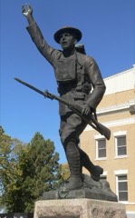 | Tripp County Veteran's Memorial | 2.9 miles | 2009 |
| National Archives record | The nomination case file for reference 83003020 in Record Group 79. |
| Tripp County | All 5 listed properties in this county. |