 Block
From the record
One of 44 National Register listings published here for Clay County · listed in 1988 · category: Building.
Sources: the case file at the National Archives · the National Register database, National Park Service
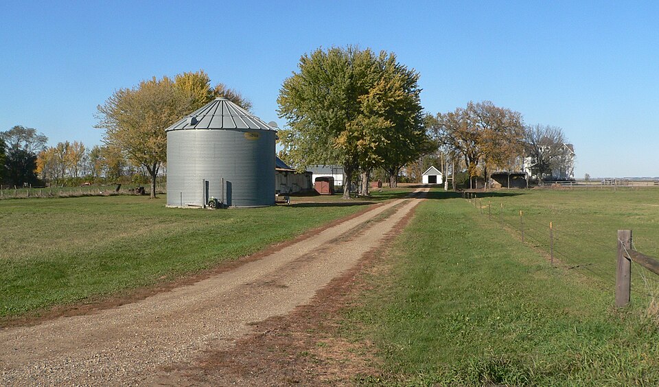
Listed on the National Register of Historic Places in 1988.
One of 44 National Register listings published here for Clay County · listed in 1988 · category: Building.
Sources: the case file at the National Archives · the National Register database, National Park Service
Regional context, not property-specific evidence. The federal wildfire occurrence database lists 9 fires within 5 miles of Jens N. and Anna Junker Farmstead between 2002 and 2020, burning about 7 acres in total. None started naturally. None was recorded as arson. Distance is straight-line from the map coordinates, so a fire counted here may appear on a neighbouring settlement's page as well.
| Reported cause | Fires |
|---|---|
| Missing data/not specified/undetermined | 6 |
| Debris and open burning | 1 |
| Equipment and vehicle use | 1 |
| Smoking | 1 |
The most recent of them, most recent first, with the day each was reported and the service that recorded it.
| Date | Cause | Size | Reported by | Name on the report |
|---|---|---|---|---|
| 1 August 2007 | Missing data/not specified/undetermined | under an acre | South Dakota Wildland Fire Suppression | not named |
| 28 July 2002 | Missing data/not specified/undetermined | 2.0 acres | Vermillion Volunteer Fire Department | EMMICK |
| 25 May 2010 | Missing data/not specified/undetermined | 1.0 acres | South Dakota Wildland Fire Suppression | SMOKING BUTT |
| 22 May 2014 | Debris and open burning | 2.0 acres | South Dakota Wildland Fire Suppression | WEST HWY 12 - ARF10 |
| 18 May 2015 | Equipment and vehicle use | under an acre | South Dakota Wildland Fire Suppression | 454TH |
| 12 April 2014 | Missing data/not specified/undetermined | under an acre | South Dakota Wildland Fire Suppression | KNOX BROS |
| 31 March 2005 | Smoking | 1.0 acres | South Dakota Wildland Fire Suppression | not named |
| 19 December 2020 | Missing data/not specified/undetermined | under an acre | South Dakota Wildland Fire Suppression | DITCH FIRE |
Regional context, not property-specific evidence. The National Weather Service names Meckling, the town this property stands in, in 45 storm reports between 1997 and 2025: 34 hail, 6 thunderstorm wind, 5 flood. No death or injury is recorded in these reports. Each account below is quoted exactly as the forecast office filed it, from the NOAA Storm Events Database, and each date opens the federal record of that event.
| When | Event | Place named | Harm | What the report says |
|---|---|---|---|---|
| July 1997 | Thunderstorm Wind | Meckling | $200,000 | no account filed |
| August 2000 | Thunderstorm Wind | Meckling | $50,000 | A microburst destroyed a pole shed and caused tree and power line damage, resulting in power outages. |
| June 1999 | Thunderstorm Wind | Meckling | $5,000 | Thunderstorm winds blew down large tree limbs. |
| May 2022 | Hail | Meckling | - | Crop damage is an estimate from insured losses. Information provided by the United States Department of Agriculture. |
| May 2022 | Thunderstorm Wind | Meckling | - | A semi-truck was blown over between Meckling and Vermillion on State Highway 50. |
| July 2020 | Hail | Meckling | - | Strong winds accompanied the hail. Crop damage is an estimate from insured losses. Information provided by the United States Department of Agriculture. |
| April 2017 | Hail | Meckling | - | Hail was brief. |
| April 2017 | Hail | Meckling | - | Mostly pea size hail, but also had some nickel sized. |
| August 2015 | Thunderstorm Wind | Meckling | - | Thunderstorm winds caused tree damage. The winds were accompanied by penny size hail. |
| August 2015 | Hail | Meckling | - | Hail was accompanied by damaging winds. |
| June 2014 | Flood | Meckling | - | Persistent moderate to heavy rain caused flooding of some fields and other lowlands, including several roads. This flooding lasted well into the daytime hours after the rain subsided. |
| May 2011 | Flood | Meckling | - | Flooding along the Missouri River developed and then increased in late May as runoff from excessive upstream snowmelt and rain reached the area. Lowlands flooded included a few roads near the River. The river reached its highest May levels at the end of the month. |
| July 2011 | Flood | Meckling | - | Flooding from upstream spring snowmelt and subsequent heavy rain continued at major levels through July. Lowlands along the river including numerous roads, parks, recreational areas and several homes remained flooded. Thousands of acres of usually dry land, including several farms, remained flooded. The river began a very slow general fall late in the month. The river reached record high stages near Gayville and near Maskell, Nebraska in early July. |
| June 2011 | Flood | Meckling | - | Flooding from upstream spring snowmelt and subsequent heavy rain continued to worsen for most of June. Lowlands along the river including numerous roads, parks, recreational areas and several homes were flooded. Thousands of acres of usually dry land were flooded, with several farms affected and farm equipment damaged. The river reached record high stages near Gayville and near Maskell, Nebraska on June 29th. |
| August 2011 | Flood | Meckling | - | Flooding from upstream spring snowmelt and subsequent heavy rain continued at moderate levels at the start of August. Lowlands along the river including numerous roads, parks, recreational areas and several homes remained flooded. Thousands of acres of usually dry land, including several farms, remained flooded. The river fell slowly during the month. The highest stage at Gayville was 1.4 feet above flood stage on August 1st. |
| September 2010 | Hail | Meckling | - | Large hail was accompanied by estimated 40 mph wind gusts. |
| July 2009 | Hail | Meckling | - | Large hail covered the ground and South Dakota Highway 50. |
| June 2009 | Thunderstorm Wind | Meckling | - | Thunderstorm wind gusts to 60 mph were accompanied by penny size hail. |
| June 2009 | Hail | Meckling | - | Hail was accompanied by wing gusts up to 60 mph. |
| April 2025 | Hail | Meckling | - | no account filed |
| May 2022 | Hail | Meckling | - | no account filed |
| August 2016 | Hail | Meckling | - | no account filed |
| September 2010 | Hail | Meckling | - | no account filed |
| September 2010 | Hail | Meckling | - | no account filed |
| July 2009 | Hail | Meckling | - | no account filed |
| July 2009 | Hail | Meckling | - | no account filed |
| July 2009 | Hail | Meckling | - | no account filed |
| July 2009 | Hail | Meckling | - | no account filed |
| June 2009 | Hail | Meckling | - | no account filed |
| June 2009 | Hail | Meckling | - | no account filed |
| June 2008 | Hail | Meckling | - | no account filed |
| June 2008 | Hail | Meckling | - | no account filed |
| September 2007 | Hail | Meckling | - | no account filed |
| September 2007 | Hail | Meckling | - | no account filed |
| September 2007 | Hail | Meckling | - | no account filed |
| April 2006 | Hail | Meckling | - | no account filed |
| June 2006 | Hail | Meckling | - | no account filed |
| June 2005 | Hail | Meckling | - | no account filed |
| June 2005 | Hail | Meckling | - | no account filed |
| May 2004 | Hail | Meckling | - | no account filed |
| May 2004 | Hail | Meckling | - | no account filed |
| May 2004 | Hail | Meckling | - | no account filed |
| May 2004 | Hail | Meckling | - | no account filed |
| June 2003 | Hail | Meckling | - | no account filed |
| May 1999 | Hail | Meckling | - | no account filed |
No historic map-sheet match is published for this property yet. That does not mean no map exists. This record needs a coordinate-quality review before it can be joined to a sheet boundary. Browse the county's mapped places while that work is pending.
Other National Register properties close enough to walk or drive between, ordered by distance from this one. Both positions come from the same geocoding pass that matched these properties to their map sheets.
| Photograph | Property | Distance | Listed |
|---|---|---|---|
| Calle Nissen Johnsen Farm | 1.2 miles | 1999 | |
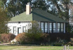 | Lincoln School #12 | 1.5 miles | 2000 |
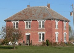 | William Andre House | 3.2 miles | 2002 |
| National Archives record | The nomination case file for reference 88002841 in Record Group 79. |
| Clay County | All 44 listed properties in this county. |