Block
From the record
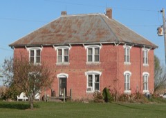
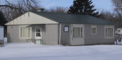
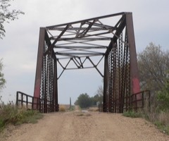
44 National Register listings published here.
Sources: the National Register database, National Park Service
51 topographic sheets cover 21 settlements here, and 44 properties are on the National Register of Historic Places.
44 National Register listings published here.
Sources: the National Register database, National Park Service
Every property in this county listed on the National Register of Historic Places, with the year it was listed and the federal nomination document.
Every wildfire the federal occurrence database records inside this county: 107 of them, burning about 1,049 acres. None started naturally and 3 were recorded as arson. Each settlement page carries the fires within five miles of it.
| Reported cause | Fires |
|---|---|
| Debris and open burning | 43 |
| Missing data/not specified/undetermined | 26 |
| Smoking | 14 |
| Equipment and vehicle use | 10 |
| Misuse of fire by a minor | 7 |
| Arson/incendiarism | 3 |
| Railroad operations and maintenance | 2 |
| Recreation and ceremony | 1 |
| Power generation/transmission/distribution | 1 |
The five largest, by the area the report gives. None of them was recorded as arson.
| Date | Cause | Size | Reported by | Name on the report |
|---|---|---|---|---|
| 14 January 2000 | Debris and open burning | 250 acres | Wakonda Fire & Rescue | COUNTY LINE |
| 14 January 2000 | Missing data/not specified/undetermined | 200 acres | Volin Volunteer Fire Department | WAKANDA |
| 1 November 1999 | Debris and open burning | 110 acres | Wakonda Fire & Rescue | DENNIS GANGCHOW |
| 18 November 1999 | Debris and open burning | 100 acres | Wakonda Fire & Rescue | HWY 19 & 302 ST |
| 29 April 2010 | Missing data/not specified/undetermined | 45 acres | South Dakota Wildland Fire Suppression | BRANICK |
| 23 March 1992 | Debris and open burning | 36 acres | Lake Andes National Wildlife Refuge | ANDERSON |
| 2 April 2005 | Missing data/not specified/undetermined | 35 acres | South Dakota Wildland Fire Suppression | not named |
| 9 March 2005 | Missing data/not specified/undetermined | 30 acres | South Dakota Wildland Fire Suppression | not named |
Every settlement page carries the fires within five miles of it - see the settlement index below.
The NOAA Storm Events Database holds 383 reports for this county, causing no deaths, 2 injuries and about $10,616,500 in recorded property damage. Each settlement page carries the reports that name it.
| Kind of event | Reports |
|---|---|
| Hail | 174 |
| Thunderstorm Wind | 113 |
| Flood | 44 |
| Tornado | 31 |
| Flash Flood | 19 |
| Lightning | 1 |
| Funnel Cloud | 1 |
The most serious of them, by death, then injury, then recorded damage. The accounts are quoted exactly as the forecast office filed them.
| When | Event | Place named | Harm | What the report says |
|---|---|---|---|---|
| July 1998 | Thunderstorm Wind | Vermillion | 2 hurt | no account filed |
| June 2024 | Flood | Burbank | $6,500,000 | Rainfall amounts across Clay County from June 20-22 ranged from around a third of an inch across southern areas to 1 to 2 inches across northern areas. Farther north and upstream, 6 to 10 inches of rain fell across portions of southeast South Dakota, with locally higher amounts in excess of 12 inches. This rainfall resulted in record flooding along the Vermillion River and extensive overland flooding along the adjoining flood plain.||Two primary residences were impacted by flood waters across the northern portion of the county with each reporting more than three feet of water in their basements. One owner along the Vermillion River lost 100 percent of their land while countless other acres of farmland were lost in the vicinity of the river. One farmstead alone lost 60 plus acres. ||Many county and township roads across the northern portion of the county experienced flood damage ranging from gravel wash to major impacts. A couple concrete box culverts and bridges were destroyed by backup from the Vermillion River. Preliminary damage assessments estimate loss to public infrastructure to be 500 thousand dollars. ||Within the city of Vermillion, voluntary evacuations were activated near Saginaw and Missouri Streets. Cotton Park experienced extensive flood impacts, including major damage to about one mile of trail and a destroyed frisbee golf course, estimated to cost 1.5 million dollars. The Vermillion wastewater treatment plant also experienced significant damage, forcing the release of untreated water into the Vermillion River. Damage to the plant is estimated at 4.5 million dollars.||For additional information on river flooding, please see other flood entries for Clay County. |
| June 1990 | Tornado (F1) | not stated | $2,500,000 | no account filed |
| March 2019 | Flood | Burbank | $440,000 | Multiple rural roads under water. Other flooding resulted in extensive damage to public infrastructure including numerous county and township roads, culverts, and some bridges. |
| September 2010 | Hail | Vermillion | $250,000 | Large hail damaged numerous vehicles with dent and cracked and broken windshields. Twelve skylights at a local Wal-Mart store were broken. Some damage to roofs and siding was also sustained. |
| July 1997 | Thunderstorm Wind | Meckling | $200,000 | no account filed |
| May 2008 | Tornado (EF1) | Wakonda | $100,000 | A tornado destroyed a barn, damaged or destroyed several outbuildings, scattered lumber across a field, and damaged trees and power lines. |
| June 2014 | Flood | Irene | $50,000 | Persistent moderate to heavy rain caused flooding of fields and other lowlands, including several roads, homes, and businesses. This flooding lasted for almost two days, and was aggravated locally by additional storms during that time. Some roads were damaged or washed out. |
| June 2000 | Thunderstorm Wind | Burbank | $50,000 | Thunderstorm winds uprooted trees and caused other tree and power line damage. |
| August 2000 | Thunderstorm Wind | Meckling | $50,000 | A microburst destroyed a pole shed and caused tree and power line damage, resulting in power outages. |
| June 2000 | Thunderstorm Wind | Vermillion | $50,000 | Thunderstorm winds caused widespread tree damage and destroyed a picnic shelter. A few vehicles were damaged by tree debris. |
| June 1999 | Thunderstorm Wind | Vermillion | $50,000 | Thunderstorm winds caused extensive tree damage and minor damage to structures near the University of South Dakota campus. |
| May 2000 | Thunderstorm Wind | Wakonda | $30,000 | Thunderstorm winds uprooted trees, destroyed a small shed, three pieces of farm equipment, damaged a barn, and killed one farm animal. |
| June 2010 | Thunderstorm Wind | Dalesburg | $25,000 | Thunderstorm winds destroyed a farm building and heavily damaged two others. |
| April 1985 | Tornado (F1) | not stated | $25,000 | no account filed |
| June 1984 | Tornado (F2) | not stated | $25,000 | no account filed |
| September 1981 | Tornado (F2) | not stated | $25,000 | no account filed |
| August 1967 | Tornado (F2) | not stated | $25,000 | no account filed |
| May 1965 | Tornado (F2) | not stated | $25,000 | no account filed |
| September 2019 | Flood | Wakonda | $20,000 | Excessive rainfall from September 10-12 in upper portions of the Vermillion River Basin (6.78 inches 2 miles east of Montrose, 5.63 inches at Montrose) resulted in a crest on the Vermillion River near Wakonda (gage site WKAS2) of 1.58 feet above flood stage on September 16. Highway 19 south of Centerville was closed due to high water, along with numerous other county roads. |
| June 2010 | Thunderstorm Wind | Wakonda | $20,000 | Thunderstorm winds damaged a shop, and displaced debris up to a half mile to the east. |
| July 2000 | Thunderstorm Wind | Wakonda | $20,000 | Thunderstorm winds caused widespread tree damage including numerous large branches and some small trees down. |
| July 1997 | Lightning | Vermillion | $20,000 | no account filed |
| June 2010 | Thunderstorm Wind | Vermillion | $15,000 | Thunderstorm winds blew part of the roof off a church. |
| June 2023 | Thunderstorm Wind | Wakonda | $10,000 | Thunderstorm winds heavily damaged a barn and split several trees on an acreage. Property damage costs are a rough estimate. |
| September 2019 | Flood | Westerville | $10,000 | Excessive rainfall from September 10-12 in upper portions of the Vermillion River Basin (6.78 inches 2 miles east of Montrose, 5.63 inches at Montrose, 4.68 inches at Hurley) resulted in a crest on the Vermillion River at Vermillion (gage site VERS2) of 2.43 feet above flood stage on September 19. Numerous county roads were inundated with water with considerable flooding of agricultural lands. |
| June 2010 | Thunderstorm Wind | Greenfeld | $10,000 | Thunderstorm winds blew empty grain bins off anchors. |
| May 2008 | Thunderstorm Wind | Irene | $10,000 | Thunderstorm winds blew over three empty grain bins. |
| May 2008 | Thunderstorm Wind | Wakonda | $10,000 | Thunderstorm winds destroyed a farm building. |
| June 2000 | Thunderstorm Wind | Burbank | $10,000 | Thunderstorm winds caused tree damage, including 6 inch limbs broken off. The winds also caused power line damage. |
| July 2013 | Thunderstorm Wind | Burbank | $5,000 | Thunderstorm winds caused tree damage, including at least one large limb blown down. The falling limb damaged the corner of a house. A power outage was reported. |
| June 2010 | Thunderstorm Wind | Vermillion | $5,000 | Thunderstorm winds blew a delivery truck over. the winds also caused tree damage, including large branches blown down. |
| May 2010 | Thunderstorm Wind | Westerville | $5,000 | Thunderstorm winds damaged power lines, and blew the roof off a barn. |
| May 2008 | Thunderstorm Wind | Hub City | $5,000 | Thunderstorm winds caused tree damage and blew shingles off a roof. |
| June 1999 | Thunderstorm Wind | Vermillion | $5,000 | Thunderstorm winds caused tree damage, including several large limbs down. |
| June 1999 | Thunderstorm Wind | Meckling | $5,000 | Thunderstorm winds blew down large tree limbs. |
| June 1992 | Tornado (F0) | not stated | $2,500 | no account filed |
| June 1986 | Tornado (F1) | not stated | $2,500 | no account filed |
| August 1985 | Tornado (F1) | not stated | $2,500 | no account filed |
| July 2020 | Thunderstorm Wind | Vermillion | $2,000 | One tree was toppled and several large branches downed by thunderstorm winds. Property damage amounts are rough estimates. |
| July 2020 | Thunderstorm Wind | Vermillion | $1,000 | Large limbs were taken down on the east side of Vermillion by thunderstorm winds. Property damage amounts are rough estimates. |
| May 2011 | Thunderstorm Wind | Greenfeld | $1,000 | Thunderstorm winds blew shingles off a roof. |
| July 2025 | Thunderstorm Wind | Greenfeld | - | Thunderstorm wind gusts were measured by a personal weather station. |
| July 2025 | Thunderstorm Wind | Dalesburg | - | Thunderstorm wind gusts were measured by South Dakota Mesonet station BFMS2 Beresford 7 WSW. |
| July 2025 | Thunderstorm Wind | Westerville | - | A wind gust was estimated around 60 mph at the intersection of 455th Avenue and 306th Street. |
| July 2025 | Thunderstorm Wind | Dalesburg | - | An extended period of thunderstorm wind gusts was measured by South Dakota Mesonet station BFMS2 Beresford 7 WSW. |
| July 2025 | Thunderstorm Wind | Davidson Arpt | - | A 61 mph thunderstorm wind gust was measured at Harold Davidson Field Airport (KVMR). |
| June 2025 | Thunderstorm Wind | Vermillion | - | A portion of a storage building was destroyed by thunderstorm wind gusts. |
| June 2025 | Thunderstorm Wind | Vermillion | - | Several large trees limbs were brought down by thunderstorm winds. One large tree was blown over and was leaning on a house. |
| May 2024 | Hail | Westerville | - | A considerable amount of nickel to quarter size hail fell. |
| July 2024 | Thunderstorm Wind | Vermillion | - | Thunderstorm winds downed multiple trees and large branches across the southeast portions of Vermillion. |
| July 2024 | Thunderstorm Wind | Vermillion | - | A tree was downed by thunderstorm winds in Vermillion. |
| June 2024 | Flash Flood | Irene | - | Rainfall from 3 to 5 inches during the early evening resulted in flash flooding that inundated two homes with up to 3 feet of water and covered many rural roads in the northern portion of the county. For a more comprehensive description of flood damage, please see other entries for areal and river flooding for Clay County. |
| June 2024 | Flood | Wakonda | - | The Vermillion River near Wakonda rose above flood stage the morning of June 21st, cresting around 4.93 feet above flood stage (18.93 feet) on June 22nd. This crest is in the Major Stage and broke the previous record. The river then fell below flood stage on the evening of June 28th. For a more comprehensive description of flood damage, please see other entries for Clay County. |
| June 2024 | Flood | Westerville | - | The Vermillion River at Vermillion rose above flood stage the morning of June 23rd, cresting around 12.15 feet above flood stage (33.15 feet) on June 24th. This crest is in the Major Stage and broke the previous record. The river then fell below flood stage on the morning of June 30th. For a more comprehensive description of flood damage, please see other entries for Clay County. |
| July 2023 | Thunderstorm Wind | Dalesburg | - | Thunderstorm wind gusts as high as 63 mph were measured by South Dakota State University Mesonet site BFMS2 7 miles west-southwest of Beresford. |
| July 2023 | Thunderstorm Wind | Vermillion | - | Several large branches were blown down by thunderstorm winds around town. |
| May 2023 | Hail | Hub City | - | A significant accumulation of pea to dime size hail occurred. |
| May 2023 | Thunderstorm Wind | Hub City | - | Thunderstorm winds snapped several large trees. |
| June 2023 | Hail | Wakonda | - | Crop damage is an estimate from insured losses. Information provided by the United States Department of Agriculture. |
The Survey's mineral resources record lists 2 workings inside this county. All of them still produce. Each settlement page carries the workings within five miles of it.
| Commodity | Workings |
|---|---|
| Sand and Gravel, Construction | 1 |
| Stone, Crushed/Broken | 1 |
The least common of them first, because a county's hundredth gravel pit says nothing its first ten did not.
| Where | Site | Commodity | Status | Recorded |
|---|---|---|---|---|
| Wakonda Quarry | Stone, Crushed/Broken | Producer | ||
| Wrigg Pit | Sand and Gravel, Construction | Producer |
Named settlements recorded in the Geographic Names Information System, each with the topographic sheets covering it. Villages, hamlets and abandoned places alike. Each is shown with the nearest named watercourse or landform and the survey quadrangle it falls on.
Pleasant Valley township · 57069 · Near Cabbage Flat · Hub City quadrangle
18 sheets, 1898 to 1986
Bethel township · 57072 · Gayville NE quadrangle
9 sheets, 1955 to 1985
No longer a settlement
Prairie Center township · 57069 · On Baptist Creek · Hub City quadrangle
18 sheets, 1898 to 1986
Riverside township · 57014 · On Frog Creek · Wakonda quadrangle
11 sheets, 1898 to 1985
Glenwood township · 57004 · Beresford quadrangle
10 sheets, 1897 to 1985
No longer a settlement
Glenwood township · 57004 · Centerville quadrangle
10 sheets, 1897 to 1985
No longer a settlement
Garfield township · 57069 · Hub City quadrangle
18 sheets, 1898 to 1986
No longer a settlement
Riverside township · 57014 · On Frog Creek · Wakonda quadrangle
11 sheets, 1898 to 1985
No longer a settlement
Bethel township · 57072 · Gayville quadrangle
10 sheets, 1955 to 1985
No longer a settlement
Star township · 57073 · Wakonda quadrangle
11 sheets, 1898 to 1985
No longer a settlement
The vanished settlements of Clay County: the places named above that are no longer on the map.