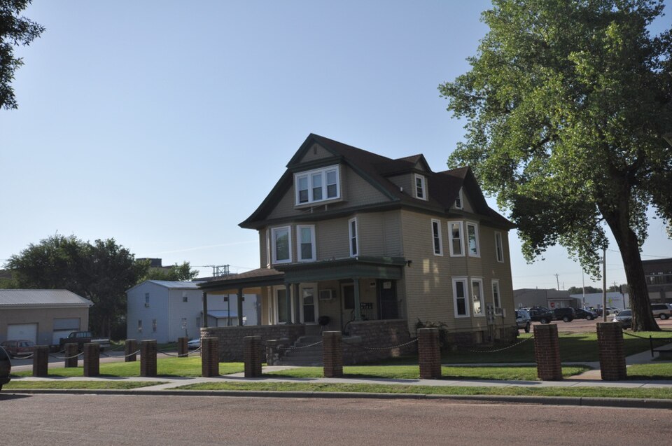
| August 2000 | Thunderstorm Wind | Mitchell | 10 hurt, $8,000,000 | A wet microburst with winds estimated at 120 mph caused heavy damage in and around Mitchell. Apartments and several mobile homes were destroyed, vehicles were overturned, and other damage occurred to buildings and vehicles. Widespread tree and power line damage also occurred. Ten people were injured, although the majority of the injuries were minor. The damage path was approximately a mile and a half long and a mile wide, extending over the southwest part of Mitchell. |
| June 1997 | Thunderstorm Wind | Mitchell | 5 hurt, $500,000 | no account filed |
| July 2002 | Hail | Mitchell | $3,000,000 | Large hail caused severe damage to numerous vehicles, including many at car dealerships. Damage also occurred to windows, siding, and shingles on buildings. The hail caused damage to greens at a municipal golf course. |
| May 2012 | Hail | Mitchell | $2,000,000 | Large hail caused widespread damage to vehicles, buildings, and structures in and near Mitchell. In addition to dented vehicles and broken windows, the hail damaged the roofs and siding of homes and businesses. Two of the highest individual damage amounts included $175,000 to the Corn Palace, the roof of which needed replacing, and $100,000 damage to the roof of the Central Electric Cooperative Building. The roofs of numerous homes suffered lesser damages, and siding was also damaged. Damaged vehicles included several law enforcement and other city and county government vehicles. |
| September 2019 | Flash Flood | Mitchell | $250,000 | Numerous homes and businesses were inundated by flood water in Mitchell. |
| May 2007 | Flood | Mitchell | $200,000 | Heavy rainfall caused flooding of low areas including fields, homes, businesses, schools, roads, streams, and bridges. The flooding was a longer term event than flash flooding. Long term major flooding of the James River also resulted, with the river peaking at 7.4 feet above flood stage near Mitchell on May 10th. Some parks and other recreation areas were affected, especially in and near Mitchell. A few roads and bridges were washed out by the high water. The flooding delayed planting of crops in some areas. |
| August 2000 | Tornado (F1) | Mitchell | $100,000 | A brief tornado damaged several structures. |
| September 2019 | Flash Flood | Mitchell | $75,000 | Several vehicles stalled around Mitchell in rising waters. |
| June 2000 | Thunderstorm Wind | Mitchell | $60,000 | Thunderstorm winds caused tree and power line damage, blew part of the roof off a motel, blew down billboard signs, and caused minor damage to other buildings and vehicles. |
| June 2020 | Thunderstorm Wind | Mitchell | $50,000 | Numerous trees were uprooted or snapped throughout Mitchell. Property damage costs are rough estimates. |
| April 2019 | Lightning | Mitchell | $50,000 | Lightning during an evening thunderstorm struck the bell tower of the First Lutheran Church, sending several large chunks of brick and stone hurtling through the air for up to 50 yards. There was significant structural damage to the roof. The organ soundboard, computer server, and video system were disabled by the lightning strike. |
| July 2004 | Hail | Mitchell | $50,000 | no account filed |
| July 2010 | Thunderstorm Wind | Mitchell | $25,000 | Thunderstorm winds caused tree and power line damage, including several trees blown down. A house was damaged by a tree falling onto its roof. |
| August 2014 | Thunderstorm Wind | Mitchell | $20,000 | Thunderstorm winds severely damaged a mobile home, damaged the roof of a shed, and caused tree damage including 4 inch diameter limbs blown down. |
| June 2005 | Flash Flood | Mitchell | $20,000 | Heavy rainfall of up to four inches caused widespread street flooding, especially on the west side of Mitchell. At least 10 vehicles stalled in high water. At least 12 homes and businesses were flooded, as well as several lower level apartments. The basement of one apartment building was flooded by 10 feet of water, knocking out boilers and a hot water heater. |
| July 2003 | Thunderstorm Wind | Mitchell | $20,000 | Thunderstorm winds caused widespread tree damage, including large trees and branches down. The winds also destroyed or damaged several large signs. The winds caused minor power line damage, causing localized power outages. |
| June 2020 | Thunderstorm Wind | Mitchell | $15,000 | Numerous three inch limbs were taken down, along with a few power poles. Property damage costs are rough estimates. |
| June 2020 | Thunderstorm Wind | Mitchell | $10,000 | Several large branches were removed from trees, and a pickup topper was blown down the street. Property damage costs are rough estimates. |
| August 2011 | Thunderstorm Wind | Mitchell | $10,000 | Thunderstorm winds blew down power lines and caused tree damage, including several trees blown down. |
| July 2010 | Thunderstorm Wind | Mitchell | $10,000 | Thunderstorm winds caused damage to trees and power lines. |
| July 2010 | Thunderstorm Wind | Mitchell | $10,000 | Thunderstorm winds blew the roof off a garage. The winds also caused tree damage, including large branches blown down. |
| July 2010 | Thunderstorm Wind | Mitchell | $10,000 | Thunderstorm winds caused tree damage and blew down power lines, causing a power outage on the north side of Mitchell. |
| August 2009 | Thunderstorm Wind | Mitchell | $10,000 | Thunderstorm winds caused tree and power line damage, with brief resulting power outages. The tree damage included large branches blown down. The winds were accompanied by three quarter inch diameter hail. |
| August 2004 | Lightning | Mitchell | $10,000 | Lightning struck and damaged the brick chimney at the public safety building. |
| July 1998 | Thunderstorm Wind | Mitchell | $10,000 | no account filed |
| July 1997 | Lightning | Mitchell | $4,000 | no account filed |
| September 2004 | Lightning | Mitchell | $2,000 | Lightning struck and damaged a brick chimney, and burned out a transformer at an amusement center. |
| May 2012 | Thunderstorm Wind | Mitchell | $1,000 | Thunderstorm winds broke a large sign at an Interstate 90 exit, and caused tree damage. |
| July 1997 | Lightning | Mitchell | $1,000 | no account filed |
| July 2024 | Hail | Mitchell | - | Along with hail up to the size of nickels, wind gusts to around 50 mph resulted in stripped leaves from trees. |
| June 2024 | Flash Flood | Mitchell | - | After as much as 3 to 5 inches of rainfall between 8 pm and 11 pm, flash flooding pushed water up to homes and flooded basements in many portions of the city of Mitchell. No travel was recommended with numerous stranded motorists, and portions of Interstate 90 were closed due to water flowing over the road. For a more comprehensive description of flood damage, please see other entries for areal and river flooding for Davison County. |
| May 2022 | Thunderstorm Wind | Mitchell | - | A thunderstorm wind gust of 58 mph was measured by mesonet site FW9779 4 miles south-southeast of Mitchell. Crop damage is an estimate from insured losses. Information provided by the United States Department of Agriculture. |
| May 2022 | Hail | Mitchell | - | Crop damage is an estimate from insured losses. Information provided by the United States Department of Agriculture. |
| May 2022 | Thunderstorm Wind | Mitchell | - | A thunderstorm wind gust to 63 mph was measured by a hand-held anemometer in Mitchell. |
| June 2022 | Thunderstorm Wind | Mitchell | - | Thunderstorm winds damaged a gas station canopy. |
| May 2022 | Thunderstorm Wind | Mitchell | - | Thunderstorm winds uprooted a large tree. |
| July 2022 | Thunderstorm Wind | Mitchell | - | A pontoon boat was blown off its trailer by thunderstorm winds while sitting in a parking lot. |
| August 2020 | Thunderstorm Wind | Mitchell | - | Personal weather station KSDMITCH21 measured a peak wind gust of 72 mph. |
| June 2020 | Hail | Mitchell | - | Crop damage is an estimate from insured losses. Information provided by the United States Department of Agriculture. |
| July 2015 | Thunderstorm Wind | Mitchell | - | Thunderstorm winds caused tree damage. |
| July 2015 | Thunderstorm Wind | Mitchell | - | Thunderstorm winds blew down branches. |
| July 2015 | Heavy Rain | Mitchell | - | Rainfall totaled 1.58 inch in 1.5 hours. |
| July 2015 | Flash Flood | Mitchell | - | Heavy rain caused flash flooding of numerous streets in Mitchell. |
| May 2014 | Hail | Mitchell | - | Hail was mostly pea size. The hail was accompanied by just under an inch of rain. |
| May 2012 | Thunderstorm Wind | Mitchell | - | Thunderstorm winds caused tree damage, including branches blown down. |
| May 2012 | Flood | Mitchell | - | Heavy rain caused minor flooding of the James River, affecting some farmland and roads. The river crested at 2.4 feet above flood stage near Mitchell on May 8th. |
| September 2012 | Thunderstorm Wind | Mitchell | - | Thunderstorm winds caused tree damage. |
| May 2011 | Flood | Mitchell | - | Moderate to major flooding of the James River, ongoing since the snowmelt season in March, continued through May but slowly subsided. Farmland and other lowlands near the river remained flooded. With the river subsiding slowly, no new flooding was reported, although some additional road damage became apparent as water slowly receded. The highest stage near Mitchell was 5.8 feet above flood stage at the start of the month. |
| June 2011 | Flood | Mitchell | - | Moderate to major flooding of the James River, ongoing since the snowmelt season in March, continued through June. Farmland and other lowlands near the river remained flooded, with the water level first falling slowly, then rising due to runoff from heavy rain. The highest stage near Mitchell was 4.9 feet above flood stage at the end of the month, though this was still almost a foot below the peak stage in May. |
| August 2011 | Flood | Mitchell | - | Moderate to major flooding of the James River, ongoing since the snowmelt season in March, continued into early August, with the flooding continuing but very slowly abating through the month. Flooding of farmland and other lowlands near the river very slowly abated. The highest stage near Mitchell was 4.6 feet above flood stage on August 1st. |
| July 2011 | Flood | Mitchell | - | Moderate to major flooding of the James River, ongoing since the snowmelt season in March, continued through July. Farmland and other lowlands near the river remained flooded, with the water level varying slightly up and down due to sporadic heavy rainfall. The highest stage near Mitchell was 4.9 feet above flood stage on July 3rd, slightly higher than the peak stage of June, but not as high as peak levels earlier in the Spring. |
| September 2011 | Flood | Mitchell | - | Flooding of the James River, ongoing since the snowmelt season in March, abated very slowly through September. Flooding of farmland and other lowlands steadily decreased, and very few roads continued to be affected. The highest stage near Mitchell was 2.3 feet above flood stage on September 2nd. |
| April 2010 | Flood | Mitchell | - | Flooding of the James River continued from March through all of April. The river fell slowly during the month, with no new flooding. Farmland and some roads remained flooded, but flooding of major roads abated. The river fell from 6.7 feet above flood stage near Mitchell at the start of April to 4.1 feet above flood stage at the end of the month. |
| May 2010 | Flood | Mitchell | - | Flooding of the James River continued from March and April through all of May. The river fell very slowly, with some farmland and roads remaining flooded. |
| September 2010 | Flood | Mitchell | - | Heavy rain caused minor flooding along the James River, with lowlands including a small amount of farmland affected. The river at Mitchell crested at 1.5 feet above flood stage on September 27th. |
| June 2010 | Flood | Mitchell | - | Moderate to major flooding of the James River was observed for most of the month. The river, which has been slowly falling before June, rose again due to heavy rain, and the number of fields and roads flooded increased again. The river crested at near 8.1 feet above flood stage at Mitchell, which was higher than the March crest. |
| June 2010 | Flash Flood | Mitchell | - | Heavy rain caused flash flooding of several streets in Mitchell, especially at the intersection of 9th Street and Sanborn Avenue. |
| August 2010 | Flood | Mitchell | - | Moderate to major flooding along the James River continued into the start of August. The river was at its highest levels during the first few days of the month, although it remained below its spring crest at Mitchell. The river then fell slowly. Flooding of fields and some roads slowly abated. |
| March 2010 | Flood | Mitchell | - | Melting of a heavy winter snowpack caused flooding of the James River which became major during the middle and late part of the month. Numerous fields and roads were flooded, including South Dakota Highway 38 east of Mitchell. The river crested at 8.00 feet above flood stage near Mitchell on March 18th. |
| July 2010 | Flood | Mitchell | - | Moderate to major flooding along the James River continued, with numerous fields and some roads remaining covered. The river rose near the end of the month, when some of the heaviest rain fell, but remained below its peak June crest at Mitchell. |
 Block