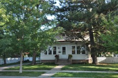
Block
From the record
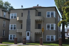
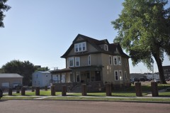
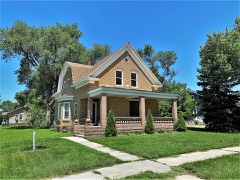
25 National Register listings published here.
Sources: the National Register database, National Park Service
28 topographic sheets cover 7 settlements here, and 25 properties are on the National Register of Historic Places.
25 National Register listings published here.
Sources: the National Register database, National Park Service
Every property in this county listed on the National Register of Historic Places, with the year it was listed and the federal nomination document.
Every wildfire the federal occurrence database records inside this county: 154 of them, burning about 1,761 acres. 6 started naturally and 3 were recorded as arson. Each settlement page carries the fires within five miles of it.
| Reported cause | Fires |
|---|---|
| Missing data/not specified/undetermined | 80 |
| Debris and open burning | 39 |
| Equipment and vehicle use | 14 |
| Natural | 6 |
| Smoking | 3 |
| Arson/incendiarism | 3 |
| Railroad operations and maintenance | 2 |
| Recreation and ceremony | 2 |
| Fireworks | 2 |
| Misuse of fire by a minor | 1 |
| Power generation/transmission/distribution | 1 |
| Other causes | 1 |
The five largest, by the area the report gives. None of them was recorded as arson.
| Date | Cause | Size | Reported by | Name on the report |
|---|---|---|---|---|
| 11 April 2015 | Debris and open burning | 250 acres | South Dakota Wildland Fire Suppression | FLAMING RACOON |
| 18 May 2010 | Debris and open burning | 200 acres | South Dakota Wildland Fire Suppression | BOYDS GUNSTOCK |
| 14 July 2006 | Missing data/not specified/undetermined | 100 acres | South Dakota Wildland Fire Suppression | not named |
| 17 July 2006 | Natural | 100 acres | South Dakota Wildland Fire Suppression | not named |
| 22 June 2000 | Debris and open burning | 100 acres | Mitchell Fire Department | WAYNE LYONS |
| 21 March 2015 | Missing data/not specified/undetermined | 60 acres | South Dakota Wildland Fire Suppression | HIGHWAY 42 FIRE |
| 20 July 2003 | Equipment and vehicle use | 60 acres | South Dakota Wildland Fire Suppression | TRAVIS HOSTLER |
| 29 February 2000 | Debris and open burning | 60 acres | South Dakota Wildland Fire Suppression | MORRISON |
Every settlement page carries the fires within five miles of it - see the settlement index below.
The NOAA Storm Events Database holds 467 reports for this county, causing 1 death, 53 injuries and about $45,577,000 in recorded property damage. Each settlement page carries the reports that name it.
| Kind of event | Reports |
|---|---|
| Thunderstorm Wind | 180 |
| Hail | 166 |
| Flood | 72 |
| Tornado | 24 |
| Flash Flood | 19 |
| Lightning | 5 |
| Heavy Rain | 1 |
The most serious of them, by death, then injury, then recorded damage. The accounts are quoted exactly as the forecast office filed them.
| When | Event | Place named | Harm | What the report says |
|---|---|---|---|---|
| April 2019 | Flood | Loomis | 1 killed | Runoff from occasional precipitation in late March and April maintained considerable flooding throughout the flood plain across Davison county. 416th Avenue near Rosedale Colony and 257th Street near the gage site were impacted by water. A direct fatality to a 22 year-old male occurred early on April 3, when his vehicle entered floodwaters around 7 feet in depth just west of the James River bridge on 250th Street.||The James River at Mitchell (gage site JRMS2) crested at 6.30 feet above flood stage on April 22, the sixth highest crest on record. Major flooding continued at the end of the month. |
| May 1962 | Tornado (F3) | not stated | 32 hurt, $2,500,000 | no account filed |
| August 2000 | Thunderstorm Wind | Mitchell | 10 hurt, $8,000,000 | A wet microburst with winds estimated at 120 mph caused heavy damage in and around Mitchell. Apartments and several mobile homes were destroyed, vehicles were overturned, and other damage occurred to buildings and vehicles. Widespread tree and power line damage also occurred. Ten people were injured, although the majority of the injuries were minor. The damage path was approximately a mile and a half long and a mile wide, extending over the southwest part of Mitchell. |
| June 1997 | Thunderstorm Wind | Mitchell | 5 hurt, $500,000 | no account filed |
| May 1989 | Thunderstorm Wind | not stated | 2 hurt | no account filed |
| May 1962 | Tornado (F3) | not stated | 2 hurt | no account filed |
| August 1969 | Tornado (F2) | not stated | 1 hurt, $25,000 | no account filed |
| May 1954 | Tornado (F2) | not stated | 1 hurt, $25,000 | no account filed |
| September 2019 | Flood | Metzgerville | $15,400,000 | Heavy rainfall from September 10-12 totalling 7 to 8 inches near Mitchell led to widespread areal flooding. Travel was significantly hampered across most of the county, including the closure of Interstate 90. Smaller creeks and ponding resulted in the closure of most township and county roads. Five miles south of Mitchell, a bridge over Enemy Creek was washed out, requiring a swift water rescue of one person who was overwhelmed by the current. Three residents located one-half mile east of this bridge were also evacuated from waist deep waters. This bridge was one of nine damaged across the county. A no-wake order was placed on Lake Mitchell due to extremely high water. Significant street flooding occurred around Mitchell for the better part of three days. Property damage costs are rough estimates. Flooding also resulted in the loss of crops. Crop loss estimates provided by the United States Department of Agriculture. |
| June 2024 | Flood | Metzgerville | $10,250,000 | Rainfall amounts across Davison County from June 20-22 ranged from 5 to 9 inches. Overland flooding ensued with additional major flooding along Firesteel Creek and the James River. ||County-wide, flood damages to roads ranged from gravel wash to more significant impacts involving erosion and culvert wash outs. One of the more significant road damages occurred along 255th St when a private dam failed and caused part of the road to give way. An estimated 4.24 million dollars of damage to public infrastructure was reported. Flood water also damaged around 149 homes and 9 businesses, resulting in an estimated loss of 5.42 million and 343 thousand dollars, respectively. ||In the city of Michell, flood waters required the evacuation of 44 trailers at two trailer courts. In addition, the city's wastewater treatment facility was damaged with an estimated cost of 250 thousand dollars. ||The majority of overland flooding subsided by June 25, but river flooding continued through the end of the month. For additional information on river flooding, please see other flood entries for Davison County. |
| July 2002 | Hail | Mitchell | $3,000,000 | Large hail caused severe damage to numerous vehicles, including many at car dealerships. Damage also occurred to windows, siding, and shingles on buildings. The hail caused damage to greens at a municipal golf course. |
| May 2012 | Hail | Mitchell | $2,000,000 | Large hail caused widespread damage to vehicles, buildings, and structures in and near Mitchell. In addition to dented vehicles and broken windows, the hail damaged the roofs and siding of homes and businesses. Two of the highest individual damage amounts included $175,000 to the Corn Palace, the roof of which needed replacing, and $100,000 damage to the roof of the Central Electric Cooperative Building. The roofs of numerous homes suffered lesser damages, and siding was also damaged. Damaged vehicles included several law enforcement and other city and county government vehicles. |
| April 2011 | Flood | Mt Vernon | $1,000,000 | Major flooding of the James River, as well as flooding of small streams and lakes in the county, continued through April. Much farmland remained flooded, both near to and away from the James River. The James River was 6.7 feet above flood stage near Mitchell on April 1st, and fell very slowly during the month. A large area of land and numerous roads were flooded at the start of the month. Water was running over other roads, from flooded streams, creeks, and fields as well as from the James River. Many roads were heavily damaged. Some homes and businesses were also flooded, with the flooding of these places slowly alleviating through the month. High water and groundwater levels from record precipitation in the year 2010, a main reason the flooding onset was so fast in March, was also a main reason that the flooding subsided so slowly during April. |
| March 2019 | Flood | Mt Vernon | $600,000 | Flooding resulted in extensive damage to public infrastructure including numerous county and township roads, culverts, and some bridges. The property damage costs include estimates for public property losses. |
| June 2003 | Tornado (F2) | Mt Vernon | $500,000 | A tornado damaged crops, trees, and numerous buildings on several farms. On one farm the northeast corner of a home was heavily damaged, and several buildings including a barn, a grainery, and a machine shed were destroyed. Large trees were blown down. |
| September 2019 | Flash Flood | Mitchell | $250,000 | Numerous homes and businesses were inundated by flood water in Mitchell. |
| May 2007 | Flood | Mitchell | $200,000 | Heavy rainfall caused flooding of low areas including fields, homes, businesses, schools, roads, streams, and bridges. The flooding was a longer term event than flash flooding. Long term major flooding of the James River also resulted, with the river peaking at 7.4 feet above flood stage near Mitchell on May 10th. Some parks and other recreation areas were affected, especially in and near Mitchell. A few roads and bridges were washed out by the high water. The flooding delayed planting of crops in some areas. |
| July 2010 | Flash Flood | Loomis | $100,000 | Heavy rainfall of over 4 inches caused widespread flash flooding of streets, yards, basements, and some homes and businesses in and near Mitchell. Water was up to two feet deep in some streets. Flooded businesses included the Queen of Peace Hospital, where flooding was reported in the emergency department and in a corridor. |
| August 2000 | Tornado (F1) | Mitchell | $100,000 | A brief tornado damaged several structures. |
| June 2020 | Thunderstorm Wind | Mt Vernon | $80,000 | The main floor of a home was destroyed. A detached garage was also destroyed. Property damage costs are rough estimates. |
| September 2019 | Flash Flood | Mitchell | $75,000 | Several vehicles stalled around Mitchell in rising waters. |
| June 2010 | Flash Flood | (Mhe)Mitchell Arpt | $75,000 | Heavy rainfall of at least 3 inches caused Enemy Creek to overflow and flood nearby roads. The rainfall also caused flooding of roads and basements in Mitchell. A motorcycle business was flooded, resulting in damage to merchandise, although little damage to the motorcycles was reported. |
| June 2020 | Thunderstorm Wind | Mt Vernon | $60,000 | A barn was destroyed, along with damage to the roof and siding of a home. Property damage costs are rough estimates. |
| June 2000 | Thunderstorm Wind | Mitchell | $60,000 | Thunderstorm winds caused tree and power line damage, blew part of the roof off a motel, blew down billboard signs, and caused minor damage to other buildings and vehicles. |
| June 2020 | Thunderstorm Wind | Mt Vernon | $50,000 | Several power poles were downed or snapped by wind. Property damage costs are rough estimates. |
| June 2020 | Thunderstorm Wind | Mitchell | $50,000 | Numerous trees were uprooted or snapped throughout Mitchell. Property damage costs are rough estimates. |
| September 2019 | Flood | Loomis | $50,000 | A continuation of flooding from August, the James River near Mitchell (gage site JRMS2) responded sharply to 5 to 8 inches of rainfall between September 10-12 (7.54 inches at Mitchell) to reach the 4th highest crest on record at 8.05 feet above flood stage on September 13. Innumerable county and township roads near the river were inundated, with significant flooding of South Dakota Highway 37 east of Mitchell and 42 east of Ethan. Significant amounts of agricultural land remained flooded. Moderate flooding continued at the end of the month. |
| April 2019 | Lightning | Mitchell | $50,000 | Lightning during an evening thunderstorm struck the bell tower of the First Lutheran Church, sending several large chunks of brick and stone hurtling through the air for up to 50 yards. There was significant structural damage to the roof. The organ soundboard, computer server, and video system were disabled by the lightning strike. |
| June 1995 | Thunderstorm Wind | not stated | $50,000 | Thunderstorm winds blew down several trees and many limbs and branches, and also blew down a statue at a cemetery. Heavy rain of two to three inches falling in two storms flooded roads, a golf course, parks, and agricultural land. |
| July 2004 | Hail | Mitchell | $50,000 | no account filed |
| June 2020 | Thunderstorm Wind | Mt Vernon | $45,000 | Numerous trees were uprooted or snapped throughout Mt. Vernon. Property damage costs are rough estimates. |
| June 2011 | Flash Flood | Betts | $30,000 | Heavy rainfall produced flash flooding which flooded fields, a few roads, and washed out a bridge. |
| August 2002 | Thunderstorm Wind | (Mhe)Mitchell Arpt | $30,000 | Thunderstorm winds caused tree damage, including several large branches blown down. One branch damaged a pickup truck when it fell. The winds also blew down power lines, resulting in power outages. |
| August 2000 | Tornado (F1) | Ethan | $30,000 | A tornado damaged several farm buildings, caused tree damage, and blew down at least one power line. |
| June 2020 | Thunderstorm Wind | Mt Vernon | $25,000 | Portions of a hog barn roof were blown off. Property damage costs are rough estimates. |
| September 2019 | Flood | Mt Vernon | $25,000 | Firesteel Creek near Mount Vernon (gage site MTVS2) responded sharply to 5 to 9 inches of rainfall between September 10-12 (6.49 inches at White Lake, 5.68 inches near Stickney and 7.83 inches 5 miles west southwest of Mitchell) to reach the sixth highest crest on record at 7.17 feet above flood stage on September 13. Innumerable county and township roads were inundated and damaged, along with extensive agricultural flooding. |
| July 2010 | Thunderstorm Wind | Mitchell | $25,000 | Thunderstorm winds caused tree and power line damage, including several trees blown down. A house was damaged by a tree falling onto its roof. |
| April 1985 | Tornado (F1) | not stated | $25,000 | no account filed |
| April 1962 | Tornado (F2) | not stated | $25,000 | no account filed |
| August 2014 | Thunderstorm Wind | Mitchell | $20,000 | Thunderstorm winds severely damaged a mobile home, damaged the roof of a shed, and caused tree damage including 4 inch diameter limbs blown down. |
| June 2005 | Flash Flood | Mitchell | $20,000 | Heavy rainfall of up to four inches caused widespread street flooding, especially on the west side of Mitchell. At least 10 vehicles stalled in high water. At least 12 homes and businesses were flooded, as well as several lower level apartments. The basement of one apartment building was flooded by 10 feet of water, knocking out boilers and a hot water heater. |
| July 2003 | Thunderstorm Wind | Mitchell | $20,000 | Thunderstorm winds caused widespread tree damage, including large trees and branches down. The winds also destroyed or damaged several large signs. The winds caused minor power line damage, causing localized power outages. |
| June 2020 | Thunderstorm Wind | Mitchell | $15,000 | Numerous three inch limbs were taken down, along with a few power poles. Property damage costs are rough estimates. |
| August 2012 | Thunderstorm Wind | (Mhe)Mitchell Arpt | $15,000 | Thunderstorm winds broke windows in at least 30 vehicles, and caused tree damage. |
| June 2020 | Thunderstorm Wind | Mitchell | $10,000 | Several large branches were removed from trees, and a pickup topper was blown down the street. Property damage costs are rough estimates. |
| August 2011 | Thunderstorm Wind | Mitchell | $10,000 | Thunderstorm winds blew down power lines and caused tree damage, including several trees blown down. |
| July 2010 | Thunderstorm Wind | Mitchell | $10,000 | Thunderstorm winds caused damage to trees and power lines. |
| July 2010 | Thunderstorm Wind | Mitchell | $10,000 | Thunderstorm winds blew the roof off a garage. The winds also caused tree damage, including large branches blown down. |
| July 2010 | Thunderstorm Wind | Mitchell | $10,000 | Thunderstorm winds caused tree damage and blew down power lines, causing a power outage on the north side of Mitchell. |
| August 2009 | Thunderstorm Wind | Mitchell | $10,000 | Thunderstorm winds caused tree and power line damage, with brief resulting power outages. The tree damage included large branches blown down. The winds were accompanied by three quarter inch diameter hail. |
| August 2004 | Lightning | Mitchell | $10,000 | Lightning struck and damaged the brick chimney at the public safety building. |
| June 2003 | Thunderstorm Wind | Mt Vernon | $10,000 | Thunderstorm winds damaged a farmhouse. |
| June 2003 | Thunderstorm Wind | Mt Vernon | $10,000 | Thunderstorm winds damaged a farmhouse and destroyed outbuildings. |
| July 1998 | Thunderstorm Wind | Mitchell | $10,000 | no account filed |
| October 2019 | Flood | Loomis | $5,000 | A continuation of flooding from September, the James River near Mitchell (gage site JRMS2) spent a vast majority of the month at minor flood stage, but started on October 1 in moderate flooding at 3.18 feet above flood stage. Significant amounts of agricultural land remained flooded. Minor flooding continued at the end of the month. Property damage costs are rough estimates. |
| June 2010 | Thunderstorm Wind | Ethan | $5,000 | Thunderstorm winds destroyed a shed and caused tree damage. |
| July 1997 | Lightning | Mitchell | $4,000 | no account filed |
| June 2015 | Thunderstorm Wind | Mt Vernon | $3,000 | Thunderstorm winds destroyed a small outbuilding, and damaged shingles and broke windows on a house. |
| June 1992 | Tornado (F2) | not stated | $2,500 | no account filed |
| June 1992 | Tornado (F2) | not stated | $2,500 | no account filed |
The Survey's mineral resources record lists 21 workings inside this county. 6 still produce and 15 are closed or unrecorded. Each settlement page carries the workings within five miles of it.
| Commodity | Workings |
|---|---|
| Sand and Gravel, Construction | 20 |
| Limestone, General | 1 |
The least common of them first, because a county's hundredth gravel pit says nothing its first ten did not.
| Where | Site | Commodity | Status | Recorded |
|---|---|---|---|---|
| Quarry Chalk | Limestone, General | Unknown | ||
| Buchman Pit | Sand and Gravel, Construction | Past Producer | ||
| Butts Pit | Sand and Gravel, Construction | Producer | ||
| Graham Pit | Sand and Gravel, Construction | Producer | ||
| Gravel Pit | Sand and Gravel, Construction | Unknown | ||
| Gravel Pit | Sand and Gravel, Construction | Unknown | ||
| Gravel Pit | Sand and Gravel, Construction | Unknown | ||
| Gravel Pit | Sand and Gravel, Construction | Unknown | ||
| Gravel Pit | Sand and Gravel, Construction | Unknown | ||
| Gravel Pit | Sand and Gravel, Construction | Unknown | ||
| Gravel Pit | Sand and Gravel, Construction | Unknown | ||
| Gravel Pit | Sand and Gravel, Construction | Unknown | ||
| Gravel Pit | Sand and Gravel, Construction | Unknown | ||
| Gravel Pit | Sand and Gravel, Construction | Unknown | ||
| Gravel Pit | Sand and Gravel, Construction | Unknown | ||
| Hohn Pit | Sand and Gravel, Construction | Producer | ||
| Mac Loon Pit | Sand and Gravel, Construction | Past Producer | ||
| Morrison Pit | Sand and Gravel, Construction | Producer | ||
| Old Ellwein Pit | Sand and Gravel, Construction | Producer | ||
| Sand & Gravel Pit | Sand and Gravel, Construction | Past Producer | ||
| Zeal Pit | Sand and Gravel, Construction | Producer |
Named settlements recorded in the Geographic Names Information System, each with the topographic sheets covering it. Villages, hamlets and abandoned places alike. Each is shown with the nearest named watercourse or landform and the survey quadrangle it falls on.
Mitchell unorganized territory · 57301 · Mitchell quadrangle
12 sheets, 1899 to 1990