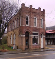
Block
From the record
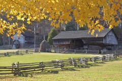
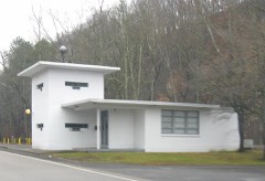
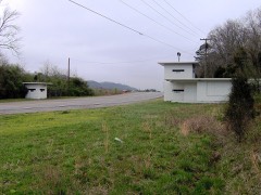
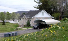
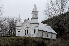
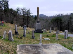
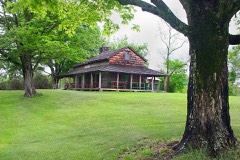
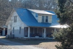
21 National Register listings published here.
Sources: the National Register database, National Park Service
128 topographic sheets cover 81 settlements here, and 21 properties are on the National Register of Historic Places.
21 National Register listings published here.
Sources: the National Register database, National Park Service
Every property in this county listed on the National Register of Historic Places, with the year it was listed and the federal nomination document.
Every wildfire the federal occurrence database records inside this county: 287 of them, burning about 21,229 acres. 7 started naturally and 153 were recorded as arson. Each settlement page carries the fires within five miles of it.
| Reported cause | Fires |
|---|---|
| Arson/incendiarism | 153 |
| Debris and open burning | 62 |
| Missing data/not specified/undetermined | 38 |
| Power generation/transmission/distribution | 9 |
| Natural | 7 |
| Misuse of fire by a minor | 4 |
| Smoking | 4 |
| Recreation and ceremony | 3 |
| Other causes | 2 |
| Equipment and vehicle use | 2 |
| Railroad operations and maintenance | 2 |
| Fireworks | 1 |
The five largest, by the area the report gives. Four of them were set deliberately.
| Date | Cause | Size | Reported by | Name on the report |
|---|---|---|---|---|
| 1 November 2000 | Arson/incendiarism | 2,944 acres | Tennessee Division of Forestry | not named |
| 31 October 2000 | Arson/incendiarism | 1,500 acres | Tennessee Division of Forestry | not named |
| 3 November 2016 | Missing data/not specified/undetermined | 1,400 acres | Tennessee Division of Forestry | SR116 |
| 8 November 2016 | Missing data/not specified/undetermined | 932 acres | Tennessee Division of Forestry | CHARLES BRANCH LANE |
| 2 March 2006 | Debris and open burning | 932 acres | Tennessee Division of Forestry | not named |
| 8 October 2016 | Arson/incendiarism | 932 acres | Tennessee Division of Forestry | BOOT JACK |
| 4 November 2016 | Missing data/not specified/undetermined | 781 acres | Tennessee Division of Forestry | SR116-DEVONIA |
| 8 November 2016 | Arson/incendiarism | 764 acres | Tennessee Division of Forestry | GILMORE TRAIL |
Every settlement page carries the fires within five miles of it - see the settlement index below.
The NOAA Storm Events Database holds 360 reports for this county, causing 1 death, 10 injuries and about $2,921,700 in recorded property damage. Each settlement page carries the reports that name it.
| Kind of event | Reports |
|---|---|
| Thunderstorm Wind | 238 |
| Hail | 86 |
| Flash Flood | 22 |
| Flood | 9 |
| Tornado | 4 |
| Funnel Cloud | 1 |
The most serious of them, by death, then injury, then recorded damage. The accounts are quoted exactly as the forecast office filed them.
| When | Event | Place named | Harm | What the report says |
|---|---|---|---|---|
| April 1998 | Flash Flood | Lake City | 1 killed | no account filed |
| May 1995 | Hail | Clinton | 9 hurt, $500,000 | Several vehicles were badly damaged by hail. Nine persons were treated for bruises after being hit in the head by hail. A local newspaper had a skylight broken in the press room. A few auto dealerships had about 400 cars damaged. Other cars were damaged as well. |
| April 2019 | Thunderstorm Wind | Batley | 1 hurt | A woman was struck and injured by a falling tree at her home on Nesper Road in Oak Ridge. |
| February 2019 | Flood | Norris | $600,000 | Portion of Dairy Pond Road closed. All told, Emergency Management estimated about $600,000 in flood damages across Anderson County from the overall event. |
| November 2002 | Tornado (F2) | Lake City | $213,000 | no account filed |
| July 2009 | Thunderstorm Wind | South Clinton | $100,000 | A 100 year old elm tree fell onto a home which resulted in damage to the home's deck, back room, and the roof over the kitchen. |
| April 2007 | Thunderstorm Wind | Lake City | $60,000 | Numerous trees were reported down across the county although the greatest concentration of tree damaged was in the vicinity of Lake City. Also Lighthouse Marina on Norris Dam sustained damage to the docks and boats. |
| June 2011 | Tornado (EF1) | Oak Ridge | $50,000 | An NWS storm survey reported an EF-1 tornado touched down 6 miles east of Oak Ridge. It formed near the Bull Run Fossil Fuel Plant then traveled northeast toward near Etmore Road just east of Oak Ridge. It had a path length of 1.5 miles and a path width of 80 yards. The max winds of 90 mph downed numerous trees and produced slight roof damage on 3 homes. |
| June 1994 | Thunderstorm Wind | Claxton | $50,000 | Several trees, power lines and power poles were knocked down. A few of the trees went into some homes. |
| July 2002 | Thunderstorm Wind | Oak Ridge | $50,000 | no account filed |
| May 2004 | Thunderstorm Wind | Oak Ridge | $40,000 | no account filed |
| February 2009 | Thunderstorm Wind | South Clinton | $35,000 | Law enforcement personnel reported numerous trees and powerlines downed by thunderstorm winds countywide. In addition, 3 homes were damaged by the winds. |
| April 2006 | Thunderstorm Wind | Countywide | $30,000 | The roof on a school gymnasium in Clinton was damaged. Numerous trees and powerlines down across the county. The Clinton Utility Board reported around 3000 people lost power. |
| June 1995 | Thunderstorm Wind | Oak Ridge | $30,000 | One outbuilding was blown down. One home had its garage roof ripped off. A large number of trees were blown down as well. Some of the fallen trees damaged nearby vehicles. |
| July 2006 | Thunderstorm Wind | Clinton | $25,000 | no account filed |
| July 2002 | Thunderstorm Wind | Clinton | $25,000 | no account filed |
| November 2002 | Thunderstorm Wind | Countywide | $25,000 | no account filed |
| January 1997 | Thunderstorm Wind | Marlow | $25,000 | no account filed |
| August 1996 | Thunderstorm Wind | Andersonville | $25,000 | no account filed |
| June 2009 | Thunderstorm Wind | South Clinton | $20,000 | Law enforcement personnel reported numerous trees and powerlines downed by thunderstorm winds in the Clinton area. |
| June 2009 | Thunderstorm Wind | South Clinton | $20,000 | Law enforcement personnel reported numerous trees downed by thunderstorm winds countywide. |
| May 2007 | Thunderstorm Wind | Oak Ridge | $20,000 | Numerous trees were reported down in the eastern half of Oak Ridge. |
| April 2007 | Thunderstorm Wind | Lake City | $20,000 | Numerous trees down near Lake City. |
| June 2007 | Thunderstorm Wind | Oak Ridge | $20,000 | Several trees and powerlines were downed by thunderstorm winds in and around Oak Ridge. |
| August 2005 | Thunderstorm Wind | Clinton | $20,000 | Numerous trees and powerlines down across the eastern third of county. Reported by Clinton Utilities. |
| August 2005 | Thunderstorm Wind | Norris | $20,000 | Numerous trees and powerlines down across the northeast portions of the county in the Norris area and surrounding areas. Reported by Clinton Utilities. |
| May 1995 | Thunderstorm Wind | Clinton | $20,000 | The county courthouse was damaged. Many trees and power lines were blown down. One tree fell on a house. |
| July 2004 | Thunderstorm Wind | Oak Ridge | $20,000 | no account filed |
| July 2004 | Thunderstorm Wind | Oak Ridge | $20,000 | no account filed |
| May 2003 | Thunderstorm Wind | Countywide | $20,000 | no account filed |
| November 2002 | Thunderstorm Wind | Countywide | $20,000 | no account filed |
| July 2002 | Thunderstorm Wind | Oliver Spgs | $20,000 | no account filed |
| June 1999 | Thunderstorm Wind | Countywide | $20,000 | no account filed |
| March 1997 | Hail | Nrn Part Of County | $20,000 | no account filed |
| August 2005 | Thunderstorm Wind | Clinton | $18,000 | Several trees in and around Claxton. |
| August 2005 | Thunderstorm Wind | Norris | $18,000 | Numerous trees down countywide. |
| June 2001 | Thunderstorm Wind | Oak Ridge | $18,000 | no account filed |
| April 2011 | Thunderstorm Wind | Clinton | $15,000 | Law enforcement personnel reported numerous trees downed by thunderstorm wind countywide. |
| June 2009 | Thunderstorm Wind | South Clinton | $15,000 | Law enforcement personnel reported a few trees and powerlines downed by thunderstorm winds countywide. In addition, a home in Claxton was damaged by a falling tree from the wind. |
| June 2008 | Thunderstorm Wind | South Clinton | $15,000 | Dispatch reported numerous trees downed by thunderstorm winds countywide. |
| June 2005 | Thunderstorm Wind | Clinton | $15,000 | Several trees down across north half of county. |
| June 2005 | Thunderstorm Wind | Countywide | $15,000 | Several trees and a few powerlines downed across the county. Reported by Clinton Utilities and the Anderson County Highway Department. |
| August 2005 | Thunderstorm Wind | Lake City | $15,000 | A few trees down on powerlines near Lake City. Reported by Clinton Utilities. |
| July 2005 | Thunderstorm Wind | Briceville | $15,000 | no account filed |
| May 2003 | Thunderstorm Wind | Clinton | $15,000 | no account filed |
| June 2003 | Thunderstorm Wind | Countywide | $15,000 | no account filed |
| November 2002 | Thunderstorm Wind | Countywide | $15,000 | no account filed |
| August 2002 | Thunderstorm Wind | Mills Creek | $15,000 | no account filed |
| July 1997 | Thunderstorm Wind | Andersonville | $14,000 | Powerlines down in Brushy Valley area. |
| June 2009 | Thunderstorm Wind | Oak Ridge | $12,000 | The newspaper reported several trees and powerlines downed by thunderstorm winds in the Oak Ridge area. |
| June 2008 | Thunderstorm Wind | South Clinton | $12,000 | Trained spotter reported numerous trees downed by thunderstorm winds in Claxton. |
| April 2006 | Thunderstorm Wind | Countywide | $12,000 | Numerous trees down countywide. |
| July 2006 | Thunderstorm Wind | Oak Ridge | $12,000 | no account filed |
| July 2006 | Thunderstorm Wind | Oak Ridge | $12,000 | no account filed |
| July 2004 | Thunderstorm Wind | Oak Ridge | $12,000 | no account filed |
| July 2004 | Thunderstorm Wind | Countywide | $12,000 | no account filed |
| June 2011 | Flash Flood | Elza | $10,000 | Law enforcement personnel reported heavy rain from thunderstorms caused water completely covering the road on Blockhouse Valley Road southwest of Clinton. |
| October 2009 | Thunderstorm Wind | Clinton | $10,000 | Law enforcement officials reported several trees downed by thunderstorm winds in Clinton. |
| June 2009 | Thunderstorm Wind | Knapp | $10,000 | Law enforcement personnel reported a home was damaged by thunderstorm winds southeast of Lake City. |
| April 2008 | Thunderstorm Wind | Lake City | $10,000 | The utility company reported several trees downed by thunderstorm winds along Norris Freeway. |
The Survey's mineral resources record lists 15 workings inside this county. 5 still produce and 10 are closed or unrecorded. Each settlement page carries the workings within five miles of it.
| Commodity | Workings |
|---|---|
| Stone, Crushed/Broken | 4 |
| Manganese | 3 |
| Stone, Crushed/Broken, Limestone, General | 2 |
| Clay | 2 |
| Bloating Material | 1 |
| Zinc, Lead | 1 |
| Thorium | 1 |
| Barium-Barite | 1 |
The least common of them first, because a county's hundredth gravel pit says nothing its first ten did not.
| Where | Site | Commodity | Status | Recorded |
|---|---|---|---|---|
| Briceville | Bloating Material | Past Producer | Sedimentary | |
| Moore | Zinc, Lead | Prospect | ||
| Oak Ridge Occurence | Barium-Barite | Occurrence | ||
| Union Carbide/ Oak Ridge, Tn. | Thorium | Plant | ||
| Briceville Deposit | Clay | Occurrence | ||
| Ralph Rodgers and Co. Quarry - Oak Ridge | Stone, Crushed/Broken, Limestone, General | Producer | ||
| Taylors No. 1 Quarry | Stone, Crushed/Broken, Limestone, General | Producer | 1945 | |
| Wolf Valley Mine | Clay | Producer | ||
| Bright and Howell Prospect | Manganese | Occurrence | ||
| Conda Nance Farm | Manganese | Prospect | 1949 | |
| Wallace Prospect | Manganese | Past Producer | 1914 | |
| Anderson County Plant | Stone, Crushed/Broken | Past Producer | Limestone | |
| Anderson County Plant | Stone, Crushed/Broken | Past Producer | ||
| Oak Ridge Quarry | Stone, Crushed/Broken | Producer | ||
| Taylors No.1 Quarry | Stone, Crushed/Broken | Past Producer |
Named settlements recorded in the Geographic Names Information System, each with the topographic sheets covering it. Villages, hamlets and abandoned places alike. Each is shown with the nearest named watercourse or landform and the survey quadrangle it falls on.
District 3 · 37705 · Near Gooseneck Hollow · Norris quadrangle
22 sheets, 1893 to 1979
District 4 · 37716 · Near Llewellyn Island · Lake City quadrangle
20 sheets, 1893 to 1979
District 1 · 37849 · On Blazer Branch · Clinton quadrangle
22 sheets, 1893 to 1979
No longer a settlement
District 4 · 37716 · On Cane Creek · Lake City quadrangle
20 sheets, 1893 to 1979
No longer a settlement
District 4 · 37710 · On Charleys Branch · Duncan Flats quadrangle
20 sheets, 1893 to 1979
District 1 · 37716 · Near Wolf Valley · Clinton quadrangle
22 sheets, 1893 to 1979
No longer a settlement
District 8 · 37830 · Near Emory Valley · Clinton quadrangle
22 sheets, 1893 to 1979
District 4 · 37769 · Near Longfield Hollow · Lake City quadrangle
20 sheets, 1893 to 1979
District 5 · 37716 · On White Log Branch · Windrock quadrangle
24 sheets, 1893 to 2000
No longer a settlement
District 4 · 37710 · On Stallion Branch · Fork Mountain quadrangle
21 sheets, 1893 to 1979
District 1 · 37716 · On Brushy Creek · Norris quadrangle
22 sheets, 1893 to 1979
No longer a settlement
District 3 · 37754 · Near Chestnut Ridge · Big Ridge Park quadrangle
16 sheets, 1897 to 1981
No longer a settlement
District 4 · 37769 · On Doe Creek · Lake City quadrangle
20 sheets, 1893 to 1979
No longer a settlement
District 6 · 37830 · On Walker Branch · Bethel Valley quadrangle
24 sheets, 1895 to 1998
No longer a settlement
District 3 · 37754 · On Mount Olive Branch · Big Ridge Park quadrangle
16 sheets, 1897 to 1981
District 4 · 37710 · Near Three Forks Hollow · Lake City quadrangle
20 sheets, 1893 to 1979
District 3 · 37754 · On Moore Branch · Norris quadrangle
22 sheets, 1893 to 1979
No longer a settlement
District 4 · 37769 · On Right Fork Coal Creek · Lake City quadrangle
20 sheets, 1893 to 1979
District 4 · 37710 · On Double Camp Creek · Duncan Flats quadrangle
20 sheets, 1893 to 1979
District 4 · 37710 · Near Three Forks Hollow · Lake City quadrangle
20 sheets, 1893 to 1979
District 3 · 37754 · Near Chestnut Ridge · Big Ridge Park quadrangle
16 sheets, 1897 to 1981
District 5 · 37840 · Near Toddy Mountain · Windrock quadrangle
24 sheets, 1893 to 2000
District 1 · 37716 · Near Black Island (historical) · Clinton quadrangle
22 sheets, 1893 to 1979
District 2 · 37716 · Near Carroll Hollow · Clinton quadrangle
22 sheets, 1893 to 1979
The vanished settlements of Anderson County: the places named above that are no longer on the map.