 Block
From the record
One of 21 National Register listings published here for Anderson County · listed in 2024 · category: Building.
Sources: the National Register database, National Park Service
Listed on the National Register of Historic Places in 2024.
One of 21 National Register listings published here for Anderson County · listed in 2024 · category: Building.
Sources: the National Register database, National Park Service
Regional context, not property-specific evidence. The federal wildfire occurrence database lists 54 fires within 5 miles of Cross - Boggs Place between 1997 and 2020, burning about 2,261 acres in total. 3 started naturally. 18 were recorded as arson. Distance is straight-line from the map coordinates, so a fire counted here may appear on a neighbouring settlement's page as well.
| Reported cause | Fires |
|---|---|
| Debris and open burning | 18 |
| Arson/incendiarism | 18 |
| Missing data/not specified/undetermined | 6 |
| Natural | 3 |
| Power generation/transmission/distribution | 3 |
| Railroad operations and maintenance | 2 |
| Equipment and vehicle use | 1 |
| Recreation and ceremony | 1 |
| Misuse of fire by a minor | 1 |
| Smoking | 1 |
The most recent of them, most recent first, with the day each was reported and the service that recorded it.
| Date | Cause | Size | Reported by | Name on the report |
|---|---|---|---|---|
| 8 September 2002 | Arson/incendiarism | 60 acres | Tennessee Division of Forestry | not named |
| 8 August 1998 | Debris and open burning | 2.0 acres | Tennessee Division of Forestry | not named |
| 22 August 1998 | Debris and open burning | 1.5 acres | Tennessee Division of Forestry | not named |
| 3 July 2012 | Natural | 25 acres | Tennessee Division of Forestry | HACKWORTH |
| 17 July 2006 | Debris and open burning | 1.5 acres | Tennessee Division of Forestry | not named |
| 10 June 2007 | Natural | 5.0 acres | Tennessee Division of Forestry | DUTCH VALLEY RD |
| 2 May 2007 | Arson/incendiarism | 35 acres | Tennessee Division of Forestry | 4 MAN |
| 5 April 2006 | Arson/incendiarism | 3.0 acres | Tennessee Division of Forestry | not named |
Regional context, not property-specific evidence. The federal mineral resources record lists 4 workings within 5 miles of Cross - Boggs Place: 2 producers, 1 plant, 1 occurrence. 3 still produce. What was taken out: Thorium, Barium-Barite, Stone, Crushed/Broken, Limestone, General, Stone, Crushed/Broken. Distance is straight-line from the map coordinates, so a quarry counted here may appear on a neighbouring settlement's page as well.
| Where | Site | Commodity | Status | Recorded |
|---|---|---|---|---|
| Oak Ridge Occurence | Barium-Barite | Occurrence | ||
| Oak Ridge Quarry | Stone, Crushed/Broken | Producer | ||
| Ralph Rodgers and Co. Quarry - Oak Ridge | Stone, Crushed/Broken, Limestone, General | Producer | ||
| Union Carbide/ Oak Ridge, Tn. | Thorium | Plant |
Regional context, not property-specific evidence. The National Weather Service names Clinton, the town this property stands in, in 81 storm reports between 1995 and 2023: 55 thunderstorm wind, 18 hail, 6 flash flood, 2 flood. The reports record 9 injuries. Each account below is quoted exactly as the forecast office filed it, from the NOAA Storm Events Database, and each date opens the federal record of that event.
| When | Event | Place named | Harm | What the report says |
|---|---|---|---|---|
| May 1995 | Hail | Clinton | 9 hurt, $500,000 | Several vehicles were badly damaged by hail. Nine persons were treated for bruises after being hit in the head by hail. A local newspaper had a skylight broken in the press room. A few auto dealerships had about 400 cars damaged. Other cars were damaged as well. |
| July 2009 | Thunderstorm Wind | South Clinton | $100,000 | A 100 year old elm tree fell onto a home which resulted in damage to the home's deck, back room, and the roof over the kitchen. |
| February 2009 | Thunderstorm Wind | South Clinton | $35,000 | Law enforcement personnel reported numerous trees and powerlines downed by thunderstorm winds countywide. In addition, 3 homes were damaged by the winds. |
| July 2006 | Thunderstorm Wind | Clinton | $25,000 | no account filed |
| July 2002 | Thunderstorm Wind | Clinton | $25,000 | no account filed |
| June 2009 | Thunderstorm Wind | South Clinton | $20,000 | Law enforcement personnel reported numerous trees and powerlines downed by thunderstorm winds in the Clinton area. |
| June 2009 | Thunderstorm Wind | South Clinton | $20,000 | Law enforcement personnel reported numerous trees downed by thunderstorm winds countywide. |
| August 2005 | Thunderstorm Wind | Clinton | $20,000 | Numerous trees and powerlines down across the eastern third of county. Reported by Clinton Utilities. |
| May 1995 | Thunderstorm Wind | Clinton | $20,000 | The county courthouse was damaged. Many trees and power lines were blown down. One tree fell on a house. |
| August 2005 | Thunderstorm Wind | Clinton | $18,000 | Several trees in and around Claxton. |
| April 2011 | Thunderstorm Wind | Clinton | $15,000 | Law enforcement personnel reported numerous trees downed by thunderstorm wind countywide. |
| June 2009 | Thunderstorm Wind | South Clinton | $15,000 | Law enforcement personnel reported a few trees and powerlines downed by thunderstorm winds countywide. In addition, a home in Claxton was damaged by a falling tree from the wind. |
| June 2008 | Thunderstorm Wind | South Clinton | $15,000 | Dispatch reported numerous trees downed by thunderstorm winds countywide. |
| June 2005 | Thunderstorm Wind | Clinton | $15,000 | Several trees down across north half of county. |
| May 2003 | Thunderstorm Wind | Clinton | $15,000 | no account filed |
| June 2008 | Thunderstorm Wind | South Clinton | $12,000 | Trained spotter reported numerous trees downed by thunderstorm winds in Claxton. |
| October 2009 | Thunderstorm Wind | Clinton | $10,000 | Law enforcement officials reported several trees downed by thunderstorm winds in Clinton. |
| August 2006 | Thunderstorm Wind | Clinton | $10,000 | Several trees and powerlines down across the northern half of the county. |
| June 2004 | Thunderstorm Wind | Clinton | $10,000 | Trees down |
| July 1995 | Thunderstorm Wind | Clinton | $10,000 | Some metal roofs were blown off. Several trees and power lines were knocked down as well. |
| July 2004 | Thunderstorm Wind | Clinton | $10,000 | no account filed |
| July 2004 | Thunderstorm Wind | Clinton | $10,000 | no account filed |
| July 1999 | Thunderstorm Wind | Clinton | $10,000 | no account filed |
| June 1997 | Thunderstorm Wind | Clinton | $10,000 | no account filed |
| August 2014 | Thunderstorm Wind | Clinton | $8,000 | Law enforcement personnel reported many trees downed by thunderstorm wind countywide. |
| June 2009 | Thunderstorm Wind | Clinton | $8,000 | Highway department personnel reported several trees downed by thunderstorm winds across the eastern side of the county. |
| May 2006 | Thunderstorm Wind | Clinton | $8,000 | no account filed |
| February 2011 | Thunderstorm Wind | Clinton | $5,000 | Law enforcement personnel reported a few trees downed by thunderstorm wind at Clinton. |
| June 2009 | Thunderstorm Wind | South Clinton | $5,000 | Law enforcement personnel reported a few trees downed by thunderstorm winds in the southern portions of Clinton. |
| July 1999 | Thunderstorm Wind | Clinton | $5,000 | no account filed |
| June 2006 | Thunderstorm Wind | Clinton | $4,000 | Large limbs downed on a powerline near Clinton. |
| June 2011 | Thunderstorm Wind | Clinton | $3,000 | Law enforcement personnel reported 2 trees downed by thunderstorm wind on Oliver Springs Highway 2 miles southwest of Clinton. |
| July 2006 | Thunderstorm Wind | Clinton | $3,000 | no account filed |
| August 2009 | Thunderstorm Wind | Clinton | $2,000 | Law enforcement officials reported one tree downed by thunderstorm winds south of Clinton. |
| August 2007 | Thunderstorm Wind | Clinton | $2,000 | Sheriffs dispatch reported one tree down on Highway 61 between Clinton and Norris. |
| March 2017 | Flash Flood | Clinton | $1,000 | Flooding reported at the Ponderosa Zoo. |
| July 2022 | Flash Flood | Clinton | - | Some homes on Pop Hollow Rd being evacuated. |
| June 2021 | Thunderstorm Wind | Clinton | - | Several trees were blown down near the Museum of Appalachia. |
| March 2020 | Thunderstorm Wind | Clinton | - | One tree and a few power lines were reported down at East Wolf Valley Road in Heiskell. |
| June 2019 | Thunderstorm Wind | Clinton | - | Multiple trees were reported down near Clinton. |
| June 2019 | Hail | Clinton | - | Quarter size hail was reported near Clinton. |
| October 2019 | Thunderstorm Wind | Clinton | - | A large tree fell onto a home causing extensive damage. |
| May 2017 | Thunderstorm Wind | South Clinton | - | Several trees were reported down across the county. |
| March 2017 | Flash Flood | Clinton | - | Creek out of its banks on Gamble Farm. |
| February 2016 | Thunderstorm Wind | South Clinton | - | A barn/storage structure were damaged. |
| February 2016 | Thunderstorm Wind | South Clinton | - | Several trees were reported down. |
| February 2016 | Thunderstorm Wind | South Clinton | - | Several power lines and trees were reported down along Lee Road. |
| July 2016 | Thunderstorm Wind | South Clinton | - | Several trees were reported down in Clinton. |
| July 2016 | Thunderstorm Wind | South Clinton | - | Several trees were reported down across the eastern part of the county. |
| July 2015 | Thunderstorm Wind | South Clinton | - | Several trees were reported down off West Wolf Valley Road in Clinton. |
| July 2014 | Thunderstorm Wind | South Clinton | - | Several trees were reported down in Clinton. |
| May 2013 | Thunderstorm Wind | South Clinton | - | Several trees were reported down on roadways in various parts of the county. |
| April 2012 | Hail | Clinton | - | Personnel from the broadcast media reported thunderstorms produced quarter-size hail in Clinton. |
| March 2012 | Hail | Clinton | - | Ping pong ball sized hail fell in Clinton. |
| March 2012 | Hail | South Clinton | - | Quarter size hail was reported in Clinton. |
| April 2011 | Hail | Clinton | - | Law enforcement personnel reported thunderstorms produced quarter to golfball-size hail near exit 122 in Clinton. |
| September 2009 | Flash Flood | Clinton | - | Isolated flash flooding occurred with a foot of water over area roads in the Clinton, Tennessee area. A mud slide occurred due to the flash flooding on Spring Street in Clinton, Tennessee and Johnson Gap and Granite roads were also closed due to flash flooding. |
| August 2007 | Hail | Clinton | - | The county highway department reported penny size hail near Clinton. |
| April 2006 | Hail | Clinton | - | Nickel-size hail in Clinton. |
| April 2006 | Hail | Clinton | - | Penny-size hail near Clinton. |
No historic map-sheet match is published for this property yet. That does not mean no map exists. This record needs a coordinate-quality review before it can be joined to a sheet boundary. Browse the county's mapped places while that work is pending.
Other National Register properties close enough to walk or drive between, ordered by distance from this one. Both positions come from the same geocoding pass that matched these properties to their map sheets.
| Photograph | Property | Distance | Listed |
|---|---|---|---|
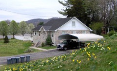 | Luther Brannon House | 1.6 miles | 1991 |
 | Oak Ridge Historic District | 3.5 miles | 1991 |
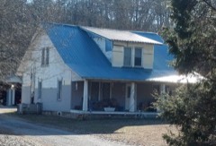 | J. B. Jones House | 4.7 miles | 1991 |
| Woodland-Scarboro Historic District | 4.8 miles | 1991 | |
 | Green McAdoo School | 4.8 miles | 2005 |
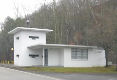 | Bear Creek Road Checking Station | 5.0 miles | 1992 |
| National Archives record | The nomination case file for reference 100010138 in Record Group 79. |
| Anderson County | All 21 listed properties in this county. |