 Block
From the record
78 National Register listings published here.
Sources: the National Register database, National Park Service
143 topographic sheets cover 204 settlements here, and 78 properties are on the National Register of Historic Places.
78 National Register listings published here.
Sources: the National Register database, National Park Service
Every property in this county listed on the National Register of Historic Places, with the year it was listed and the federal nomination document.
| Photograph | Property | Type | Listed | Reference |
|---|---|---|---|---|
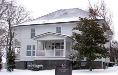 | John Alexander House | building | 1989 | 89000864 |
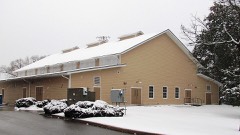 | Alumni Gym | building | 1989 | 89000865 |
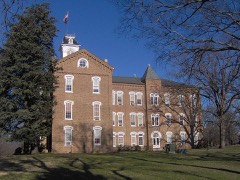 | Anderson Hall | building | 1975 | 75001732 |
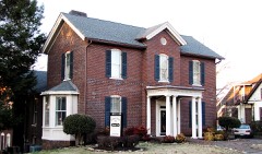 | Peter Bartlett House | building | 1989 | 89000866 |
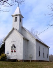 | Bethlehem Methodist Church | building | 1989 | 89000867 |
| Brick Mill Site | site | 1989 | 89000868 | |
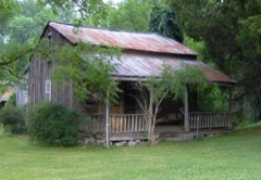 | Peter Brickey House | building | 1989 | 89000869 |
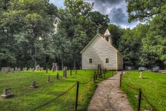 | Cades Cove Historic District | district | 1977 | 77000111 |
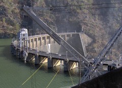 | Calderwood Dam | structure | 1989 | 89001069 |
| Calderwood Dam (Boundary Increase) | district | 1990 | 90001016 | |
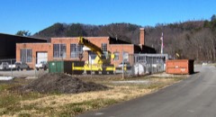 | Calderwood Hydroelectric Development | district | 2004 | 04000545 |
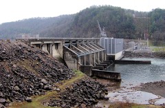 | Chilhowee Hydroelectric Development | district | 2004 | 04000546 |
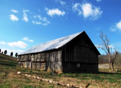 | Langston Clark Barn | building | 1989 | 89000870 |
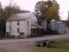 | Clover Hill Mill | building | 1989 | 89000871 |
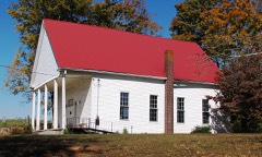 | Cloyd's Creek Presbyterian Church | building | 1989 | 89000873 |
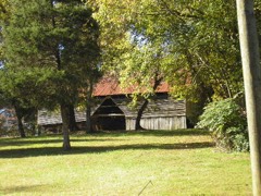 | Mary Cochrane Barn | building | 1989 | 89000872 |
| John J. Craig Quarry Historic District | district | 1989 | 89000874 | |
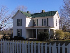 | Gideon Crawford House | building | 1989 | 89000875 |
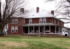 | James R. Davis House | building | 1989 | 89000876 |
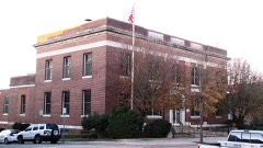 | Federal Building | building | 1989 | 89001217 |
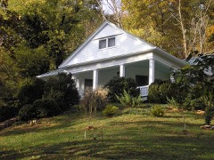 | A. J. Fisher House | building | 1989 | 89000877 |
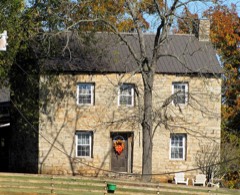 | Samuel Frazier House | building | 1989 | 89000878 |
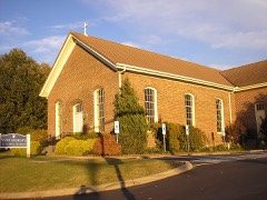 | Friends Church | building | 1989 | 89000879 |
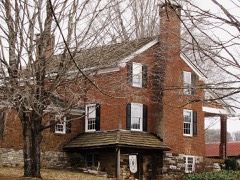 | Samuel George House | building | 1982 | 82003952 |
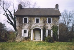 | James Gillespie House | building | 1989 | 89000880 |
| John Hackney House | building | 1989 | 89000881 | |
| John Hackney Mill Site | site | 1989 | 89000882 | |
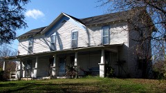 | Alexander Hamil Hosue | building | 1989 | 89000883 |
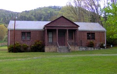 | Happy Valley School | building | 1989 | 89000884 |
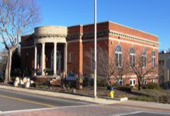 | Harper Memorial Library | building | 1989 | 89000885 |
| William Henderson House | building | 1989 | 89000886 | |
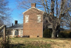 | Henry Farm (Boundary Increase) | district | 2011 | 11000417 |
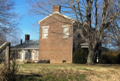 | Henry House | building | 1974 | 74001901 |
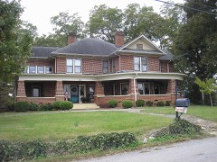 | John Hitch House | building | 1993 | 89000924 |
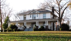 | Pete Hood House | building | 1989 | 89000888 |
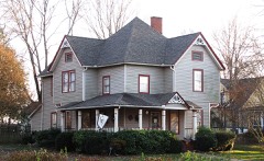 | Indiana Avenue Historic District | district | 1989 | 89001071 |
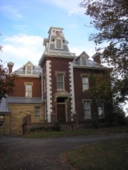 | David Jones House | building | 1982 | 82004840 |
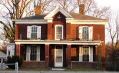 | David Jones House | building | 1989 | 89000889 |
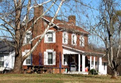 | Macklin Kerr House | building | 1989 | 89000891 |
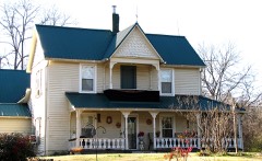 | Hezekiah Kizer House | building | 1989 | 89000892 |
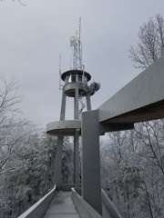 | Look Rock Observation Tower | structure | 2017 | 100001750 |
| Louisville Historic District | district | 1974 | 74001902 | |
| James Martin House | building | 1989 | 89000893 | |
| John Martin Mill | building | 1989 | 89000894 | |
| Warner Martin House | building | 1989 | 89000895 | |
 | Maryville College Historic District | district | 1982 | 82003953 |
| James McCampbell Barn | building | 1989 | 89000896 | |
| Minnis McCampbell Barn | building | 1989 | 89000897 | |
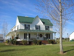 | John McConnell House | building | 1989 | 89000898 |
| Thomas McCullock House | building | 1989 | 89000899 | |
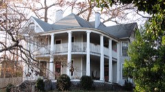 | McNutt-Howard House | building | 1989 | 89000900 |
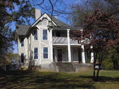 | McNutt-McReynolds House | building | 1989 | 89000901 |
| Millennium Manor | building | 2020 | 100005788 | |
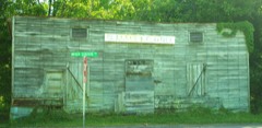 | Miser Station Store | building | 1989 | 89000902 |
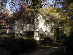 | Morningside | building | 1989 | 89000904 |
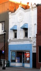 | Samuel A. Patton Building | building | 1989 | 89000905 |
| Peery Mill Site | site | 1989 | 89000887 | |
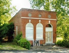 | People's Bank of Friendsville | building | 1989 | 89000906 |
| Pistol Creek Dam and Mill Race | structure | 1989 | 89000907 | |
| Stephen Porter House | building | 1989 | 89000908 | |
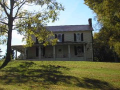 | John M. Rorex House | building | 1989 | 89000909 |
| Russell-Lackey-Prater House | building | 1989 | 89001961 | |
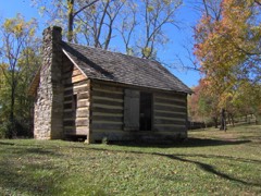 | Sam Houston Schoolhouse | building | 1972 | 72001228 |
| Shaddon Mill Site | site | 1989 | 89001094 | |
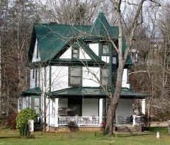 | John F. Shea House | building | 1989 | 89000910 |
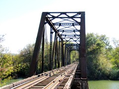 | Southern Railroad Bridge | structure | 1989 | 89000911 |
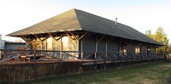 | Southern Railroad Freight Depot | building | 1989 | 89000912 |
| Dr. William P. Stevenson House | building | 1989 | 89000913 | |
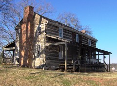 | Thompson-Brown House | building | 1978 | 78002574 |
| Carl Trundle Barn | building | 1989 | 89000890 | |
| Tobler Vineyard House | building | 1989 | 89000914 | |
| Vose School | building | 2017 | 100001368 | |
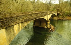 | Walland Bridge | structure | 1989 | 89000915 |
| Walland Power Plant | building | 1989 | 89000916 | |
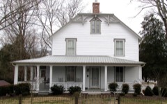 | Marcus Warren House | building | 1989 | 89000917 |
| White's Mill | building | 1989 | 89000918 | |
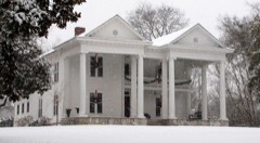 | Willard-Clark House | building | 1989 | 89000919 |
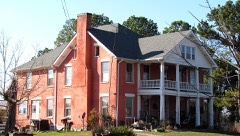 | Isaac Yearout House | building | 1989 | 89000920 |
Every wildfire the federal occurrence database records inside this county: 317 of them, burning about 16,587 acres. 43 started naturally and 94 were recorded as arson. Each settlement page carries the fires within five miles of it.
| Reported cause | Fires |
|---|---|
| Arson/incendiarism | 94 |
| Debris and open burning | 84 |
| Natural | 43 |
| Missing data/not specified/undetermined | 38 |
| Smoking | 18 |
| Equipment and vehicle use | 15 |
| Power generation/transmission/distribution | 9 |
| Recreation and ceremony | 9 |
| Misuse of fire by a minor | 6 |
| Other causes | 1 |
The five largest, by the area the report gives. Two of them were set deliberately.
| Date | Cause | Size | Reported by | Name on the report |
|---|---|---|---|---|
| 29 November 2001 | Arson/incendiarism | 3,200 acres | Tennessee Division of Forestry | not named |
| 17 November 2016 | Missing data/not specified/undetermined | 1,492 acres | Tennessee Division of Forestry | EAST MILLER COVE |
| 17 July 1998 | Arson/incendiarism | 970 acres | Tennessee Division of Forestry | not named |
| 24 May 2007 | Recreation and ceremony | 970 acres | Great Smoky Mountains National Park | BUCK SHANK |
| 5 April 2006 | Natural | 913 acres | Great Smoky Mountains National Park | CHILLY SPRING KNOB |
| 24 June 2008 | Natural | 614 acres | Tennessee Division of Forestry | ALLEGENEY LOOP RD |
| 19 August 1999 | Natural | 523 acres | Great Smoky Mountains National Park | BLACKSMITH |
| 3 July 2006 | Smoking | 400 acres | Tennessee Division of Forestry | HWY 129 |
Every settlement page carries the fires within five miles of it - see the settlement index below.
The NOAA Storm Events Database holds 534 reports for this county, causing 1 death, 15 injuries and about $20,181,903 in recorded property damage. Each settlement page carries the reports that name it.
| Kind of event | Reports |
|---|---|
| Thunderstorm Wind | 369 |
| Hail | 108 |
| Flash Flood | 19 |
| Flood | 17 |
| Tornado | 16 |
| Funnel Cloud | 3 |
| Lightning | 2 |
The most serious of them, by death, then injury, then recorded damage. The accounts are quoted exactly as the forecast office filed them.
| When | Event | Place named | Harm | What the report says |
|---|---|---|---|---|
| July 1996 | Lightning | Rockford | 1 killed | no account filed |
| July 2012 | Thunderstorm Wind | Tremont | 4 hurt | One person was killed and four were injured when trees were blown down at the Abrams Creek Campground. |
| June 1972 | Tornado (F1) | not stated | 3 hurt, $250,000 | no account filed |
| July 2012 | Thunderstorm Wind | Cades Cove | 3 hurt | One person was killed and three were injured when trees were blown down in the Cades Cove area. |
| March 2011 | Tornado (EF3) | Kiser | 2 hurt, $2,500,000 | An EF-3 tornado produced 140 mph winds along a 5.8 mile path with a maximum damage path width of 500 yards. Twenty six homes sustained damage ranging from fifty percent to entirely demolished as a result of the tornado. |
| April 1974 | Tornado (F2) | not stated | 2 hurt, $250,000 | no account filed |
| March 2023 | Thunderstorm Wind | Alcoa | 1 hurt | A tree was reported to have fallen on a woman in a vehicle. She was taken to the hospital with minor injuries. |
| May 1999 | Lightning | Maryville | $6,000,000 | no account filed |
| May 2003 | Flash Flood | Countywide | $3,640,000 | no account filed |
| February 2019 | Flood | Lanier | $2,750,000 | Over 250 homes affected. Several roads flooded. |
| April 2011 | Tornado (EF4) | Chilhowee | $1,000,000 | Chilhowee EF4 Tornado. An NWS survey team reported an EF4 tornado touched down west of Chilhowee Lake in northern Monroe County. The max wind of 170 mph smashed a TVA transmission tower in the Lake, and ground up miles of forest in both Cherokee National Forest, then in Great Smoky Mountains National Park. ||This tornado started in northern Monroe County in the Cherokee National Forest, then crossed Chilhowee Lake where it smash the tower, entering into Blount County. On the far shore of the lake (now in Blount County and also entering the Great Smoky Mountains National Park), it took a right turn at 33.5574/84.0061, traveled ENE deeper into the park, towards Cades Cove. Before getting to Cades Cove it took a left turn near 35.5794/83.9878 and headed to the NE. It finally dissipated about 4 miles north of Cades Cove, still in the Park. Its total path was 14.5 miles long. |
| August 1995 | Thunderstorm Wind | Alcoa | $1,000,000 | A Thunderstorm downburst with a record wind gust to 86 mph occurred at Knoxville McGhee-Tyson (TYS) Airport damaging two national guard helicopters, airborne freight containers and an air freight depot. Heavy damage to trees, and a nearby trailer park also occurred. |
| February 1993 | Tornado (F2) | Maryville | $500,000 | The tornado that went through Loudon County continued across Blount County through the town of Friendsville and ending just west of Maryville. One large home was destroyed and several other were damaged. Numerous trees were snapped. |
| June 2001 | Tornado (F0) | Maryville | $200,000 | no account filed |
| April 2010 | Thunderstorm Wind | Lanier | $120,000 | Law enforcement personnel reported a home destroyed and several trees downed by thunderstorm winds on Cannon Road. |
| July 2005 | Thunderstorm Wind | Alcoa | $100,000 | no account filed |
| April 1996 | Thunderstorm Wind | Alcoa | $100,000 | no account filed |
| August 1997 | Thunderstorm Wind | Countywide | $75,000 | no account filed |
| July 2005 | Thunderstorm Wind | (Tys)Mcghee Tyson Kn | $60,000 | no account filed |
| April 2011 | Thunderstorm Wind | Alcoa | $40,000 | Law enforcement personnel reported moderate roof damage to homes by thunderstorm wind in the Louisville area. |
| July 2005 | Thunderstorm Wind | Maryville | $35,000 | no account filed |
| June 2009 | Thunderstorm Wind | Maryville | $30,000 | Law enforcement officials reported numerous trees and powerlines downed by thunderstorm winds countywide. In addition, a roof in downtown Maryville was damaged by the winds. |
| June 2007 | Thunderstorm Wind | Maryville | $30,000 | Thunderstorm winds downed numerous trees and powerlines countywide. A few homes and vehicles in Maryville were damaged from falling trees. |
| August 2002 | Thunderstorm Wind | Countywide | $30,000 | no account filed |
| November 2002 | Thunderstorm Wind | Louisville | $30,000 | no account filed |
| February 2012 | Tornado (EF0) | Marble Hill | $25,000 | A NWS storm survey determined an EF0 tornado touched down in Blount County 3 miles northeast of Greenback on Maple Lane. It had a path width of about 100 yards and a path length of 3/4 of a mile. The maximum wind of 85 mph was responsible for damaging a few trees and dislodging a light awning from the front of a house. |
| February 2009 | Thunderstorm Wind | Maryville | $25,000 | Law enforcement personnel reported numerous trees and powerlines downed by thunderstorm winds from Maryville through the southern half of the county. In addition, a falling tree damaged a roof in Maryville. |
| June 2009 | Thunderstorm Wind | Oakhurst | $25,000 | Law enforcement personnel reported numerous trees and powerlines downed by thunderstorm winds countywide from Maryville to Townsend. |
| August 1995 | Thunderstorm Wind | Maryville Alcoa | $25,000 | Several trees were blown down and several fires started due to lightning strikes. |
| June 2002 | Thunderstorm Wind | Maryville | $25,000 | no account filed |
| July 2002 | Thunderstorm Wind | Louisville | $25,000 | no account filed |
| March 1975 | Tornado (F1) | not stated | $25,000 | no account filed |
| March 2012 | Tornado (EF0) | Prospect | $20,000 | An EF-0 tornado touched down three miles south of Seymour on Keener Road. The path length was 1.5 miles long with a width of 70 yards. The tornado generated winds around 75 miles an hour. |
| April 2010 | Tornado (EF2) | Lanier | $20,000 | The NWS storm survey determined a tornado tracked from Loudon County for one-half of a mile along Thompson Bridge road. It was classified as an EF2 tornado with winds estimated at 110 mph with a path width of 100 yards. |
| February 2008 | Thunderstorm Wind | Maryville | $20,000 | Dispatch reported several trees and powerlines down in Maryville. Alcoa Electric reported 1100 to 1200 customers in Maryville lost power. |
| April 2007 | Thunderstorm Wind | Alcoa | $20,000 | A few trees and power lines were reported down at various locations across the county. |
| June 2007 | Thunderstorm Wind | Maryville | $20,000 | Thunderstorm winds downed numerous trees and powerlines on and around Sevierville Road, Nina DeLozier Road and Davis Ford Road near Maryville. |
| June 2005 | Thunderstorm Wind | Maryville | $20,000 | Numerous trees and powerlines down in and around the city of Maryville. |
| August 2005 | Thunderstorm Wind | Maryville | $20,000 | Several trees and large limbs downed on powerlines across eastern half of county. Reported by Sevier County Electric. |
| March 2006 | Thunderstorm Wind | Maryville | $20,000 | no account filed |
| May 2004 | Thunderstorm Wind | Louisville | $20,000 | no account filed |
| May 2004 | Thunderstorm Wind | Walland | $20,000 | no account filed |
| May 2004 | Thunderstorm Wind | Maryville | $20,000 | no account filed |
| July 2004 | Thunderstorm Wind | Countywide | $20,000 | no account filed |
| July 2004 | Thunderstorm Wind | Alcoa | $20,000 | no account filed |
| June 2003 | Thunderstorm Wind | Countywide | $20,000 | no account filed |
| June 2003 | Thunderstorm Wind | Alcoa | $20,000 | no account filed |
| May 2003 | Thunderstorm Wind | Countywide | $20,000 | no account filed |
| July 2002 | Thunderstorm Wind | Maryville | $20,000 | no account filed |
| June 2008 | Thunderstorm Wind | Maryville | $18,000 | Dispatch reported numerous trees and powerlines downed by thunderstorm winds countywide. |
| June 2007 | Thunderstorm Wind | Alcoa | $18,000 | Numerous trees across the northeast portion of the county were downed by thunderstorm winds. |
| July 1999 | Thunderstorm Wind | Countywide | $17,000 | no account filed |
| May 2003 | Thunderstorm Wind | Alcoa | $16,000 | no account filed |
| June 2009 | Thunderstorm Wind | Walland | $15,000 | Law enforcement officials reported numerous trees downed by thunderstorm winds in the eastern half of the county. |
| June 2009 | Thunderstorm Wind | Maryville | $15,000 | Law enforcement personnel reported one tree downed onto four cars by thunderstorm winds in Maryville. |
| August 2009 | Thunderstorm Wind | Alcoa | $15,000 | Law enforcement personnel and the local newspaper reported several trees and powerlines downed by thunderstorm winds east of the airport from the Alcoa area to Maryville. |
| June 2008 | Thunderstorm Wind | Maryville | $15,000 | Dispatch reported numerous trees downed by thunderstorm winds across the northern and western portions of the county. |
| June 2007 | Thunderstorm Wind | Maryville | $15,000 | Thunderstorm winds downed several trees in Maryville. |
| February 2005 | Thunderstorm Wind | Happy Vly | $15,000 | Trees fell in the Happy Valley area damaging a home's roof and chimney. Also damaged a nearby vehicle. |
| June 2005 | Thunderstorm Wind | Townsend | $15,000 | A few trees down on powerlines in the Townsend area. Reported by Sevier County Electric System. |
The Survey's mineral resources record lists 80 workings inside this county. 8 still produce and 72 are closed or unrecorded. Each settlement page carries the workings within five miles of it.
| Commodity | Workings |
|---|---|
| Marble, Dimension | 28 |
| Iron | 19 |
| Manganese | 12 |
| Stone, Crushed/Broken | 6 |
| Barium-Barite | 3 |
| Zinc | 3 |
| Barium-Barite, Lead | 2 |
| Lead | 2 |
| Stone, Crushed/Broken, Limestone, General | 1 |
| Barium-Barite, Lead, Zinc, Iron, Fluorine-Fluorite | 1 |
| Iron, Manganese | 1 |
| Limestone, General | 1 |
| Stone, Crushed/Broken, Marble, Dimension | 1 |
| Fluorine-Fluorite, Iron, Lead, Zinc | 1 |
The least common of them first, because a county's hundredth gravel pit says nothing its first ten did not.
| Where | Site | Commodity | Status | Recorded |
|---|---|---|---|---|
| Alcoa Reduction Works | Aluminum, Contained or Metal | Plant | 1914 | |
| Blount County Highway Dept. Quarry | Limestone, General | Past Producer | Sedimentary | |
| Friendsville Prospect | Barium-Barite, Lead, Zinc, Iron, Fluorine-Fluorite | Occurrence | 1905 | |
| Friendsville Quarry | Fluorine-Fluorite, Iron, Lead, Zinc | Producer | ||
| Marmor Marble Quarry | Stone, Crushed/Broken, Marble, Dimension | Producer | ||
| Maryville Plant # 524 Quarry | Stone, Crushed/Broken, Limestone, General | Producer | Dolomite | |
| Quarry | Limestone, Dimension | Past Producer | ||
| Unnamed Iron-Manganese Prospect | Iron, Manganese | Occurrence | Limonite | |
| Friendsville Prospect | Lead | Past Producer | ||
| Griffitts Prospect | Zinc, Barium-Barite, Lead | Past Producer | ||
| J. F. Chapman Barite Prospect | Barium-Barite, Lead | Occurrence | ||
| J.F. Chapman Barite Prospect | Barium-Barite, Lead | Occurrence | Barite, Galena | |
| Jones Prospect | Zinc | Prospect | ||
| Maryville | Zinc | Prospect | ||
| Mcreynolds Barite Prospect | Barium-Barite | Occurrence | Barite | |
| Mcreynolds Barite Prospect | Barium-Barite | Occurrence | ||
| Blount County Hwy. Dept. Quarry | Stone, Crushed/Broken | Past Producer | ||
| Caney Branch Quarry | Stone, Crushed/Broken | Producer | 1969 | |
| Evans Quarry #16 | Stone, Crushed/Broken | Past Producer | ||
| John J Craig Quarry #21 | Stone, Crushed/Broken | Past Producer | ||
| Maryville Plant #524 & Quarry | Stone, Crushed/Broken | Producer | ||
| Rockford Mine | Stone, Crushed/Broken | Past Producer | ||
| Aikens Prospect | Manganese | Prospect | 1951 | |
| Colton Prospect | Manganese | Prospect | 1951 | |
| Curtis Prospect | Manganese | Past Producer | 1918 | |
| Louisville Mine | Manganese | Past Producer | Residual | |
| Louisville Mine | Manganese | Past Producer | 1918 | |
| Louisville Prospects | Manganese | Occurrence | ||
| Mcmurray Prospect | Manganese | Occurrence | ||
| R.P. Webb Property | Manganese | Past Producer | 1951 | |
| Sellers Prospect | Manganese | Occurrence | ||
| Townsend Prospect | Manganese | Prospect | 1951 | |
| Unnamed Iron-Manganese Prospect | Iron, Manganese | Occurrence | ||
| Williams Prospect | Manganese | Prospect | 1951 | |
| Big Flag Springs Iron Mine | Iron | Past Producer | 1957 | |
| Big Flag Springs Iron Mine | Iron | Past Producer | ||
| Big Flag Springs Or Mint Mine | Iron | Past Producer | 1957, 1962 | |
| Blockhouse Iron Prospect | Iron | Occurrence | Hematite | |
| Blockhouse Iron Prospect | Iron | Occurrence | ||
| Carpenter Bank | Iron | Past Producer | Residual | |
| Carpenter Bank | Iron | Past Producer | Limonite | |
| Carpenter Bank | Iron | Past Producer | ||
| Iron Prospect | Iron | Prospect | ||
| Kerr Iron Mine | Iron | Past Producer | 1880 | |
| Kerr Iron Mine | Iron | Past Producer | ||
| Seaton Bank | Iron | Past Producer | Residual | |
| Seaton Iron Bank | Iron | Past Producer | Limonite | |
| Seaton Iron Bank | Iron | Past Producer | ||
| The Flats | Iron | Past Producer | ||
| Wilson Iron Bank | Iron | Past Producer | Limonite | |
| Wilson Iron Bank | Iron | Past Producer | Residual | |
| Wilson Iron Bank | Iron | Past Producer | ||
| Brown Quarry | Marble, Dimension | Past Producer | ||
| Buzzard's Roost Quarry | Marble, Dimension | Past Producer | ||
| Carl Reed Quarry | Marble, Dimension | Past Producer | ||
| Craig Quarry | Marble, Dimension | Past Producer | ||
| Crisp Quarry | Marble, Dimension | Past Producer | ||
| Endsley Quarry | Marble, Dimension | Past Producer | ||
| Evans Quarry #17 | Marble, Dimension | Past Producer | ||
| Evans Quarry #18 | Marble, Dimension | Past Producer | ||
| French Pink Quarry | Marble, Dimension | Past Producer | ||
| John J Craig Quarry #19 | Marble, Dimension | Past Producer | ||
| John J Craig Quarry #20 | Marble, Dimension | Past Producer | ||
| Knoxville Quarry Co Quarry #22 | Marble, Dimension | Past Producer | ||
| Knoxville Quarry Co Quarry #23 | Marble, Dimension | Past Producer | ||
| Knoxville Quarry Co Quarry #24 | Marble, Dimension | Past Producer | ||
| Lee Marble Quarry | Marble, Dimension | Producer | Metamorphic | |
| Lee Marble Quarry | Marble, Dimension | Past Producer | ||
| Marble Quarry | Marble, Dimension | Past Producer | ||
| Marmor Marble Quarry | Marble, Dimension | Producer | Metamorphic | |
| Marthens Quarry | Marble, Dimension | Past Producer | ||
| Mcmullen Quarry #7 | Marble, Dimension | Past Producer | ||
| Mcmullen Quarry #8 | Marble, Dimension | Past Producer | ||
| Mcmullen Quarry #9 | Marble, Dimension | Past Producer | ||
| Quaker Marble Co Quarry #13 | Marble, Dimension | Past Producer | ||
| Quaker Marble Co Quarry #14 | Marble, Dimension | Past Producer | ||
| Tennessee Marble Company | Marble, Dimension | Past Producer | ||
| Tennessee Producers Co. Prospect | Marble, Dimension | Prospect | ||
| Tennessee Producers Co. Quarry | Marble, Dimension | Prospect | ||
| Tennessee Producers Co. Quarry | Marble, Dimension | Past Producer |
Named settlements recorded in the Geographic Names Information System, each with the topographic sheets covering it. Villages, hamlets and abandoned places alike. Each is shown with the nearest named watercourse or landform and the survey quadrangle it falls on.
District 7 · 37803 · Near Nelson Ridge · Tallassee quadrangle
22 sheets, 1895 to 2003
No longer a settlement
District 3 · 37804 · On Flag Branch · Maryville quadrangle
28 sheets, 1886 to 1983
No longer a settlement
District 9 · 37804 · On Nails Creek · Maryville quadrangle
28 sheets, 1886 to 1983
No longer a settlement
District 1 · 37701 · On Dunlap Branch · Maryville quadrangle
28 sheets, 1886 to 1983
District 4 · 37804 · On Duncan Branch · Maryville quadrangle
28 sheets, 1886 to 1983
District 2 · 37701 · On Culton Creek · Maryville quadrangle
28 sheets, 1886 to 1983
District 2 · 37801 · On Laurel Bank Branch · Louisville quadrangle
24 sheets, 1895 to 1981
District 3 · 37804 · On Springfield Branch · Maryville quadrangle
28 sheets, 1886 to 1983
District 9 · 37804 · Near Upper McCammon Island · Maryville quadrangle
28 sheets, 1886 to 1983
No longer a settlement
District 8 · 37882 · Near Lakey Woods Knob · Calderwood quadrangle
25 sheets, 1886 to 2003
District 10 · 37777 · Near Vinegar Valley · Louisville quadrangle
24 sheets, 1895 to 1981
District 9 · 37804 · Near Lower McCammon Island · Maryville quadrangle
28 sheets, 1886 to 1983
District 1 · 37801 · Near Clover Hill Ridge · Binfield quadrangle
23 sheets, 1895 to 1981
District 7 · 37878 · Near Buchannan Mountain · Tallassee quadrangle
22 sheets, 1895 to 2003
District 4 · 37803 · On South Fork Crooked Creek · Blockhouse quadrangle
29 sheets, 1886 to 1983
District 4 · 37803 · Near Pea Ridge · Blockhouse quadrangle
29 sheets, 1886 to 1983
37737 · On Dunlap Hollow Creek · Meadow quadrangle
20 sheets, 1895 to 1981
No longer a settlement
District 3 · 37804 · On Springfield Branch · Maryville quadrangle
28 sheets, 1886 to 1983
District 4 · 37803 · Near Black Sulphur Knobs · Blockhouse quadrangle
29 sheets, 1886 to 1983
District 2 · 37701 · On Duncan Creek · Maryville quadrangle
28 sheets, 1886 to 1983
District 8 · 37804 · On Ellejoy Creek · Wildwood quadrangle
27 sheets, 1886 to 1983
No longer a settlement
District 3 · 37804 · On Duncan Branch · Maryville quadrangle
28 sheets, 1886 to 1983
District 10 · 37777 · Near Tomb Ridge · Louisville quadrangle
24 sheets, 1895 to 1981
No longer a settlement
District 4 · 37803 · Near Clover Hill Ridge · Binfield quadrangle
23 sheets, 1895 to 1981
District 5 · 37801 · Near Clover Hill Ridge · Binfield quadrangle
23 sheets, 1895 to 1981
District 9 · 37853 · On Russell Branch · Maryville quadrangle
28 sheets, 1886 to 1983
District 4 · 37804 · On Duncan Branch · Maryville quadrangle
28 sheets, 1886 to 1983
District 2 · 37701 · On Laurel Bank Branch · Louisville quadrangle
24 sheets, 1895 to 1981
District 1 · 37801 · On Pistol Branch · Blockhouse quadrangle
29 sheets, 1886 to 1983
District 6 · 37801 · Near Spradling Ridge · Binfield quadrangle
23 sheets, 1895 to 1981
District 8 · 37882 · On Kinzel Branch · Kinzel Springs quadrangle
26 sheets, 1886 to 1983
District 10 · 37777 · On Polecat Branch · Maryville quadrangle
28 sheets, 1886 to 1983
District 6 · 37737 · On Pistol Branch · Binfield quadrangle
23 sheets, 1895 to 1981
District 8 · 37882 · Near Fry Fields · Kinzel Springs quadrangle
26 sheets, 1886 to 1983
District 10 · 37777 · Near Vinegar Valley · Louisville quadrangle
24 sheets, 1895 to 1981
District 3 · 37804 · On Springfield Branch · Maryville quadrangle
28 sheets, 1886 to 1983
District 10 · 37801 · Near Jenkins Ridge · Louisville quadrangle
24 sheets, 1895 to 1981
District 9 · 37777 · On Russell Branch · Maryville quadrangle
28 sheets, 1886 to 1983
District 4 · 37803 · Near Black Sulphur Knobs · Blockhouse quadrangle
29 sheets, 1886 to 1983
District 7 · 37803 · Near Look Rock · Blockhouse quadrangle
29 sheets, 1886 to 1983
District 8 · 37886 · On Mount Nebo · Kinzel Springs quadrangle
26 sheets, 1886 to 1983
No longer a settlement
District 2 · 37801 · On Laurel Bank Branch · Louisville quadrangle
24 sheets, 1895 to 1981
District 5 · 37803 · On Brown Creek · Blockhouse quadrangle
29 sheets, 1886 to 1983
District 8 · 37804 · On Flag Branch · Maryville quadrangle
28 sheets, 1886 to 1983
No longer a settlement
District 4 · 37803 · On Duncan Branch · Blockhouse quadrangle
29 sheets, 1886 to 1983
District 1 · 37701 · On Brown Creek · Maryville quadrangle
28 sheets, 1886 to 1983
District 4 · 37803 · Near Needmore Hill · Blockhouse quadrangle
29 sheets, 1886 to 1983
District 10 · 37777 · Near Bear Hollow · Louisville quadrangle
24 sheets, 1895 to 1981
District 9 · 37804 · On Peppermint Branch · Maryville quadrangle
28 sheets, 1886 to 1983
District 1 · 37804 · On Brown Creek · Maryville quadrangle
28 sheets, 1886 to 1983
District 10 · 37777 · Near Jenkins Ridge · Louisville quadrangle
24 sheets, 1895 to 1981
District 10 · 37777 · Near Jenkins Ridge · Louisville quadrangle
24 sheets, 1895 to 1981
District 6 · 37801 · Near Clover Hill Ridge · Binfield quadrangle
23 sheets, 1895 to 1981
District 1 · 37701 · On Springfield Branch · Maryville quadrangle
28 sheets, 1886 to 1983
District 8 · 37886 · Near Chestnut Ridge · Kinzel Springs quadrangle
26 sheets, 1886 to 1983
District 1 · 37801 · On Pistol Branch · Blockhouse quadrangle
29 sheets, 1886 to 1983
District 2 · 37801 · Near Long Hollow · Louisville quadrangle
24 sheets, 1895 to 1981
District 4 · 37803 · Near Black Sulphur Knobs · Blockhouse quadrangle
29 sheets, 1886 to 1983
District 8 · 37882 · Near Lakey Woods Knob · Tallassee quadrangle
22 sheets, 1895 to 2003
No longer a settlement
District 8 · 37882 · Near Black Mash Hollow · Kinzel Springs quadrangle
26 sheets, 1886 to 1983
District 8 · 37882 · Near Big Hollow · Thunderhead Mountain quadrangle
22 sheets, 1886 to 2000
District 8 · 37882 · Near Campground Hollow · Kinzel Springs quadrangle
26 sheets, 1886 to 1983
District 4 · 37803 · Near Needmore Hill · Binfield quadrangle
23 sheets, 1895 to 1981
District 8 · 37886 · Near Garland Hollow · Kinzel Springs quadrangle
26 sheets, 1886 to 1983
District 8 · 37886 · On Hatcher Creek · Kinzel Springs quadrangle
26 sheets, 1886 to 1983
District 2 · 37701 · On Culton Creek · Maryville quadrangle
28 sheets, 1886 to 1983
District 6 · 37803 · Near Needmore Hill · Binfield quadrangle
23 sheets, 1895 to 1981
District 9 · 37804 · Near Upper McCammon Island · Wildwood quadrangle
27 sheets, 1886 to 1983
District 8 · 37882 · On Shop Creek · Calderwood quadrangle
25 sheets, 1886 to 2003
No longer a settlement
District 5 · 37803 · On Brown Creek · Blockhouse quadrangle
29 sheets, 1886 to 1983
District 2 · 37701 · On Laurel Bank Branch · Maryville quadrangle
28 sheets, 1886 to 1983
The vanished settlements of Blount County: the places named above that are no longer on the map.