 Block
From the record
One of 78 National Register listings published here for Blount County · listed in 1989 · category: Building.
Sources: the National Register database, National Park Service
Listed on the National Register of Historic Places in 1989.
One of 78 National Register listings published here for Blount County · listed in 1989 · category: Building.
Sources: the National Register database, National Park Service
Regional context, not property-specific evidence. The federal wildfire occurrence database lists 24 fires within 5 miles of Tobler Vineyard House between 1999 and 2020, burning about 275 acres in total. 1 started naturally. 5 were recorded as arson. Distance is straight-line from the map coordinates, so a fire counted here may appear on a neighbouring settlement's page as well.
| Reported cause | Fires |
|---|---|
| Debris and open burning | 12 |
| Arson/incendiarism | 5 |
| Missing data/not specified/undetermined | 3 |
| Misuse of fire by a minor | 1 |
| Natural | 1 |
| Equipment and vehicle use | 1 |
| Smoking | 1 |
The most recent of them, most recent first, with the day each was reported and the service that recorded it.
| Date | Cause | Size | Reported by | Name on the report |
|---|---|---|---|---|
| 24 June 2007 | Arson/incendiarism | 1.5 acres | Tennessee Division of Forestry | TARKLIN VALLEY |
| 9 May 2014 | Debris and open burning | under an acre | Tennessee Division of Forestry | EAGLETON VILLAGE |
| 27 May 2007 | Smoking | 45 acres | Tennessee Division of Forestry | MCCAMMON RD |
| 1 May 2018 | Debris and open burning | 10 acres | Tennessee Division of Forestry | TARWATER |
| 9 April 2002 | Debris and open burning | 3.0 acres | Tennessee Division of Forestry | not named |
| 5 April 2020 | Debris and open burning | 2.0 acres | Tennessee Division of Forestry | BROWN |
| 3 April 2006 | Natural | 1.0 acres | Tennessee Division of Forestry | not named |
| 19 April 2016 | Arson/incendiarism | 40 acres | Tennessee Division of Forestry | SELF HOLLOW HOLLY BROOK |
Regional context, not property-specific evidence. The federal mineral resources record lists 20 workings within 5 miles of Tobler Vineyard House: 18 past producers, 1 prospect, 1 producer. 1 still produces. What was taken out: Iron, Marble, Dimension, Limestone, Dimension, Stone, Crushed/Broken. Distance is straight-line from the map coordinates, so a quarry counted here may appear on a neighbouring settlement's page as well.
| Where | Site | Commodity | Status | Recorded |
|---|---|---|---|---|
| Caney Branch Quarry | Stone, Crushed/Broken | Producer | 1969 | |
| Rockford Mine | Stone, Crushed/Broken | Past Producer | ||
| Limestone Quarry | Limestone, Dimension | Past Producer | ||
| Limestone Quarry | Limestone, Dimension | Past Producer | ||
| Limestone Quarry | Limestone, Dimension | Past Producer | ||
| Limestone Quarry | Limestone, Dimension | Past Producer | ||
| Iron Prospect | Iron | Prospect | ||
| Jones Quarry | Marble, Dimension | Past Producer | ||
| Marble Quarry | Marble, Dimension | Past Producer | ||
| Marble Quarry | Marble, Dimension | Past Producer |
Regional context, not property-specific evidence. The National Weather Service names Rockford, the town this property stands in, in 5 storm reports between 1996 and 2020: 2 thunderstorm wind, 1 lightning, 1 flash flood, 1 flood. The reports record 1 death. Each account below is quoted exactly as the forecast office filed it, from the NOAA Storm Events Database, and each date opens the federal record of that event.
| When | Event | Place named | Harm | What the report says |
|---|---|---|---|---|
| July 1996 | Lightning | Rockford | 1 killed | no account filed |
| April 2020 | Flash Flood | Rockford | $5,000 | Numerous roads flooded in northwestern portion of the county. A business and a home took water. |
| August 2006 | Thunderstorm Wind | Rockford | $5,000 | A few trees down near Rockford. |
| April 2002 | Thunderstorm Wind | Rockford | $5,000 | no account filed |
| February 2020 | Flood | Rockford | - | Numerous road closures across the county. |
No historic map-sheet match is published for this property yet. That does not mean no map exists. This record needs a coordinate-quality review before it can be joined to a sheet boundary. Browse the county's mapped places while that work is pending.
Other National Register properties close enough to walk or drive between, ordered by distance from this one. Both positions come from the same geocoding pass that matched these properties to their map sheets.
| Photograph | Property | Distance | Listed |
|---|---|---|---|
| Stephen Porter House | 0.8 miles | 1989 | |
| Warner Martin House | 1.7 miles | 1989 | |
| Thomas McCullock House | 2.0 miles | 1989 | |
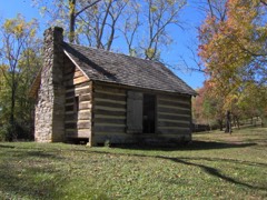 | Sam Houston Schoolhouse | 2.2 miles | 1972 |
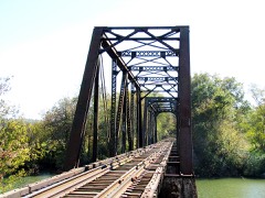 | Southern Railroad Bridge | 2.5 miles | 1989 |
| Carl Trundle Barn | 3.5 miles | 1989 |
| National Archives record | The nomination case file for reference 89000914 in Record Group 79. |
| Blount County | All 78 listed properties in this county. |