 Block
From the record
7 National Register listings published here.
Sources: the National Register database, National Park Service
120 topographic sheets cover 85 settlements here, and 7 properties are on the National Register of Historic Places.
7 National Register listings published here.
Sources: the National Register database, National Park Service
Every property in this county listed on the National Register of Historic Places, with the year it was listed and the federal nomination document.
| Photograph | Property | Type | Listed | Reference |
|---|---|---|---|---|
| Jellico Commercial Historic District | district | 1999 | 99001344 | |
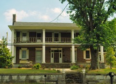 | Kincaid-Howard House | building | 1976 | 76001766 |
| LaFollette Coke Ovens | site | 2016 | 16000811 | |
 | LaFollette House | building | 1975 | 75001736 |
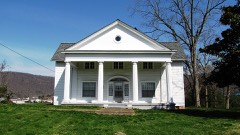 | A.E. Perkins House | building | 1997 | 97001529 |
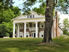 | Smith-Little-Mars House | building | 1976 | 76001767 |
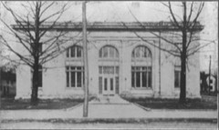 | U.S. Post Office and Mine Rescue Station | building | 1984 | 84003467 |
Every wildfire the federal occurrence database records inside this county: 629 of them, burning about 73,991 acres. 3 started naturally and 327 were recorded as arson. Each settlement page carries the fires within five miles of it.
| Reported cause | Fires |
|---|---|
| Arson/incendiarism | 327 |
| Debris and open burning | 128 |
| Missing data/not specified/undetermined | 120 |
| Railroad operations and maintenance | 20 |
| Other causes | 9 |
| Equipment and vehicle use | 9 |
| Power generation/transmission/distribution | 6 |
| Natural | 3 |
| Smoking | 3 |
| Recreation and ceremony | 2 |
| Misuse of fire by a minor | 1 |
| Fireworks | 1 |
The five largest, by the area the report gives. Five of them were set deliberately.
| Date | Cause | Size | Reported by | Name on the report |
|---|---|---|---|---|
| 9 November 2016 | Missing data/not specified/undetermined | 10,586 acres | Tennessee Division of Forestry | STINKING CREEK |
| 2 November 2000 | Arson/incendiarism | 8,134 acres | Tennessee Division of Forestry | not named |
| 11 October 2000 | Arson/incendiarism | 2,050 acres | Tennessee Division of Forestry | not named |
| 5 November 2000 | Arson/incendiarism | 1,728 acres | Tennessee Division of Forestry | not named |
| 16 April 2008 | Railroad operations and maintenance | 1,501 acres | Tennessee Division of Forestry | HWY 25 |
| 17 August 2007 | Debris and open burning | 1,400 acres | Tennessee Division of Forestry | MCCLOUD MTN |
| 6 March 2007 | Arson/incendiarism | 1,220 acres | Tennessee Division of Forestry | WESTBOURNE MTN 2 |
| 2 November 2012 | Arson/incendiarism | 1,216 acres | Tennessee Division of Forestry | FLATWOOD RD |
Every settlement page carries the fires within five miles of it - see the settlement index below.
The NOAA Storm Events Database holds 279 reports for this county, causing no deaths, no injuries and about $8,015,501 in recorded property damage. Each settlement page carries the reports that name it.
| Kind of event | Reports |
|---|---|
| Thunderstorm Wind | 208 |
| Hail | 45 |
| Flash Flood | 19 |
| Flood | 6 |
| Tornado | 1 |
The most serious of them, by death, then injury, then recorded damage. The accounts are quoted exactly as the forecast office filed them.
| When | Event | Place named | Harm | What the report says |
|---|---|---|---|---|
| June 2019 | Flash Flood | La Follette | $6,400,000 | Several small drainages off of the nearby hills north of town converge and then go under Hwy 63 near the middle school. Both Hwy 63 and some parking lots of businesses near the middle school were being covered by flowing water at this time. Water continued to rise such that by 8:00 p.m. major flash flooding was developing. At its worst, knee deep water was in structures on the north side of Hwy 63, while apartments and two churches on lower ground on the south side of the highway took four to eight feet of water. Elsewhere, a manufactured home on Cedar Creek near Fincastle was washed off of its foundation. Numerous roads were closed and vehicles flooded in the event. Radar estimated over 6 inches of rain near LaFollette in less than three hours. |
| March 2021 | Flash Flood | La Follette | $353,000 | Flooding resulted in the evacuation of ten homes from Caryville to La Follette. A large span of ground beneath train tracks washed away. Multiple homes were flooded near Duff. Some mudslides were also reported across the area. Damages across the county from this flood event totaled $353,000. |
| June 2003 | Flash Flood | Countywide | $100,000 | Roads, culverts, and private bridges washed out countywide. |
| July 1994 | Thunderstorm Wind | La Follette | $50,000 | Two plots of tobacco were blown down. A building under construction and a barn were both knocked down. Several large trees were knocked down as well. |
| July 2004 | Thunderstorm Wind | Well Spg | $50,000 | no account filed |
| April 2007 | Thunderstorm Wind | Fordtown | $30,000 | Numerous trees were reported down across the county. |
| May 2006 | Thunderstorm Wind | La Follette | $30,000 | no account filed |
| April 2014 | Thunderstorm Wind | Jellico | $25,000 | Law enforcement personnel reported numerous trees downed by thunderstorm wind along with a roof blown off home in Jellico. |
| April 2012 | Thunderstorm Wind | Caryville | $25,000 | A trained spotter reported multiple tress downed and large limbs on roofs by thunderstorm wind 2 miles northeast of Caryville near Jacksboro. |
| July 2006 | Thunderstorm Wind | Countywide | $25,000 | no account filed |
| September 2006 | Thunderstorm Wind | Countywide | $25,000 | no account filed |
| June 2009 | Thunderstorm Wind | Fordtown | $20,000 | The highway department officials reported numerous trees downed by thunderstorm winds countywide. |
| June 2009 | Thunderstorm Wind | Elk Vly | $20,000 | Law enforcement personnel reported numerous trees downed by thunderstorm winds in the Elk Valley area. |
| June 2009 | Thunderstorm Wind | Fordtown | $20,000 | The highway department reported numerous trees downed by thunderstorm winds in the La Follette area and countywide. |
| April 2007 | Thunderstorm Wind | La Follette | $20,000 | Numerous trees down near La Follette. |
| June 2007 | Thunderstorm Wind | Jellico | $20,000 | Thunderstorm winds downed numerous trees and powerlines in and around Jellico. |
| April 2006 | Thunderstorm Wind | La Follette | $20,000 | A large barn was blown off its foundation and destroyed. |
| June 1997 | Thunderstorm Wind | Countywide | $20,000 | Numerous trees and powerlines down throughout county. |
| March 2006 | Thunderstorm Wind | Jacksboro | $20,000 | no account filed |
| July 2006 | Thunderstorm Wind | La Follette | $20,000 | no account filed |
| May 2004 | Thunderstorm Wind | La Follette | $20,000 | no account filed |
| July 2004 | Thunderstorm Wind | La Follette | $20,000 | no account filed |
| June 2002 | Thunderstorm Wind | Fincastle | $20,000 | no account filed |
| August 2002 | Thunderstorm Wind | La Follette | $20,000 | no account filed |
| August 2002 | Thunderstorm Wind | Countywide | $20,000 | no account filed |
| November 2002 | Thunderstorm Wind | Countywide | $20,000 | no account filed |
| August 2005 | Thunderstorm Wind | La Follette | $18,000 | Several trees down near La Follette. |
| August 2005 | Thunderstorm Wind | Caryville | $18,000 | Several trees down southern portion of county. |
| April 2011 | Thunderstorm Wind | Jellico | $15,000 | Emergency manager personnel reported many trees downed and power pole split by thunderstorm wind in Jellico. |
| April 2007 | Thunderstorm Wind | La Follette | $15,000 | A few trees down countywide. |
| June 2007 | Thunderstorm Wind | La Follette | $15,000 | A few trees were reported down countywide. |
| October 2006 | Thunderstorm Wind | La Follette | $15,000 | A few trees and powerlines down countywide. |
| June 2005 | Thunderstorm Wind | Countywide | $15,000 | Numerous trees and powerlines downed countywide. Reported by LaFollette Utilities. |
| June 2004 | Thunderstorm Wind | La Follette | $15,000 | Numerous trees down across the west half of the county |
| June 2004 | Thunderstorm Wind | La Follette | $15,000 | Numerous large tree limbs across roads and power lines |
| July 2006 | Thunderstorm Wind | La Follette | $15,000 | no account filed |
| May 2003 | Thunderstorm Wind | Countywide | $15,000 | no account filed |
| June 2003 | Thunderstorm Wind | Countywide | $15,000 | no account filed |
| May 2003 | Thunderstorm Wind | Jacksboro | $15,000 | no account filed |
| March 1997 | Thunderstorm Wind | Countywide | $15,000 | no account filed |
| June 2008 | Thunderstorm Wind | Fordtown | $12,000 | La Follette Utilities reported several trees and powerlines downed by thunderstorm winds countywide. |
| April 2007 | Thunderstorm Wind | Oswego | $12,000 | Several trees were reported down in Jellico on highway 297. |
| April 2006 | Thunderstorm Wind | Countywide | $12,000 | Numerous trees down countywide. |
| July 2004 | Thunderstorm Wind | La Follette | $12,000 | no account filed |
| June 2003 | Thunderstorm Wind | Countywide | $12,000 | no account filed |
| June 2011 | Thunderstorm Wind | La Follette | $10,000 | Highway department personnel reported several trees downed on Demory Road by thunderstorm wind in La Follette. |
| August 2010 | Flash Flood | Elk Vly | $10,000 | High department personnel reported slow moving thunderstorms brought heavy rain to Elk Valley resulting in a minor mudslide on Lick Fork Lane. Part of the bank containing a tree slid onto the road. |
| June 2009 | Thunderstorm Wind | Fordtown | $10,000 | Law enforcement personnel reported a few trees and powerlines downed by thunderstorm winds countywide. |
| February 2008 | Thunderstorm Wind | Jacksboro | $10,000 | The Campbell County highway department reported several trees down countywide. |
| February 2008 | Thunderstorm Wind | Elk Vly | $10,000 | The sheriff's office reported a few trees down in the Elk Valley area. |
| April 2008 | Thunderstorm Wind | Campbell Arpt | $10,000 | The utility company reported one tree and a few powerlines downed by thunderstorm winds in the Pinecrest community near Jacksboro. |
| October 2007 | Thunderstorm Wind | La Follette | $10,000 | The Campbell County Highway Department reported several trees downed by thunderstorm winds across the roads countywide from around 320 to 335 AM EDT. |
| May 2004 | Thunderstorm Wind | La Follette | $10,000 | no account filed |
| June 2003 | Thunderstorm Wind | Four Corners | $10,000 | no account filed |
| May 2002 | Thunderstorm Wind | Jacksboro | $10,000 | no account filed |
| June 1998 | Thunderstorm Wind | Caryville | $10,000 | no account filed |
| February 2012 | Thunderstorm Wind | Oak Grove | $8,000 | Highway department personnel reported several trees downed by thunderstorm wind near Norris. |
| June 2009 | Thunderstorm Wind | Fordtown | $8,000 | The highway department officials reported several trees downed by thunderstorm winds northeast of La Follette. |
| June 2009 | Thunderstorm Wind | Stinking Creek | $8,000 | Law enforcement officials reported several trees downed by thunderstorm winds across the northern half of the county. |
| April 2006 | Thunderstorm Wind | Jacksboro | $8,000 | A few trees down near Jacksboro. |
The Survey's mineral resources record lists 11 workings inside this county. 9 still produce and 2 are closed or unrecorded. Each settlement page carries the workings within five miles of it.
| Commodity | Workings |
|---|---|
| Stone, Crushed/Broken | 4 |
| Stone, Crushed/Broken, Limestone, General | 3 |
| Silica | 2 |
| Limestone, General | 1 |
| Silica, Sand and Gravel, Construction | 1 |
The least common of them first, because a county's hundredth gravel pit says nothing its first ten did not.
| Where | Site | Commodity | Status | Recorded |
|---|---|---|---|---|
| Scott County Road Dept. Quarry | Limestone, General | Past Producer | Sedimentary | |
| White Silica Sand Company Pit | Silica, Sand and Gravel, Construction | Producer | ||
| Carborundum Co/ Jacksboro, Tn. | Silica | Plant | ||
| White Silica Sand Co. Pit | Silica | Producer | 1929 | |
| Campbell County Highway Dept. Quarry | Stone, Crushed/Broken, Limestone, General | Producer | Limestone | |
| Jellico Stone Company Quarry | Stone, Crushed/Broken, Limestone, General | Producer | Limestone | |
| Key Limestone Divisionpit #27 | Stone, Crushed/Broken, Limestone, General | Producer | Limestone | |
| Campbell County Quarry | Stone, Crushed/Broken | Producer | ||
| Jellico Stone Co. Quarry | Stone, Crushed/Broken | Producer | ||
| Key Limestone Division Pit No. 27 | Stone, Crushed/Broken | Producer | ||
| Scott County Road Dept. Quarry | Stone, Crushed/Broken | Past Producer |
Named settlements recorded in the Geographic Names Information System, each with the topographic sheets covering it. Villages, hamlets and abandoned places alike. Each is shown with the nearest named watercourse or landform and the survey quadrangle it falls on.
District 1 · 37766 · Near Little Dividing Ridge · Demory quadrangle
21 sheets, 1893 to 1979
District 1 · 37766 · Near Sugar Hollow · Demory quadrangle
21 sheets, 1893 to 1979
No longer a settlement
District 5 · 37819 · Near Negro Mountain · Jellico West quadrangle
16 sheets, 1890 to 1981
No longer a settlement
District 4 · 37714 · On Bruce Creek · Jacksboro quadrangle
21 sheets, 1893 to 1979
District 3 · 37757 · Near Spicewood Hollow · Jacksboro quadrangle
21 sheets, 1893 to 1979
District 1 · Near Malloby Hollow · White Hollow quadrangle
17 sheets, 1897 to 1981
No longer a settlement
District 1 · 37766 · Near Shelby Hollow · White Hollow quadrangle
17 sheets, 1897 to 1981
No longer a settlement
District 1 · 37766 · Near Chestnut Stump Ridge · Demory quadrangle
21 sheets, 1893 to 1979
District 1 · 37766 · Near Big Hollow · Demory quadrangle
21 sheets, 1893 to 1979
No longer a settlement
District 4 · 37769 · Near Tidwell Hollow · Jacksboro quadrangle
21 sheets, 1893 to 1979
District 5 · 37729 · Near Rich Mountain · Jellico East quadrangle
17 sheets, 1890 to 1981
District 5 · 37766 · On Jim Branch · Ivydell quadrangle
19 sheets, 1893 to 1979
No longer a settlement
District 1 · 37766 · Near Powder Mill Hollow · White Hollow quadrangle
17 sheets, 1897 to 1981
No longer a settlement
District 1 · 37766 · Near Willoughby Hollow · Demory quadrangle
21 sheets, 1893 to 1979
No longer a settlement
District 5 · 37766 · Near Dock Hollow · Jellico West quadrangle
16 sheets, 1890 to 1981
District 1 · 37766 · On Dossett Creek · Well Spring quadrangle
17 sheets, 1897 to 1981
No longer a settlement
District 5 · 37729 · On Tackett Creek · Jellico East quadrangle
17 sheets, 1890 to 1981
District 1 · 37766 · In Whitman Hollow · Demory quadrangle
21 sheets, 1893 to 1979
No longer a settlement
District 5 · 37762 · Near Old Standard Hollow · Jellico West quadrangle
16 sheets, 1890 to 1981
The vanished settlements of Campbell County: the places named above that are no longer on the map.