 Block
From the record
9 National Register listings published here.
Sources: the National Register database, National Park Service
128 topographic sheets cover 159 settlements here, and 9 properties are on the National Register of Historic Places.
9 National Register listings published here.
Sources: the National Register database, National Park Service
Every property in this county listed on the National Register of Historic Places, with the year it was listed and the federal nomination document.
| Photograph | Property | Type | Listed | Reference |
|---|---|---|---|---|
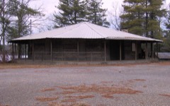 | Camp Nakanawa Wigwam | building | 1999 | 99001345 |
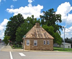 | Crossville Tennessee Highway Patrol Building | building | 2003 | 03000281 |
 | Cumberland County Courthouses | building | 1980 | 80003783 |
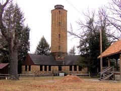 | Cumberland Homesteads Historic District | district | 1988 | 88001593 |
| Cumberland Mountain School | district | 1993 | 93000779 | |
 | Palace Theater | building | 1994 | 93001477 |
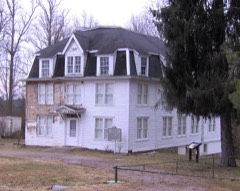 | Pioneer Hall | building | 1978 | 78002576 |
 | Greenberry Wilson House | building | 1996 | 96000719 |
| "See Rock City" Barn | building | 2024 | 100011196 |
Every wildfire the federal occurrence database records inside this county: 627 of them, burning about 14,116 acres. 2 started naturally and 324 were recorded as arson. Each settlement page carries the fires within five miles of it.
| Reported cause | Fires |
|---|---|
| Arson/incendiarism | 324 |
| Debris and open burning | 206 |
| Missing data/not specified/undetermined | 62 |
| Equipment and vehicle use | 16 |
| Smoking | 5 |
| Power generation/transmission/distribution | 4 |
| Recreation and ceremony | 4 |
| Natural | 2 |
| Other causes | 2 |
| Misuse of fire by a minor | 1 |
| Fireworks | 1 |
The five largest, by the area the report gives. 7 of them were set deliberately.
| Date | Cause | Size | Reported by | Name on the report |
|---|---|---|---|---|
| 16 April 2005 | Arson/incendiarism | 2,000 acres | Tennessee Division of Forestry | LITTLE PEAVINE MTN. |
| 27 October 2000 | Arson/incendiarism | 650 acres | Tennessee Division of Forestry | not named |
| 3 November 2016 | Missing data/not specified/undetermined | 470 acres | Tennessee Division of Forestry | BIG ROCK #3 |
| 14 April 2006 | Arson/incendiarism | 400 acres | Tennessee Division of Forestry | WATTENBARGER FIRE |
| 6 February 2015 | Arson/incendiarism | 389 acres | Tennessee Division of Forestry | GRAPEVINE HOLLOW #2 |
| 15 November 2013 | Arson/incendiarism | 378 acres | Tennessee Division of Forestry | HEBBERTSBURG RD. |
| 30 October 2012 | Arson/incendiarism | 350 acres | Tennessee Division of Forestry | BIG ROCK 10 30 12 |
| 2 April 2016 | Arson/incendiarism | 337 acres | Tennessee Division of Forestry | MILLSTONE GAP |
Every settlement page carries the fires within five miles of it - see the settlement index below.
The NOAA Storm Events Database holds 305 reports for this county, causing 8 deaths, 96 injuries and about $16,812,543 in recorded property damage. Each settlement page carries the reports that name it.
| Kind of event | Reports |
|---|---|
| Thunderstorm Wind | 139 |
| Hail | 82 |
| Flash Flood | 32 |
| Tornado | 24 |
| Flood | 12 |
| Lightning | 12 |
| Heavy Rain | 3 |
| Funnel Cloud | 1 |
The most serious of them, by death, then injury, then recorded damage. The accounts are quoted exactly as the forecast office filed them.
| When | Event | Place named | Harm | What the report says |
|---|---|---|---|---|
| November 2002 | Tornado (F3) | Crossville | 4 killed, 18 hurt, $500,000 | An F3 tornado struck the Lake Tansi area and the southern sections of Crossville Sunday night, killing 4 people and injuring 18. 33 homes and mobile were destroyed and 128 homes and mobile homes were damaged. There was damage to one public building. The heaviest damage was along Lantana Drive, Dunbar Road, and Pigeon Ridge Road. 5 homes were damaged on U.S. Highway 127 and just south of Three Creek Road. One well built home lost an entire roof and several walls. The couple, their 3 children, and a guest, huddled under a mattress in the hallway. 50 acres of hardwoods were twisted and tangled. 100-year-old oak trees were snapped like wheat straws.Mobile homes on the Ballyhoo Campground and modular homes in Lake Tansi were destroyed. The four fatalities occurred in mobile homes. A couple was killed at 298 Lantana Drive when their mobile home was lifted off its foundation and placed on another trailer. Edward, 80 and Mary Laffer 75 were killed. Another couple died at 4040 Lone Wolf Circle. Robert, 55 and Sandy Scarbrough , 52, were killed and their bodies were found across Lake Mohawk. |
| February 2012 | Tornado (EF2) | Plateau | 2 killed, 7 hurt, $1,000,000 | An EF2 tornado with maximum wind speeds around 125 mph touched down along Castro-Pugh Road just north of Plateau Road in northern Cumberland County. Intermittent damage continued to the east-northeast for approximately 1 mile before the damage became continuous along Clear Creek Road. Hundreds of trees were uprooted and snapped and a home suffered roof damage in this area.||The tornado continued east-northeast and reached EF2 intensity in the Rinnie community along Highway 127. A brick home slid off its foundation and was completely destroyed, killing one woman, and another nearby home lost its entire roof. A double wide mobile home along Hollow Road was also completely destroyed, killing another woman, with debris tossed hundreds of yards. At least a thousand trees were uprooted or snapped around this location. New aerial imagery from Google Earth released in Spring 2013 indicated the tornado continued eastward and widened to 1/2 mile, blowing down thousands of more trees as it moved across inaccessible forested areas of northern Cumberland County. Damage was apparent eastward to past Roy Taylor Road. |
| April 1975 | Tornado (F2) | not stated | 1 killed, 4 hurt, $250,000 | no account filed |
| April 1965 | Tornado (F3) | not stated | 1 killed, $250,000 | no account filed |
| May 1995 | Tornado (F3) | Newton to | 20 hurt, $2,000,000 | The tornado first touched down in the southwest part of Cumberland County and moved northeast. Two business were destroyed. Eleven homes and 14 mobiles homes were destroyed. Many other homes were damaged. One house had a gas leak in it prompting emergency management officials to evacuate a handful of nearby residents. Other homes had roof damage. Numerous trees and power lines were knocked down. |
| April 1974 | Tornado (F2) | not stated | 20 hurt, $250,000 | no account filed |
| August 1990 | Thunderstorm Wind | not stated | 11 hurt | no account filed |
| April 2006 | Tornado (F1) | Crossville | 4 hurt, $4,000,000 | 6 homes were destroyed (2 were mobile homes). 6 other homes with 50% of the structure damaged and a total of 181 homes damaged. There was $3.2 million estimate for just homes. This estimate did not include out-buildings or vehicles. Final debris estimates on clean-up have reached over $200,000.Final estimate will approach $4 million in damage. |
| April 1995 | Thunderstorm Wind | Linary | 4 hurt, $30,000 | Four persons were injured when the mobile home they were sleeping in was blown into a row of trees. |
| May 1999 | Hail | Crab Orchard | 4 hurt | EMA reported marble to golf ball size hail covering the ground at a 3 inch depth on I-40. Over a half dozen wreckers were sent to clear the accidents on the interstate. Traffic was backed up for 12 miles to the Roane county line. There were 4 injuries. Snow plows were used to clear the hail off the interstate. At a Godsey residence on Hwy 70 E in Crab Orchard, hailstones measured 7 inches deep in his garden. |
| March 2020 | Thunderstorm Wind | Browntown | 1 hurt, $3,000,000 | The massive, severe macroburst that struck White County moved into Cumberland County near Pleasant Hill and continued northeast for another 27 miles to the Morgan County border. Within the 5 miles wide macroburst, severe wind damage struck Pleasant Hill, Baker Crossroads, Crossville, and Fairfield Glade. Hundreds of trees were blown down with some falling into and through homes, including on Glade Creek Road and Deck Road in Pleasant Hill. Several homes suffered roof, gutter and siding damage on Carter Town Road, Norman Drive, Eureka Drive, Creston Road, and Bristow Road in the Baker Crossroads area, as well as the Charleston Plantation apartments in Crossville. A warehouse building collapsed at the corner of Highway 70 and Northside Drive, and part of the roof was blown off the Cumberland Farmers Co-op Building in Crossville. A tractor trailer was blown over on Taylors Chapel Road, and a metal garage was destroyed at North Cumberland Elementary School. Old Jamestown Highway and I-40 at mile marker 319 were both blocked by downed trees, and numerous other roads were blocked by fallen trees, power lines, power poles, and other debris. 1 person was injured at the Deer Run RV Park in Fairfield Glade when a tree fell through an RV. Peak wind gusts of 63 mph were measured at both the Crossville Memorial Airport ASOS and the City of Crossville downtown Davis weather station, which were located on the south edge of the macroburst. Winds in the core of the macroburst were estimated up to 95 mph. |
| August 2024 | Lightning | Isoline | 1 hurt | Lightning reportedly struck and severely injured a man worked in a tree along Wilson Road in Crossville. The man was air flighted to a Knoxville hospital due to internal burns and a broken vertebra. His injuries were not life threatening. |
| May 2018 | Lightning | Pomona Rd | 1 hurt | Lightning struck a home on Stonecrest Avenue causing one minor injury. |
| August 2009 | Lightning | Vandever | 1 hurt | Lightning struck a tree that fell on a 66 year old women, who lives about five miles southwest from Crossville on Lantana Road, as thunderstorms moved through this area. She was rushed to a regional trauma center after she was rescued. She was trapped underneath the tree for some period of time, but was conscious during the entire event. Extent of injury and condition were not reported. |
| May 2013 | Flash Flood | Dripping Spgs | $1,000,000 | The emergency manager of Cumberland County reported flash flooding across the entire county. There were multiple road closures as well as two homes inundated by six to eight inches of flood waters in downtown Crossville resulting in evacuations. Additionally, WATE Channel 6 in Knoxville reported at least five vehicles stalled due to flooding with one such stalled vehicle resulting in a rescue of an elderly woman trapped in her vehicle. Much of the flood damage occurred in the city of Crossville. |
| July 2015 | Flash Flood | Welch | $500,000 | Major flash flooding affected much of Cumberland County from the evening hours on July 2 into the morning hours on July 3. Numerous roads throughout the county were flooded and closed, including Southwood Drive at Lantana Road, Cow Pen Road at Mayland Road, East Cove Road, Cumberland Cove at Highway 70, Bud Tanner Road, Old Claysville Road, White Horse Road at Crazy Horse Road, and Old Flynn's Cove Road.|Some roads were washed away and destroyed, including George Branch Drive at Dripping Springs Road. One 31 year old man drove into a 30 foot ravine that was caused by a washed out culvert on George Branch Drive and was killed. A CoCoRaHS observer 4.3 miles S of Monterey measured 7.94 inches of rain over the 48 hour period ending at 7am on July 3rd. |
| February 1993 | Tornado (F0) | Darton to | $500,000 | Three homes were destroyed and several trees and power lines were knocked down. |
| October 1993 | Thunderstorm Wind | Crab Orchard | $500,000 | An elementary school gymnasium and cafeteria were damaged and several trees were downed as well. |
| May 2025 | Tornado (EF1) | New Era | $250,000 | An EF-1 tornado touched down along Vandever Road near New Era, causing timber damage and minor structural damage to homes. As the tornado moved east-northeast, more substantial timber damage was noted along with two homes that had roof removal. The tornado continued to produce timber and powerline damage along Rhea Road until it lifted near the intersection of Rhea Road and Old State Highway 28. Damages are a rough estimate. |
| April 2023 | Thunderstorm Wind | Camp Nakawana | $250,000 | Straight-line winds caused significant damage near Monterey. A home and three-car garage along George Branch Court suffered roof and siding damage, and their dairy barn was destroyed. Along nearby Cumberland Lakes Drive, over 20 trees were reportedly downed or uprooted. Damages are estimated. |
| June 2023 | Tornado (EF1) | Dykes Xrds | $250,000 | This EF1 tornado touched down near Highway 70 about 3.6 miles northwest of downtown Crossville. A home on the south side of Highway 70 west of Ivey Road was destroyed when it slid off its foundation which it was not properly attached to, and a couple of outbuildings were destroyed on the north side of the highway. The tornado weakened as it moved northeast, but was widely visible and several local residents captured it on video. The tornado crossed Interstate 40 and caused minor damage to a hotel roof before lifting near Highway 127. No injuries or fatalities were reported. Damages are a rough estimate. |
| August 2023 | Thunderstorm Wind | (Csv)Crossville Mem | $250,000 | An ASOS station in Crossville measured a 64 mph wind gust from a severe thunderstorm. These winds downed numerous trees and powerlines in the area and caused 4,420 customers to be without power in Crossville and western Cumberland County. Two homes were damaged by falling trees. Damages are a rough estimate. |
| May 2017 | Thunderstorm Wind | Lantana | $250,000 | A NWS storm survey found the rear flank downdraft of a supercell thunderstorm caused severe wind damage in a 3 mile long by 1/2 mile wide swath across Lake Tansi. Dozens of trees and power lines were blown down from Ona Road east-southeast across Cravens Drive, the Lake Tansi Golf Course, Seminole Loop, Cheyenne Drive, Pawnee Road, Pomo Circle, Piute Road, Natchez Trace, and Flathead Road. Up to 50 trees were reported snapped or uprooted on holed 6 through 9 at the Lake Tansi Golf Course alone. Many roads were blocked and some trees fell onto homes and vehicles. Wind speeds were estimated up to 85 mph. In June 2017, a Presidential Disaster Declaration was made for Cumberland County due to the widespread wind damage. |
| May 2020 | Thunderstorm Wind | Crossville | $215,240 | Numerous trees and power lines were blown down across Cumberland County. A tree fell onto a house on Vandever Road near Highway 127 South, and another tree fell onto a house on Old Peavine Road. |
| April 2007 | Tornado (EF1) | Newton | $145,000 | Two barns were destroyed on Wilsons Way. The older barn was built in 1902 and was over 100 years-old. One mobile home shifted off its foundation on Dugger Branch Road. One home had lost part of its roof on Clarence Blaylock Road. Numerous trees were snapped and slight debarking was noted on trees along a path length of four tenths of a mile on Thomas Springs Rd. The tornado destroyed a mobile home on Cherokee Drive. A camper and a barn was destroyed at 626 Thomas Springs Rd. Several oak trees were uprooted as well. |
| May 2009 | Tornado (EF1) | (Csv)Crossville Mem | $125,000 | This EF1 Tornado, with maximum estimated wind speed at 100 mph, touched down along Taylors Chapel Road, or about 4.1 miles southwest of Downtown Crossville. Numerous trees were uprooted and snapped along the path along with several|power lines down. Some homes sustained roof damage due to fallen trees. The area that suffered the most damage extended from Locksley Circle Road, northeast across Black Oak Lane and along Oak Drive. Newspaper reported that the Laurelwood subdivision was one of the hardest hit areas also. ||This tornado lifted just east of the intersection of Myrtle Avenue and Fourth Street, just southwest of the Cumberland County High School. This was 9 tenths of a mile southwest of the downtown area. No injuries were reported with this storm.||Newspaper reports also mentioned that several vehicles were also damaged. |
| February 2007 | Lightning | Lantana | $100,000 | A home was struck by lightning, and was fully engulfed in flames. The home was a total loss. |
| May 2003 | Thunderstorm Wind | Crossville | $100,000 | Newspaper story about numerous downed trees in the southern part of the city. A shed was destroyed on Highland Dr. There were 16 homes damaged, and 21 power poles were broken. A large red oak tree fell and cut a home in half on Lantana Rd. Also, a large oak tree fell on a Jeep pickup on Mimosa Dr. The South Cumberland Elementary School had broken windows, damage to the roof, and one portable classroom was a total loss. |
| July 2023 | Flash Flood | Crossville | $50,000 | Heavy rain in the Crossville area caused vehicles to stall in flood waters near Old Jamestown Highway and Industrial Drive. Damages are a rough estimate. |
| March 2020 | Tornado (EF2) | Rinnie | $50,000 | An EF-2 tornado touched down near the intersection of Highway 127 and Atkins Road in Rinnie where trees were uprooted and a single wide mobile home sustained roof damage. The tornado moved northeast and crossed Smith Road, causing minor roof damage to two homes, destroying two outbuildings, pushing over a power pole, and uprooting approximately 20 trees. Taking an eastward turn, the tornado tracked just south of Beaty Road where more trees were uprooted and two additional outbuildings were destroyed. The tornado strengthened to EF-1 as it continued east-southeast, uprooting dozens of trees on Cold Springs Road and Myatt Creek Road. Entering the Catoosa Wildlife Management Area, the tornado reached its maximum width and peak intensity of EF-2 as it snapped and uprooted thousands of trees across Turner Creason Road, Charlie McCoy Road, and Roy Taylor Road. The tornado weakened as it moved further to the east and crossed John Q Wyatt Road, and is estimated to have lifted along the Morgan County border north of Witt Road. However, the tornado may have continued eastward into Morgan County, and the path may be extended in the future once high resolution satellite imagery becomes available. |
| August 2010 | Thunderstorm Wind | Crossville | $50,000 | Numerous trees were blown down across the western portion of the county. |
| June 2010 | Lightning | Linary | $50,000 | Lightning struck a barn and set fire to it, causing major damage. The barn was located on U.S. Highway 127 South, just south of the Cumberland Mountain State Park. A house was also struck by lightning on U.S. Highway 127 South, but no fire was reported. |
| February 2007 | Lightning | Crab Orchard | $50,000 | Lightning is blamed as the cause of a fire that damaged two condos by fire and water, and two other condos with smoke damage. The fire was in the Renegade Mountain region. |
| January 2010 | Flash Flood | Rinnie | $35,000 | Emergency Management Officials reported some creeks had risen over bridges along with some flooding of county roadways. |
| January 2023 | Thunderstorm Wind | Creston | $25,000 | A severe thunderstorm tracking eastward through Cumberland County produced straight-line wind damage just north of Crossville. The emergency manager reported damage on Tabor Loop which included an uprooted tree, another tree that fell on a house, a damaged carport and garage, metal roofing torn off a barn, and shingle damage to another residence. Damages are a rough estimate. |
| April 2021 | Tornado (EF0) | Pleasant Hill | $25,000 | This EF-0 tornado quickly spun up near Highway 70 and Brownstown Road causing minor tree damage. The tornado then moved directly through the Pleasant Hill community where several structures were damaged, including the elementary school and a nursing home, along with a few other buildings. Most of these structures either lost parts of their roofs, had broken glass in windows or doors, or suffered siding damage. The tornado was at its strongest and widest in this area. Continuing northeast, the tornado then travelled along Bud Tanner Road causing mostly downed trees, although a couple of homes had minor roof damage. Minor tree damage continued to be observed on Claysville Road and Stonecrest Loop before the tornado weakened considerably and finally dissipated prior to reaching Interstate 40. |
| October 2021 | Tornado (EF1) | Creston | $25,000 | An EF-1 tornado touched down on the north side of Crossville near the Obed River and moved northward across Rye Woody Road, Lawson Road, and Tabor Loop before lifting. At least seven homes and several outbuildings were damaged on Rye Woody Road and Lawson Road with three homes and another under construction suffering significant roof and exterior damage. Numerous trees were also snapped and uprooted in all directions and power lines blown down. Path length 0.99 miles and path width 50 yards. Max winds 90 mph. |
| February 2011 | Thunderstorm Wind | Crossville | $25,000 | Trees were reported downed across the county. |
| April 2011 | Thunderstorm Wind | Oak Hill | $25,000 | Trees were downed between Crossville and Crab Orchard on Interstate 40 both east and west bound lanes. One east bound lane was blocked as the result of trees being downed. |
| April 2011 | Thunderstorm Wind | Lantana | $25,000 | In Tansi, multiple trees were downed, with some on driveways and one on a house. Power lines were also downed as well. Specific details concerning damage to the house were unknown. |
| May 2010 | Flash Flood | Newton | $25,000 | Flooding reported on Newton Road in Southern Cumberland County. Residents reported several inches of water on the road. |
| May 2010 | Hail | Westel | $25,000 | Some tree damage was reported. |
| October 2010 | Thunderstorm Wind | Lantana | $25,000 | Numerous trees were reported downed across the western portion of the county. |
| June 2010 | Thunderstorm Wind | Fairfield Glade | $25,000 | Several trees and power lines were blown down. |
| June 2010 | Thunderstorm Wind | Oak Hill | $25,000 | Trees and telephone pole wires were blown down near Interstate 40. |
| June 2009 | Thunderstorm Wind | Crossville | $25,000 | Medium sized trees were downed with small debris blown over the immediate area. Details of what small debris consisted was unkown. |
| May 1973 | Tornado (F1) | not stated | $25,000 | no account filed |
| June 1972 | Tornado (F2) | not stated | $25,000 | no account filed |
| October 2021 | Flash Flood | Welch | $20,000 | Several roads were flooded and damaged across Cumberland County including East Cove Road, Cow Pen Road, Bud Tanner Road, Wolf Creek Road, Lowe Road, and Claysville Lane. |
| November 2017 | Flash Flood | Dripping Spgs | $20,000 | Numerous roads across the county were flooded or washed out. Grassland Road south of Lake Tansi is impassable due to flooding and closed. One water rescue was conducted on Spruce Loop southwest of Crossville. |
| April 2007 | Tornado (EF0) | Crossville | $20,000 | A EF0 tornado uprooted several trees and took part of a roof of a mobile home at 1159 Tanner Rd. Off Exit# 311 on I-40, just north and east of I-40, a small wooden building was destroyed, and two trees were snapped. Also a few metal shingles came off a metal shed in the McClanahan Drive through Jonia lane area. A riding lawn mower was hurled 200 yards in a field behind a church. |
| May 2024 | Thunderstorm Wind | Fairfield Glade | $15,000 | Trees were reported down in Fairfield Glade. Damages are a rough estimate. |
| May 2021 | Thunderstorm Wind | Peavine | $15,000 | Dozens of trees were blown down around the Heatherhurst Golf Course with some trees falling onto homes and across roads. |
| August 2021 | Thunderstorm Wind | Fairfield Glade | $15,000 | A microburst blew down several trees and power lines around the area of Norcross Road at Lakewood Drive near St. George Lake in Fairfield Glade. A few boats were damaged on the lake, and some homes had trees fall onto them. |
| April 2011 | Tornado (EF0) | Baker Xrds | $15,000 | EF-0 tornado with maximum winds 70 to 80 mph touched down near the intersection of Pomona Road and U.S Highway 70N. Damage continued northeast approximately 4.5 miles to near the intersection of Potato Farm Road and U.S Highway 127. Numerous trees were snapped and twisted along the 50 to 100 yard wide path. |
| June 1998 | Thunderstorm Wind | Pomona | $15,000 | no account filed |
| February 1997 | Thunderstorm Wind | Countywide | $15,000 | no account filed |
| February 2009 | Thunderstorm Wind | Crossville | $12,000 | Numerous trees and power lines were blown down across the county. |
| October 2021 | Flood | Elmore | $10,000 | Report of part of Clear Creek Road washed away by flood waters. |
| January 2020 | Thunderstorm Wind | Ozone | $10,000 | Trees and power lines were blown down throughout Cumberland County with several roads blocked. |
The Survey's mineral resources record lists 33 workings inside this county. 22 still produce and 11 are closed or unrecorded. Each settlement page carries the workings within five miles of it.
| Commodity | Workings |
|---|---|
| Stone, Crushed/Broken | 16 |
| Stone, Dimension | 6 |
| Flagstone | 5 |
| Sand and Gravel, Construction | 4 |
| Stone, Crushed/Broken, Limestone, General | 1 |
| Limestone, General | 1 |
| Stone | 1 |
The least common of them first, because a county's hundredth gravel pit says nothing its first ten did not.
| Where | Site | Commodity | Status | Recorded |
|---|---|---|---|---|
| Crab Orchard Quarry | Stone | Past Producer | ||
| Cumberland County Highway Dept. Quarry | Stone, Crushed/Broken, Limestone, General | Producer | 1953 | |
| Franklin Mine | Limestone, General | Producer | Limestone | |
| Burkhart Quarry | Sand and Gravel, Construction | Producer | Conglomerate | |
| Potter Sand Co. #37 Pit | Sand and Gravel, Construction | Producer | 1950 | |
| Taylor Mine | Sand and Gravel, Construction | Producer | ||
| Taylor Pit | Sand and Gravel, Construction | Producer | Conglomerate | |
| Crab Orchard Mill | Flagstone | Producer | ||
| Davis Mine | Flagstone | Producer | ||
| Lantana Building Stone Quarry | Flagstone | Producer | ||
| Peck Quarry | Flagstone | Producer | ||
| Turner Brothers Quarry | Flagstone, Stone, Crushed/Broken | Producer | ||
| Brown Quarry | Stone, Dimension | Producer | ||
| Crab Orchard Mill | Stone, Dimension | Past Producer | ||
| Crab Orchard Quarry | Stone, Dimension | Producer | Sandstone | |
| Davis Mine | Stone, Dimension | Producer | 1969 | |
| Eller and Tuttle Quarry | Stone, Dimension | Producer | 1957 | |
| Turner Brothers Quarry | Stone, Dimension | Producer | 1946 | |
| Burkhart Quarry | Stone, Crushed/Broken | Past Producer | ||
| Crab Orchard Quarry | Stone, Crushed/Broken | Past Producer | Limestone | |
| Crab Orchard Quarry | Stone, Crushed/Broken | Past Producer | Sedimentary | |
| Crossville Limestone Company Pit No. 48 | Stone, Crushed/Broken | Producer | Limestone | |
| Crossville Mill | Stone, Crushed/Broken | Past Producer | Sedimentary | |
| Crossville Mine | Stone, Crushed/Broken | Producer | ||
| Cumberland Co. Highway Dept. Quarry | Stone, Crushed/Broken | Producer | ||
| Davis Mine | Stone, Crushed/Broken | Past Producer | Sedimentary | |
| Eller and Tuttle Quarry | Stone, Crushed/Broken | Past Producer | Sedimentary | |
| Franklin Mine | Stone, Crushed/Broken | Producer | ||
| Highway 127 Quarry | Stone, Crushed/Broken | Producer | ||
| Pit No. 1 | Stone, Crushed/Broken | Producer | ||
| Potter Sandstone Quarry | Stone, Crushed/Broken | Past Producer | ||
| Taylor Pit | Stone, Crushed/Broken | Past Producer | ||
| Turner Brothers Quarry | Stone, Crushed/Broken | Past Producer | Sedimentary |
Named settlements recorded in the Geographic Names Information System, each with the topographic sheets covering it. Villages, hamlets and abandoned places alike. Each is shown with the nearest named watercourse or landform and the survey quadrangle it falls on.
District 4 · 38571 · On Owens Branch · Crossville quadrangle
24 sheets, 1892 to 1982
District 9 · 38558 · On Black Gum Branch · Hebbertsburg quadrangle
19 sheets, 1895 to 1979
District 8 · 38572 · On Keith Branch · Herbert Domain quadrangle
21 sheets, 1892 to 1981
No longer a settlement
District 7 · 38571 · On Gum Branch · Campbell Junction quadrangle
20 sheets, 1897 to 1982
District 8 · 38571 · On Wilkerson Creek · Pleasant Hill quadrangle
21 sheets, 1892 to 1981
District 4 · 38571 · On Lavender Branch · Fox Creek quadrangle
17 sheets, 1895 to 1979
District 7 · 38571 · On Laurel Branch · Fox Creek quadrangle
17 sheets, 1895 to 1979
District 7 · 38571 · On How Come You Creek · Jones Knob quadrangle
16 sheets, 1895 to 1979
No longer a settlement
District 4 · 38555 · On Little Obed River · Crossville quadrangle
24 sheets, 1892 to 1982
District 2 · 38555 · On Little Obed River · Crossville quadrangle
24 sheets, 1892 to 1982
District 3 · 38555 · Near Keating Hollow · Dorton quadrangle
22 sheets, 1887 to 1981
District 7 · 38571 · Near Big Hill · Campbell Junction quadrangle
20 sheets, 1897 to 1982
District 9 · 38558 · Near Chestnut Oak Ridge · Fox Creek quadrangle
17 sheets, 1895 to 1979
District 3 · 38555 · On Coon Hollow Branch · Crossville quadrangle
24 sheets, 1892 to 1982
District 4 · 38571 · On Wolfpen Branch · Crossville quadrangle
24 sheets, 1892 to 1982
District 9 · 38558 · Near Chestnut Oak Ridge · Fox Creek quadrangle
17 sheets, 1895 to 1979
District 4 · 38571 · On Hanby Branch · Fox Creek quadrangle
17 sheets, 1895 to 1979
No longer a settlement
District 4 · 38571 · On South Fork Elmore Creek · Fox Creek quadrangle
17 sheets, 1895 to 1979
District 2 · 38555 · On Town Branch · Crossville quadrangle
24 sheets, 1892 to 1982
District 6 · 38555 · Near McCullough Mountain · Grassy Cove quadrangle
22 sheets, 1887 to 1981
District 8 · 38572 · On Little Laurel Creek · Herbert Domain quadrangle
21 sheets, 1892 to 1981
District 2 · 38555 · On Town Branch · Crossville quadrangle
24 sheets, 1892 to 1982
District 3 · 38555 · On Cox Branch · Dorton quadrangle
22 sheets, 1887 to 1981
No longer a settlement
District 5 · 38572 · On Stillhouse Creek · Crossville quadrangle
24 sheets, 1892 to 1982
District 8 · 38583 · On Frey Branch · Pleasant Hill quadrangle
21 sheets, 1892 to 1981
District 1 · 38555 · On Peters Branch · Crossville quadrangle
24 sheets, 1892 to 1982
District 8 · 38572 · Near Officer Knob · Pleasant Hill quadrangle
21 sheets, 1892 to 1981
District 8 · 38572 · Near Officer Knob · Pleasant Hill quadrangle
21 sheets, 1892 to 1981
District 4 · 38571 · On Potter Creek · Crossville quadrangle
24 sheets, 1892 to 1982
District 5 · 38572 · On Stillhouse Creek · Crossville quadrangle
24 sheets, 1892 to 1982
District 2 · 38555 · On Town Branch · Crossville quadrangle
24 sheets, 1892 to 1982
District 1 · 38555 · On Peters Branch · Crossville quadrangle
24 sheets, 1892 to 1982
District 7 · 38571 · On Adams Creek · Fox Creek quadrangle
17 sheets, 1895 to 1979
No longer a settlement
District 8 · 38572 · On Keith Branch · Herbert Domain quadrangle
21 sheets, 1892 to 1981
No longer a settlement
District 3 · 38555 · On Byrd Creek · Dorton quadrangle
22 sheets, 1887 to 1981
District 8 · 38583 · On Maple Branch · Pleasant Hill quadrangle
21 sheets, 1892 to 1981
No longer a settlement
District 8 · 38572 · On East Fork Little Cane Creek · Herbert Domain quadrangle
21 sheets, 1892 to 1981
District 4 · 38571 · On Gould Creek · Isoline quadrangle
17 sheets, 1897 to 1982
District 8 · 38555 · On Spring Branch · Crossville quadrangle
24 sheets, 1892 to 1982
District 3 · 38572 · On Stillhouse Creek · Crossville quadrangle
24 sheets, 1892 to 1982
District 8 · 38578 · On Frey Branch · Pleasant Hill quadrangle
21 sheets, 1892 to 1981
District 3 · 38572 · On Apple Orchard Branch · Vandever quadrangle
23 sheets, 1892 to 1983
District 3 · 38555 · On Threemile Creek · Crossville quadrangle
24 sheets, 1892 to 1982
District 3 · 38555 · On Newman Branch · Grassy Cove quadrangle
22 sheets, 1887 to 1981
District 4 · 38571 · Near Lavender Knob · Fox Creek quadrangle
17 sheets, 1895 to 1979
District 1 · 38555 · On Spiers Branch · Crossville quadrangle
24 sheets, 1892 to 1982
District 1 · 38555 · On Spiers Branch · Crossville quadrangle
24 sheets, 1892 to 1982
District 8 · 38572 · On Big Branch · Pleasant Hill quadrangle
21 sheets, 1892 to 1981
District 8 · 38572 · On Dugger Branch · Herbert Domain quadrangle
21 sheets, 1892 to 1981
District 1 · 38555 · On Town Branch · Crossville quadrangle
24 sheets, 1892 to 1982
District 1 · 38555 · On Town Branch · Crossville quadrangle
24 sheets, 1892 to 1982
The vanished settlements of Cumberland County: the places named above that are no longer on the map.