 Block
Crossville, Tennessee
24 topographic sheets cover this place, the earliest surveyed in 1892 and the latest in 1982. It stands in District 2. It lies in ZIP code area 38555. It stands on Town Branch. The Survey maps it on the Crossville quadrangle. 12,071 people lived here at the 2020 count. It stands 1,854 feet above sea level.
Research this city
On record in Crossville
Buildings and businesses the archive holds for this place. Each opens its own page, with the source record it came from.
On the National Register 6 records
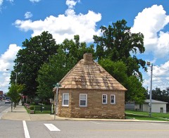 Crossville Tennessee Highway Patrol Buildinglisted 2003
 Cumberland County Courthouseslisted 1980
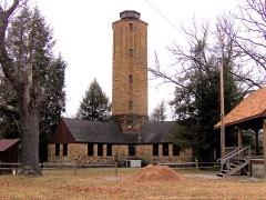 Cumberland Homesteads Historic Districtlisted 1988
 Palace Theaterlisted 1994
- Cumberland Mountain Schoollisted 1993
- "See Rock City" Barnlisted 2024
Population over time
2 figuresCrossville grew from 10,795 to 12,071 between 2010 and 2020. These are the recorded population figures Wikidata holds for this place, reached through the Geographic Names Information System number this page is keyed on rather than by name, so they belong to this place and not to another of the same name. Most are census counts, but not all are: an early figure may be a founding or settlement estimate, and an estimate published within five years of a census is left out. The change column is computed, and is left blank where more than 20 years separate a figure from the one before it, because a gap that long is not a change between two counts.
| Year | People | Change |
|---|---|---|
| 2010 | 10,795 | |
| 2020 | 12,071 | +1,276 (+12%) |
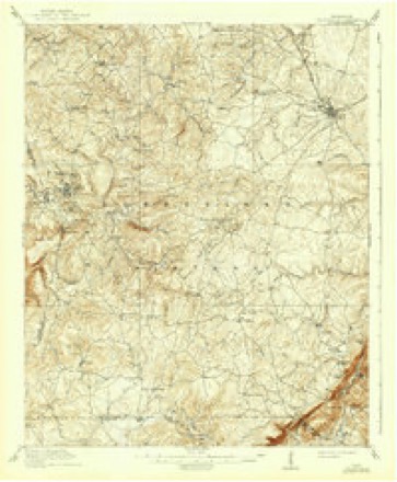
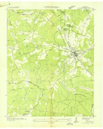
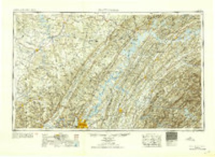
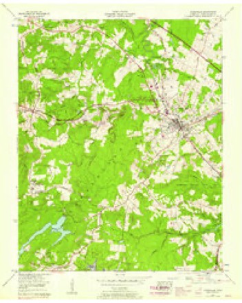
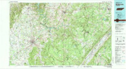
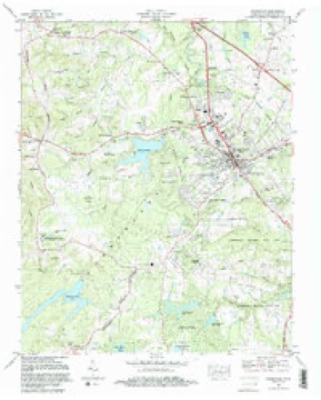
Topographic sheets covering this place
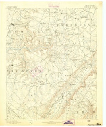
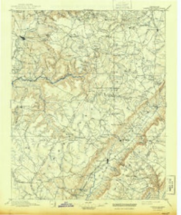
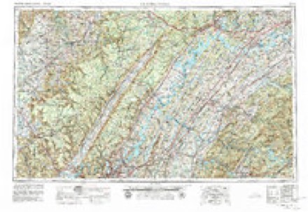
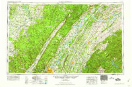
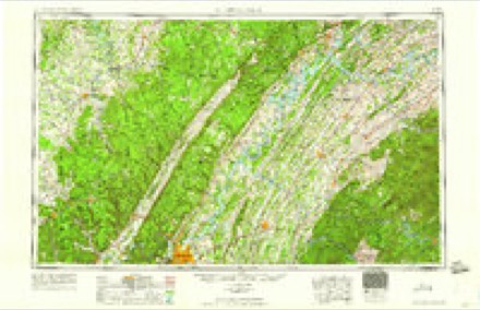
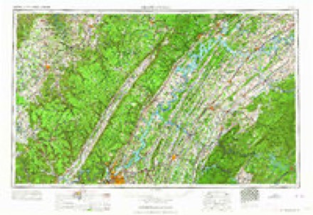
12 surveys from 24 printed sheetsMatched by testing this settlement's coordinate against the published boundary of every sheet in the United States Geological Survey's historical collection. Each opens the scanned sheet at the Survey.
- 1892 USGS Pikeville quadrangle1:125000
- 1895 USGS Pikeville quadrangle1:125000, 7 printings
- 1912 USGS Crossville quadrangle1:62500, 2 printings
- 1936 USGS Crossville quadrangle1:24000
- 1953 USGS Chattanooga quadrangle1:250000
- 1956 USGS Crossville quadrangle1:24000, 3 printings
- 1957 USGS Chattanooga quadrangle1:250000, 3 printings
- 1959 USGS Chattanooga quadrangle1:250000
- 1960 USGS Chattanooga quadrangle1:250000
- 1964 USGS Chattanooga quadrangle1:250000
- 1981 USGS Mc Minnville quadrangle1:100000
- 1982 USGS Crossville quadrangle1:24000, 2 printings
Fires near this place
53 since 1997Regional context, not property-specific evidence. The federal wildfire occurrence database lists 53 fires within 5 miles of Crossville between 1997 and 2019, burning about 171 acres in total. None started naturally. 17 were recorded as arson. Distance is straight-line from the map coordinates, so a fire counted here may appear on a neighbouring settlement's page as well.
| Reported cause | Fires |
|---|---|
| Debris and open burning | 30 |
| Arson/incendiarism | 17 |
| Missing data/not specified/undetermined | 3 |
| Misuse of fire by a minor | 1 |
| Equipment and vehicle use | 1 |
| Fireworks | 1 |
The most recent of them, most recent first, with the day each was reported and the service that recorded it.
| Date | Cause | Size | Reported by | Name on the report |
|---|---|---|---|---|
| 21 September 2019 | Missing data/not specified/undetermined | 1.0 acres | Tennessee Division of Forestry | STUMP DUMP |
| 20 September 1998 | Arson/incendiarism | 1.0 acres | Tennessee Division of Forestry | not named |
| 30 August 2011 | Debris and open burning | under an acre | Tennessee Division of Forestry | DAVIDSON RD |
| 24 June 2008 | Debris and open burning | 10 acres | Tennessee Division of Forestry | not named |
| 7 May 2008 | Debris and open burning | 1.5 acres | Tennessee Division of Forestry | not named |
| 5 May 2008 | Debris and open burning | 6.0 acres | Tennessee Division of Forestry | not named |
| 11 May 1999 | Debris and open burning | under an acre | Tennessee Division of Forestry | not named |
| 9 April 2001 | Debris and open burning | 5.0 acres | Tennessee Division of Forestry | not named |
Settlements close enough to share some of these fires:
Mines and quarries near this place
10 of 15 shownRegional context, not property-specific evidence. The federal mineral resources record lists 15 workings within 5 miles of Crossville: 9 producers, 6 past producers. 9 still produce. What was taken out: Stone, Crushed/Broken, Flagstone, Stone, Dimension, Sand and Gravel, Construction. Distance is straight-line from the map coordinates, so a quarry counted here may appear on a neighbouring settlement's page as well.
| Where | Site | Commodity | Status | Recorded |
|---|---|---|---|---|
| Potter Sand Co. #37 Pit | Sand and Gravel, Construction | Producer | 1950 | |
| Crab Orchard Mill | Stone, Dimension | Past Producer | ||
| Crab Orchard Quarry | Stone, Dimension | Producer | Sandstone | |
| Davis Mine | Stone, Dimension | Producer | 1969 | |
| Turner Brothers Quarry | Stone, Dimension | Producer | 1946 | |
| Crab Orchard Mill | Flagstone | Producer | ||
| Davis Mine | Flagstone | Producer | ||
| Lantana Building Stone Quarry | Flagstone | Producer | ||
| Peck Quarry | Flagstone | Producer | ||
| Turner Brothers Quarry | Flagstone, Stone, Crushed/Broken | Producer |
Storms near this place
60 of 85 shownRegional context, not property-specific evidence. The National Weather Service names Crossville in 85 storm reports between 1995 and 2025: 40 thunderstorm wind, 27 hail, 11 flash flood, 3 flood. The reports record 4 deaths and 22 injuries. Each account below is quoted exactly as the forecast office filed it, from the NOAA Storm Events Database, and each date opens the federal record of that event.
| When | Event | Place named | Harm | What the report says |
|---|---|---|---|---|
| November 2002 | Tornado (F3) | Crossville | 4 killed, 18 hurt, $500,000 | An F3 tornado struck the Lake Tansi area and the southern sections of Crossville Sunday night, killing 4 people and injuring 18. 33 homes and mobile were destroyed and 128 homes and mobile homes were damaged. There was damage to one public building. The heaviest damage was along Lantana Drive, Dunbar Road, and Pigeon Ridge Road. 5 homes were damaged on U.S. Highway 127 and just south of Three Creek Road. One well built home lost an entire roof and several walls. The couple, their 3 children, and a guest, huddled under a mattress in the hallway. 50 acres of hardwoods were twisted and tangled. 100-year-old oak trees were snapped like wheat straws.Mobile homes on the Ballyhoo Campground and modular homes in Lake Tansi were destroyed. The four fatalities occurred in mobile homes. A couple was killed at 298 Lantana Drive when their mobile home was lifted off its foundation and placed on another trailer. Edward, 80 and Mary Laffer 75 were killed. Another couple died at 4040 Lone Wolf Circle. Robert, 55 and Sandy Scarbrough , 52, were killed and their bodies were found across Lake Mohawk. |
| April 2006 | Tornado (F1) | Crossville | 4 hurt, $4,000,000 | 6 homes were destroyed (2 were mobile homes). 6 other homes with 50% of the structure damaged and a total of 181 homes damaged. There was $3.2 million estimate for just homes. This estimate did not include out-buildings or vehicles. Final debris estimates on clean-up have reached over $200,000.Final estimate will approach $4 million in damage. |
| May 2020 | Thunderstorm Wind | Crossville | $215,240 | Numerous trees and power lines were blown down across Cumberland County. A tree fell onto a house on Vandever Road near Highway 127 South, and another tree fell onto a house on Old Peavine Road. |
| May 2003 | Thunderstorm Wind | Crossville | $100,000 | Newspaper story about numerous downed trees in the southern part of the city. A shed was destroyed on Highland Dr. There were 16 homes damaged, and 21 power poles were broken. A large red oak tree fell and cut a home in half on Lantana Rd. Also, a large oak tree fell on a Jeep pickup on Mimosa Dr. The South Cumberland Elementary School had broken windows, damage to the roof, and one portable classroom was a total loss. |
| July 2023 | Flash Flood | Crossville | $50,000 | Heavy rain in the Crossville area caused vehicles to stall in flood waters near Old Jamestown Highway and Industrial Drive. Damages are a rough estimate. |
| August 2010 | Thunderstorm Wind | Crossville | $50,000 | Numerous trees were blown down across the western portion of the county. |
| February 2011 | Thunderstorm Wind | Crossville | $25,000 | Trees were reported downed across the county. |
| June 2009 | Thunderstorm Wind | Crossville | $25,000 | Medium sized trees were downed with small debris blown over the immediate area. Details of what small debris consisted was unkown. |
| April 2007 | Tornado (EF0) | Crossville | $20,000 | A EF0 tornado uprooted several trees and took part of a roof of a mobile home at 1159 Tanner Rd. Off Exit# 311 on I-40, just north and east of I-40, a small wooden building was destroyed, and two trees were snapped. Also a few metal shingles came off a metal shed in the McClanahan Drive through Jonia lane area. A riding lawn mower was hurled 200 yards in a field behind a church. |
| February 2009 | Thunderstorm Wind | Crossville | $12,000 | Numerous trees and power lines were blown down across the county. |
| July 2018 | Thunderstorm Wind | Crossville | $10,000 | Cumberland County Highway Department reported numerous trees were blown down blocking roadways all across Cumberland County. |
| January 1997 | Thunderstorm Wind | Crossville | $10,000 | no account filed |
| April 2022 | Thunderstorm Wind | Crossville | $5,000 | Trees were blown down in Crossville. |
| January 2020 | Thunderstorm Wind | Crossville | $5,000 | The roof corner was peeled off a commercial building in Crossville, with trees and power lines also blown down in the area. |
| June 2019 | Thunderstorm Wind | Crossville | $5,000 | A tree was blown down across Highway 70 North. Power outages were reported across Cumberland County. |
| July 2016 | Thunderstorm Wind | Crossville | $5,000 | Several reports of trees down throughout the city of Crossville. In addition, an apartment complex suffered minor roof damage, a store had window damage, and a storage shed was blown across a street. |
| April 2008 | Thunderstorm Wind | Crossville | $5,000 | Trees were down and blocking road near Highway 68 and Buck Creek Rd. |
| June 1995 | Thunderstorm Wind | Crossville | $5,000 | Several telephone lines were knocked down. |
| October 2021 | Thunderstorm Wind | Crossville | $3,000 | Trees were blown down near the Cumberland County Community Complex on Livingston Road in Crossville. |
| March 2017 | Thunderstorm Wind | Crossville | $3,000 | Cumberland County Emergency Management reported a few small trees were blown down across the county. |
| July 2016 | Thunderstorm Wind | Crossville | $2,000 | A Facebook picture showed a tree blown down onto a truck in Crossville. |
| April 2007 | Hail | Crossville | $2,000 | Cocorahs observer reported quarter size hail which damaged the shingles on his roof. |
| April 2018 | Thunderstorm Wind | Crossville | $1,000 | A tree was blown down on Myrtle Avenue in Crossville. |
| July 2018 | Lightning | Crossville | $1,000 | Lightning struck a transformer and caught it on fire on Main Street in Crossville. |
| February 2011 | Flash Flood | Crossville | $1,000 | Flooding was reported at the corner of Industrial Drive and Old Jamestown Road. Water was reported to have a depth of up to the hubcaps of a full-size van. |
| May 2010 | Thunderstorm Wind | Crossville | $1,000 | A couple trees were blown down near Highway 101 and I-40. |
| January 2008 | Thunderstorm Wind | Crossville | $1,000 | A few trees and power lines were blown down around the county. |
| July 2007 | Thunderstorm Wind | Crossville | $1,000 | Trees and power lines were down near Peavine and U.S. Highway 70. |
| July 2004 | Flash Flood | Crossville | $1,000 | Tabor Loop Road was flooded. |
| November 2004 | Flash Flood | Crossville | $1,000 | Several low spots were flooded near Crossville...including Spruce Loop Road. |
| July 2008 | Thunderstorm Wind | Crossville | $100 | A large tree limb was down along Plateau Rd. |
| May 1995 | Hail | Crossville | $1 | no account filed |
| March 2025 | Flash Flood | Crossville | - | Heavy rain caused flooding along Highway 127N between Crossville and Clarkrange. Extent of damages are unknown. |
| May 2024 | Thunderstorm Wind | Crossville | - | An ASOS station at the Crossville airport measured a wind gust of 58 mph with a severe thunderstorm. |
| March 2020 | Thunderstorm Wind | Crossville | - | A peak wind gust of 63 mph was measured at the City of Crossville downtown Davis weather station. |
| October 2014 | Hail | Crossville | - | Quarter to golf ball size hail fell in Crossville. |
| August 2012 | Hail | Crossville | - | Nickel size hail reported in Crossville. |
| July 2007 | Hail | Crossville | - | Reports of pea to penny size hail. |
| April 2007 | Hail | Crossville | - | Amateur radio report of golf ball size hail at Lake Tansi area. |
| March 2006 | Thunderstorm Wind | Crossville | - | Power pole and lones were down. |
| April 2006 | Hail | Crossville | - | Quarter size hail west of U.S. Highway 70. |
| June 2006 | Thunderstorm Wind | Crossville | - | Sheriff's office reported a couple of trees were down. |
| April 2005 | Hail | Crossville | - | Spotter reported pea tp penny size hail. |
| June 2005 | Thunderstorm Wind | Crossville | - | One tree was blown down at the police station. |
| June 2005 | Thunderstorm Wind | Crossville | - | 911 center reported a tree was blown down at Fairfield Glade. |
| August 2005 | Thunderstorm Wind | Crossville | - | Several large trees down near U.S. Highway 127. |
| May 2004 | Thunderstorm Wind | Crossville | - | Tree was blown down. |
| May 2004 | Hail | Crossville | - | Law enforcement reported nickel size hail at Plateau Road and I-40. |
| July 2004 | Thunderstorm Wind | Crossville | - | Trees down near I-40 mile marker 314. |
| August 2003 | Thunderstorm Wind | Crossville | - | 911 Center reported minor roof damage to a residence at Fairfield Glade. |
| August 2003 | Thunderstorm Wind | Crossville | - | Trees and power lines were down on Dunbar Road near Lake Tansi. |
| August 2003 | Flash Flood | Crossville | - | Sheriff's office reported water over some roads in the city. |
| August 2003 | Flash Flood | Crossville | - | Major street flooding was reported. Cars were stalled in parking lots with 6 inches of water. The highest water was on Miller Avenue. |
| September 2003 | Thunderstorm Wind | Crossville | - | Emergency Manager estimated wind gusts up to 60 mph at 1042 AM CST. Metal canopies and power lines were down at intersection of U.S. Highway 70 and Elmore. Also, a large Kroger sign was blown down. About a dozen trees were blown down at an industrial park along U.S. Highway 127. The strong winds blew down a large Taco Bell sign and a large McDonald sign. |
| September 2003 | Flash Flood | Crossville | - | Many roads were under high water. |
| April 2003 | Hail | Crossville | - | Spotter reported penny size hail at Fairfield Glade. |
| June 2003 | Thunderstorm Wind | Crossville | - | Trees were blown down in the Lake Tansi area. |
| November 2002 | Hail | Crossville | - | Law enforcement reported baseball size hail on Highway 127 south. |
| November 2002 | Hail | Crossville | - | Emergency management reported dime size hail. |
| November 2002 | Hail | Crossville | - | Spotter reported dime size hail. |
Nearest settlements
The eight closest, with where each one stands in the county. Distances are straight-line, computed from the Geographic Names Information System coordinates.
| Map | Place | Distance | Sheets |
|---|---|---|---|
| Harrison Addition | 0.4 miles | 24 | |
| Lynwood Acres | 0.4 miles | 24 | |
| Grassland Addition | 0.6 miles | 24 | |
| Maplewood Estates | 0.7 miles | 24 | |
| Camelot | 0.8 miles | 24 | |
| Woodstock Estates | 0.8 miles | 24 | |
| Mitchel Heights | 1.0 miles | 24 | |
| Town Branch Estates | 1.1 miles | 24 |
Elsewhere
Matched on this settlement's Geographic Names Information System number rather than its name, so it cannot be a different place of the same name in another state.
| Wikipedia article on Crossville | An encyclopaedic summary. Its text is share-alike, so it is linked here rather than copied. |
| Wikidata item Q1028151 | The structured record the population and elevation above come from. Public domain (CC0). |
Provenance
This settlement is recorded in the Geographic Names Information System as feature 1306203. The sheet list is computed by point-in-boundary test against the United States Geological Survey's historical topographic inventory. Both are works of the United States government and carry no copyright under 17 U.S.C. 105.
Wildfire. Short, Karen C. 2022. Spatial wildfire occurrence data for the United States, 1992-2020 [FPA_FOD_20221014]. 6th Edition. Fort Collins, CO: Forest Service Research Data Archive. https://doi.org/10.2737/RDS-2013-0009.6 Collected with United States Government funding and usable without additional permissions or fees.
Mines and quarries. USGS Mineral Resources Data System (MRDS) https://mrdata.usgs.gov/mrds/ A work of the United States government, no copyright under 17 U.S.C. 105.
Storms. NOAA National Centers for Environmental Information, Storm Events Database https://www.ncei.noaa.gov/stormevents/ A work of the United States government, no copyright under 17 U.S.C. 105. Narratives are quoted verbatim from the National Weather Service report and are not edited or summarised.